
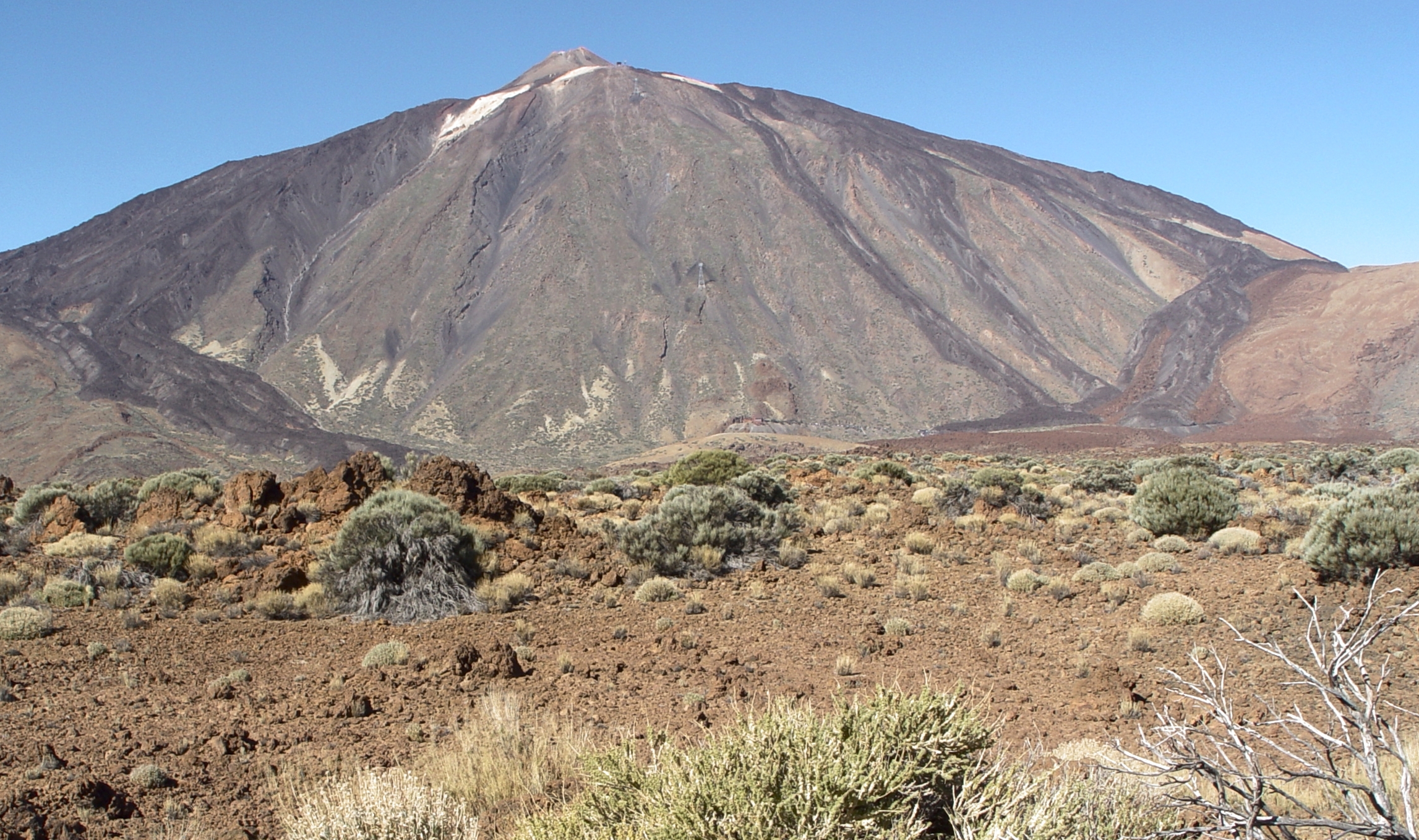
Earth science explains the planet as a connected, changing system. Rocks, water, air, ice and living organisms do not operate in separate rooms: a storm can move soil into a river, a changing coast can alter habitats, and processes far below the surface can reshape the land above.
The gold standard is an explanation that connects a process with the evidence for it, at the right place and timescale. A dramatic photograph can start a question. It cannot, by itself, establish a cause, a geological age or a safe decision.
This root guide connects the existing articles on geology, hydrology, weather, climate, oceanography, mapping, field evidence and engineering. The subject guides provide depth; this article shows how to move between them without losing the underlying question.
Our running example is a fictional learning group investigating a muddy stream after rain. Its records and calculations are invented for teaching. They are not water-quality clearance, a hazard assessment or permission to enter a waterway, excavation or unstable site. Use safe, permitted observation points and the appropriate professional or official guidance.
Find the part you need
Choose the question closest to your task. Each chapter stays open and connects with the relevant specialist guides.
Full chapter index · Specialist article directory · Common questions
Chapter index
See Earth as a system · Chapters 1–3
Read time, water and landscapes · Chapters 4–6
Connect air, oceans and life · Chapters 7–9
Build and use evidence · Chapters 10–12
Work the case and continue · Chapters 13–14
A useful Earth-science question often starts where two processes meet. Rainfall is an atmospheric event, but the water reaching a stream also depends on the surface and subsurface through which it travels. A muddy channel therefore invites questions about weather, ground, flow and material movement.
NASA’s Earth-system research framework distinguishes the atmosphere, hydrosphere, cryosphere, geosphere and biosphere. These labels organise air, water, frozen water, the solid Earth and life. They are a map for investigation, not walls separating independent subjects.
For the fictional stream, begin with a short chain: rain falls; some water is stored or moves through the ground; some travels across the surface; material may be carried towards the channel. Each link suggests something different to observe. The chain is a proposed explanation, not yet a finding about this particular storm.
A learner should be able to point to the connection being investigated. “Water and soil interact” is a beginning. “We are checking whether material from the disturbed slope reached this inlet during the observed event” is a question that can guide evidence gathering.
Use the specialist subject roots to deepen one connection at a time. The aim is an integrated explanation, not a longer list of sphere names.
Continue with the specialist guides
Earth systems contain places where material is held and pathways through which it moves. The distinction between a store and a transfer prevents several common mistakes. Water in a pond is a stored quantity; water passing a monitoring point over time is a flow.
The USGS water-cycle explanation describes both storage and movement. A cycle is not a promise that every location receives the same amount back, or that water returns immediately to where it began.
In the fictional enquiry, a learner sees the stream level fall and concludes that water has disappeared from the system. A better question is where it went relative to the chosen boundary: downstream, into another store, or along a pathway not being observed. The group needs a boundary before it can discuss a balance.
Keep quantity, rate and concentration distinct. A depth reading does not automatically provide volume. A volume does not establish a flow rate without a time interval. A concentration describes material relative to a quantity of water, not the total material transported.
Write units beside the names of measures before calculating. The units often reveal that two apparently similar observations are answering different questions.
Continue with the specialist guides
CHAPTER 3 OF 14 · See Earth as a system
3. Understand the solid Earth through processes, not colours
A rock’s colour can help describe it, but it does not independently establish its origin. Earth science connects minerals, textures, structures and context with the processes that could have produced them. A loose specimen and a rock still in its geological setting provide different kinds of evidence.
The rock cycle describes possible transformations among igneous, sedimentary and metamorphic rocks. It is not a compulsory circular itinerary that every rock follows at the same speed. The USGS rock-cycle teaching material illustrates why a rock’s history can involve more than one transformation.
Plate tectonics provides another scale of explanation: relatively rigid parts of Earth’s outer shell move in relation to one another. This helps connect patterns of deformation, earthquakes and volcanism. It does not mean every landform can be explained by naming the nearest plate boundary.
For a beginner, separate three questions: what can be described, which process is proposed and what context supports that proposal? A smooth pebble may invite a transport question; it does not supply its own complete travel history.
Continue into geology for the rock record and into geophysics or geotechnical engineering when the question concerns conditions below a site rather than a hand specimen.
Continue with the specialist guides
CHAPTER 4 OF 14 · Read time, water and landscapes
4. Read geological time without inventing a date
Earth science often reconstructs events that nobody witnessed. A relationship may establish an order before it establishes a numerical age. “This event occurred before that one” is a meaningful result even when the interval between them is unknown.
Age estimates also need an event definition. Does a method concern formation, cooling, burial, last light exposure or another process? A number belongs to the event and material the method can address, not automatically to everything nearby. The USGS dating-terminology discussion distinguishes levels of age information and cautions against treating “absolute” as a synonym for certainty.
The fictional stream exposes a dark band beneath a lighter deposit. The learners may describe the arrangement safely from a permitted viewpoint. They cannot assign ages from colour, or assume that every visible boundary represents the same duration. Disturbance and missing material may complicate the story.
Build a sequence with explicit limits: observed relationship, possible event order and what additional evidence would be needed for an age estimate. Leave a gap where evidence is missing.
Use the dating guides for their particular materials, assumptions and reference systems. Radiocarbon, luminescence, ash-layer correlation and tree-ring work are connected routes, not interchangeable clocks.
Continue with the specialist guides
- The Gold Standard of Teaching Radiocarbon Dating | Calibration, Context and Honest Age Ranges
- The Gold Standard of Teaching Optically Stimulated Luminescence Dating | Light Exposure, Burial and Age Uncertainty
- The Gold Standard of Teaching Tephrochronology | Volcanic Ash Fingerprints and Time Markers
- The Gold Standard of Teaching Dendrochronology | Tree Rings, Crossdating and Chronological Evidence
CHAPTER 5 OF 14 · Read time, water and landscapes
5. Follow water through a catchment
A stream receives water from a surrounding area and from pathways that are not all visible at the surface. Understanding a catchment means asking where water can come from, where it is stored and which routes connect it to the observation point.
A paved surface, planted area and permeable ground need not respond identically to a rainfall event. The important question is not simply how much rain fell, but how the particular setting affected movement and storage. A photograph of rain near the stream does not describe the whole contributing area.
For the fictional project, the learners mark visible inlets, permitted observation points and relevant ground features on a base map. They record what is known and identify uncertain connections rather than drawing arrows wherever a route seems convenient.
A map is especially useful when two observations disagree. An upstream reading may describe water before an inlet joins. A downstream reading may include additional contributions. Calling them duplicates could conceal the very process being investigated.
Continue into hydrology for water movement, hydraulic engineering for controlled flow and urban drainage for designed networks. These subjects connect, but a classroom catchment sketch is not a drainage design or a determination that a route will remain safe during rain.
Continue with the specialist guides
CHAPTER 6 OF 14 · Read time, water and landscapes
6. Separate weathering, erosion, transport and deposition
A landscape changes through linked but different processes. Weathering changes material at or near its location. Erosion removes material; transport moves it; deposition leaves it in a new place. Keeping these terms distinct makes the explanation more precise.
In the fictional enquiry, brown water is evidence of an observed appearance. It is not yet evidence of the exact source, material composition or total quantity transported. The learners should not rename the colour “construction pollution” merely because construction is visible somewhere nearby.
A source explanation needs a connection between candidate material, pathway and observed receiving point. Other possibilities remain open until evidence distinguishes them. Photographs of a disturbed slope may help frame the question, but the pathway and timing still matter.
Likewise, a clearer-looking stream later in the day does not establish that all material has left the system or that the water is safe. Some observations concern appearance; others concern measured constituents or deposited material. They cannot stand in for one another without justification.
Use the erosion-control and water-quality routes for their respective questions. The scientific habit is to locate the process and choose a measure that addresses it, rather than asking one photograph to explain everything.
Continue with the specialist guides
CHAPTER 7 OF 14 · Connect air, oceans and life
7. Connect weather, climate and energy
Weather concerns atmospheric conditions and events over relatively short periods. Climate concerns patterns and statistics over longer periods. WMO’s weather overview explains the distinction and the role of long-term observations. One storm can be studied carefully without being sufficient evidence for a local climate trend.
Earth’s energy balance helps explain why the atmosphere cannot be understood in isolation. Incoming sunlight, reflection and outgoing thermal radiation connect the surface and atmosphere. NASA’s radiation-budget introduction provides the physical framework. A single temperature reading is only one observation within that wider system.
For the fictional group, the first task is to describe the particular rainfall event accurately. Was the amount measured at the site or taken from a station elsewhere? Does the observation period match the stream visit? A daily rainfall total does not reveal every detail of rainfall timing or intensity.
For a climate question, the dataset, period, station history and treatment of missing records become central. Do not build a long-term conclusion by stitching together attractive examples of unusual weather.
Follow the weather guide for observations and forecasts; follow the climate guide for longer-term patterns. Both require careful attention to scale.
Continue with the specialist guides
CHAPTER 8 OF 14 · Connect air, oceans and life
8. See oceans and ice as connected parts of the planet
The ocean is not merely the place rivers end, and frozen water is not simply a decorative feature of a cold region. Earth-system science studies transfers among water, ice, air and land. A local observation may belong to a much larger system without measuring that larger system directly.
This distinction matters when moving between articles. A stream sample does not measure ocean condition. A coastal observation does not establish a global ocean trend. The connection is a reason to investigate pathways and scale, not a licence to extend a conclusion indefinitely.
In a learning discussion, trace a plausible sequence from a catchment to a receiving coast. At each step, ask what could be added, removed, stored or changed. Do not assume that material remains at its original concentration throughout the journey.
The same discipline applies to a claim about ice or sea level. Identify what the observation actually represents and which additional processes the broader explanation requires. A dramatic image may communicate a phenomenon while remaining inadequate for a quantitative conclusion.
Use oceanography, coastal restoration and environmental-science routes to examine those connections in depth. When the question concerns boats, coastal structures or water access, move into the relevant operational or engineering guide rather than treating a systems explanation as safety advice.
Continue with the specialist guides
CHAPTER 9 OF 14 · Connect air, oceans and life
9. Include life and human activity without making them catch-all causes
Living organisms and human activity can alter Earth-system pathways. Vegetation, land management, water use and construction may all be relevant to a particular enquiry. Their relevance needs to be explained through the process under examination, not inserted as a general statement that “everything is connected.”
In the fictional catchment, learners notice both a planted area and disturbed ground. They list possible effects on water and material movement, then mark which have direct evidence. A plausible influence is a hypothesis until the investigation supports its role in the observed event.
Do not set up a false choice between a natural process and a human contribution. Rain can move material through a landscape whose surface has been changed. The explanation may require both the event and the conditions through which it acted.
A useful account identifies the boundary and competing explanations. Did the enquiry examine one inlet, the whole stream or a broader catchment? Did maintenance alter the site between visits? Were changes recorded contemporaneously or reconstructed afterwards?
Continue into ecology, environmental science, forestry or agriculture when the question turns towards living systems and managed land. The root connection stays the same: name the pathway, describe the evidence and keep the conclusion within its scope.
Continue with the specialist guides
CHAPTER 10 OF 14 · Build and use evidence
10. Use maps and remote sensing as evidence, not omniscience
A map is a selected representation of a place. Its scale, date, coordinate reference, classification and source determine what it can support. A detailed-looking map can still be inappropriate for a particular measurement.
Remote sensing adds observations made from a distance, including from aircraft or satellites. The resulting image or data product must be interpreted in relation to what was measured and how it was processed. A pixel’s colour is not automatically the property named in a classroom caption.
For the fictional stream, a historical image helps locate a formerly vegetated patch. Before calling the change a cause of the muddy water, the learners check whether the image dates align with the event, whether the boundaries can be located reliably and whether field information supports the interpretation.
Coordinate mistakes are especially easy to miss when an overlay looks neat. Keep the reference information with the data and use the geospatial case for the difference between apparent precision and a correct transformation.
Choose the map for the task. A regional illustration may orient a reader while being unsuitable for a site boundary or engineering decision. The appropriate next route may be cartography, remote sensing, geodetic engineering or ground-based survey.
Continue with the specialist guides
- The Gold Standard of Cartography
- The Gold Standard of Remote Sensing
- The Gold Standard of Geodetic Engineering | Reference Frames on a Changing Earth
- Gold Standard Practical Case Study 151 | The Drone Orchard Map Was Precise but Used the Wrong Coordinate Transformation
- Ministry of Education V3.0 Reference 54 | Satellites, Remote Sensing and Earth Observation Literacy: Read the Planet, Check the Evidence
CHAPTER 11 OF 14 · Build and use evidence
11. Make measurements comparable before explaining a change
Two numbers become a comparison only after their meanings are aligned. Check the property, unit, location, time interval, sampling method and relevant instrument or laboratory information. Shared formatting is not evidence of equivalence.
The fictional group receives one result in milligrams per litre and another in grams per litre. Copying both into a column headed “mg/L” creates a false trend. Convert the units explicitly, retain the original records and make the conversion checkable.
Location matters just as much. A sample at an inlet and one from a quiet edge may address different water conditions. Time matters when a storm changes rapidly. A result after the event may not represent the conditions during the event.
If a method changes, do not hide the change to protect a smooth graph. State it, investigate comparability and narrow the interpretation where necessary. More decimal places cannot repair a different sampling question.
Use calibration and environmental-testing guides to understand the connection between an instrument reading and a defensible result. In a school task, the first objective is simpler: write what was measured clearly enough that another learner can tell whether the intended comparison is valid.
Continue with the specialist guides
- Ministry of Education V3.0 Reference 57 | Measurement Standards and Calibration Literacy: Why Numbers Must Agree
- The Gold Standard of Environmental Laboratory Testing | Representative Samples, Defensible Results and Clear Limits
- The Gold Standard of Teaching Statistics | Questions, Variation and Valid Inference
- The Gold Standard Of Water Quality Monitoring
CHAPTER 12 OF 14 · Build and use evidence
12. Distinguish a hazard from the risk to people
A hazardous process and the consequences for a particular community are related but different subjects. UNDRR’s risk-assessment terminology includes hazard characteristics, exposure, vulnerability and coping capacity. A map of a physical process therefore does not answer every question about potential harm.
A classroom explanation of flooding cannot determine whether a particular route or building is safe. Current official warnings, site conditions and competent assessment take precedence over an educational diagram.
For the fictional group, a high stream level is a reason to keep to safe, authorised observation arrangements, not an invitation to obtain a closer photograph. If the planned visit cannot be conducted safely, record the missing observation. Never turn continuity of a dataset into a reason to approach danger.
The same boundary applies to earthquakes, volcanic activity, unstable slopes and excavations. Understanding a mechanism is valuable, but it does not grant authority to inspect or enter a hazardous place.
Continue into the seismology, volcanology, warning-literacy and engineering routes for their distinct roles. Ask whether a statement concerns the process, the exposed setting, a protective measure or demonstrated performance. These are connected questions, not interchangeable assurances.
Continue with the specialist guides
- The Gold Standard of Seismology
- The Gold Standard of Volcanology
- Ministry of Education V3.0 Reference 91 | Earthquakes, Seismic Risk and Tsunami Warning Literacy: From Ground Motion to Trusted Alerts
- The Gold Standard of Earthquake Engineering | Buildings That Protect Life and Recover
- The Gold Standard of Seismic Isolation Engineering | Tested Isolators and Whole-Building Response
CHAPTER 13 OF 14 · Work the case and continue
13. Work the muddy-stream case without overclaiming
The fictional learners propose that a later runoff event carried more suspended material because its concentration was higher. Their simplified dataset gives event A a volume of ten cubic metres and a representative concentration of forty milligrams per litre. Event B has five cubic metres and sixty milligrams per litre.
For this teaching calculation, assume each concentration correctly represents the corresponding entire event. Ten cubic metres equals ten thousand litres, giving four hundred thousand milligrams, or four hundred grams, for event A. Five thousand litres multiplied by sixty milligrams per litre gives three hundred grams for event B.
The concentration rises, while the calculated transported mass falls. Neither measure is wrong: they answer different questions. In real monitoring, a single grab sample may not represent the whole event, so this assumption would need evidence rather than convenience.
The calculation also does not identify the source or establish whether the water meets any safety or environmental requirement. Those are additional questions involving the relevant constituents, methods and standards.
A defensible conclusion is narrow: under the stated fictional assumptions, event B has higher concentration but lower calculated mass. The next enquiry concerns whether the samples represent the events and which evidence could distinguish the proposed sources. The repair begins by naming the missing evidence, not by choosing the most dramatic explanation.
Continue with the specialist guides
CHAPTER 14 OF 14 · Work the case and continue
14. Turn the subject into an independent explanation
A learner understands an Earth-science connection when they can apply it to a new setting without borrowing a conclusion. Ask them to identify a process, propose an observable consequence and explain one reason the observation might be incomplete.
For the stream case, a useful final account has four parts: what was observed, which process might explain it, what supports that explanation and what remains unresolved. The map, calculation and photograph should each have a clear job. None needs to pretend to do all the others.
A parent or tutor can help with a concrete question: “Does this number describe a store, a rate, a concentration or a total?” Another is, “Which part of your explanation did you observe directly?” These questions reveal misunderstandings without requiring a recital of technical definitions.
For a longer investigation, keep a change log: revised sampling point, missed visit, new map, altered method or corrected unit. The log makes the history of the evidence visible.
Use the directory below to continue at the closest point of uncertainty. Earth science becomes useful beyond the lesson when someone can connect processes across scales while resisting the temptation to claim more than the evidence shows.
Continue with the specialist guides
- The Gold Standard of Teaching Earth Science | Read Rocks, Time and Earth Systems
- The Gold Standard of Education | Learning That Transfers into Life
- The Gold Standard | Sectors and Services Article Directory
Contents · Previous chapter · Continue to the article directory
Connected specialist article directory
Choose the section that matches your question. Each specialist guide retains its own subject and practical scope.
Core Earth-system subjects
Use the existing roots for deeper treatment of rocks, water, air, climate, oceans, living systems and physical geography.
Browse 8 published guides
Rock records, ground conditions and geological time
Follow the material and event being investigated. These guides address different forms of geological and chronological evidence.
Browse 10 published guides
- The Gold Standard of Geologists | Rock Records, Ground Truth and Defensible Interpretation
- The Gold Standard of Geophysical Engineering | Subsurface Evidence with Known Limits
- The Gold Standard of Geotechnical Engineering | Ground Uncertainty Managed Before It Moves
- The Gold Standard of Teaching Geoarchaeology | Sediments, Site Formation and Earth History
- The Gold Standard of Teaching Soil Micromorphology | Thin Sections, Microstratigraphy and Site Formation
- The Gold Standard of Teaching Radiocarbon Dating | Calibration, Context and Honest Age Ranges
- The Gold Standard of Teaching Optically Stimulated Luminescence Dating | Light Exposure, Burial and Age Uncertainty
- The Gold Standard of Teaching Tephrochronology | Volcanic Ash Fingerprints and Time Markers
- The Gold Standard of Teaching Dendrochronology | Tree Rings, Crossdating and Chronological Evidence
- Ministry of Education V3.0 Reference 71 | Geology, Critical Minerals and Resource Literacy: From Ore to Useful Material
Water movement, sediment and designed landscapes
Choose between movement, transported material, monitoring, drainage and restoration rather than treating them as the same task.
Browse 8 published guides
- The Gold Standard of Rivers
- The Gold Standard of Water Resources Engineering | From Catchment to Community
- The Gold Standard of Hydraulic Engineering | Flow That Reaches the Right Place
- The Gold Standard of Erosion Control Engineering | Keeping Soil Out of Waterways
- The Gold Standard Of Water Quality Monitoring
- The Gold Standard Of Urban Drainage
- The Gold Standard Of Urban Stormwater Design
- The Gold Standard Of Coastal Ecosystem Restoration
Maps, location and Earth observation
Use these when a conclusion depends on representation, coordinates, image interpretation or locating a feature correctly.
Browse 7 published guides
- The Gold Standard of Cartography
- The Gold Standard of Remote Sensing
- The Gold Standard of Geodetic Engineering | Reference Frames on a Changing Earth
- The Gold Standard of Cartographers | Accurate Places, Honest Maps and Useful Navigation
- Gold Standard Practical Case Study 151 | The Drone Orchard Map Was Precise but Used the Wrong Coordinate Transformation
- Ministry of Education V3.0 Reference 54 | Satellites, Remote Sensing and Earth Observation Literacy: Read the Planet, Check the Evidence
- Ministry of Education V3.0 Reference 65 | Maps, Navigation and Geospatial Data Literacy: Read the Place Before the Route
Hazards, warning literacy and protective engineering
Keep process understanding, current warnings, local exposure and engineering performance distinct.
Browse 6 published guides
- The Gold Standard of Seismology
- The Gold Standard of Volcanology
- Ministry of Education V3.0 Reference 91 | Earthquakes, Seismic Risk and Tsunami Warning Literacy: From Ground Motion to Trusted Alerts
- The Gold Standard of Earthquake Engineering | Buildings That Protect Life and Recover
- The Gold Standard of Seismic Isolation Engineering | Tested Isolators and Whole-Building Response
- Gold Standard Practical Case Study 162 | The Flood Model Passed Its Historical Validation but Omitted a Newly Blocked Drain
Teaching, measurement and connections to life
Use these for enquiry design, dependable measurements and transfer into a new question.
Browse 8 published guides
- The Gold Standard of Teaching Earth Science | Read Rocks, Time and Earth Systems
- The Gold Standard of Teaching Environmental Science | Measure Systems and Weigh Trade-offs
- Ministry of Education V3.0 Reference 76 | Weather Observation and Forecasting Systems Literacy: Read the Sky, Verify the Prediction
- The Gold Standard of a Ministry of Education | Climate Change, Sustainability and Environmental Learning
- Ministry of Education V3.0 Reference 57 | Measurement Standards and Calibration Literacy: Why Numbers Must Agree
- The Gold Standard of Environmental Laboratory Testing | Representative Samples, Defensible Results and Clear Limits
- The Gold Standard of Teaching Statistics | Questions, Variation and Valid Inference
- The Gold Standard of Education | Learning That Transfers into Life
Common questions
Is Earth science the same as geology?
Geology is a central part of Earth science, but Earth science also connects water, atmosphere, oceans, ice and life. Choose the subject route matching the process you are trying to explain.
Does a rock layer provide its own age?
No. A relationship may support an event sequence without a numerical age. An age estimate requires an appropriate method, material and interpretation of the event being dated.
Does muddy water establish pollution or its source?
Not by appearance alone. Identify the property of concern, the measurement required and the evidence connecting a proposed source with the observation.
Can a higher concentration mean a lower total amount?
Yes. Total amount also depends on the corresponding quantity of water. The fictional worked case illustrates this, while making its representative-sampling assumption explicit.
Can this guide establish that a site is safe?
No. It supports learning and navigation. Follow current official warnings, site permissions and competent professional assessment for real hazards.
Primary references and onward reading
- NASA: Earth System Science Research
- USGS: What is Earth’s water cycle?
- USGS: The Rock Cycle
- USGS: Plate tectonics and Earth’s structure
- USGS: Suggested terminology for Quaternary dating methods
- WMO: Weather and climate distinction
- NASA: Earth’s Radiation Budget
- UNDRR: Disaster risk assessment
The running example is a fictional teaching case. Read each specialist guide within its stated scope and consult the primary reference for the particular subject.
The Gold Standard of Education | Learning That Transfers into Life · The Gold Standard | Sectors and Services Article Directory · Return to the chapter index