
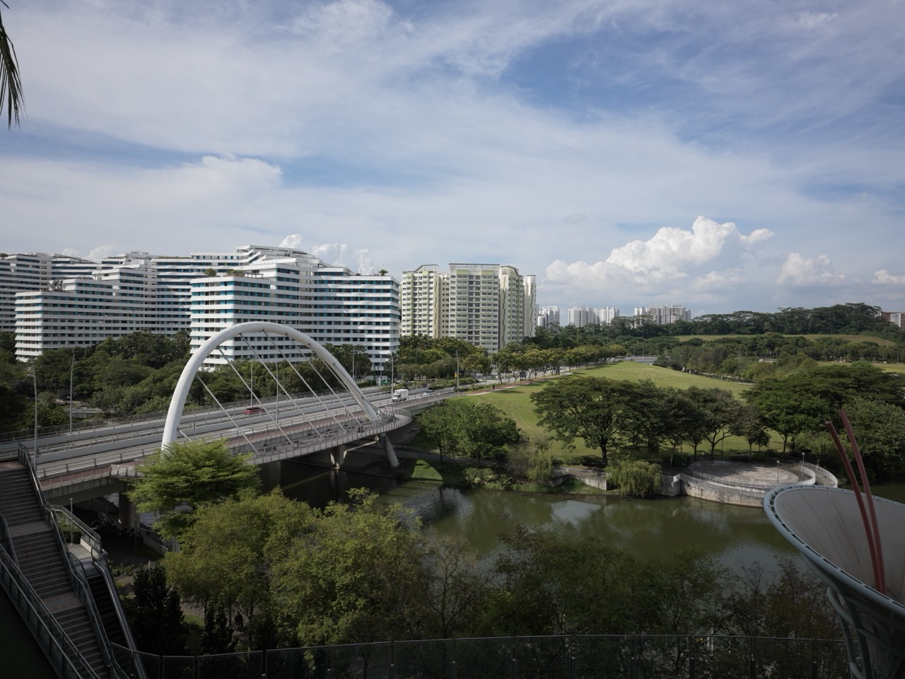
eduKate · The Gold Standard of Waterways
Find your next learning step
Choose the question closest to your purpose, or read the full guide in order.
Full chapter index · Questions and checks · The Education root
The gold standard of waterways is a connected water route that performs its intended functions, with clear responsibilities, current information and care for the people and environments affected. A waterway may carry vessels, convey water, support habitats or form part of a public landscape. The relevant standard depends on which service is being claimed.
This root concentrates on managed corridors and their interfaces. The Rivers root examines river systems; Water and Hydrology explain wider water relationships. Here the question is how channels, structures, access, information and maintenance work together without treating one successful component as proof that the whole route works.
The worked examples are fictional. They teach interpretation and arithmetic, not navigation, flood assessment or permission to enter water, operate vessels or alter a channel.
Full chapter index
1–4 · Foundations and worked understanding
5–8 · Processes and applications
9–12 · Evidence, responsibility and transfer
13–15 · Specialists, questions and sources
CHAPTER 1 OF 15
Waterways · Understand, apply and check
1. Define the service before judging the channel
Begin with what the waterway is intended to do. A drainage channel, a navigable canal and a landscaped urban water corridor can overlap in appearance while having different operating requirements. A photograph cannot establish their authorised uses.
Write a plain-language service statement. Identify the route, users, relevant conditions and limits. A claim that a reach looks clean is different from a claim about water quality, navigability or flood performance. Each needs its own evidence.
The same place may support several purposes, and those purposes can interact. Public access, habitat, conveyance and maintenance arrangements must fit the actual site. Improving one visible feature does not automatically improve every function.
For students, compare two supplied waterway descriptions. List what each promises and what remains unknown. This simple classification task prevents a common mistake: evaluating a system against an attractive purpose that it was never designed or authorised to serve.
CHAPTER 2 OF 15
Waterways · Understand, apply and check
2. Read a corridor as a connected system
A corridor contains reaches and interfaces. Bridges, crossings, banks, gates, outfalls, structures and access points may matter depending on the service. The useful question is how the connected parts behave, not simply how many parts exist.
A route can be limited by one interface even when the surrounding reaches perform well. An accessible waterfront path does not establish an uninterrupted journey, and a deep-looking reach does not establish suitable conditions along a vessel’s entire route.
Draw a schematic from an approved map or supplied plan. Label the connections, changes in responsibility and known constraints. Keep the schematic separate from an operational chart: a classroom diagram is not a navigation aid.
The map also helps identify missing information. Does a maintenance record cover only one reach? Does an access description include the crossing? A good system explanation shows where the evidence stops rather than extending it silently across the whole corridor.
CHAPTER 3 OF 15
Waterways · Understand, apply and check
3. Separate water level, bed level and depth
Water level and bed level describe elevations relative to a reference. Depth describes a vertical separation. These terms are connected but not interchangeable. A number without a datum, location and time can be misleading.
Hydrographic work uses defined reference systems and suitable methods. The International Hydrographic Organization’s survey material explains why positioning, uncertainty and vertical references matter. Appropriate survey and navigation decisions require current professional information.
A change in water level can change depth at a location without changing the bed. A change in the bed can change depth even when the water surface returns to the same level. Both relationships matter when interpreting a report.
For learners, draw a labelled cross-section before inserting numbers. Mark the reference line, bed and water surface. The drawing makes it easier to see which measurements can be compared and why two elevations using different references cannot simply be subtracted.
Source reading: International Hydrographic Review — Hydrographic Surveys: Purpose and Scale
For a worked explanation of what readings at a few positions can establish about the unobserved space between them, read The Gold Standard of Waterways | Interpreting Sparse Depth Readings Without Inventing a Channel Minimum.
CHAPTER 4 OF 15
Waterways · Understand, apply and check
4. Worked example: a depth calculation has a boundary
In a fictional cross-section, the bed elevation at one measured point is minus 3.2 metres and the water surface elevation is plus 0.8 metres, both relative to the same stated reference. The vertical separation is 0.8 − (−3.2) = 4.0 metres.
That is the calculated depth at the specified point and stated water level in the example. It is not the minimum depth throughout a channel, a guarantee of current conditions or a clearance assessment for any vessel.
Suppose another record gives a bed value without its reference. Do not insert it into the calculation until the relationship between the references is established. Correct arithmetic cannot repair incompatible measurement definitions.
The transferable Mathematics is subtraction across zero. The transferable scientific habit is attaching the result to its conditions. A strong answer includes the number, unit, location, reference and limitation rather than allowing a neat result to become an unrestricted operational claim.
CHAPTER 5 OF 15
Waterways · Understand, apply and check
5. Recognise the difference between flow and appearance
A waterway’s operation depends on the relevant water system, structures and conditions. A calm-looking surface does not establish how flow may change or what is happening at an interface. The Hydrology and Rivers roots provide the broader physical context.
For managed systems, operating arrangements can influence conditions. PUB’s water-activity guidance explains that reservoir operations can produce rapid flow and that activities are subject to specific arrangements. Readers should consult current official guidance, not infer permission from an attractive waterside setting.
Avoid reducing performance to one photograph before and after work. Images can document visible change, but they cannot by themselves establish hydraulic capability or conditions during a different event.
For students, distinguish observation from explanation. ‘The surface appears still in this photograph’ is a bounded observation. ‘This route has no dangerous current’ is a much larger claim that the image does not establish. Precise language is part of understanding the system.
Source reading: PUB — Water Activities
CHAPTER 6 OF 15
Waterways · Understand, apply and check
6. Keep public space and authorised activity distinct
A waterway can be enjoyable from an approved public route without being open for swimming, boating or unrestricted events. Access to the bank, permission for an activity and suitability under current conditions are different questions.
PUB’s ABC Waters resources show how waterways and water-related spaces can be integrated with the urban environment. That is a useful design and learning connection, not a universal permission statement for every place or activity.
Before an organised visit, the responsible adult or organiser should use the relevant authority’s current access information, activity requirements and notices. A general educational article cannot replace that check.
A classroom planning exercise can compare a map, a visitor page and an activity notice. Ask what each source establishes. Students learn that public information has purposes and limits: a destination description introduces the place, while an operational notice may change what is possible on a particular day.
Source reading: PUB — About ABC Waters · PUB — Water Activities · PUB — Reservoirs and Waterways
CHAPTER 7 OF 15
Waterways · Understand, apply and check
7. Treat water quality as a measured question
Clear-looking water is not proof of suitability for a particular use. Water-quality claims need relevant parameters, methods, locations and times. The Water Quality Monitoring guide explains the evidence chain in greater detail.
An observation of litter, colour or odour can be worth reporting through the appropriate channel. It is not a complete chemical, biological or public-health assessment. Equally, a favourable result for one parameter should not be expanded into a claim about every aspect of quality.
A useful report says what was measured and why. Was the question ecological condition, discharge compliance or another defined purpose? Different questions can require different evidence and responsible interpretation.
For learners, use supplied data rather than collecting water without an approved programme. Compare units, sampling locations and dates. Explain one supported conclusion and one question the data cannot answer. The discipline is to keep the conclusion no broader than the measurement.
CHAPTER 8 OF 15
Waterways · Understand, apply and check
8. Maintain the intended function, not just a tidy surface
Maintenance can involve inspection, vegetation, debris, structures, sediment and access arrangements, depending on the waterway. The responsible organisation needs a defined scope and people competent for the work. Ordinary users should not improvise channel clearance or structural repairs.
Dredging is a specialist activity, not merely removing visible material. The linked Dredging Engineering guide considers depth, sediment and marine stewardship. Erosion Control and River Restoration guides examine different causes and outcomes that may be relevant along a corridor.
A completed work order is evidence that a defined task was recorded as complete. Verification should connect the task to the intended result. Moving material does not, by itself, establish that the route’s wider performance is restored.
For students, compare activity and outcome statements: ‘debris removed from the listed location’ and ‘the system now performs to its intended standard’. What additional evidence connects them? This distinction transfers to engineering, public services and many ordinary maintenance decisions.
CHAPTER 9 OF 15
Waterways · Understand, apply and check
9. Worked example: completion percentage is not readiness
Imagine a fictional programme containing 25 scheduled checks. Twenty-four are complete and one remains outstanding. The completion percentage is 24 ÷ 25 × 100 = 96 per cent.
The remaining check concerns a critical interface in the supplied scenario. The high completion percentage does not establish that the route is ready for its intended use. The tasks are counted equally in the percentage, but they need not have equal consequences.
The correct response is not to invent a weighted score after seeing the result. It is to use the programme’s defined acceptance and authorisation arrangements and resolve the outstanding issue through the responsible process.
For a learning exercise, ask students to write a truthful status sentence: ‘Twenty-four of twenty-five checks are complete; readiness remains unconfirmed because the specified critical check is outstanding.’ The sentence is less dramatic than a green dashboard, but much more useful to someone making the next decision.
| Fictional programme measure | Result |
|---|---|
| Scheduled checks | 25 |
| Completed checks | 24 |
| Completion percentage | 96% |
| Outstanding checks | 1 critical interface check |
| Readiness | Not established by the percentage |
CHAPTER 10 OF 15
Waterways · Understand, apply and check
10. Connect habitat and engineering choices
Waterways can connect habitats as well as places. Bank treatment, water conditions and surrounding land use can matter to ecological relationships. The Wetlands, Ecology and coastal restoration guides provide routes into those questions.
A natural-looking design is not automatically functioning habitat, and a highly engineered setting is not understood by dismissing its ecological possibilities. Describe the actual conditions, intended functions and monitoring evidence.
Interventions should consider the wider system. Moving a problem beyond a project boundary is not the same as solving it. Appropriate assessment needs to examine the relevant upstream, downstream and neighbouring relationships.
For students, add an ecological layer to the corridor schematic. Mark where claims are supported by observation, supplied records or a source. The goal is to connect engineering and ecology without pretending that a simple drawing performs either professional assessment.
CHAPTER 11 OF 15
Waterways · Understand, apply and check
11. Build a usable record and handover
Information should remain useful after the original team leaves. A managed waterway needs clear responsibility for records, monitoring, maintenance and responding to changes. The relevant arrangement depends on the actual service and authority.
A useful record identifies what was checked, where, when, by which method and with what result. Important uncertainty and outstanding actions should travel with the record. A detached photograph or unexplained tick is difficult for the next person to interpret.
Current notices matter because conditions and arrangements can change. Preserve the date and scope when using an official document in a report. Do not treat an old event notice as a permanent rule or an old survey as an assurance of today’s route.
A handover exercise makes this practical. Give another group a fictional inspection record and ask what they can responsibly conclude. Their unanswered questions reveal where the first group’s record needs clearer context.
Source reading: PUB — Notices
CHAPTER 12 OF 15
Waterways · Understand, apply and check
12. Transfer the learning into ordinary decisions
The repair route begins with maps, units, signed numbers and observation versus inference. Work the depth example with changed values and explain why a common reference matters. The answer needs meaning as well as arithmetic.
The stabilisation route follows one service across the corridor. Identify the users, interfaces, evidence and responsibilities. Distinguish a completion measure from the condition required for use.
The extension route compares competing functions, data quality and boundaries of responsibility. Ask what evidence would change the conclusion. Use specialist guides to deepen the relevant question rather than collecting unrelated technical vocabulary.
The gold standard of waterways is a route understood and cared for as a connected service. Define its purpose, examine its interfaces and keep claims tied to current evidence. A channel becomes meaningful when we understand what it supports and what responsible continuity requires.
These existing ecosystem guides go deeper into distinct questions. Choose by purpose; a related guide is not a substitute for the evidence or authority needed for an actual decision.
Understand the water system
The Gold Standard of Rivers — Natural river processes and their evidence.
The Gold Standard of Water — Water across sources, uses and responsibilities.
The Gold Standard of Hydrology — The movement and storage of water.
The Gold Standard Of Water Management — Managing water as a service.
Examine engineering and maintenance
The Gold Standard of Dredging Engineering | Safe Depths, Sediment and Marine Stewardship — Depth, sediment and dredging responsibilities.
The Gold Standard of Erosion Control Engineering | Keeping Soil Out of Waterways — Preventing soil entering waterways.
The Gold Standard of River Restoration Engineering | Living Channels and Verifiable Recovery — Living channels and verifiable recovery.
The Gold Standard Of Port Management — The wider port operating system.
Check quality, habitat and warnings
The Gold Standard Of Water Quality Monitoring — Measurements behind water-quality claims.
The Gold Standard Of Flood Early Warning — The chain from observation to warning.
The Gold Standard Of Coastal Ecosystem Restoration — Restoration in connected coastal systems.
The Gold Standard of Coastal Engineering | Connected Defences and Adaptable Shorelines — Connected defences and adaptable shorelines.
What is the gold standard of waterways?
A connected route performing its intended services with appropriate evidence, responsibilities and ongoing care.
Is a waterway always navigable?
No. Its purpose, authorised uses and actual conditions need to be established.
Does public access permit water activities?
No. Access and activity permission are different; consult current official guidance.
Can bed elevation be treated as depth?
No. Depth depends on the water surface and a compatible reference.
Does clear water prove water quality?
No. A relevant quality claim needs appropriate measurements and interpretation.
Does 96 per cent completion mean a route is ready?
Not necessarily. The outstanding task and defined acceptance arrangements matter.
Primary explanatory resources support the concepts in this guide. For a real site, activity or system, check current official requirements and use appropriate professional advice; examples here are not operational instructions.
PUB — Reservoirs and Waterways
International Hydrographic Review — Hydrographic Surveys: Purpose and Scale
Learning transfers into life
Return to The Gold Standard of Education to connect subject knowledge with practical judgment.
For the approved learning and teaching reference, see Secondary 1 Mathematics Tutor Clementi — small-group tutorials. This guide does not change that reference.