
Things to do in Singapore | Boat Quay. Walk the historic riverfront where modern Singapore’s commercial port took shape, cross Cavenagh and Elgin bridges, study conserved shophouses, watch the river traffic, eat beside the CBD skyline and use this compact stretch to understand how a mangrove riverbank became the mercantile heart of nineteenth-century Singapore.
Boat Quay is one of the best places in Singapore to understand a simple idea:
cities grow around movement.
Goods moved by river.
Merchants moved between offices and warehouses.
Workers moved cargo from boats to godowns.
Bridges connected both banks.
Banks and trading houses gathered close to the money and goods.
The modern restaurants and skyscrapers came later.
- Walk the conserved Boat Quay shophouse row.
- Cross Elgin Bridge and Cavenagh Bridge.
- Look upstream toward Clarke Quay and downstream toward Fullerton.
- Use the Singapore River Walk to understand the old port system.
- Compare the low-rise riverfront with the high-rise financial district immediately behind it.
- Take a river cruise if you want to see all three quays from the water.
- Return after dark to compare heritage tourism with the former cargo economy.
Read: Things to do in Singapore | Singapore River
Read: Things to do in Singapore | Raffles Place
Read: Things to do in Singapore | Clarke Quay
Start With the Big Idea: Boat Quay Was the Commercial Riverfront
National Heritage Board’s Singapore River Walk explains that Boat Quay began as a mangrove and tidal riverbank.
By the 1820s, Singapore’s mercantile community had recognised the river as the better port location because it provided more sheltered access than the exposed northern shoreline.
The riverbanks were progressively embanked and turned into quays so goods could move efficiently between river craft, godowns and shophouses.
Boat Quay became one of the most important spaces in early commercial Singapore.
Official heritage route: Roots.gov.sg | Singapore River Walk
Walk the Shophouse Curve
Boat Quay’s conserved shophouses follow the bend of the Singapore River.
That curve is not decorative.
It is inherited from the geography of the river.
The buildings line the route where cargo once met land.
Look at the narrow frontages and long internal plans typical of shophouse architecture.
The riverfront had to fit many merchants into a limited strip of commercially valuable land.
Density appeared long before skyscrapers.
Imagine the Cargo Chain
Before containerisation and modern port terminals, cargo movement required many human and physical steps.
- large ships anchored offshore or at suitable harbour points;
- smaller boats carried goods into the river;
- coolies transferred cargo at the quay;
- goods entered warehouses and shophouses;
- merchants arranged sales, finance and onward transport;
- carts and later motor vehicles moved goods inland.
Boat Quay was therefore a logistics interface.
The modern river promenade hides the physical intensity of the old working waterfront.
Cross Elgin Bridge
Elgin Bridge links the north and south banks of the Singapore River and occupies one of the oldest bridge-crossing points in the city.
Its importance comes from connection.
Commercial activity on one side of a river is less useful if people and goods cannot reach the other side easily.
Bridges increased the effective size of the commercial district.
One piece of infrastructure made both banks more valuable.
Cross Cavenagh Bridge
Cavenagh Bridge is one of Singapore’s best-known historic bridges and remains a pedestrian crossing today.
Its iron structure immediately signals a different engineering era from the concrete bridges around it.
Use the crossing to look back toward Boat Quay and imagine the river before the modern skyline existed.
The bridge is a good reminder that transport infrastructure can survive beyond the technology and traffic patterns that originally justified it.
Walk Toward Fullerton
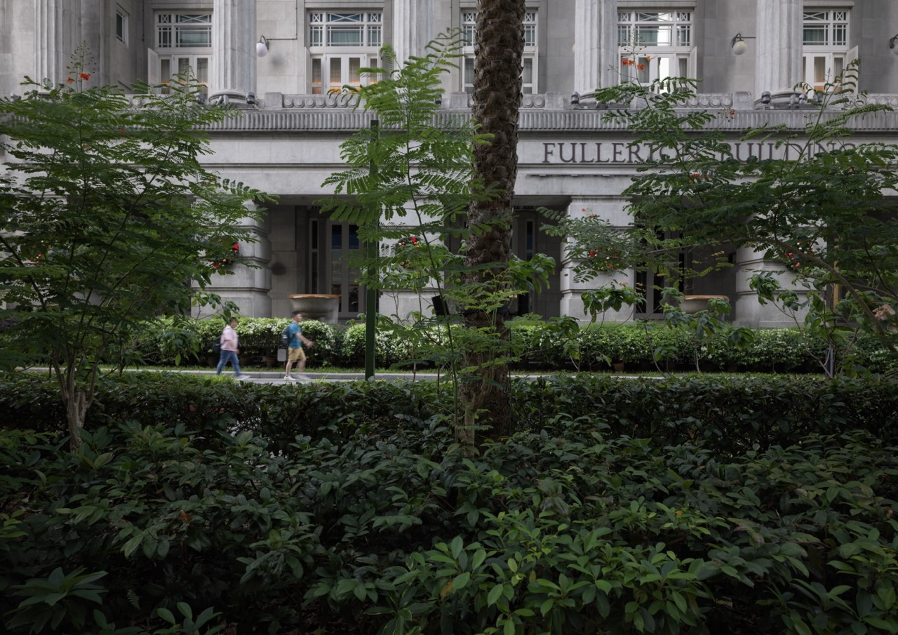
Downstream, Boat Quay leads naturally toward the Fullerton area and the mouth of the Singapore River.
That transition helps explain why finance and government accumulated nearby.
Trade generated paperwork.
Trade required customs, banks, offices, exchange and administration.
The commercial riverfront therefore seeded the modern financial district behind it.
Raffles Place did not emerge independently of the river economy.
It grew beside it.
Continue nearby: Things to do in Singapore | Raffles Place
Look Back at the CBD
Stand beside the river and turn away from the water.
The contrast is one of Singapore’s strongest urban images.
Low conserved shophouses occupy the foreground.
Skyscrapers rise immediately behind them.
The scene compresses two economic systems:
- nineteenth-century trade in small riverfront buildings;
- twenty-first-century finance in vertical office towers.
The continuity is commerce.
The physical form changed because the scale and technology of commerce changed.
Walk Upstream Toward Clarke Quay
Boat Quay should not be explored as an isolated heritage strip.
Walk upstream and the river’s economic geography unfolds.
Boat Quay sat close to the commercial core.
Clarke Quay contained important warehousing and market functions.
Robertson Quay farther upstream carried additional warehouses and workshops.
The three quays behaved like connected zones inside one river economy.
Continue upstream: Things to do in Singapore | Clarke Quay
Take a River Cruise to Change Perspective
A river cruise is useful because the street grid disappears.
From the water, the quay walls and shophouses align into one continuous corridor.
The visitor begins to see the river as the original road.
That is the key historical shift.
Today we organise the city around roads and MRT lines.
Early commercial Singapore organised a large part of itself around navigable water.
Use Boat Quay to Teach Reclamation and Shoreline Change
The river mouth and nearby coastline changed substantially through reclamation.
The old riverfront remained while the city extended outward into Marina Bay and the modern Downtown Core.
This means Boat Quay now feels inland compared with its earlier relationship to the open sea.
Urban coastlines move.
History remains anchored to streets that were once much closer to water.
Eat Beside the River, but Read the Building First
Today Boat Quay is strongly associated with restaurants and bars.
That modern use keeps the shophouses economically active.
Before choosing where to eat, spend two minutes looking at the architecture.
Where would goods have entered?
How narrow is the frontage?
How deep is the building?
What does the five-foot way do?
The meal becomes more interesting when the building stops being background scenery.
Compare Daytime and Nighttime Boat Quay
Daytime reveals heritage.
Nighttime reveals the modern leisure economy.
The same riverfront supports both.
This is temporal reuse.
The buildings do not change between noon and midnight.
The dominant users do.
A district can increase its usefulness by serving different populations at different hours.
A Simple Boat Quay Half-Day Plan
- Morning: arrive at Raffles Place MRT.
- Walk: descend toward Boat Quay and follow the river curve.
- Bridge stop: cross Elgin Bridge or Cavenagh Bridge.
- History stop: use the Singapore River Walk material to reconstruct the old port.
- Lunch: eat along the river or in the CBD.
- Extension: continue upstream to Clarke Quay or downstream to Fullerton and Marina Bay.
Boat Quay Through the eduKate Ecosystem
Things to do in Singapore | Singapore River
Things to do in Singapore | Raffles Place
Things to do in Singapore | Clarke Quay
Things to do in Singapore | Downtown Core
Frequently Asked Questions
What is Boat Quay famous for?
Its conserved riverfront shophouses, dining, nightlife and central role in the early commercial history of the Singapore River.
Was Boat Quay really a working port?
Yes. It was one of the principal places where goods moved between river craft, warehouses, merchants and the wider town.
Can we walk from Boat Quay to Clarke Quay?
Yes. It is one of Singapore’s best continuous heritage walks.
Is Boat Quay good for children?
Yes in the daytime for bridges, river history and architecture. Keep children close to you along busy waterfront and road sections.
What is the main learning idea?
Movement. Boat Quay shows how trade, buildings, bridges and finance clustered around a river because moving goods efficiently created economic value.
Official References and Heritage Sources
Roots.gov.sg | Singapore River Walk
Things to do in Singapore | Boat Quay
Boat Quay is where Singapore’s commercial city first learned to move at scale.
Boats became warehouses.
Warehouses became finance.
Bridges connected both banks.
The river tied everything together.
Today the cargo is gone, but the shape of the system remains.