
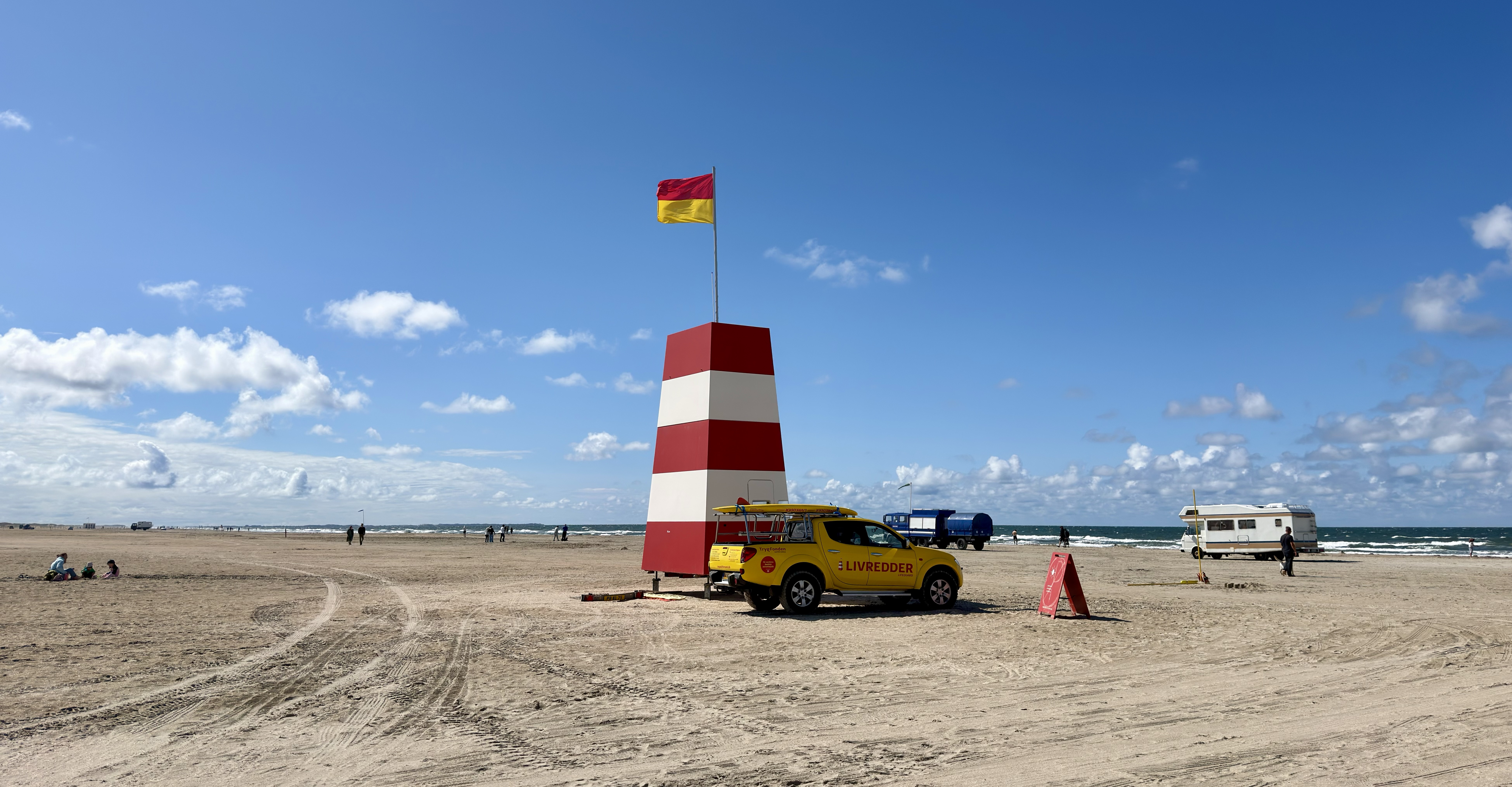
What are the best places to visit on Rømø? Start with the extraordinary causeway across the Wadden Sea, spend time on Lakolk and Sønderstrand’s enormous western beaches, and visit Naturcenter Tønnisgård to understand the island’s protected environments. Go north for Kommandørgården, the old whalebone fence and legally accessible Juvre dyke; discover maritime remembrance at Sct. Clemens Church, wartime history in Tvismark Plantage and the international ferry harbour at Havneby. Finish, if conditions and abilities suit, with an authorised tidal-flat nature or oyster safari. Together the ten experiences connect landscape, history, wildlife and island life.
Rømø is a Danish island in the Wadden Sea off southwestern Jutland. It is unusual among the region’s islands because a causeway connects directly to mainland Denmark, so visitors do not need a passenger ferry from Esbjerg or another Danish port to reach it. From Havneby on southern Rømø, a separate ferry links to List on Sylt in Germany. Two days allow a comfortable first visit to the beach, heritage sites and one guided nature activity; three days give more flexibility for weather, family time or a longer coastal walk.
October 2026 travel note: The Wadden Sea is a UNESCO World Heritage natural property, extended to include Denmark’s section in 2014. Rømø’s causeway and permitted western beaches can be enjoyed responsibly, but the Danish Nature Agency states that Juvre Sand is a military area closed to entry at all times. Tidal-flat excursions require careful planning, while beach-driving zones and lifeguard services vary. The Rømø–Sylt ferry publishes a schedule through 1 November before winter times change. Confirm current access and operator information instead of depending on a year-round timetable printed in a holiday article.


The ten Rømø places at a glance
- 1. Rømødæmningen Causeway and Wadden Sea Observation Points — Arrival geography, tidal habitats and the story of an island road.
- 2. Lakolk Beach: Rømø’s Expansive Western Sands — Wide sandy beach, suitable bathing, dunes and family time.
- 3. Sønderstrand: Wind Sports and Southern Beach Landscapes — Kite sports, blokart, shore recreation and responsible beach access.
- 4. Naturcenter Tønnisgård and the Rømø Mini Museum — Nature interpretation, family activities and guided Wadden Sea experiences.
- 5. Kommandørgården at Toftum: A Whaling Captain’s Historic Farm — Eighteenth-century whaling wealth, farm architecture and museum interpretation.
- 6. Juvre Whalebone Fence and the Northern Dyke View — Unusual maritime materials, protected marshland and military-area awareness.
- 7. Sct. Clemens Church at Kirkeby: Captains’ Graves and Maritime Gifts — Living religious heritage, whaling captain memorials and island history.
- 8. Tvismark Plantage and the Second World War Bunkers — Forest walks, dune history and safely interpreted wartime structures.
- 9. Havneby Harbour and the Rømø–Sylt Ferry — Working harbour, international island connections and a distinctive sea crossing.
- 10. Guided Wadden Sea Tidal-Flat and Oyster Safari — Tide science, responsible coastal foraging and conservation.
The sequence is a practical collection, not one continuous walk or drive. The causeway, Lakolk and Tønnisgård work for an introductory day. Northern heritage and legal dyke viewpoints belong together. Sct. Clemens and Tvismark fit a cultural itinerary, while Havneby and Sønderstrand provide southern options. A guided tidal-flat excursion must be timed around actual water conditions and the organiser’s schedule, not fitted casually into the last hour of an already full day.
Quick answers: which experiences suit your trip?
- First visit: Causeway viewpoint, Lakolk Beach and a short Tønnisgård or town stop.
- Families: A safe beach section, nature-centre activities and one museum or forest outing.
- History: Kommandørgården, the whalebone fence, Sct. Clemens and guided Tvismark bunkers.
- Outdoor sports: Organised blokart or wind activities in the correct Sønderstrand zone.
- Birdwatching: Legal causeway stopping bays and the public Juvre dyke, not restricted military or nesting sites.
- Wildlife and tides: A locally guided Wadden Sea excursion with footwear and timing appropriate to the group.
- International route: Havneby–List/Sylt ferry with separate booking and return planning.
- Accessibility: Check sandy surfaces, historic museum thresholds and tide-walk requirements individually.
1. Rømødæmningen Causeway and Wadden Sea Observation Points
Where: The 9.2-kilometre mainland–Rømø causeway. Best for: Arrival geography, tidal habitats and the story of an island road.
Rømø’s approach is unusual because visitors can drive across the Wadden Sea on a raised causeway rather than take a mainland ferry. Rømødæmningen, completed in 1948, connects the island to mainland Denmark near Skærbæk. The drive is itself a landscape lesson. As the water rises or recedes, the same surrounding flats appear to change shape and colour, while groups of birds feed or rest at different distances. Before the causeway, residents and visitors relied more heavily on boats, and the arrival point at Kongsmark was connected to Lakolk by older transport arrangements. The causeway therefore changed island life as well as holiday planning.
The Danish Nature Agency describes the causeway as nearly nine kilometres long, and National Park Wadden Sea gives its length as 9.2 kilometres. There are designated stopping places where drivers can pause safely to observe the tidal environment and birds. Use those stopping bays rather than stopping unexpectedly on the road or walking out onto the adjacent tidal flats. Vehicles, cycles and pedestrians need predictable separation because the causeway remains a functioning road. The National Park specifically warns against walking on the tidal flats beside the causeway, where the water and soft ground can create dangers that are not apparent from the roadway.
The landscape reveals how physical engineering affects nature. Channels and sediment-control structures on the flanks of the causeway influence where suspended material accumulates. The Nature Agency explains that land-reclamation practices were discontinued in 1992, and that the dyke has suffered storm-surge damage in different years. This shows that a road across water is not a fixed object whose surroundings never change. Maintenance, weather, tides and coastal sediment all matter. A first-time visitor can watch birds through binoculars from a legal stopping bay while remembering that the wider area is habitat, not a car park.
Ask why a nine-kilometre road can have such an effect on an island community. It can change deliveries, commuting and tourism, yet the sea continues to shape traffic and coastal conditions. Observe how tidal mudflats differ from the much broader sandy beach on the western side. The two sides of Rømø experience different environments despite being close together. Treat the crossing as your first real stop rather than simply the drive before the holiday begins, and give it the care and attention a living coast deserves.
Route suggestion: Plan a brief stop at an official bay on arrival or departure, never on the traffic lane or on tidal flats.
Back to all ten places · Next place
2. Lakolk Beach: Rømø’s Expansive Western Sands
Where: West-central Rømø at Lakolk Strand. Best for: Wide sandy beach, suitable bathing, dunes and family time.
Lakolk Beach is the best-known beach landscape on Rømø, a huge open sweep of sand that can make the horizon feel farther away than expected. Cars and caravans sometimes appear on designated areas of the beach, a characteristic that surprises visitors used to beaches reached only by foot. The scale invites long walks, kite flying and time outdoors, but it should not be confused with universal unrestricted vehicle access. Rules, signs, protected dunes and conditions determine where vehicles and visitors can go. The landscape is both a place for recreation and part of a coastal system that moves and changes with the wind and sea.
Choose your activity before driving onto the sand. For a family beach day, find a lawful, suitable parking area away from swimming activities and leave time for children to enjoy the open space. In summer, designated lifeguard arrangements may operate, but the presence of a lifeguard structure in an August 2026 photograph does not promise that staff will be present in October or winter. Check current bathing guidance, flags and weather. Sea temperature, currents and tidal change require attention. A walk beside the water is a worthwhile visit even when swimming conditions are unsuitable.
The beach’s breadth makes it easy to underestimate distances. A line of vehicles far away may take longer than expected to reach on foot, and mist or strong wind can reduce orientation. Keep sight of your planned access point, supervise children, and do not drive in areas prohibited by signs. Soft sand may trap vehicles, while high water can make parking close to the sea unwise. Avoid crossing fragile dune vegetation for shortcuts. A responsible day places nature and other visitors ahead of the desire for a car-on-the-beach photograph.
Lakolk is particularly good for learning about wind and sediment. Sand grains are moved along the shore, and dune grasses help stabilise some deposits, producing a landscape that is never exactly the same from year to year. Ask children to look for marks left by wind, wheels and footprints, then consider which vanish quickly and which forms may persist. The beach also offers a practical conversation about sharing public space: swimmers, walkers, vehicles and nature need rules so that one visitor’s enjoyment does not make the place unsafe for others.
Route suggestion: Pair Lakolk with nearby Tønnisgård or a moderate forest walk; do not schedule a distant tidal excursion as an afterthought.
Back to all ten places · Next place
3. Sønderstrand: Wind Sports and Southern Beach Landscapes
Where: Southwestern Rømø at Sønderstrand. Best for: Kite sports, blokart, shore recreation and responsible beach access.
Sønderstrand is famous for its broad firm sands, wind and opportunities for land-sailing sports. Its openness attracts kite-buggy and blokart activities, which make sense in a place where wind can be both a challenge and an energy source. The Danish visitor information distinguishes Sønderstrand from Lakolk in emphasis: the southern beach includes areas where wind-powered recreation is especially popular. For a first-time visitor, watching trained participants manage the equipment can be interesting even without taking part. The beach is also beautiful as a wide, open natural landscape, not just a sporting arena.
If you want to try blokart or kite-buggy, book an appropriate operator and ask about conditions, helmets, age limits, safety briefings and cancellation rules. A land yacht is not an ordinary bicycle: when the wind strengthens, the forces and stopping distances change. Dedicated zones help keep users away from beach walkers and children, and those boundaries must be respected. Do not assume that every stretch of sand can be used for a motor vehicle or land-sailing session. Beach access rules and local restrictions can differ even between two famous Rømø beaches.
The broad shore also provides a chance for a quieter walk, but make a conscious decision about where to be. Avoid walking through a group of moving kite buggies or standing downwind of equipment while participants are preparing to launch. Changing tides and wet sand can affect access. In autumn, a crisp open day may be dramatic but also cold; in poor visibility or high wind the sensible alternative may be a forest or museum visit. Families with small children may enjoy watching from a safe distance rather than taking part in every activity.
Sønderstrand is a good example of renewable energy in its most immediate form: moving air exerts force on a sail and produces motion. Ask how a rider changes direction, limits speed and anticipates another person’s movement. This is also a lesson in public safety, because a recreation space needs rules so different visitors can enjoy it without conflict. Enjoy the wind as a part of Rømø’s natural character, not as a guarantee that every activity will be safe or available on your chosen date.
Route suggestion: Use as a dedicated southern beach afternoon, or a booked wind-sports session with enough space and weather flexibility.
Back to all ten places · Next place
4. Naturcenter Tønnisgård and the Rømø Mini Museum
Where: Central Rømø, at Tønnisgård. Best for: Nature interpretation, family activities and guided Wadden Sea experiences.
Naturcenter Tønnisgård provides one of the best starting points for understanding Rømø. The historic farm setting houses an interpretation centre where visitors can learn about dunes, the Wadden Sea, birds and local natural history. The Danish Nature Agency lists a wide range of potential guided activities, including birdwatching, bunker tours, coastal foraging and children’s workshops. Its value lies in helping travellers choose what is suitable for the season and how to approach sensitive habitats safely, rather than simply selling activities. A landscape makes more sense after someone explains the relationship between its tidal flats, wildlife and centuries of island life.
Check which exhibitions, guided events and family activities are available on your actual dates. An amber-polishing workshop or a bird trip may be scheduled on particular days rather than operating continuously. Children can enjoy a hands-on activity when provided, while adults may be interested in local geology or the complexities of the Wadden Sea. The small Rømø Mini Museum, described by the Nature Agency as a simple panel exhibition in a neighbouring wooden structure, offers another way to learn about the island’s origin; current access should still be checked locally. Do not assume every programme advertised for summer operates through late October.
Tønnisgård is also the practical place to investigate tide-dependent outings. A local guide can interpret routes, help guests understand necessary footwear and explain whether an oyster safari or mudflat visit is appropriate. Unfamiliar visitors should not set out onto tidal flats independently on the strength of a general travel article. Even a guided outing may be postponed when wind, water levels or access restrictions make conditions unsuitable. Listen to the organiser’s safety instructions and select a shorter indoor visit if mobility, age or weather is an issue.
The strongest learning method here is to make an observation in an exhibition, then look for its real-world counterpart. A panel about how dunes form can prepare you for Lakolk; a display about birds can improve a distant causeway observation; information about old bunkers can explain why some structures remain hidden in Tvismark’s sand. This connections-first approach gives an island holiday lasting educational value without requiring that every visit feel like a school excursion.
Route suggestion: Use the nature centre before a longer coastal or bunker outing; confirm programme availability and guided departure times.
Back to all ten places · Next place
5. Kommandørgården at Toftum: A Whaling Captain’s Historic Farm
Where: Juvrevej 60, Toftum, northern Rømø. Best for: Eighteenth-century whaling wealth, farm architecture and museum interpretation.
Kommandørgården is one of Rømø’s most distinctive heritage buildings, a historic farm associated with the island’s eighteenth-century whaling era. The Danish Nature Agency dates the surviving farm to 1746 and explains that the term kommandør referred to a whaling captain. Some such captains earned substantial wealth from North Atlantic voyages and invested in elaborate farms at home. Interior decoration could include Dutch and Frisian tiles, painted woodwork and fine household objects. The building illustrates how a relatively remote Danish island became connected with distant seas, commerce and cultural influences.
A visit should go beyond the picturesque exterior. When the National Museum’s museum farm is open, exhibits can explain who lived there, how the household worked and what whaling voyages involved. The history should not be romanticised. These expeditions were hazardous for crews and deadly for whales, while economic gains depended on markets and a substantial supporting workforce. Consider the many people at home who helped maintain the farm, raise children and manage goods while mariners were absent. That broader view gives the attractive architecture a more accurate human context.
Check the National Museum’s current opening calendar; a heritage farm is not automatically open every day of the year. Historic rooms, thresholds and fragile interiors may be unsuitable for some visitors, so ask about mobility access beforehand. Do not handle antiques or decorative items, climb onto old farm equipment or enter closed parts of the property. Photography may have specific rules. If the museum is not open, treat the permitted external viewpoint as a shorter heritage stop and focus on other public sites, rather than attempting to access a private or staff area.
The farm is also useful for comparing local and international history. Why do imported tiles appear in a Danish island home? What does the wealth of a sea captain tell us about international markets and the risks of his profession? A child may find the decorated rooms interesting, while an adult can ask how this prosperous household coexisted with other island families. The site is a reminder that travel and commerce connect even remote places to difficult global histories, including the use and exploitation of marine animals.
Route suggestion: Pair Kommandørgården with the nearby Juvre whalebone fence and a responsible northern dyke viewpoint.
Back to all ten places · Next place
6. Juvre Whalebone Fence and the Northern Dyke View
Where: Juvrevej 82 and public parts of Juvre Dige, northern Rømø. Best for: Unusual maritime materials, protected marshland and military-area awareness.
The whalebone fence at Juvre is one of Rømø’s most unusual small heritage landmarks. According to the Danish Nature Agency, a fence constructed in 1772 uses whale bones, a physical reminder of the historic Arctic whaling trade associated with Rømø’s captains. At first the idea can sound almost invented, yet it becomes understandable when seen within the island’s maritime economy and the availability of materials. The fence is historically valuable because it communicates both prosperity and the uncomfortable realities of using whales as a resource. It should be appreciated without turning the whaling industry into a simple tale of adventure.
Continue only along authorised public routes to parts of Juvre Dige, which provide broad views of marshland and bird habitats. Walking and cycling are permitted on the dyke under the Nature Agency’s information, but that is not permission to step into adjacent working, private or restricted zones. Northern Rømø includes Juvre Sand, an active military exercise area where entry is prohibited at all times. Do not cross into it, even if a map appears to show a straightforward coastal path. The Nature Agency also warns that training lasers can present eye hazards and that binoculars are inappropriate when observing military exercises.
A safe northern outing therefore focuses on the fence from a lawful viewing position, the public dyke and the surrounding open landscape. Follow signs and maintain distance from any military perimeter. Do not enter privately occupied land simply because a heritage feature stands nearby. Birds in the marshland need quiet, and seals or other wildlife should not be approached. In windy weather, a dyke can be more exposed than a nearby road, so bring suitable clothing and turn back when conditions are uncomfortable.
The two features provide contrasting lessons. The whalebone fence shows how human work and international trade leave traces in a local landscape. The dyke demonstrates how people manage land, water and coastal risk through engineering. Military restrictions add an important practical dimension: not every spectacular-looking place is an open tourist destination. Learning to distinguish a lawful route from a prohibited area is part of responsible travel, and no photograph is worth overriding safety rules.
Route suggestion: Make a northern historical-and-viewpoint half-day, staying on public dyke paths and out of Juvre Sand’s restricted zone.
Back to all ten places · Next place
7. Sct. Clemens Church at Kirkeby: Captains’ Graves and Maritime Gifts
Where: Havnebyvej 152, Kirkeby, central-southern Rømø. Best for: Living religious heritage, whaling captain memorials and island history.
Sct. Clemens Church, or Rømø Kirke, provides a different way to understand the island’s seafaring history. The churchyard contains grave markers commemorating captains who served on whaling and seal-hunting vessels in northern waters. Inside, the parish’s own interpretation describes votive ships, old brass chandeliers, carved religious objects and other evidence of gifts from seafarers and local families. These objects were not collected simply to create a tourist display. They belonged to a living community that expressed fear, gratitude, wealth and remembrance through its church.
The parish describes chandeliers given by captains in 1704, and records names of donors and families. It also explains the church’s memorial to local men who died during the First World War. These details make clear that Rømø’s connection to the sea changed with political circumstances: Arctic maritime ventures created both prosperity and loss, and war later affected islanders in new ways. A thoughtful visitor should read interpretation before turning a grave marker into a social-media backdrop. Churchyards are places of personal remembrance for present-day families as well as historic sites.
Sct. Clemens remains a functioning church. Services, funerals and other community events take priority over tourism. Check visiting information with the parish before assuming that the interior will be available. Dress and speak appropriately and avoid interrupting worship or photographing individuals closely. The church may have historic steps or thresholds; visitors needing step-free access should ask directly about the arrangements. A public exterior stop can still be meaningful if an interior visit is unsuitable or unavailable.
The most useful question is why a sailor would donate a model ship or a chandelier to a church. The answer may involve faith, thanks for survival, commemoration or social status. The objects connect maritime experience with family and community life. Comparing Sct. Clemens with Kommandørgården reveals two different expressions of the same historic wealth: a private household and a shared religious institution. Seeing both makes the eighteenth-century story more complete than either attraction alone.
Route suggestion: Pair with Kirkeby and a central-island stop; approach church services and graves respectfully.
Back to all ten places · Next place
8. Tvismark Plantage and the Second World War Bunkers
Where: Central-northern Rømø, pine plantation near Tønnisgård. Best for: Forest walks, dune history and safely interpreted wartime structures.
Tvismark Plantage is a wooded landscape planted amid dunes and heath, a welcome contrast with Rømø’s wide open western beaches. The Nature Agency estimates its area at around 1.5 square kilometres and identifies remnants of numerous German military bunkers from the occupation of Denmark during the Second World War. Around the site known as the Mammut radar bunker, the occupying military maintained a significant radar position. After the war, many bunkers were buried or left in place rather than removed. Their remains are a stark reminder that the island’s location mattered for twentieth-century military purposes as well as earlier navigation and whaling.
Use established public forest paths, and enjoy the combination of pines, dune ground and quieter picnic settings where available. Do not attempt to enter locked bunkers or crawl through damaged concrete structures. Some bunker remains are partly buried and can have unstable openings, sharp metal and hazardous spaces. The Nature Agency notes that the local nature centre arranges authorised guided bunker tours, giving visitors an opportunity to learn about the installations without improvising access. Check whether the tour operates on your chosen date, its physical requirements and whether enclosed spaces are suitable for your party.
A guided tour can make the landscape’s historical layers clearer, but visitors should not glorify the occupation or reduce the wartime experience to a game of exploring hidden chambers. The bunkers formed part of a military network, with technical functions and wider consequences. A safe public forest walk is also worthwhile when tours are unavailable. Observe the contrast between planted woodland and open dune areas, where different vegetation changes the feeling of wind and shelter. Respect forestry operations, protected plants and any temporary closures.
This is a useful place to compare technologies across time. Rømø’s lighthouse history belongs to navigation through visible signals; the bunkers introduce radar and the wartime effort to detect distant movement. What can a radar installation determine that a lighthouse cannot? Why were large structures built and then abandoned? The forest setting also raises questions about how nature and humans change a landscape over decades. One stop can therefore support history, technology and ecology without sensationalising the conflict.
Route suggestion: Pair with Naturcenter Tønnisgård and a short plantation walk, with bunker entry only on an authorised guided tour.
Back to all ten places · Next place
9. Havneby Harbour and the Rømø–Sylt Ferry
Where: Southern Rømø, Havneby and the List/Sylt route. Best for: Working harbour, international island connections and a distinctive sea crossing.
Havneby is Rømø’s southern maritime town, known for its harbour and the ferry connection to List on the German island of Sylt. This crossing is different from the road causeway to mainland Denmark: it carries people and vehicles across water between two countries and two distinct island cultures. The FRS Syltferry service operates a published seasonal timetable, with multiple daily sailings and shorter service periods in some months. Travellers can enjoy a public harbour walk without necessarily crossing to Sylt, but a ferry excursion can provide a broader perspective on the islands of the Wadden Sea.
The harbour includes working operations as well as passenger facilities. Keep out of vehicle marshalling lanes, watch for moving equipment and obey ferry staff instructions. Restaurants and fishing-related businesses can make a good meal stop, but opening and seafood availability may change. If planning the Germany crossing, make sure to book the exact direction, vehicle type and travel date, and check whether an open return is permitted. The 2026 operator’s schedule has separate time periods for summer, autumn and winter, so a crossing listed in July cannot automatically be assumed in late October or November.
The ferry timetable advises passengers about check-in, and vehicles are assigned to loading lanes under the operator’s procedures. Follow those rather than arriving at a random quay expecting a place aboard. Cross-border travel may also involve identity or vehicle documentation depending on current rules. If you want a day on Sylt, the amount of time ashore depends on the actual sailings and onward transport from List, not only the crossing duration. Do not combine a long tidal-flat hike with a nonrefundable last boat on the assumption that conditions will remain predictable.
Havneby offers a final way to understand how islands work. Rømø has a causeway to mainland Denmark but still maintains an international ferry link. The harbour supports trade, employment and mobility while exposing people to changing sea conditions. Compare this with the historic need for a lighthouse and with the supply functions of the mainland road. A small island can be part of several overlapping transport networks, each with different strengths, costs and vulnerabilities.
Route suggestion: Use as a southern town-and-harbour half-day, or as a separately booked Sylt crossing with confirmed return.
Back to all ten places · Next place
10. Guided Wadden Sea Tidal-Flat and Oyster Safari
Where: Authorised guided tidal-flat routes from Rømø. Best for: Tide science, responsible coastal foraging and conservation.
A guided outing into the Wadden Sea offers one of Rømø’s most distinctive educational experiences. At low tide, enormous areas of sand and mud become exposed, revealing tidal channels, shellfish habitats and feeding opportunities for wading birds. Naturcenter Tønnisgård organises excursions that may include learning about edible shellfish and oyster gathering under local rules. The interest is not simply collecting something from the flats. It is understanding how the movement of water creates a productive and internationally important coastal ecosystem, and how people have used it while attempting to protect wildlife.
Book with a competent local organiser rather than setting out alone. Unfamiliar tidal flats can contain soft mud, deep channels and areas that flood quickly as the tide returns. A route possible at one time may be impossible only a little later. Official excursion information gives walking distances and footwear requirements; do not assume the activity is suitable for every child or visitor with limited mobility. Carry only the equipment the guide recommends, stay within the group and never try to extend the tour to a more distant sandbank after the organiser tells you to return.
Shellfish harvesting introduces separate food-safety and legal issues. Wild oysters can carry pathogens or accumulate harmful substances, and a beach visitor should not assume that an oyster found on the flats is safe to eat raw. Follow the guide’s current rules about where gathering is allowed, protected areas, seasonal closures and safe handling. People with seafood allergies should not participate in tasting without appropriate caution. A guided nature outing can be fascinating even when no oysters are collected or tasted. Animal habitats and national-park restrictions take priority over souvenir gathering.
The Wadden Sea is UNESCO-listed for ecological and geological processes, not because a visitor is entitled to walk anywhere when the water is low. At a safe and authorised point, ask why the same ground is underwater part of the day and exposed for the rest, how creatures survive that cycle, and why migratory birds depend on the area’s food supply. The best outcome is understanding tides, intertidal life and conservation—not collecting the largest bag of shellfish. Responsible guides know when to change the route or cancel because nature has the final say.
Route suggestion: Make this the main activity of a tide-dependent day, with Tønnisgård or a short town walk as the flexible second stop.
How to plan one, two or three days on Rømø
One day: causeway, beach and one cultural stop
Because you can drive to Rømø from mainland Denmark, a day trip is quite feasible. Begin with a short stop at an official observation bay on the causeway, then proceed to Lakolk for the coast. Spend meaningful time on the beach without assuming a summer lifeguard service is active. Choose an afternoon at Naturcenter Tønnisgård if it has a suitable programme, or a shorter visit to Sct. Clemens Church or a legal forest route. This is already a useful introduction. Avoid trying to include the military north, an international ferry excursion and an oyster safari in the same day.
If a tidal-flat tour is the reason for travelling, reverse the method. Book the guide first, check the exact tide-dependent departure and then add one flexible nearby stop. An oyster safari cannot be moved into the afternoon simply because a museum visit takes longer than expected. Likewise, a booked wind-sports lesson should be the main beach activity, with room for cancellation if strong weather arrives. A realistic one-day trip favours a few well-chosen experiences over ten superficial photographs.
Two days: north and middle, then south and tidal culture
On day one, drive across the causeway and explore Tønnisgård or Lakolk, then travel north for Kommandørgården and the whalebone fence. Take a permitted section of Juvre Dige if the weather and your abilities allow, staying completely outside Juvre Sand’s military exercise zone. On day two, choose Sct. Clemens and Tvismark for cultural history, then enjoy the southern beach at Sønderstrand or Havneby harbour. If a guide confirms a suitable tidal excursion, give it priority over trying to complete the other activities. This grouping reduces repetitive driving and gives room for meals and unforeseen changes.
Three days: add a guided Wadden Sea or Sylt experience
A third day is valuable for travellers who want a specialised guided nature outing or a ferry day to Sylt. Both experiences have operating constraints and deserve time on their own. The Wadden Sea trip must fit the tidal window, while the ferry to List follows a separate seasonal timetable and the destination on Sylt requires its own transport planning. Choose one as the main event rather than pretending both can be completed easily alongside the island’s remaining sites. With no advance booking, a relaxed forest and beach day is an excellent alternative.
Getting to Rømø and using the Rømø–Sylt ferry
Rømødæmningen is the island’s road connection from southwestern Jutland, completed in 1948. It crosses more than nine kilometres of tidal landscape and makes Rømø accessible without paying for a mainland–island passenger ferry. Drivers should use designated observation places only and pay attention to any weather or traffic notices. The Danish Wadden Sea National Park explicitly restricts access to tidal flats immediately beside the causeway, despite how attractive they may appear when exposed at low tide. A causeway crossing should never become an unplanned walk into mud channels.
A completely separate route is the FRS Syltferry between Havneby on Rømø and List on Sylt, Germany. The official operator’s 2026 timetable includes seasonal service periods and multiple departures on many dates, but individual times, check-in and vehicle lanes must be confirmed for the chosen crossing. The autumn schedule runs through 1 November 2026, and winter dates have a different pattern. If travelling with a bicycle, car or pet, check the ticket rules rather than assuming every passenger ticket includes them. If planning a return from Sylt, verify onward transport from List before deciding how much time is available for sightseeing.
If travelling without a private car, local bus routes and tours may be useful, but public transport on rural Rømø should be checked against your precise destinations and date. A stop near the causeway is not necessarily a convenient starting point for a lengthy beach walk. Cycling is rewarding on appropriate roads and marked paths, yet strong wind and sandy terrain can make longer distances more demanding than a map suggests. Never cycle across restricted military land or into protected wildlife habitat.
The Wadden Sea UNESCO property and what protection means
UNESCO inscribed the Wadden Sea on the World Heritage List in 2009; the property was extended in 2014 to include Denmark’s component alongside the German and Dutch sections. The designation recognises extensive natural processes and outstanding biological productivity across a shared tidal system. It does not mean that every building, church, beach vehicle track or whaling farm on Rømø is individually listed as World Heritage. Those cultural sites have their own historical value and access rules, while the transnational property’s core significance lies in natural ecosystems.
The tides are fundamental. Water enters channels and floods flats, then retreats and exposes broad areas of sand and mud. Those same flats support worms, shellfish, fish and birds, and they can be treacherous to people without local knowledge. A tide chart does not reveal every deep channel or soft patch. This is why organised tours are recommended for unfamiliar visitors and why the safest route may change between seasons. The island’s west-facing beaches and its east-facing Wadden Sea landscape belong to related but distinct coastal environments; neither should be reduced to a single generalisation about ‘a sandy island’.
Coastal birds need space. Follow signed nesting protection zones and respect dog-leash rules, including the Danish National Park’s restrictions on beaches in the main breeding season. Never make flocks take flight intentionally for photography, and do not enter military or restricted wildlife areas. A visit becomes richer when you recognise that much of the coastline is an ecosystem with its own rhythms rather than a blank recreational surface.
Beach driving, dunes and the military north: safety first
Rømø is known for certain beaches where driving is permitted, but the permission is local and conditional. Use the legally designated vehicle sections, remain within the posted limits, and take particular care around families, sunbathers, walkers and active kite equipment. Soft or wet sand can trap cars. Do not park where a rising tide could reach the vehicle or block emergency routes. At Lakolk, lifeguard services may be seasonal; seeing a rescue truck or red-and-white marker in a 2026 summer photograph is not evidence that rescue staff are present on another day. Follow current flags, patrol notices and local weather advice.
Sønderstrand’s specialist kite sports require their own safety discipline. A moving land yacht can travel quickly in strong wind, and users should keep to designated zones and appropriate instruction. Visitors walking nearby should be aware of moving equipment and avoid standing in launch areas. Dune grasses and low coastal vegetation help retain sand, so do not shortcut through protected dune slopes merely to reach a parking spot. A wide open beach is not free from rules, risks or ecological value.
Northern Rømø has an especially serious restriction. Juvre Sand is an active military area, and the Danish Nature Agency states that access is prohibited at all times. The public Juvre dyke and a specific distant viewing point do not authorise crossing into exercise land. Exercises may use laser equipment that presents eye hazards, and the agency cautions against binoculars when watching military training. Rather than trying to see military activity, focus on the permitted whalebone heritage and the landscape. A destination is still worth learning about when part of it is not safe or lawful to enter.
When to visit, what to pack and the right family pace
Summer usually offers the widest choice of family beach services, organised wind sports and nature excursions, but the same season can bring busier roads and popular beach areas. Spring and autumn may be especially rewarding for quiet nature observation and migratory birds, while wind, shorter days and reduced staffing change outdoor plans. Winter is another kind of trip: shorter coastal walks, permitted viewing points and selected cultural stops are often more realistic than swimming or long intertidal excursions. Some operators offer guided events outside summer, so check their actual calendar instead of assuming the whole island closes or operates uniformly.
Pack a windproof layer, water, sun protection, footwear suited to sand and wet paths, a current map and a means to check the weather. For a guided tidal-flat outing, follow the organiser’s advice on boots and clothing, and do not add an improvised solo extension. Children may enjoy a kite workshop or a safe stretch of sand more than a multi-hour history lecture. Travellers with mobility limitations should ask about actual surfaces, museum thresholds and guided-route requirements; a flat-looking coastline can still be difficult to cross in soft sand or mud.
Food is part of island travel, but weather and season may affect local offerings. Seafood restaurants around Havneby and elsewhere can be appealing, while shellfish foraging has safety considerations that a casual tourist should not ignore. Do not describe an uncooked wild oyster as automatically safe to eat. If a certain restaurant, museum or workshop is essential, contact the business to confirm opening and booking. Leave enough time between activities for travel and rest so that the holiday becomes enjoyable rather than a test of punctuality.
What curious travellers can learn on Rømø
Rømø is useful for connecting subjects often kept separate. A causeway explains engineering and the effects of changing transport infrastructure. Lakolk and Sønderstrand show winds, dunes and recreation rules. Kommandørgården and Sct. Clemens reveal maritime trade, religious remembrance and the human cost of whaling. Tvismark explains twentieth-century radar and wartime occupation, while the Wadden Sea helps readers understand tidal ecology. These are not unrelated highlights; they reveal how people and natural systems interact on a relatively small island.
Use a short method at each stop: observe, ask, verify. At the whalebone fence, ask why whale bones were available and then check official interpretation. At a dune, observe how grasses catch sand before considering the science. At the church, read a sailor’s memorial rather than inventing the owner’s life story. At a tidal viewpoint, watch the water safely and ask how birds use the exposed flats. This habit produces more accurate understanding than relying on photographs or confident claims from an old travel brochure.
The island also demonstrates that responsible travel involves boundaries. A causeway viewpoint can be open when adjacent mudflats are unsafe; a museum can welcome visitors when a private house is closed; a dyke path can be permitted beside a military area where entry is prohibited. Understanding these distinctions is a practical learning skill. The holiday becomes more meaningful when visitors can appreciate a protected landscape without insisting on entering every corner of it.
English–Chinese vocabulary for a Rømø trip
- island — 岛屿 — dǎoyǔ
- causeway — 堤道 — dīdào
- tidal flat — 潮滩 — cháotān
- high tide — 涨潮 — zhǎngcháo
- low tide — 退潮 — tuìcháo
- sand dune — 沙丘 — shāqiū
- lifeguard — 救生员 — jiùshēngyuán
- whaling — 捕鲸 — bǔjīng
- maritime heritage — 海事遗产 — hǎishì yíchǎn
- lighthouse — 灯塔 — dēngtǎ
- seal — 海豹 — hǎibào
- shellfish — 贝类 — bèilèi
- forest plantation — 人工林 — réngōnglín
- navigation — 航海导航 — hánghǎi dǎoháng
- nature conservation — 自然保护 — zìrán bǎohù
- guided tour — 导览活动 — dǎolǎn huódòng
Choose only the words that fit what you encounter. Say ’causeway’ as you cross to the island, ‘tidal flat’ at a permitted viewpoint and ‘whaling’ while learning about Kommandørgården. A few accurately understood terms linked to a lived experience can be more memorable than reciting a large vocabulary list. The aim is for readers to notice, describe and understand the real world more clearly.
Frequently asked questions about visiting Rømø
Where is Rømø and how can I reach it?
Rømø is a Danish Wadden Sea island off southwestern Jutland. A causeway approximately 9.2 kilometres long connects the island to the mainland, so ordinary visitors can arrive by road without taking a ferry from Denmark. Havneby additionally has a separate ferry connection to the German island of Sylt.
Is Rømø a car-free island?
No. Unlike Hiddensee, Rømø is accessible by road and has vehicle routes. Certain western beach areas also allow cars under local rules. That permission does not extend to every dune, beach, military area or nature reserve; follow signs and current regulations.
Can I drive on Lakolk and Sønderstrand beaches?
Vehicles can access designated beach sections, subject to current local rules, speed limits and conditions. Do not drive outside permitted areas, close to swimming activity or over protected dunes. Watch the tide and soft sand, and respect emergency access.
Are there lifeguards at Lakolk all year?
No such assumption is safe. Lifeguard services are seasonal or operationally dependent. Always consult the current bathing flags and advice, and never treat a summer rescue photograph as proof of autumn staffing.
Can I reach Rømø from Germany by ferry?
Yes. FRS Syltferry runs between List on Sylt and Havneby on Rømø. This is separate from the Danish mainland causeway. The service has seasonal departure tables; check the exact timetable and booking rules for the planned journey.
What is the Wadden Sea UNESCO designation?
The Wadden Sea is a transnational natural World Heritage property, first inscribed in 2009 and expanded to include Denmark in 2014. Its international significance is ecological and geological. That does not mean every heritage building or road on Rømø is individually inscribed by UNESCO.
Is it safe to walk on the tidal flats without a guide?
It can be hazardous. Tidal channels, soft mud and rapidly rising water create risks, especially for visitors without local knowledge. Book an appropriately guided tour if you want to explore the flats. The National Park warns against walking on flats adjacent to the causeway.
What is Kommandørgården?
It is a historic eighteenth-century whaling captain’s farm at Toftum, associated with Rømø’s maritime economy and decorated with materials reflecting far-ranging trade. Museum opening and guided access are separate from viewing its exterior from a lawful public position.
Where is the whalebone fence?
The Danish Nature Agency identifies a whalebone fence at Juvrevej 82, dating to 1772. Its unusual material connects the island’s houses and farms with Arctic whaling history. Respect private boundaries and visit only from permitted areas.
Can I enter Juvre Sand?
No. The Danish Nature Agency states that the military area at Juvre Sand is closed to entry at all times. The public dyke is a different route. Do not cross the range boundary, and follow official warnings about exercises and optical hazards.
Can I explore the Second World War bunkers?
Some preserved bunkers in Tvismark Plantage can be experienced through authorised guided tours arranged by Naturcenter Tønnisgård. Many are locked, partly buried or unsafe for independent entry. Enjoy legal forest paths rather than climbing through old concrete structures.
Can I collect or eat wild oysters on a Wadden Sea tour?
Only within the rules of an authorised activity and with appropriate food-safety precautions. Wild shellfish can pose health risks, particularly when eaten raw. A guided nature trip is worthwhile even if no oysters are tasted or collected.
How many days should I spend on Rømø?
A day trip can provide a causeway viewpoint, one beach and a short cultural stop. Two days allow a northern heritage route and southern beach or harbour day. Three days provide flexibility for a booked guided tidal-flat outing or a crossing to Sylt.
Which Rømø places are best for children?
A suitable section of Lakolk Beach, a nature-centre activity and an easy forest or heritage stop can work well. A specialised wind-sports lesson or tidal-flat hike requires age, weather and safety assessment rather than being treated as universally suitable.
Official Rømø sources and related eduKate island travel guides
The geographic, nature-protection and travel-planning details in this article were checked against official Danish Nature Agency, Wadden Sea National Park, VisitDenmark, parish, ferry-operator and UNESCO resources in October 2026. Use the primary site or guide to confirm live access, tides, museum seasons and cancellations. Background history is generally stable, but operational conditions can change without notice.
- Danish Nature Agency — Rømø attractions, military restrictions and causeway
- Danish Wadden Sea National Park — Rømø, birds and safe causeway stops
- VisitDenmark — Lakolk Beach
- VisitDenmark — Sønderstrand
- VisitDenmark — Naturcenter Tønnisgård
- VisitDenmark — Tønnisgård exhibitions
- VisitDenmark — guided oyster safari
- Visit Sønderjylland — Rømø natural and cultural heritage
- Rømø–Tønder tourism — attractions, church and Havneby
- Sct. Clemens Parish — maritime gifts and church history
- FRS Syltferry — Rømø–Sylt ferry 2026 timetable
- UNESCO World Heritage Centre — Wadden Sea natural property
- eduKate — Top 10 Places to Visit When Touring Fanø
- eduKate — Top 10 Places to Visit When Touring Anholt
- eduKate — Top 10 Places to Visit When Touring Læsø
- eduKate — Top 10 Places to Visit When Touring Denmark
- eduKate — World Travel & Luxury Hub
Featured photo: Lakolk Strand, Rømø, photographed on 10 August 2026 by Olgierd Rudak, Wikimedia Commons original, Creative Commons Attribution-ShareAlike 4.0; photograph unmodified. Its visible lifeguard marker and vehicle depict that day and are not evidence of current staffing or permission.
Rømø rewards travellers who understand its variety. The causeway reveals the daily reality of life beside a tidal sea; the western beaches show the force of wind and sand; the whaling farms and church remember trade, wealth and loss; forest bunkers preserve a difficult chapter of wartime history; and the protected flats teach the value of patience and boundaries. Plan the visit around real conditions, keep clear of prohibited areas and leave enough time to enjoy the island rather than racing through a checklist.