
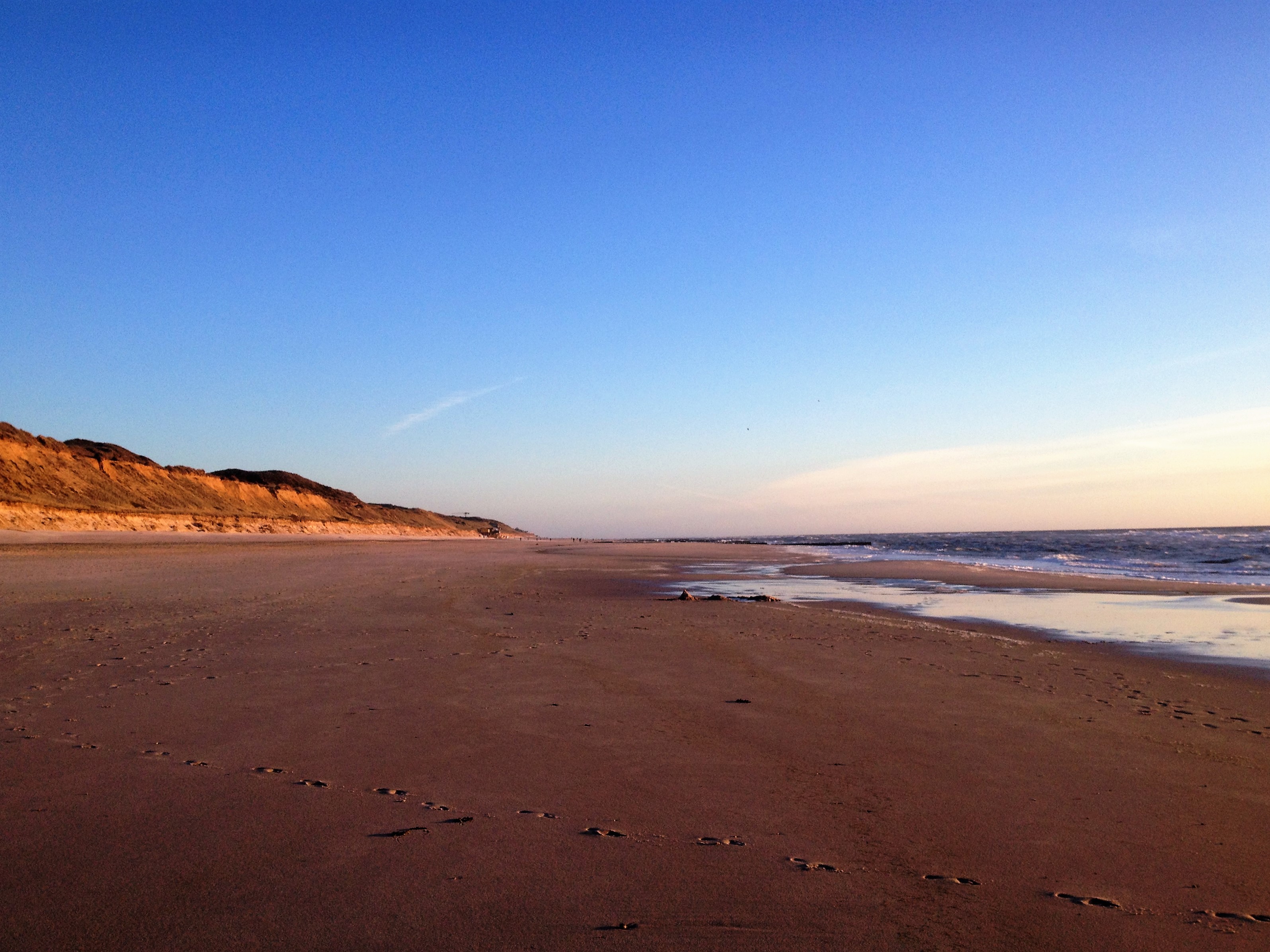
What are the ten best places to visit on Sylt? Begin at Westerland, with its famous beach and rail arrival point. Explore the Red Cliff between Kampen and Wenningstedt, the historic Frisian village of Keitum, Morsum’s spectacular geological cliff and the bird-rich Rantum Basin. In the north, discover List Harbour, the Natural Forces Adventure Center, Germany’s northernmost point at Ellenbogen and the strictly protected shifting dunes. Finish at Hörnum’s lighthouse and the changing southern coastline of Hörnum Odde. These places show that Sylt is much more than a fashionable North Sea beach destination.
Sylt is Germany’s best-known North Frisian island, connected to the mainland by the Hindenburgdamm railway embankment, not an ordinary road bridge. Passengers can arrive by train at Westerland, motorists use a car train from Niebüll, and a car-and-passenger ferry links Havneby on Denmark’s Rømø with List on Sylt. A four-day first visit works well when divided into central, eastern, northern and southern areas. An excellent shorter trip can focus on one or two neighbouring regions instead of racing the length of the island.
October 2026 travel and access note: The Hörnum Lighthouse’s public tours for 2026 are officially fully booked; it is not sensible to promise an available slot. Entry into List’s protected shifting dunes is prohibited except under authorised permission or tours. Swimming at Ellenbogen is forbidden due to dangerous currents, and a long section of Hörnum Odde may become impassable at high tide. Sylt’s official tourism pages provide specific rail and ferry arrangements and nature warnings; check them for your actual dates instead of trusting older brochures or photographs.


The top ten Sylt places at a glance
- 1. Westerland Promenade, Beach and Rail Arrival Town — Island orientation, North Sea culture, shops and main transport hub.
- 2. Rotes Kliff: The Red Cliff Between Kampen and Wenningstedt — Distinctive geology, sunsets and protected cliff paths.
- 3. Keitum Captain’s Village, Old Frisian House and St. Severin Church — Historic thatched houses, Frisian culture, churches and museums.
- 4. Morsum Kliff and the Protected Geological Landscape — Glacial geology, protected rock formations and nature walks.
- 5. Rantum Basin Bird Sanctuary and the Nine-Kilometre Dike Walk — Wetland restoration, birdwatching and Wadden Sea ecology.
- 6. List Harbour and the Natural Forces Adventure Center — Maritime village, interactive science and an island ferry gateway.
- 7. Lister Ellenbogen: Germany’s Northernmost Point — Northern headland, sheep, maritime views and protected nature.
- 8. The Shifting Dunes of List: Observe, Don’t Enter — Sand movement, dune ecology and restricted nature access.
- 9. Hörnum Lighthouse and the Southern Harbour — Maritime history, a guided lighthouse climb and North Frisian sea views.
- 10. Hörnum Odde: A Changing Southern Peninsula — Coastal erosion, tidal safety and a dramatic headland walk.
The list is ordered to make planning clear, not to form a single day’s route. Westerland is the main arrival point, Keitum and Morsum belong to the island’s calmer east, and Kampen’s Red Cliff is a western nature stop. List, Ellenbogen and the shifting dunes are northern choices. Hörnum belongs to the south. Rantum fits in the central region. For a good holiday, choose one main area per day and use public transport or driving time realistically.
Quick picks by travel style
- First visit: Westerland, Red Cliff and a calm Keitum afternoon.
- Geology: Rotes Kliff and Morsum Kliff, keeping to protected public paths.
- Frisian culture: Keitum’s preserved captain’s houses, museum and church.
- Birdwatching: A selected legal section of Rantum Basin, with binoculars.
- Families: The Natural Forces Adventure Center and a suitable designated beach.
- Far north: List Harbour and Ellenbogen, strictly avoiding dangerous swimming areas.
- Nature access: List’s shifting dunes are closed to general entry; use viewpoints or a guided tour.
- South: Hörnum village, lighthouse exterior and a tide-aware Odde walk.
1. Westerland Promenade, Beach and Rail Arrival Town
Where: Central western Sylt, around Westerland railway station and seafront. Best for: Island orientation, North Sea culture, shops and main transport hub.
Westerland is where Sylt’s rail connection becomes part of a lively seaside town. Its train station receives passengers from mainland Germany across the Hindenburgdamm railway embankment, while the seafront promenade provides a classic North Sea holiday setting. The town has shops, cafés, accommodation and the central bus network that helps visitors move to the quieter regions. It is easy to dismiss Westerland as busy, yet for an initial visit its practical strengths are important: you can arrive without a car, orient yourself, find food and choose a short beach walk without arranging an expensive transfer.
Begin at the station and look at the available public transport connections before walking to the promenade. Many visitors can enjoy an easy circuit between the centre and seafront, with a meal or sheltered café stop if wind increases. The broad beach is attractive, but bathing depends on the day’s flags, currents, water temperature and seasonal lifeguard service. The North Sea is never an ordinary warm pool. Keep children within reach, and do not treat a quiet photograph from a previous summer as evidence of safe conditions in October.
Westerland makes a useful base for people travelling without a car because buses leave towards List, Kampen, Keitum, Rantum and Hörnum. However, an island bus is not a reason to schedule every extremity in one day; travel, walking distances and attraction opening add time. Cobblestones, promenades, steps to beach accesses and exposed sections all present different mobility conditions. Check suitable access points rather than assuming the entire seafront is step-free. The town is also a working residential centre, so give local people and businesses normal privacy and space.
A simple learning question is why Sylt has such a distinctive railway connection. The island is joined to the mainland by a railway embankment rather than a normal road bridge, which means even motorists may load their cars onto a train. This transport choice affects how visitors, supplies and residents move. Think about what different visitors need: a holiday family, a worker, an emergency service and a freight delivery. Westerland helps explain the island as an operational system rather than just a strip of glamorous beaches.
Route tip: Start here if arriving by train; pair with a seafront walk and one nearby beach or museum, not a full north–south circuit.
Back to the ten places · Next location
2. Rotes Kliff: The Red Cliff Between Kampen and Wenningstedt
Where: West coast near Kampen and Wenningstedt. Best for: Distinctive geology, sunsets and protected cliff paths.
The Rotes Kliff, or Red Cliff, is one of Sylt’s most recognisable geological landmarks. Its reddish colour comes from iron-rich sediments, and the cliff extends for several kilometres along the western coast between Kampen and Wenningstedt. Official island tourism describes the most prominent stretches rising roughly thirty metres above the beach. At sunset, the warm light can intensify the colour, making it a favourite photographic subject. But the cliff is not an ordinary viewing platform constructed for tourists. Its material and shape are affected by erosion, weather and the protection of nearby dune and heath habitats.
Use the signed cliff path and boardwalk approaches. The official tourism site identifies a route between Wenningstedt and Kampen, yet also notes steps and unpaved surfaces that make some sections unsuitable for wheelchairs, strollers and walkers. Do not venture close to unsupported cliff edges or descend at an improvised point merely to match a photograph. After heavy rain or wind, check whether trail maintenance or closure affects your plans. The beauty of the red face can be enjoyed from a stable distance, and an authorised shorter viewpoint is a legitimate alternative to the full walk.
The cliff became a protected nature area decades ago, and the heathland above it also contains sensitive vegetation. Stay on designated paths, avoid cutting across dunes and do not climb the fragile formation. If travelling with children, establish a clear boundary before taking photographs. A beach walk beneath cliffs needs extra awareness of falling material and the sea. Safety advice may change with conditions, so signs and the official trail operator should take precedence over any general guide.
Ask what makes one layer of sediment red and another pale. Iron compounds and geological history affect the visible colours, while waves and weather expose those materials. A tourist photo shows a particular moment, but the coast continues to change. Comparing this cliff with Morsum’s differently layered formations later in the trip gives a richer introduction to Sylt’s geology than assuming all island cliffs were created in the same way.
Route tip: Pair with Kampen and Wenningstedt on a west-coast day, allowing a legal viewpoint instead of insisting on an exposed walk.
Back to the ten places · Next location
3. Keitum Captain’s Village, Old Frisian House and St. Severin Church
Where: Eastern-central Sylt, Keitum by the Wadden Sea. Best for: Historic thatched houses, Frisian culture, churches and museums.
Keitum is a historic Frisian village whose old captains’ houses, thatched roofs, lanes and gardens give an appealing alternative to Westerland’s bustling promenade. It was once an important island centre, and maritime earnings helped shape many eighteenth-century homes. The Old Frisian House since 1640, now a museum, preserves a traditional domestic setting and gives visitors a more precise understanding of everyday life than simply admiring pretty façades. The name is a historical reference; the museum’s official information explains that the house was constructed in 1739. This nuance matters when interpreting cultural labels.
Choose a walk through public village streets, allowing time for the museums and St. Severin Church if open. The Sölring museums include exhibitions about local history and culture, while the church serves the community and may have services or private events. Many homes remain privately occupied. A photograph from the pavement is different from entering a garden or looking through a window without permission. Keep paths clear and respect the quieter rhythm of the village. Seasonal cafés and galleries may be appealing, but check their opening rather than relying on a summer travel brochure.
Old buildings can have narrow thresholds and steps, and the village’s scenic paths vary in surface. Ask specific museums about mobility access and indoor facilities. The Wadden Sea shore near Keitum is protected in places; use the signed route and avoid crossing mudflats independently. If cycling, give pedestrians space on narrow lanes and use authorised paths rather than taking shortcuts across private property. Keitum is best experienced as a slow half-day or day focused on heritage, not a hurried stop between two distant lighthouses.
Keitum helps explain how international trade and local identity develop together. A captain might bring wealth or objects from distant voyages, but the household still depended on local labour and family routines. Ask how furniture, tiles or architecture reflect movement across borders. Then consider why preserving a house as a museum is different from simply keeping a historic neighbourhood attractive. Both help visitors understand the past, but they supply different forms of evidence.
Route tip: Make Keitum a cultural half-day with the museums and church, then choose one nearby Wadden Sea viewpoint if conditions permit.
Back to the ten places · Next location
4. Morsum Kliff and the Protected Geological Landscape
Where: Eastern Sylt, near Morsum village. Best for: Glacial geology, protected rock formations and nature walks.
Morsum Kliff is one of Sylt’s outstanding geological sites, and unlike the Rotes Kliff it reveals a complex arrangement of differently coloured rock and sediment layers. The cliff is about 1.8 kilometres long and reaches approximately twenty-one metres in height. Official tourism explains that glacial pressure during the Saale Ice Age pushed older deposits together, exposing a mix of dark clay, red sands, pale kaolin and other material. The result is an unusually vivid natural cross-section. You do not need advanced geology to enjoy it, but a little context makes the colours and folds far more interesting than a simple photograph.
Visit along an authorised trail and interpretive route in the reserve. The site is protected, so do not remove stones, scramble up vulnerable slopes or take a shortcut through fragile vegetation. Weather and erosion can change the safety of coastal sections. If you are visiting with children, remain near established viewpoints and explain why geological exposures should be conserved for future study. A short scenic walk can already reveal several colour bands, and an official guide may add scientific detail that is hard to infer from appearance alone.
Morsum village itself has traditional Frisian character and is useful for a meal or gentle stop before or after the reserve. It is also the first Sylt settlement reached by rail from the mainland before continuing towards Westerland. A cycling route through the green east includes Morsum and Keitum, but its full distance is substantial and exposed to wind; do not assume it is an easy family outing simply because the land is generally flat. Choose a shorter section, a bus connection or an appropriately paced drive if that works better.
The cliff is a lesson in how the past can become visible in the present. The layers were originally deposited in different environments and later moved and tilted by ice. What you see today is a result of multiple processes, not a single wave cutting a cliff. Compare the shapes, then verify details against interpretation. A careful traveller learns to say ‘this layer is exposed’ before assuming its precise age or composition. That humility makes the site both scientifically and aesthetically richer.
Route tip: Pair with Keitum and a portion of the eastern cycling route, keeping protected-area rules foremost.
Back to the ten places · Next location
5. Rantum Basin Bird Sanctuary and the Nine-Kilometre Dike Walk
Where: Eastern-central Sylt near Rantum. Best for: Wetland restoration, birdwatching and Wadden Sea ecology.
Rantumbecken is a large water basin and important bird sanctuary where Sylt’s eastern landscape becomes a mosaic of open water, reed beds, mud and vegetation. The official island guide describes an area of around six hundred hectares and a dike loop of approximately nine kilometres. Thousands of birds may gather under suitable conditions, especially around high tide, but a particular sighting can never be guaranteed. A visitor who looks at the water through binoculars may see a far more interesting scene than someone who races around the loop looking only for a dramatic photograph.
Choose how much of the signed dike route your group will enjoy. Walking the full circuit is a distinct activity requiring time, weather protection and sufficient energy; it should not be appended casually to a busy museum day. An authorised shorter viewpoint may suit families or travellers who cannot comfortably walk nine kilometres. Keep dogs under the posted rules, avoid approaching feeding or nesting birds and do not enter closed habitat zones. Rantum’s beauty depends on being a place where wildlife can use the landscape with limited disturbance.
The dike offers open views but also means exposure to wind. On a cold autumn day, waterproof shoes, layers and water may matter more than a camera. Birdwatching is often better with patience than with distance covered. Check actual trail and reserve information before travelling, particularly if there are habitat management works or route changes. A wildlife sighting is not a service an operator can promise, and viewing birds from far away is often the most responsible way to enjoy them.
Rantum provides an ideal context for discussing migration and habitat change. Why do birds gather when water is high? How do shallow pools, reed edges and feeding areas differ? What happens when people build dikes and manage water? A good observation can lead to questions about ecological systems without requiring that a child identify every species. The larger lesson is that islands contain working human spaces and protected wildlife spaces in close proximity, and thoughtful tourism respects both.
Route tip: Make this a central-island nature day or a selected dike section, not a race around the full nine kilometres after a long beach visit.
Back to the ten places · Next location
6. List Harbour and the Natural Forces Adventure Center
Where: List, the northernmost village on Sylt. Best for: Maritime village, interactive science and an island ferry gateway.
List is the island’s northern harbour community, where vessels arrive from Rømø in Denmark and where the Wadden Sea’s coastal processes become particularly visible. A harbour walk introduces ferry transport, boat excursions and everyday services, while the Natural Forces Adventure Center—Erlebniszentrum Naturgewalten—offers a substantial indoor educational experience about the island’s environmental systems. The centre includes interactive exhibits and a dome cinema programme, with explanations designed for visitors of different ages. It is an excellent starting point for a northern trip when the weather is too unsettled for exposed dune walking.
Use the harbour to understand the international ferry connection but keep away from vehicle loading and working quays. The List–Havneby crossing carries pedestrians, cyclists and vehicles under the operator’s booking rules, and its timetable varies seasonally. If you intend to cross to Rømø, confirm both directions rather than assuming the same departures run throughout the year. The visitor centre has its own admission and opening schedule, so check whether particular exhibitions or guided nature activities are running on your date.
A visit to the centre can help explain the wider island before you enter nature reserves. Exhibits address wind, waves, dunes and the Wadden Sea, with material that encourages observation and questions. Choose one or two areas for deeper attention rather than trying to read every display. Families can balance an interactive museum session with a short harbour walk. Travellers who prefer outdoor time may use the centre as a way to plan an approved guided dune outing, not simply as a substitute when the weather is bad.
List is a good place to ask how different kinds of information guide behaviour. A ferry timetable tells you when a boat is meant to sail, while a nature sign explains a protection rule. A science exhibition offers models and evidence for physical processes, but cannot predict every gust of wind or wave on the day. Learning to use each source for its proper purpose makes island travel both safer and more rewarding.
Route tip: A northern day’s anchor with the visitor centre and harbour; combine with Ellenbogen only if weather and time allow.
Back to the ten places · Next location
7. Lister Ellenbogen: Germany’s Northernmost Point
Where: Curving peninsula north of List. Best for: Northern headland, sheep, maritime views and protected nature.
The Ellenbogen curves around the northern end of Sylt and includes Germany’s northernmost point. Its coastal shape creates impressive views of both the open North Sea and the sheltered Wadden Sea, with grazing sheep often visible beside the road. The landscape is partly privately owned and much of it is protected for nature and birds. Visiting requires more than driving to a famous geographic marker. The most rewarding experience is a carefully chosen public viewpoint or beach walk that helps reveal why the peninsula’s shape and location matter to sailors, wildlife and the people who manage it.
The official List tourism office explains that motorists pay an access toll on the private peninsula road, while pedestrians and cyclists can enter along permitted routes without a car toll. The rules and payment system can change, so check the present arrangements before driving. Sheep may cross the road and have to be given plenty of space. Use established parking and public paths, not the edges of fragile dunes or breeding habitats. The List-East and List-West lighthouses are landmarks to see from outside; they are not generally open for climbing.
There is an especially important water-safety warning at Ellenbogen: strong currents make swimming prohibited. The official destination guide states this plainly. Never treat a shallow-looking area, a sandbank at low tide or a beautiful photograph as an invitation to swim. Keep children well back from the water in hazardous sections, and do not cross into restricted sand or bird areas. The landscape is most enjoyable when visitors accept the limits that help protect both people and wildlife.
The peninsula invites an engaging geographic question: why is a narrow tongue of land important for navigation and coastal ecology? Waves, sand transport and currents shape it, while tidal waters create different habitats around its sides. The sheep also remind visitors that grazing is part of land management rather than a roadside petting attraction. Observe without approaching or feeding them, and take time to distinguish what you can see from what requires official interpretation.
Route tip: Pair with List; allow time for the toll road or cycling route and use only permitted beach viewpoints. Never swim at Ellenbogen.
Back to the ten places · Next location
8. The Shifting Dunes of List: Observe, Don’t Enter
Where: Protected dune field near List, north Sylt. Best for: Sand movement, dune ecology and restricted nature access.
List’s shifting dunes are a remarkable part of the northern island landscape. Wind pushes sand gradually across the ground, and official tourism describes dunes that can move several metres in a year. This illustrates geology and ecology in a way few museums can: a landform that looks solid from a distance is slowly moving. The area has been protected as a nature reserve since 1923, and its vulnerability is a central part of the experience. The attraction is not a sandy hill that visitors may climb at will; it is a protected system best appreciated from public viewpoints or on specialist guided routes.
The official site states that entry into the shifting dunes is strictly prohibited without special permission. The Natural Forces Adventure Center offers guided outings to the foot of the dunes, following authorised routes through the heath and surrounding landscape. Such walks can last several hours and require suitable footwear, fitness and weather protection. Visitors who do not want the longer excursion can enjoy designated observation areas, including viewpoints near Mövenbergstraße, without damaging the reserve. Do not interpret a digital footpath or an old photograph as permission to enter a closed zone.
The dunes are a particularly poor choice for improvisation. Sand can shift, protected plants can be damaged by repeated footsteps, and orientation may be difficult in a broad open landscape. Drones and off-route activities may also be restricted. A guided tour offers context while keeping the group on lawful routes; if it is cancelled for weather, take the safer alternative of the visitor centre or a short walk in List. There is no meaningful reason to cross a nature barrier for a better picture.
The educational question is why a dune migrates and why some dunes stop moving when vegetation establishes. Wind direction, sand availability, plant growth and human decisions interact over time. A visitor may be tempted to assume a landscape needs no management because it looks natural, but protecting a dynamic dune can require careful access rules. The ability to observe without physically entering every place is a useful habit for anyone interested in conservation and science.
Route tip: Visit from an authorised viewpoint or book the Natural Forces Center’s specialist dune tour; ordinary entry is prohibited.
Back to the ten places · Next location
9. Hörnum Lighthouse and the Southern Harbour
Where: Hörnum town, southern Sylt. Best for: Maritime history, a guided lighthouse climb and North Frisian sea views.
Hörnum’s red-and-white lighthouse is the southern counterpart to the northern beacons near List. It stands beside the village and is the only Sylt lighthouse normally open for guided public tours. From the gallery, visitors can see the surrounding sea and neighbouring islands in suitable weather. The tower is not a public staircase open continuously during the day: its tours are managed, ticketed and subject to conditions. The surrounding harbour and public seafront remain worthwhile even if climbing is unavailable, because they reveal the island’s connections to boats travelling among the North Frisian islands and Halligen.
The official Hörnum visitor site states that lighthouse tours for 2026 are fully booked. It also lists a minimum visitor age of eight years and a seasonal tour pattern from April to October. Do not promise a climb for a family travelling in late 2026 or advise them to turn up without a booking. Check the current official ticket situation in a later year if climbing is essential. The tower involves more than a hundred steps and exposure to wind, which makes it inappropriate for some visitors even if places become available.
Explore the harbour and village from authorised public paths. Boat departures to neighbouring islands and local tour options change with the season and weather, so verify them individually. Keep children away from working quays and never enter equipment zones for photographs. A sheltered meal or harbour view can be a pleasant stop after the drive from Westerland. If mobility is limited, select an exterior viewpoint with suitable access rather than treating a tower climb as the only way to appreciate Hörnum.
The landmark invites a comparison with the northern List lighthouses. Each serves navigation, yet not every beacon is open to the public. Their distinctive signals and locations were chosen to help sailors identify parts of the coast. Ask why a lighthouse at the island’s southern end would be useful and how technology has changed since it was built. The broader lesson is that a working historic structure can be both culturally interesting and subject to operating restrictions.
Route tip: Pair with the harbour and an authorised Hörnum Odde viewpoint; do not promise 2026 tower admission.
Back to the ten places · Next location
10. Hörnum Odde: A Changing Southern Peninsula
Where: Extreme southern tip of Sylt, beyond Hörnum. Best for: Coastal erosion, tidal safety and a dramatic headland walk.
Hörnum Odde is the southern tip of Sylt, a narrow and changing coastal landscape where sand, waves and storms continually alter the shape of the shore. Its beautiful seaward views can tempt visitors to walk as far as possible around the headland. Yet this is a place where geography itself creates important limits. The official island walking guide warns that at high tide certain parts of the tip may become impassable, and the actual coastline may have retreated since an older map was made. Seeing this dynamism from a safe public route is the real attraction.
Check the tide table and current local route information before attempting any complete circuit. Do not rely solely on a GPS line to determine whether the shore is passable. Waves, soft sand, current and eroding banks can make an apparently flat route hazardous. Visitors uncomfortable with that uncertainty should choose a shorter public harbour-to-beach walk and a safe viewpoint, with a clear return route. Wear windproof clothing and footwear that can cope with sand, and give yourself enough daylight for a comfortable return.
The official route begins near Hörnum harbour, where parking and bus connections are available, but the route’s length and access may change with conditions. Treat the ability to continue as something to assess on the day, not a promise. With children or travellers with limited mobility, a short legal shoreline outing may be entirely sufficient. Do not cross barriers, approach unstable edges or enter protected bird zones for a photo. Responsible caution is especially important on an island where the coastal shape is actively changing.
Hörnum Odde makes a powerful closing lesson for the entire Sylt journey. A map makes an island look fixed, but erosion and deposition move the coast over time. Buildings, ferry routes and dunes all reflect a continuous negotiation with wind and water. Compare this southern shore with Ellenbogen at the north and the mineral layers of Morsum or Rotes Kliff. One island contains several different kinds of coastal change, and a thoughtful itinerary helps you notice them without taking unnecessary risks.
Route tip: Make this a tide-aware short walk from Hörnum rather than a guaranteed complete circumnavigation; turn back whenever conditions demand.
Two-, four- and five-day itineraries on Sylt
Two days: central culture and one coast
With two days, choose a practical base near Westerland railway station or another settlement that fits your arrival. Day one could include the Westerland promenade and a safe public section of Rotes Kliff at Kampen or Wenningstedt. Day two can focus on Keitum and Morsum’s geological reserve, with a museum or café if open. The two days already combine sea, culture and geology without exhausting transfers to both ends of the island. A family might prefer the Natural Forces Center instead of one longer cliff walk, especially in poor weather.
Do not plan to see both Ellenbogen and Hörnum Odde in a short afternoon. Sylt may appear narrow, but it is elongated north to south, and walking to exposed headlands takes time. If a particular scenic photograph or a boat trip is important, let it become the day’s main activity. The value of Sylt lies partly in pausing and observing the landscape, not racing from marker to marker. Leave a reasonable buffer around the return train or ferry because conditions can change.
Four days: north, east, west and south
Day one: Westerland and the western cliff or beach. Day two: Keitum, Morsum and their cultural or geological interpretation. Day three: List Harbour and Natural Forces, with Ellenbogen if the weather is good and the available time suits the route. Observe the shifting dunes only from an authorised viewpoint or book the specialist guide. Day four: Rantum’s wetlands for a short or full dike visit, then Hörnum’s harbour and a safe southern viewpoint. Rearrange the days according to wind and tide rather than using the order as an inflexible instruction.
This pattern is particularly helpful because the attractions require different forms of access. The Hörnum tower needs guided reservations, and 2026 public tours are already fully booked. Ellenbogen has a private car access arrangement and a serious swimming prohibition. The shifting dunes are a nature reserve, not a sand-sledging venue. The Rantum Basin dike is a long walk if completed fully. When the constraints are understood, the journey becomes enjoyable and safe rather than a string of disappointments at closed or prohibited sites.
Five days or longer: visit without chasing more checkboxes
Use extra time for a guided nature outing, a museum and a beach afternoon. People interested in wildlife may spend longer observing Rantum Basin at suitable tidal conditions, while keen cyclists can choose an official east-island route through Keitum and Morsum. Families may appreciate an additional hands-on science visit, and walkers might select a manageable section of dune boardwalk rather than a demanding coastal tip. The main gain from more days is the freedom to wait for appropriate conditions, not the need to complete another list of attractions.
Getting to Sylt by train, car train or the Rømø ferry
Sylt’s access network is unusually varied. Passenger trains travel over the Hindenburgdamm from the mainland, with Westerland as the main island station. Drivers from Niebüll can book the DB Sylt Shuttle or an alternative car-train service, loading their vehicle onto rail wagons for the passage. There is no ordinary road bridge across the embankment for private cars to drive themselves. The rail crossing is an experience in its own right, with views across the surrounding Wadden Sea landscape.
The other important vehicle route runs from Havneby on Rømø, Denmark, to List in northern Sylt on FRS Syltferry. The operator and official tourism board describe a sailing of about forty minutes, but schedules, check-in, fares and vehicle space vary. Drivers coming from Denmark may find it a useful alternative to the car train, yet should not confuse the Rømø mainland causeway with a direct road all the way onto Sylt. The final leg is a ferry. Plan onward travel from List separately if your accommodation is around Westerland or Hörnum.
Once on Sylt, buses, bicycles and walking can make a car-free holiday practical for many visitors. Choose routes based on the actual distances and the prevailing wind rather than assuming flat land means effortless cycling. The public bus network can connect major villages, but private roads and protected dune paths require special care. A visitor with mobility needs should consult the official accessibility guide, since historical museums, lighthouse stairs and natural cliff walks can be difficult even when accommodation and rail services are accessible.
Protected areas and the UNESCO Wadden Sea context
Sylt is part of the Schleswig-Holstein Wadden Sea National Park setting, and the surrounding Wadden Sea belongs to the transnational UNESCO World Heritage property shared by Germany, Denmark and the Netherlands. The designation recognises tidal ecology and natural processes rather than individually listing every Sylt house as World Heritage architecture. The island also has its own reserves and specific rules, including the protected Red Cliff and List’s moving dunes. Understanding these layers of protection helps travellers plan without assuming that every scenic space is open to unrestricted access.
There are several kinds of restrictions worth distinguishing. At List’s shifting dunes, ordinary entry is prohibited and specialist guided access is controlled. At Ellenbogen, the landscape has bird protection and dangerous currents; swimming is prohibited. Around Rantum Basin, marked dike routes allow observation while wildlife habitats remain protected. A good travel guide should explain each restriction rather than merely tell readers to ‘respect nature’ without practical detail. The rules help preserve sensitive systems and also prevent accidents.
Tidal flats can look dry and inviting at low tide but become hazardous as the water rises. Deep channels, soft ground and variable conditions mean that unfamiliar visitors should choose a qualified Wadden Sea guide for longer outings. Do not walk onto an exposed area from the road or shore simply because another group appears far away. Conservation is not the enemy of enjoyment: a safe lookout, clear map and trained guide often create a richer experience than a risky shortcut.
Coastal erosion, winter conditions and family safety
The coastline changes. At Rotes Kliff and Morsum Kliff, erosion exposes geological layers but can create unstable edges. At Hörnum Odde, the official route specifically warns that parts of the southern tip may be impassable at high tide and that the coastline may have moved since a map was printed. Use official paths, avoid undercut slopes and leave enough time to return before the tide or daylight changes. A beautiful view does not make unsafe ground safe.
Summer provides more beach services and longer daylight, but popular spots can become busy. Spring and autumn suit people who prefer fewer crowds, yet wind and storms may make exposed walks less comfortable. Winter brings short days and possible icy surfaces. For families, a useful rhythm is one major activity, one manageable scenic stop and enough time for meals and rest. The Natural Forces Center can be a strong indoor option when the weather rules out an outdoor plan.
Hörnum’s public lighthouse tours are officially fully booked for 2026, and a general walk-in visit should not be promised. That is a good example of why operational details need to be dated rather than embedded as permanent facts. If you are travelling in a later season, check the live organiser rather than assume that last year’s opening pattern will apply. The same principle holds for guided dune tours, outdoor programmes and seasonal ferry schedules. Accurate expectations make a holiday more enjoyable.
Learning on Sylt: geology, heritage and ecological systems
Sylt is ideal for connecting subjects usually taught separately. Westerland’s rail link explains transport engineering and island economics. Keitum’s captain houses tell a story about global trade and local culture. Rotes Kliff and Morsum show different geological histories. Rantum Basin demonstrates how wetland habitats support migrating birds. List’s shifting dunes make wind-driven change visible, while the southern Odde shows how coastal erosion can alter a map. A single island offers multiple examples of people trying to live and travel within a dynamic natural environment.
Try the habit ‘observe, infer, verify’. Observe coloured layers at Morsum and ask how they were rearranged, then read the official geological explanation. Observe a dike beside Rantum and consider how it influences water and birds. Observe a Frisian house in Keitum and ask what made that architectural tradition possible. At each stop, distinguish what you really saw from something told by a guide, and check important claims with a reliable source. This makes travel both more engaging and more accurate.
Another valuable lesson is about respecting the purpose of a place. A lighthouse is a working navigational tool, not automatically a public climbing tower. A protected dune is a living system, not an adventure playground. A harbour serves local residents and businesses, and a church or historic home may still be private or in active use. Recognising these different roles helps travellers appreciate the island without imposing demands that a place cannot safely or fairly meet.
English–Chinese vocabulary for touring Sylt
- island — 岛屿 — dǎoyǔ
- railway embankment — 铁路路堤 — tiělù lùdī
- car train — 汽车运输列车 — qìchē yùnshū lièchē
- ferry — 渡轮 — dùlún
- cliff — 悬崖 — xuányá
- sand dune — 沙丘 — shāqiū
- erosion — 侵蚀 — qīnshí
- wetland — 湿地 — shīdì
- bird sanctuary — 鸟类保护区 — niǎolèi bǎohùqū
- lighthouse — 灯塔 — dēngtǎ
- captain’s house — 船长故居 — chuánzhǎng gùjū
- harbour — 港口 — gǎngkǒu
- tidal current — 潮流 — cháoliú
- geology — 地质学 — dìzhìxué
- conservation — 保护 — bǎohù
Use a few words where they belong: ‘cliff’ at Kampen, ‘wetland’ at Rantum and ‘tidal current’ when explaining why swimming is prohibited at Ellenbogen. Real places make concepts more memorable than memorising a translation list without context. A good holiday can strengthen observation and language without turning every outing into a formal lesson.
Frequently asked questions about visiting Sylt
Where is Sylt?
Sylt is a German North Frisian island off the coast of Schleswig-Holstein, surrounded by the North Sea and Wadden Sea. It has a rail link to the mainland and a vehicle ferry connection to Denmark’s Rømø.
Can I drive directly onto Sylt from Germany?
You cannot drive independently across an ordinary road bridge. Motorists load cars onto a train at Niebüll, while rail passengers can take regular trains to Westerland. An alternative vehicle route uses the Rømø–List ferry from Denmark.
How long does the ferry from Rømø take?
The FRS Syltferry crossing between Havneby on Rømø and List on Sylt normally takes about forty minutes, subject to the operator’s actual timetable and conditions. Check both outward and return services.
How many days should I spend on Sylt?
Four days provide a comfortable introduction to the centre, east, north and south. Two days can be enjoyable if you focus on Westerland, Keitum and a nearby coastal highlight rather than attempting both ends of the island.
What is the Red Cliff famous for?
Rotes Kliff near Kampen and Wenningstedt is a reddish cliff whose iron-rich sediments are especially striking in warm evening light. It is protected and affected by erosion, so use authorised paths and keep away from unstable edges.
Can I climb the lighthouse at Hörnum?
Only on guided tours with tickets and appropriate age and mobility requirements. Sylt’s official organiser states that 2026 public tours are fully booked. The lighthouse exterior and public harbour can still be enjoyed without climbing.
Can I enter Sylt’s shifting dunes?
No ordinary tourist entry is allowed. The List dune reserve is strictly protected, with approved distant viewpoints and special guided excursions on authorised routes. Do not cross signs or dune barriers.
Is swimming safe at Ellenbogen?
The official destination guide explicitly prohibits swimming at Ellenbogen because of strong and dangerous currents. Enjoy its beaches and views from lawful safe areas instead.
Do cars pay to access Ellenbogen?
The private northern peninsula has a toll for vehicle access, with payment and amounts subject to current rules. The official tourism site describes access on foot or by bicycle on permitted routes without a car toll. Sheep can cross the road, so drive carefully.
What is special about Morsum Kliff?
The cliff exposes different coloured and folded geological deposits associated with past glacial pressure. It is a protected site best seen from marked walking routes rather than by climbing the eroding face.
Where can I watch birds on Sylt?
Rantum Basin offers a designated dike route and opportunities for birdwatching. Wildlife is unpredictable and habitats are protected; use binoculars and avoid disturbing resting or nesting flocks.
Is Sylt part of a UNESCO World Heritage Site?
The surrounding Wadden Sea is part of a transnational UNESCO natural World Heritage property. This designation concerns tidal and ecological processes; it does not mean every individual Sylt town or building has separate UNESCO World Heritage status.
Can I hike all the way around Hörnum Odde?
Not reliably in all conditions. The official route warns that parts of the southern tip can be impassable at high tide and that erosion changes the coastline. Check the tide and current route, and choose a shorter safe viewpoint when needed.
Official Sylt planning resources and connected eduKate guides
The principal attractions, transport, seasonal tours and conservation guidance were reviewed from Sylt’s official visitor information in October 2026. Before travelling, recheck current tides, protected-area signs, scheduled tours and transport operators. A historic photograph or old schedule cannot confirm today’s access or weather.
- Sylt Marketing — rail, car train, ferry and island transport
- Sylt Marketing — island attractions
- Sylt Marketing — the Rotes Kliff protected coast
- Sylt Marketing — cliff path accessibility and safety
- Sylt Marketing — Keitum’s Frisian architecture and culture
- Sylt Marketing — Old Frisian House museum
- Sylt Marketing — Morsum Cliff geology
- Sylt Marketing — Rantum Basin bird sanctuary
- Sylt Marketing — Natural Forces Adventure Center
- Sylt Marketing — Ellenbogen and dangerous swimming currents
- Sylt Marketing — shifting dunes reserve and restricted access
- Sylt Marketing — Hörnum Lighthouse tours and 2026 sell-out
- Sylt Marketing — Hörnum Odde route and tidal warning
- Sylt Marketing — Rømø to List ferry
- UNESCO — Wadden Sea World Heritage property
- eduKate — Top 10 Places to Visit When Touring Rømø
- eduKate — Top 10 Places to Visit When Touring Amrum
- eduKate — Top 10 Places to Visit When Touring Hiddensee
- eduKate — World Travel & Luxury Hub
Featured photo: Rotes Kliff, Sylt, photographed 15 April 2014 by Jadeauge, Wikimedia Commons original, CC BY-SA 4.0, unmodified. Historic photograph, not a current tidal or access record.
Sylt is at its best when you notice the contrasts. Westerland and List reveal how transport and harbours serve a real community; Keitum preserves a culture of maritime households; the red and multicoloured cliffs show geological time; Rantum and the dunes explain why wildlife needs protected areas; and Hörnum demonstrates that even the shape of a familiar island changes. Pick a region, plan the journey, follow the rules and allow each place time to become something more meaningful than a check mark.