
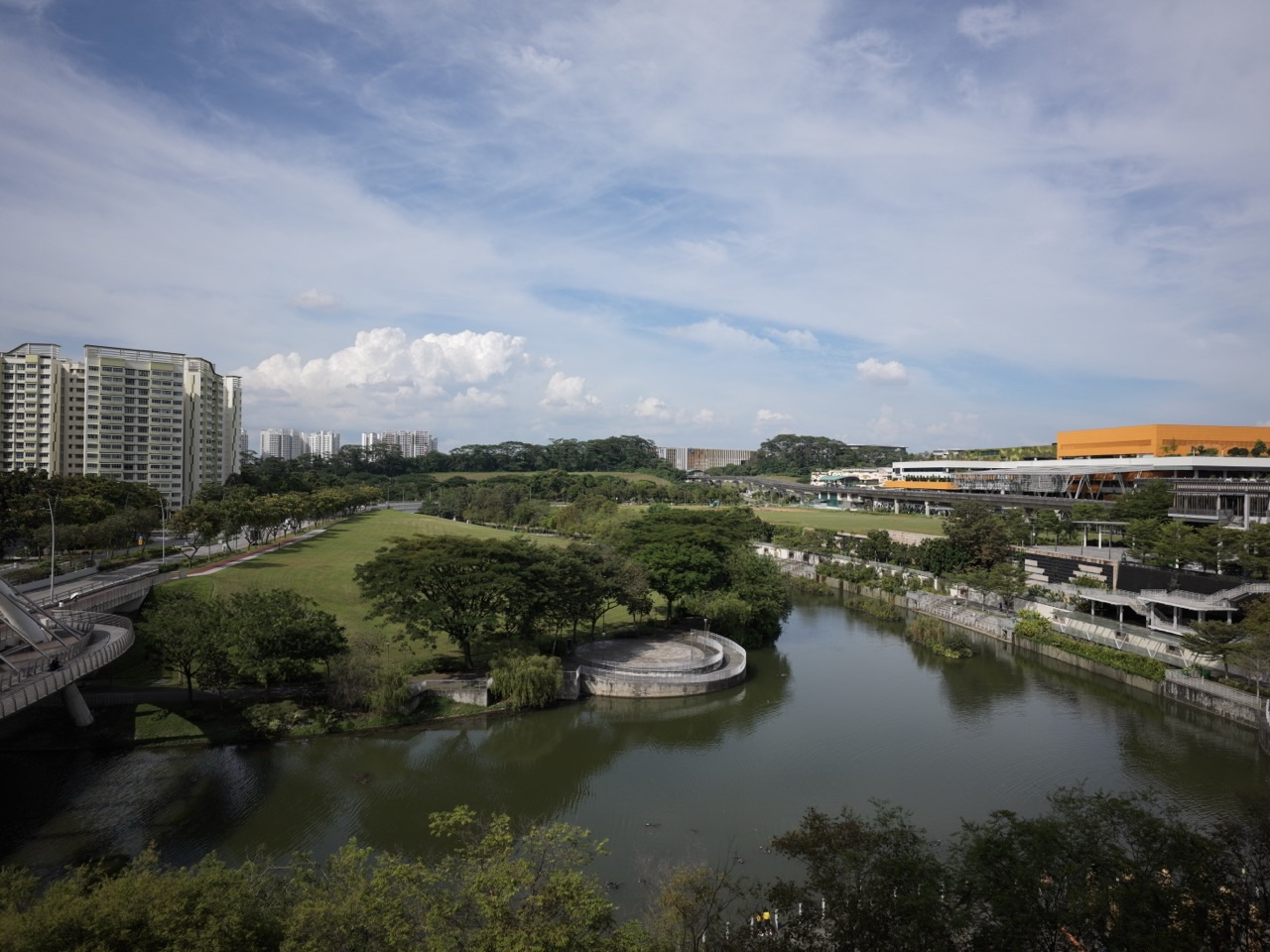
Here is one of Singapore’s most interesting geographical puzzles: a small island needs homes, jobs, transport, green space, water, energy and room to cope with an uncertain future—and very few of those needs can simply be placed somewhere else. Punggol makes the puzzle visible. Alongside homes and public spaces, its northern district is being shaped around education, work, technology and urban design. Geography, at its best, asks how all those choices fit together.
Why have Punggol Geography tuition for Singapore’s sustainable urban development and resilience? Because students must connect land-use decisions to social, economic and environmental consequences, evaluate how a city-state manages competing needs, and explain why resilience is more than reacting to one problem at a time. A useful Geography tutor helps learners use maps, official planning evidence and carefully reasoned arguments rather than treating “sustainability” as a word that earns marks merely by appearing in an answer.
This guide focuses on the Singapore cluster of the 2027 SEC G3 Geography syllabus—Small Island City-State, Opportunities and Challenges, and Sustainable and Resilient Singapore—and shows how the local environment can support wider geographical thinking. Any numerical planning exercises below are fictional teaching examples, not current planning allocations or observed data from Punggol. Parents should use the student’s own school assessment requirements and the applicable G2/G3 or Humanities examination syllabus.
The first thing to understand: space is a choice
In a city, land has an opportunity cost. Reserving an area for housing can help households while changing what remains available for industry, recreation or ecosystem protection. Protecting a natural area can support biodiversity, cooling and community well-being, while limiting some development options. Transport corridors improve access but use space and require coordination with neighbourhood needs.
A student who answers “Singapore has limited land, so we build tall buildings” has identified one plausible response to scarcity but not the full geographical problem. The sharper question is: Which demands compete, which choices are constrained, who benefits, and what future flexibility is preserved? A Geography explanation should show the relationship among competing uses, not stop after stating that Singapore is small.
This is where tuition may make a real difference. A learner can memorise “land constraints, population, transport, climate change” without knowing how those ideas connect. A thoughtful lesson asks the child to compare two land-use choices, select criteria and defend a decision with evidence. The student becomes able to reason through unfamiliar plans rather than reproduce a prepared paragraph about national success.
Punggol Digital District: a local place to read the city
According to the Urban Redevelopment Authority’s 2026 Punggol Digital District overview, the approximately 50-hectare district in Punggol North integrates the Singapore Institute of Technology with business-park developments and is intended to connect working, learning, industries and community life. URA describes it as a mixed-use economic node supporting digital and technology sectors. It is a planning example, not evidence that every target has already been met.
URA’s Punggol Digital District urban design guidance emphasises walkability, cycling, public-transport orientation, connections to green and waterfront settings, and environmental design. A learner can study why these features are planned together. Bringing jobs nearer to homes may reduce some travel burdens for certain workers, while transport connections can broaden access. Landscaping and design can create desirable pedestrian environments but need maintenance and thoughtful placement.
These are hypotheses and planning intentions until matched with reliable outcome data. Students should not claim that congestion is already eliminated, every resident now works nearby, or the district’s design guarantees lower emissions. The skill is to distinguish an official planning vision from independently measured results.
Why mixed-use planning deserves more than a buzzword
Mixed-use development places complementary functions closer together, potentially reducing the separation between some homes, services, work and learning. But proximity alone is not enough. Whether people benefit depends on affordability, physical accessibility, transport connections, the nature of available jobs and the hours at which facilities are usable.
Imagine a hypothetical district with housing on one side and workplaces on the other. The straight-line distance may be short, yet a major road without convenient crossings could make walking inconvenient. An integrated route network might improve access. The Geographic question is not simply “Is the area mixed use?” It is “How do spatial layout and lived experience interact?”
One excellent learning exercise is to compare a land-use map with a pedestrian accessibility map. The learner should identify visible patterns, explain where barriers might operate and name what additional evidence would confirm or refute the interpretation. This brings the geographical methods of the syllabus into the everyday city.
Worked example: the land-use trade-off
Take a fictional planning exercise with a ten-hectare site. Option A assigns six hectares to built facilities, two to transport infrastructure and two to accessible green space. Option B assigns five hectares to built facilities, two to transport and three to green space. Both plans allocate the full ten hectares. The difference is one hectare transferred from built use to green space.
A simple description identifies the allocation change; an evaluation asks whether that change is preferable. The answer requires criteria: How much housing or employment is lost? Does the extra greenery improve access to shade or habitat connectivity? Are open spaces equitably distributed? Are there ways to integrate green roofs, vertical space or public corridors without sacrificing the same function?
A weak answer says “Option B is better because greenery is good.” A stronger response would argue conditionally: “If the area lacks accessible green space and vulnerable users are exposed to heat, additional green space may serve important environmental and social aims. However, where essential public facilities are severely undersupplied, the built-use reduction may have an important opportunity cost. A fair comparison needs population demand, access and long-term maintenance information.”
This is what Geography tuition should teach: the answer changes when the evidence or priorities change, and the student’s reasoning should change with it.
Economic opportunities are geographical, too
Singapore’s urban strategies respond to its role within regional and global networks. The location of transport systems, business nodes, housing and education influences how people and firms interact. A district associated with digital industries may create opportunities for innovation, learning and employment, but the actual benefits depend on investment, job matching, business activity and access.
Students can be tempted to say “technology automatically makes a town sustainable”. It does not. Technology can help monitor or optimise systems, but equipment requires energy, infrastructure, governance and useful implementation. A sophisticated answer asks which problem a technology addresses and how its success would be measured.
In an urban Geography assessment, a student should also consider whose economic interests are served and whether a strategy delivers broad benefits. A place can be an employment node and still leave some residents with long commutes because their skills or jobs do not match those located nearby. Place-making goals should be evaluated against social outcomes, not only impressive architecture.
The environment is not a decorative layer
Trees, parks, waterways and connected habitats can provide important ecological functions and human benefits. Vegetation may contribute shade, local cooling and opportunities for recreation; well-managed water systems can support everyday amenity and ecological purposes. However, particular results depend on species, site design, connectivity, maintenance and the conditions of the wider urban landscape.
This means the same question can be explored at several scales. At a path, does shade improve pedestrian comfort? At a district, are green routes connected? At an island scale, how do habitat networks fit into long-term development? A child learns that Geography is not a list of isolated facts about places but a study of processes that link places together.
The Singapore Green Plan 2030 targets page sets out national objectives relating to nature, resource use, clean energy and resilience. Targets describe policy ambitions; they should not be copied as if they prove all outcomes have already been achieved. An excellent tutor shows the student how to date and qualify policy statements, especially when the exam year differs from the year a target was announced.
What Singapore’s sustainable development actually balances
Sustainable development concerns present well-being and future capacity. In Singapore’s context, environmental health, an adaptable economy and quality of life need to be considered together. The Singapore Green Plan 2030 overview organises national objectives under five pillars: City in Nature, Energy Reset, Sustainable Living, Green Economy and Resilient Future.
- City in Nature: opportunities and challenges of integrating urban life with green spaces and biodiversity.
- Energy Reset: reducing reliance on higher-emission systems and improving energy use, within Singapore’s geographical constraints.
- Sustainable Living: resource efficiency, waste reduction and choices made by people, institutions and businesses.
- Green Economy: employment, innovation and competitiveness alongside environmental responsibility.
- Resilient Future: preparing systems and communities to withstand longer-term climate and resource risks.
The student’s job is not to recite five headings as an entire essay. Each pillar provides a possible lens through which to evaluate an issue. If the question concerns water security, explain relevant sources, constraints and system choices. If it concerns housing and green spaces, reason through land use, health, access and maintenance. A plan’s name can support an argument, but it is never a substitute for the argument.
Water resilience: what happens when supply cannot be assumed
A city-state with limited land and natural freshwater resources must actively manage water supply, demand and quality. The physical challenge is accompanied by economic and infrastructural questions: where water can be collected, how it can be treated, how much energy processes require, and how systems can remain dependable during disruptions.
Students often memorise the words “water self-sufficiency” without explaining what resilience involves. A more convincing answer considers diversity of supply, efficient use, infrastructure maintenance, protection of catchments and the ability to respond when one source is constrained. Diversification can reduce dependence on a single source, though every additional system also has costs and requirements.
A useful exercise asks: “Why might a city invest in an additional water source even when the existing system meets today’s demand?” The answer should address long-term reliability, changing rainfall, population and industrial needs, and the trade-offs of different technologies, rather than assuming present adequacy ensures future security.
Food resilience and global dependence
Singapore’s urban Geography also invites students to consider how a small island city-state secures access to food through production systems, imports, logistics and adaptation. A resilient food system need not mean producing everything locally, which may be unrealistic given land and resource limitations. The geographical question is how to manage diverse risks while balancing land, water, energy and affordability.
In a hypothetical scenario, a disruption to one imported food source does not necessarily stop all supplies if alternatives are available and supply networks can adapt. But alternatives may differ in price, reliability or sustainability. Local production can contribute in appropriate cases but must compete with other uses of scarce resources. A good answer weighs the contribution and limits of each approach.
The critical skill is to avoid turning “local food” or “more imports” into a universal answer. The student should define the risk, identify what each strategy reduces, consider hidden costs and propose a defensible mix of responses.
Coastal resilience: the geography of a changing shoreline
Sea-level rise and extreme coastal water levels are long-term planning concerns for Singapore. The Green Plan Resilient Future guidance explains why the country must prepare ahead for changing coastal conditions. Adaptation is more complicated than a single high wall: authorities must consider access, habitats, flood pathways, land use, water management, construction and the changing needs of coastal communities.
PUB’s City-East Coast coastal protection plan describes planning options for that particular region, including barriers, raised measures and Long Island. These are examples of national coastal-protection planning; they should not be presented as a claim that Long Island is located in Punggol. The strategy requires site-specific analysis, and some solutions remain subject to technical studies and design decisions.
A student can learn from comparing different coastal settings. A barrier may limit some types of flooding, but its location could alter marine access or ecosystems. A nature-based measure may provide co-benefits in a suitable environment but may not supply enough protection alone for every exposure level. Geography asks students to evaluate the chosen measure in the particular physical and social setting.
Worked evaluation: protect the shore or relocate some uses?
This is an invented practice prompt: “A coastal neighbourhood faces rising flood risk. Evaluate whether upgrading coastal barriers should always take priority over adjusting land uses in vulnerable areas.” It is not an official examination question.
A weak answer says “Barriers block water so they are always the best option.” That ignores cost, overtopping possibilities, drainage interactions, maintenance, environmental impact and the needs of particular users.
A stronger argument could say: “Coastal barriers may reduce exposure in densely developed locations where valuable infrastructure cannot readily move. Their feasibility depends on coastal form, design standards, maintenance and financial resources. Land-use adaptation, revised building levels or planned relocation of selected functions may be preferable or complementary where repeated exposure cannot be managed reasonably. A robust decision compares protection benefits, long-term uncertainties, social disruption and environmental consequences.”
The evaluation is strong because it identifies which option could work under which conditions. This is a transferable structure of reasoning, not a sentence template the learner should insert into every coastal question.
What does it mean for a city to be resilient?
Resilience is not invulnerability. A resilient community or system anticipates and absorbs some shocks, adapts as conditions change and restores or transforms essential functions when disruption occurs. The concept applies to floods, heat, resource shocks and other hazards, but the precise strategies must reflect different mechanisms.
For example, a transport network might improve resilience through alternative routes, appropriate maintenance and coordination during disruptions. A water system might diversify sources and manage demand. A neighbourhood might improve heat comfort with shade, shelter and accessible information. These examples should not be mixed into one unqualified claim that “all resilience measures work for every problem”.
Ask the learner to name three parts: the stress or shock, the system exposed, and the mechanism of the proposed response. If any is missing, the evaluation is likely to become generic.
Data literacy: planning claims deserve the same scepticism as advertisements
Students may see an infographic about smart cities with attractive icons and ambitious percentages. They must learn to ask what is being measured, the baseline year, whether the data describe a target or achieved outcome, and whether two numbers use compatible definitions. A plan that announces more cycling paths does not, by itself, establish how many people use them.
Compare two fictional indicators: District A has 12 kilometres of cycling paths, while District B has 8 kilometres. Does that prove A is more cycle-friendly? Not necessarily. Path connectivity, safety, maintenance, destination access, population size and design matter. A raw length is one indicator, not the entire experience.
A tutor can make this lesson wonderfully concrete by placing a route map beside a table, then asking the child to explain what each resource supports and where the conclusion still needs further evidence. Our Punggol Geography map-skills and data-interpretation guide explains how to repair that specific weakness.
The Punggol connection should be used honestly
Punggol is a useful example because students can think about managed waterways, public paths, housing, transport, education and business districts without needing to invent a remote place. But a place name is not a school syllabus, and a familiar neighbourhood is not proof of a project’s success or failure. Evidence must be dated, sourced and distinguished from the student’s observations or expectations.
For background, eduKateSG’s Punggol schools and education guide relates learning to local settings. Parents of younger secondary students can connect the theme to Secondary 1 Geography foundations and Secondary 2 Geography housing, transport and fieldwork. Older students may find Secondary 3 Geography useful as they transition to upper-secondary processes and evaluations.
What a first tuition session should find
Give the student a current school question on urban development, sustainability or resilience. Ask them to state the central decision in a single sentence, identify what evidence is available and name two relevant evaluation criteria. If the student repeats policy slogans without connecting them to constraints, the teaching problem is one of reasoning. If they misread a land-use map or percentage chart, it is a data problem. If they know the mechanism but lack Singapore examples, it is an evidence and syllabus-coverage problem.
Good tuition responds to that diagnosis. The tutor should demonstrate one repair, let the learner practise on another context and then observe an independent attempt. Merely handing over a polished “Singapore sustainability essay” risks giving the appearance of preparation without building a portable skill.
A practical five-stage learning plan
Stage 1: one land-use dilemma
Use a simple fictional site allocation and ask which needs compete. The child should recognise the choice, quantify any supplied differences and identify missing information. Do not reward absolute claims unsupported by the scenario.
Stage 2: interpret a planning map
Select an appropriate publicly available map or teacher-supplied figure. Practise scale, connectivity, distribution and legend use, then connect the observations to a relevant planning concept. Look for whether the learner distinguishes access from proximity.
Stage 3: explain resilience mechanisms
Choose a climate, water or food-supply challenge. Have the learner trace the causal pathway from hazard or constraint to impact and then to a response. Ask what the strategy may not solve.
Stage 4: evaluate two alternatives
Offer competing options such as protecting a vulnerable coast versus changing some land uses. Require environmental, social, economic or practical criteria suited to the question. The conclusion should explain its choice, not just list strengths and weaknesses.
Stage 5: demonstrate transfer
Introduce a new Singapore context that was not used during tutoring. The student should read unfamiliar information, recognise the relevant geographical idea and defend a qualified conclusion. Independent performance, not the number of topic sheets completed, is the key outcome.
When is Geography tuition worth considering for this topic?
It may be worthwhile when a learner repeatedly treats sustainability as a slogan, struggles to read planning evidence, confuses mitigation with adaptation, or cannot judge trade-offs in longer answers. It may be unnecessary when the child can already learn from teacher feedback and explain the relevant mechanism independently in a new task.
Parents should request a clear diagnostic and reasonable study burden. The geographical content can be rich and sometimes political or ethical in its implications, but tuition should focus on understanding evidence and weighing competing perspectives rather than telling students which policy view they must adopt.
Seven questions parents can ask any Geography tutor
- Does my child need Singapore place knowledge, data skills, causal explanation or longer-answer evaluation most?
- Which actual registered subject and 2026 O-Level or 2027 SEC syllabus are we following?
- Can you show how you teach a child to distinguish a government target from a measured outcome?
- How do you integrate Punggol examples without inventing claims about local data or policies?
- Do students practise defending different decisions when the evidence changes?
- How will you check that learning transfers to new maps and unfamiliar questions?
- What are the current format, venue, tutor availability and realistic weekly practice expectations?
Where the 2027 SEC syllabus fits
The SEAB 2027 SEC G3 Geography K329 syllabus places Small Island City-State, Opportunities and Challenges, and Sustainable and Resilient Singapore in the Singapore cluster. It requires students to connect geographical understanding, data analysis and reasoned decision-making. The official G3 syllabus listing identifies the subject code and relevant cohort. Other Geography or Humanities combinations require their own official documents; a tuition label alone cannot establish the child’s examination pathway.
The Singapore Green Plan 2030 overview, URA Punggol Digital District page and PUB coastal protection guidance are public policy references, not education-provider endorsements. The official pages should be checked again whenever a parent or student uses changing targets, project status or dates in an assessment. Where information remains a proposal, treat it as a proposal.
Frequently asked questions
Is “sustainable development” just another word for environmental protection?
No. It also involves economic conditions, social well-being, resource allocation and future resilience. Environmental protection is an important part of the balance, but not the only consideration.
Does building more greenery automatically make an area sustainable?
Green spaces can bring significant benefits, but overall outcomes also depend on land-use trade-offs, species, maintenance, access, ecological connections and how the area serves different residents.
Is Punggol Digital District proof that smart technology improves every urban problem?
It offers a useful real planning context, but the existence of a project or its targets does not prove every anticipated outcome. Students should distinguish design intentions, operational measures and independently supported results.
How do climate mitigation and adaptation differ?
Mitigation addresses the drivers of climate change, such as greenhouse gas emissions; adaptation reduces or manages risks from its impacts. A strong strategy may combine both, but each has a different mechanism.
Should a Geography answer always support one planning option?
A judgement should be defensible, not predetermined. The most suitable conclusion depends on the question’s criteria, evidence, affected groups and constraints. Students should be able to explain why another context could justify a different decision.
Can children learn this without tuition?
Yes. School instruction, well-chosen official sources and deliberate reflection can be enough. Targeted help becomes more valuable when the same reasoning errors recur or the learner cannot use feedback independently.
Explore the related Geography learning routes
- Climate Change, Weather and Climate Action — understand long-term risks and responses
- Tourism Geography and Sustainable Tourism Development — weigh economic, social and environmental effects
- Plate Tectonics, Earthquakes and Disaster Risk Management — another lens on vulnerability and resilience
- Combined Humanities: Social Studies and Geography — understand the different answer demands
- Secondary 2 Geography: Housing, Transport and Investigation — build the foundational spatial reasoning
The reason Geography tuition matters here
Singapore’s planning choices are neither a set of disconnected facts nor a collection of perfect solutions. They are ongoing decisions shaped by a city-state’s resources, risks, ambitions and people. The aim of good Geography tuition is a learner who can understand those decisions, interpret the supporting evidence and explain a reasoned position when the context changes.
For a practical conversation, bring the student’s actual Singapore Geography question and marked response to eduKate Singapore, and ask what suitable teaching support is available. Confirm the lesson venue or online format directly; a page written for Punggol families is not a promise of a physical Punggol branch.
When a young person sees a map and asks not only “What will be built?” but “For whom, at what cost, and how will this work in twenty years?”, Geography is doing its job.