
What should you know about Colombia beyond its name? A useful country guide connects places with people: how a river shapes movement, how a language carries knowledge, how a school operates, and how a public decision reaches everyday life. This article takes those questions one chapter at a time.
Begin with geography and history, or move directly to food, music, learning and the environment. Cultural knowledge deserves close attention in its own right. Contemporary challenges also need careful evidence, without allowing one event or statistic to stand in for an entire country.
Colombia at a glance
- Capital: Bogotá.
- UN statistical region: South America.
- Reading date: 20 October 2026; individual observations retain their own dates.
The capital and regional classification are listed in the UNData country profile. This guide uses specific dated sources for the other subjects rather than treating an old country summary as a current account of every institution.
This is an educational overview, not a travel itinerary or personalised medical, legal or financial advice. A cultural or environmental designation does not establish present access or safety. National data cannot replace the experiences of particular households and communities.
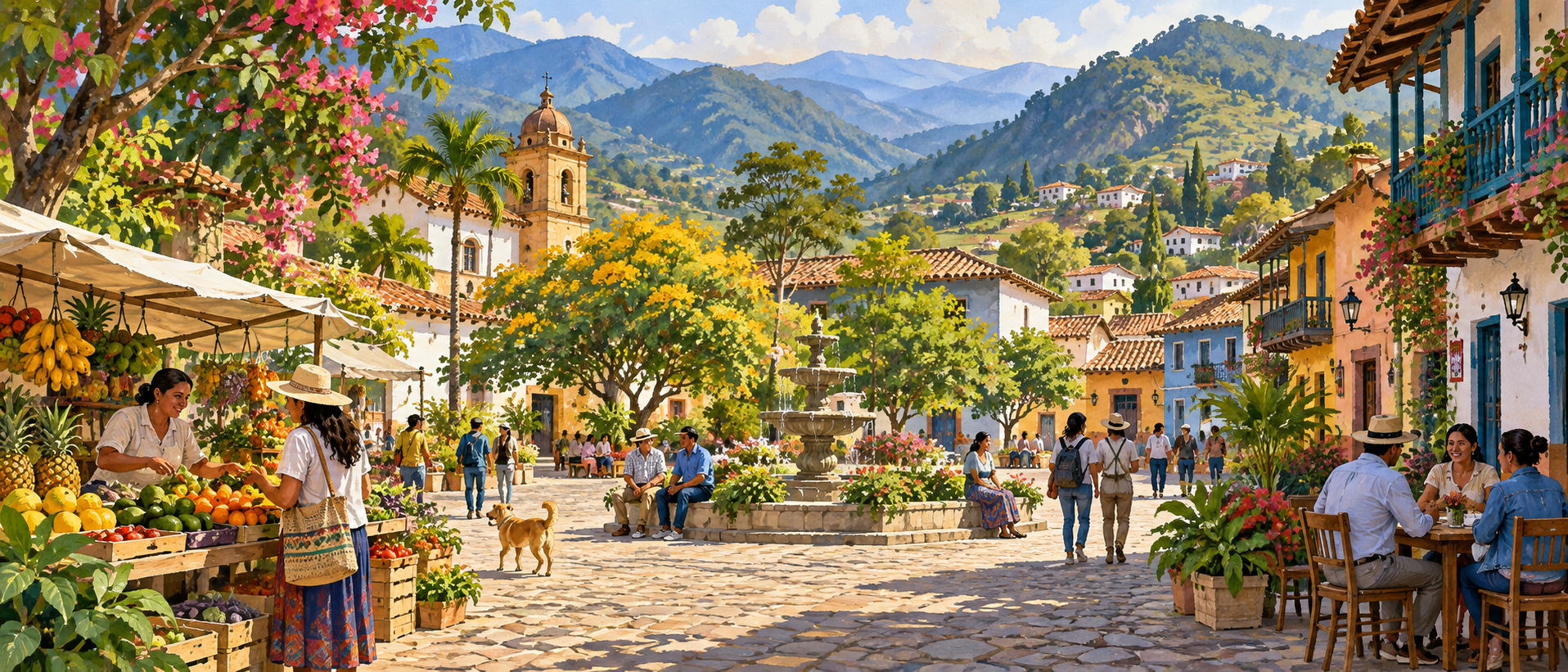
Cover illustration: an original AI-generated artistic interpretation of a mountain town plaza, produce market, colourful homes and distant green hills. This is a nonliteral composite, not a photograph or an exact view of a named place.
Choose your route through Colombia
- 1. Geography
- 2. Regions and settlements
- 3. Earlier history
- 4. Independence and modern history
- 5. Government and institutions
- 6. People and languages
- 7. Economy and trade
- 8. Agriculture and resources
- 9. Transport, energy and water
- 10. Education
- 11. Health and public services
- 12. Food and preparation
- 13. Music and oral knowledge
- 14. Arts and skilled making
- 15. Community and everyday life
- 16. Heritage and historical places
- 17. Environment and conservation
- 18. Science and practical skills
- 19. Regional and world connections
- 20. Student evidence and connections
1. Geography
Position and relief
Colombia occupies the northwestern corner of South America, where the continent approaches the Central American isthmus. Its five land neighbours are Panama, Venezuela, Brazil, Peru and Ecuador. These boundaries were established through a long process of negotiation and demarcation rather than one simultaneous agreement. Some follow rivers or watershed divides; others use surveyed lines. Consequently, a political boundary may coincide with a conspicuous natural feature or cross a relatively continuous landscape. (Cancillería)
The Andes divide into Western, Central and Eastern cordilleras, separated by the valleys of the Cauca and Magdalena rivers. To their east, the Orinoquía contains extensive plains and savannas, while the Amazonian region combines lowland forest with isolated uplands such as Chiribiquete. Caribbean and Pacific coastal lowlands add further contrasts. This arrangement places high mountains, intermontane valleys and broad eastern lowlands within one national territory, rather than a single continuous mountain belt. (SGC)
Altitude and rainfall
Near the equator, elevation helps explain differences in temperature that latitude alone cannot. Warm lowlands, cooler mountain settlements and cold highland environments may lie relatively close together. IDEAM’s climate profile also identifies distance from the coast, local winds, vegetation and the shape of mountain slopes as important influences. Conditions therefore vary between neighbouring valleys and hillsides, not only between the broad natural regions commonly shown on national maps and school atlases. (IDEAM)
Rainfall follows the seasonal movement of tropical circulation, especially the Intertropical Convergence Zone. Many areas experience two wetter periods separated by relatively drier intervals, but other regions have one principal rainy season or less clearly defined transitions. El Niño and La Niña introduce additional variation between years. Mountains influence where moist air rises and releases rain, so the timing and amount of precipitation must be understood regionally rather than through one Colombian calendar. (IDEAM)
Rivers and floodplains
The Magdalena connects the interior highlands with the Caribbean lowlands. Near Barranquilla, it carries sediment into the sea, producing a plume visible from space. An astronaut photograph taken in October 1995 shows the river mouth and the city on its western bank. This physical connection links mountain drainage, lowland channels and coastal waters: material carried from inland does not stop at the shoreline but becomes part of a changing marine environment. (NASA)
The lower river also occupies a landscape of wetlands whose extent changes with water levels. NASA compared satellite observations from March and May 2006 and documented floodwater spreading across land that had previously been relatively dry. Wetlands existed beside the Magdalena in both images, while the later scene showed a much larger inundated area. The comparison distinguishes a permanent river channel from the wider floodplain that becomes connected during high water. (NASA)
2. Regions and settlements
Highland cities
Bogotá, the national capital, stands near the eastern edge of the Sabana de Bogotá at roughly 2,600 metres above sea level. Its plateau setting distinguishes it from Colombia’s coastal cities and lower river valleys. The mountains and the broad elevated plain form the physical frame of the city. Bogotá is therefore a highland capital in an equatorial country, illustrating why a map of latitude alone gives little indication of local conditions. (Bogotá)
Medellín occupies the Aburrá Valley, where ten municipalities share a relatively narrow mountain corridor. The valley’s urban geography affects environmental conditions as well as settlement. Industries and vehicles emit pollutants within terrain that can restrict air circulation, especially under particular seasonal weather patterns. Air quality consequently requires cooperation across municipal boundaries: emissions and atmospheric movement do not remain within the administrative limits of Medellín or its neighbouring communities along the same valley. (Medellín)
Coasts and valleys
Cartagena’s Caribbean location supports a working port alongside its historic urban centre. Its cruise terminal lies within the city, about three kilometres from the old centre, and has also served as an embarkation port since 2008. Ships, passenger facilities and urban services occupy connected spaces rather than a separate offshore enclave. The terminal illustrates one maritime function of a coastal settlement without reducing the city to its monuments or its visitor economy. (Cartagena)
Cali lies on the western side of the Cauca River valley, with the Farallones rising toward the Cordillera Occidental. The municipality’s geographical account describes a valley about thirty-five kilometres wide at the city. Tributaries descend from the mountains across municipal territory toward the Cauca. Neighbouring settlements include Yumbo, Palmira and Jamundí, showing how the city belongs to a wider valley geography rather than standing alone between otherwise unoccupied mountain ranges. (Cali)
Amazonian settlement
The Colombian Amazon is a region, not the department named Amazonas. The National Planning Department’s account includes six departments entirely within it and portions of four others. It identifies an arc of settlement containing places such as Florencia, Mocoa, Puerto Asís and San José del Guaviare. These towns have different regional roles and histories, so descriptions of the Amazon as uniformly empty forest obscure an established network of communities and urban centres. (DNP)
Other centres occupy distinct frontier and river settings. Leticia lies at the meeting of Colombia, Brazil and Peru, while Mitú and Inírida serve different northeastern parts of the Amazonian region. Indigenous territories, peasant organisations and Afro-descendant community organisations also form part of its social geography. The resulting pattern combines towns with collectively organised territories and dispersed settlements, making municipal boundaries only one way of understanding how people inhabit and govern the region. (DNP)
3. Earlier history
Before European conquest
Human history in the territory now called Colombia extends many millennia before the Spanish conquest. The Museo del Oro describes archaeological traces dating back approximately sixteen thousand years, followed by diverse adaptations to coasts, valleys, forests and highlands. Hunting, gathering and fishing preceded or accompanied changes toward cultivation and more permanent settlement. These developments occurred unevenly across regions; they were not one sudden national transition from a single shared way of life. (MuseoOro)
In the Eastern Cordillera, Muisca communities formed part of a wider world of Chibcha-speaking peoples with economic and ceremonial connections. The Museo del Oro traces this regional development from about the sixth century CE. Chiefs and religious specialists held important positions, while ceramic vessels and metal offerings expressed shared ideas. Offerings deposited in sacred places were embedded in social and spiritual relationships, not merely the accumulation of valuable objects for private wealth. (MuseoOro)
Zenú engineering
In the Caribbean lowlands, Zenú communities developed canals and raised fields to manage seasonal flooding. Archaeological evidence places the system’s expansion across many centuries, beginning around 200 BCE, especially in the San Jorge basin and neighbouring lowlands. Water management supported cultivation, fishing and movement between settlements. Rather than simply excluding water, people adapted inhabited land to a landscape where rivers, channels and wetlands repeatedly changed their extent through the annual flood cycle. (MuseoOro)
The Museo del Oro connects this hydraulic landscape with other forms of skilled production. Networks of canals, fishing nets, woven materials and cast metalwork all helped organise material and symbolic life. Gold objects used lost-wax casting to produce delicate filigree-like forms. Political authority was not exclusively male: the sixteenth-century religious centre of Finzenú was led by a woman. Such evidence complicates simple pictures of precolonial society as technologically uniform or socially undifferentiated. (MuseoOro)
Colonial transformations
Spanish colonial rule reorganised territory through towns, administrative offices and religious institutions. The National Museum’s New Kingdom of Granada collection places this political history alongside African slavery, Indigenous enslavement, resistance and everyday life. Palenques, communities associated with people escaping enslavement, belong to this history of resistance. Colonial society was therefore shaped not only by officials and missionaries but also by the labour, strategies and struggles of people subjected to coercion and unequal power. (MuseoNacional)
Mining was central to the colonial economy, but it depended on activities extending well beyond the extraction site. Banco de la República’s historical research examines eighteenth-century gold production together with farming, regional exchange and royal finances. Food supplies, transport and taxation linked mining districts to other producers and institutions. Studying treasury accounts alongside agricultural and commercial evidence reveals a connected economy whose operation cannot be understood through shipments of precious metal alone. (BanRep)
4. Independence and modern history
Independence as a process
Independence developed through local political movements as well as military campaigns. In 1810, juntas and challenges to colonial authorities appeared in Cartagena, Cali, Pamplona, Socorro and other places before and around the events commemorated in Bogotá on 20 July. Communities debated sovereignty and the authority of existing officials. Participants included artisans and women as well as elite leaders, while different towns followed different paths toward autonomy or an explicit break with Spain. (Banrepcultural)
The republican victory at Boyacá on 7 August 1819 opened the way to the capture of Santafé, now Bogotá, three days later. Bolívar, Santander and other commanders depended on soldiers and civilian support across the campaign. The National Museum highlights food, horses, shelter and care supplied by local people, alongside the difficult crossing of the Eastern Cordillera. The victory transformed control of the interior, although royalist resistance elsewhere did not disappear that day. (MuseoNacional)
Republics and conflict
The early Republic of Colombia included territories that now form Colombia, Venezuela, Ecuador and Panama. Venezuela and Ecuador separated in 1830, leaving the government in Bogotá to develop through further constitutional changes. The name United States of Colombia was adopted in 1863, followed by Republic of Colombia in 1886. Panama separated in 1903. Present boundaries and institutions therefore emerged from successive reorganisations rather than being fixed immediately when independence from Spain was achieved. (Historian)
Twentieth-century politics included the violence associated with the assassination of Jorge Eliécer Gaitán in 1948 and the broader period known as La Violencia. The Liberal and Conservative parties subsequently shared power through the National Front between 1958 and 1974. This arrangement sought to end bipartisan conflict but did not resolve every source of exclusion or violence. Later armed conflict involved guerrillas, paramilitary organisations and state forces, with civilians suffering displacement and other serious abuses. (CNMH)
Peace and its limits
The 2016 Final Peace Agreement between the government and the FARC-EP ended their long armed confrontation and established commitments extending beyond disarmament. Rural reform, political participation, reintegration and victims’ rights were central to its wider purpose. Implementing such provisions requires institutions, resources and sustained work in affected territories. Signing the agreement was therefore a major historical turning point, not the completion of every social and political change it envisaged. (UN)
The United Nations’ 2026 assessment continued to distinguish that agreement from the violence affecting communities in other conflicts. Armed groups, threats against former combatants and insecurity in particular territories remained obstacles to lasting peace. Protection and implementation are connected: people cannot fully exercise promised opportunities where coercion persists. Colombia’s recent history is best described through both the achievements of negotiated peace and the unresolved struggles over security, land and public authority. (UN)
5. Government and institutions
Constitutional framework
The 1991 Constitution defines Colombia as a unitary republic with decentralised administration, territorial autonomy and a commitment to democratic participation. Public power is divided among legislative, executive and judicial branches, alongside other autonomous institutions. Congress comprises the Senate and House of Representatives. The president leads the national executive, working with ministers and administrative bodies. These divisions establish different responsibilities rather than making every state institution subordinate to the same chain of command. (Colombia)
Presidential elections operate through a majority system with a second round when the constitutional requirement is not met in the first vote. The presidential term is four years. Judicial institutions include the Constitutional Court, Supreme Court of Justice and Council of State, which have different jurisdictions. Reading this framework as a description of assigned powers is important: constitutional rules define how authority should operate, while actual performance must be assessed through separate evidence. (Colombia)
Territorial government
Colombia has thirty-two departments and the Capital District of Bogotá. Governors and mayors have their own elected mandates, while national and territorial authorities share important responsibilities. The OECD’s rural policy review describes a system that requires coordination across levels rather than isolated programmes designed from the capital. A local development priority may depend simultaneously on municipal planning, departmental support and national finance, making cooperation part of the practical operation of public administration. (OECD)
Territorial capacity varies considerably. Authorities serving dispersed rural populations face different staffing, revenue and infrastructure conditions from larger urban administrations. The OECD therefore emphasises place-based policies and stronger connections between planning instruments, including development programmes in conflict-affected territories. Decentralisation is not simply transferring a list of duties downward. It also involves whether local institutions have the resources, technical knowledge and opportunities for participation needed to carry out those duties effectively and consistently. (OECD)
Justice and accountability
The tutela mechanism allows people to seek protection of fundamental rights through the courts. Its practical significance is visible in the Constitutional Court’s own monitoring of health-related cases. In the first quarter of 2025, the court recorded 73,393 such filings, illustrating the scale of disputes reaching the justice system. These filings are not all identical judgments; the court examines patterns of barriers and compliance as part of its continuing oversight of rights protection. (Court)
The Special Jurisdiction for Peace, known as the JEP, forms part of the transitional justice framework arising from the peace process. It addresses serious crimes connected with the armed conflict within its jurisdiction and temporal limits. Victims’ participation, acknowledgment of responsibility and contributions to truth are central to its operation. It is distinct from an ordinary criminal court, using a framework intended to combine accountability with reparative and restorative obligations rather than treating reconciliation as automatic amnesty. (JEP)
6. People and languages
Counting a diverse population
Colombia’s 2018 census illustrates the difference between people directly counted and an estimate adjusted for omissions. DANE reported about 44.16 million enumerated residents and an adjusted total of approximately 48.26 million. These are historical census results, not a population estimate for 2026. This matters when comparing tables: a figure based on census interviews and a demographic adjustment may describe the same country using different statistical coverage and methods. (DANE)
The census also distinguished municipal seats, smaller population centres and dispersed rural areas, alongside questions about household conditions and ethnic self-identification. Indigenous peoples, Afro-Colombian communities, Raizales, Palenqueros and Rrom are among the categories represented in this statistical framework. Such categories concern identification and specific historical communities, not a ranking of ancestry or cultural authenticity. Their measurement requires care because undercounting and responses to identity questions can affect the resulting totals and comparisons. (DANE)
Spoken and signed languages
Spanish is the predominant language of national public life, but Colombia’s linguistic landscape extends far beyond it. In February 2026, the culture ministry identified sixty-five Indigenous languages, two creole languages, Romaní and Colombian Sign Language within its account of linguistic heritage. This explains why recent official totals can differ from older references to sixty-eight native spoken languages. Including a signed language measures a different set from one restricted to speech. (MinCulturas)
The creoles also have distinct histories and locations. An English-lexified creole is associated with San Andrés, Providencia and Santa Catalina, while Palenquero has a Spanish lexical base and is associated with San Basilio de Palenque and its communities elsewhere. Languages carry environmental knowledge, memory and relationships across generations. The ministry’s programmes consequently concern transmission and everyday use, including participation in education and public services, rather than preserving words only as museum objects. (MinCulturas)
Migration and displacement
Population movement includes both migration across international borders and displacement within Colombia. UNHCR’s work in the country addresses internally displaced people, communities whose movement is restricted by conflict, refugees and migrants from Venezuela, and Colombian returnees. These experiences are not interchangeable. A person forced from home without crossing a national frontier has a different legal situation from someone seeking asylum after leaving another country, even when both need accommodation, safety and services. (UNHCR)
Documentation is a part of responding to these movements. UNHCR’s 2025 country report describes support for registration, asylum procedures and temporary protection documentation, alongside work with local institutions. A document can help establish access to services and lawful opportunities, but does not by itself remove barriers to employment or settlement. Integration therefore involves host communities, public agencies and displaced or newly arrived families, rather than a one-time administrative decision at borders. (UNHCR)
7. Economy and trade
Production and employment
Colombia’s economy combines services, manufacturing, agriculture and extractive industries, with differences between regions and firms. The OECD’s 2024 economic survey identified weak productivity and investment as constraints on sustained growth. It also emphasised the need to diversify production as dependence on oil and coal exports creates exposure to changes in demand. The question is not simply how much the economy produces, but how reliably it generates productive employment and rising incomes. (OECD)
Informal employment remains a major feature of the labour market. The OECD’s 2024 assessment placed it at roughly fifty-six percent of workers, while stressing consequences for social protection, productivity and tax revenues. That dated estimate should not be read as a current monthly rate. Informality includes varied circumstances rather than one occupation: small enterprises, self-employment and insecure work can involve different barriers to registration, stable earnings and participation in contributory protection systems. (OECD)
Goods crossing borders
Exports include petroleum and related products, coal and other extractive goods, agricultural products and manufactures. DANE’s December 2025 bulletin recorded about US$1.57 billion in fuel and extractive exports during that month, alongside roughly US$1.01 billion in manufactures. These categories capture different production activities. A change in the price or quantity of petroleum can therefore move headline export earnings even when manufacturers experience different changes in sales. (DANE)
Agricultural products, food and beverages contributed about US$1.24 billion in exports in December 2025, with coffee and bananas among the products discussed in DANE’s analysis. Machinery, transport equipment and chemicals appeared within manufacturing, while non-monetary gold was reported in another grouping. These are monthly merchandise values measured on a free-on-board basis. They should not be confused with annual earnings, service exports or the final retail value paid by consumers abroad. (DANE)
Money and monetary policy
The Colombian peso is the national currency, and Banco de la República conducts monetary policy through an inflation-targeting framework. Its stated target is three percent, combined with a flexible exchange rate and attention to sustainable output and employment. The target describes the rate of price increase the bank seeks to achieve, not an assurance that inflation is at that level or every price moves by the same amount. (BanRep)
Short-term interest rates are a principal instrument within this framework. Policy works partly through borrowing conditions and expectations about future inflation, while the exchange rate responds to supply and demand for currencies. The central bank may intervene without promising to maintain a fixed peso value against the dollar. This arrangement distinguishes monetary stabilisation from a currency peg, and explains why changes in international conditions can affect domestic financing and the cost of imported goods. (BanRep)
8. Agriculture and resources
Coffee landscapes
Coffee production is associated with a range of Colombian mountain environments, not only the area commonly called the Coffee Axis. The protected Café de Colombia designation identifies an origin shaped by tropical location and varied growing conditions, including Andean slopes and the Sierra Nevada de Santa Marta. Arabica coffee forms the basis of this recognised product. Altitude, rainfall and local practice help distinguish producing areas within a national industry that is geographically much broader than one district. (SIC)
Harvest timing also varies between regions. Coffee growers distinguish a principal harvest from a smaller crop often called the mitaca or traviesa, but their calendar is not identical across the country. The growers’ federation’s collection manual describes central areas with two harvest periods, broadly April to June and September to December. Other areas have only one annual crop. Even within a department, locations can differ in which half of the year produces the larger harvest. (FNC)
Food crops and imports
Rice and maize connect domestic farming with food consumption and livestock feeding. FAO’s July 2026 assessment described rice cultivation in central departments and the eastern llanos as largely rain-fed, making seasonal conditions important for crop development. Maize has principal and smaller seasonal harvests. Farmers’ planting decisions also respond to input costs and expected selling prices, so favourable rainfall alone does not guarantee that a larger area will be planted or that production will increase. (FAO)
Domestic harvests coexist with cereal imports. FAO’s July 2026 brief estimated that imports supplied about three-quarters of cereal consumption needs. Yellow maize serves the feed industry, white maize also supplies human food, and wheat is another important imported cereal. These flows link Colombian households and producers with foreign harvests, shipping and exchange rates. The brief’s projections for later harvests and imports were forecasts, not final results for 2026. (FAO)
Mining and materials
Colombia’s mineral production extends beyond its well-known gold and emeralds. The US Geological Survey lists ferronickel, cement, clays, limestone, salt, silver and other materials among its outputs. These serve different markets: some are exported, while others enter construction and manufacturing within the country. A list of commodities therefore describes a varied industrial system, not simply a collection of valuable deposits waiting to be extracted from unused land or mountain landscapes. (USGS)
The geographical pattern is equally varied. USGS reporting describes large coal operations along the northern coast and gold and emerald workings in the Andes, while Cerro Matoso is associated with ferronickel production. Mine output, processing capacity and geological reserves measure different things. Transport links and processing facilities help determine whether a resource becomes a usable product, and historical production tables must retain their reference year rather than being presented as today’s operating totals. (USGS)
9. Transport, energy and water
Connecting difficult terrain
Road connections must cross mountain ranges, valleys and areas exposed to heavy rain. An IFC account of Colombia’s road-concession programme describes how physical geography interacted with maintenance problems and poorly designed contracts. The fourth-generation programme sought to improve major corridors through new financing and concession arrangements. Its history shows that connectivity depends on construction quality, upkeep and the distribution of project risks, not simply the number of kilometres announced in an investment plan. (WorldBank)
Aviation serves both domestic and international movement. Aerocivil reported 9.274 million passenger movements during January and February 2025, of which 5.261 million were domestic and 4.013 million international. These figures illustrate the importance of both markets, rather than a system concerned only with foreign visitors. They count traffic during a specified historical period, not the number of distinct people who flew: repeated journeys by one traveller can contribute more than once to passenger totals. (Aerocivil)
Electricity and fuels
Hydropower supplied roughly two-thirds of Colombia’s electricity over the decade examined in the International Energy Agency’s 2025 roadmap. Its annual contribution varied with rainfall and reservoir conditions influenced by El Niño and La Niña. A hydroelectric system can therefore have low-carbon generation while remaining exposed to dry periods. Planning must consider water and complementary sources of supply, not merely the installed capacity of dams under favourable conditions. (IEA)
Electricity is only part of the energy system. The same IEA assessment found oil supplying about ninety percent of transport energy, while coal remained important in industry. Expanding wind and solar generation consequently addresses one part of a broader transition involving vehicles, industrial processes and networks. Transmission, storage and reliable access also matter. Proposed pathways toward lower emissions describe choices and investments still to be made, rather than a transformation already completed across sectors. (IEA)
Water systems
Colombia has abundant water in aggregate, but availability and demand are unevenly distributed. IDEAM’s National Water Study examines resources through hydrographic areas and smaller subzones, allowing river systems to be considered separately from administrative boundaries. Water used by agriculture, electricity generation, industry and households follows different geographical patterns. A national total can consequently conceal pressure within catchments, especially when demand is concentrated where seasonal supply or water quality is less favourable. (IDEAM)
The study also distinguishes water resources from the conditions that make them usable. Pollution, seasonal shortages and extreme floods can all affect households and economic activity. Departmental accounts reveal different combinations of agricultural, industrial, domestic and energy uses, while catchment analysis links upstream and downstream effects. Managing water therefore requires monitoring quality and timing as well as volume, with information detailed enough to identify local problems rather than assuming uniform conditions. (IDEAM)
10. Education
The school pathway
Formal schooling is organised around preschool, basic education and upper secondary education. The education ministry describes at least one compulsory preschool grade, followed by five years of primary and four years of lower secondary schooling. Together, the latter two stages make up nine grades of basic education. This structure gives precise meaning to the different stages: primary completion is not the same milestone as completing the entire basic cycle or finishing secondary studies. (MEN)
Upper secondary education, called educación media, normally comprises grades ten and eleven and can follow an academic or technical route. Completion leads to the bachiller qualification. Territorial education secretariats participate in overseeing schools within their jurisdictions, linking national policy with local administration. The pathways are therefore both educational and institutional: what pupils study, the qualification they receive and the authority responsible for their school belong to related but distinct parts of the system. (MEN)
Assessment and further study
ICFES administers Saber 11, a national assessment associated with the end of upper secondary schooling. Its five tested areas are critical reading, mathematics, social and civic competencies, natural sciences and English. The results provide information about learning for students, institutions and the education system. A standardised examination measures selected competencies under defined conditions; it does not capture every aspect of a pupil’s abilities, practical experience or opportunities for further study and employment. (ICFES)
Higher education includes several levels rather than universities alone. Undergraduate routes encompass technical professional, technological and university professional programmes. Postgraduate study includes specialisations, master’s degrees and doctorates. These categories distinguish the level and purpose of an award, not a simple division between valuable and less valuable education. Understanding the qualification matters when comparing programmes, because an institution’s name by itself does not explain the academic level or professional preparation provided by a particular course. (MEN)
Access across places
Geography shapes educational access. The OECD’s 2018 school-resources review identified barriers associated with distance, low population density, poverty and difficulty retaining teachers in remote communities. Small rural schools may offer close contact between pupils and teachers while also struggling to provide a broad curriculum. These challenges require attention to school networks, transport, staffing and suitable learning materials, rather than assuming that an approach designed for an urban school will work unchanged everywhere. (OECD)
Multigrade teaching brings pupils from different year levels into the same classroom and forms part of Colombia’s response to dispersed settlement. Approaches such as Escuela Nueva organise learning for these settings, but their quality depends on implementation, teacher preparation and relevant materials. The OECD review treated rural education as a resource-allocation and teaching challenge together. Expanding enrolment is important, yet sustained attendance, meaningful learning and routes into further education remain separate objectives to be assessed. (OECD)
11. Health and public services
Care around people
Health care involves coordinating people and knowledge as well as supplying buildings. A PAHO account of a March 2026 forum describes Colombian discussion of stronger primary care, drawing on Costa Rican basic health teams and Brazilian territorial coordination. The examples concern how services connect with communities rather than simply how many hospitals exist. Local teams, referral arrangements and shared information address different parts of that problem. The meeting demonstrates active policy learning, not proof that every community already has equally effective services.
Colombia has also contributed an important approach to newborn care. Fundación Canguro’s institutional history traces the kangaroo mother method to E. Rey at the Instituto Materno Infantil in 1978, followed by development involving H. Martínez and L. Navarrete. Close skin contact, breast-milk feeding and organized follow-up connect family participation with professional care. The Foundation describes testing and refining the intervention through research. Its training for health professionals helps circulate this knowledge. Its history shows how a practical response can become a subject of systematic evaluation rather than remaining an untested local custom.
Interrupting river blindness
In 2013, WHO verified Colombia’s elimination of onchocerciasis, also called river blindness. The last transmission focus was Naicioná, in López de Micay, Cauca. The programme included community treatment with ivermectin twice yearly for twelve consecutive years, supported by education and surveillance. This was a coordinated public-health campaign, connecting a particular community with national institutions and international partners over an extended period.
Local transmission was interrupted in 2007, treatment stopped, and an international expert mission assessed the evidence in 2012. Verification followed in 2013, with advice to maintain surveillance for possible reappearance. These dates distinguish the intervention, observation and independent assessment. A health achievement is therefore more than an announcement: it rests on repeated work and evidence collected after the immediate campaign has ended.
Reading in neighbourhood parks
Public services also include places where people encounter books. Bogotá’s Paraderos Paralibros Paraparques are reading points within parks, with collections for children, young people and adults. Their setting brings reading into spaces already used for neighbourhood activities. A family can discover a story through conversation or a recommendation rather than beginning with a catalogue search inside a large library building.
BibloRed describes family reading, literary recommendations and introductions to its wider services at these points. The small collection and the person helping readers perform complementary jobs: books offer choices, while guidance connects those choices with someone’s interests. This is a different model from storing every possible title in one place. It emphasizes an approachable first encounter and connections to a broader public library network.
12. Food and preparation
Building a Bogotá soup
Bogotá cook Alby Mireya López, associated with the 20 de Julio market, explains her ajiaco preparation through a sequence of ingredients. Chicken and maize cook before sliced potatoes are added: pastusa first, then sabanera and finally criolla. Guascas supply the characteristic herb flavour. Naming the potatoes matters because the soup combines different ingredients rather than treating every potato as an identical unit.
The cook checks the thickness before serving, with accompaniments including capers, avocado and rice. Preparation therefore links texture in the pot with contrasting elements on the table. This is one practitioner’s account, not a rule that every household follows exactly. It also connects a familiar city dish with a named market and a cook whose decisions make the preparation particular and repeatable.
Island pots and coastal seeds
In the San Andrés archipelago, rondón combines coconut milk with fish or seafood, green plantain, cassava, tomato and onion. The cooking liquid is central to the dish rather than a garnish added after serving. Colombia’s official tourism description places it within the world of family-run native guesthouses, where preparing meals can be part of hosting. The combination links marine ingredients with cultivated roots and fruit, showing why island cooking cannot be understood by looking only at fishing.
Another food record comes from Sucre, on the Caribbean side of Colombia. UNESCO’s culinary documentation identifies sesame preparations with salt or chilli, alongside corn chicha and Zenú community knowledge. The project’s broad title also mentions Pacific cooking, but these particular examples are labelled Sucre. Seeds, seasoning and maize provide a different starting point from a seafood pot. The useful comparison is between particular ingredients and preparations, not a claim that all coastal communities share one menu.
Regional knowledge and exchange
Santander offers a distinctive example of food-related labour. An official account of hormigas culonas names San Gil, Curití and Barichara as centres of collection and preparation. The ants are washed, their wings removed, then salted and fried before sale. These steps turn a seasonal gathered ingredient into a prepared product. Families may pass the occupation between generations, linking practical handling skills with local markets. Describing the process need not attach medicinal promises or sensational labels to the food.
Popayán, a UNESCO Creative City of Gastronomy since 2005, illustrates another way to recognize culinary knowledge. Its profile identifies Indigenous, African and Spanish contributions, together with customs, symbolism and inherited skills. Food is therefore studied through the people who grow, prepare, explain and share it, not only through a list of celebrated dishes. The designation concerns a city’s creative activity. It should not be confused with the separate recognition of a monument or landscape on the World Heritage List.
13. Music and oral knowledge
Vallenato tells a story
Traditional vallenato from the Greater Magdalena region combines accordion, caja and guacharaca. The caja is played with the hands, while a scraper passes over the guacharaca’s ridged surface. Their different sound-producing actions help explain the ensemble: sustained melodic phrases meet struck and scraped rhythms. UNESCO describes four principal rhythmic airs and lyrics that interpret experience through humour, imagination and remembered events.
Family and friendship gatherings called parrandas provide occasions for performing and learning, alongside festivals and formal instruction. A song can circulate as both music and a narrated account of people or places. In 2015, UNESCO placed this traditional practice on its Urgent Safeguarding List. That category identifies a need to support transmission; it does not mean the music has disappeared or that every modern recording belongs to the same tradition.
Resonance on the Pacific
In the southern Pacific region and Ecuador’s Esmeraldas Province, marimba music and associated singing form a shared Afro-descendant heritage. Palm-wood keys sit above bamboo resonators, with drums and maracas joining the ensemble. Striking a key and amplifying its vibration are distinct parts of the instrument’s construction. The materials and arrangement help turn a maker’s knowledge into a musician’s range of sounds.
Chanted stories and poems accompany celebrations, religious observances and farewells to the dead. Elders transmit narratives, while teachers help younger musicians learn performance skills. Thus a musical event joins instrument making, bodily movement and social memory. The shared Colombian-Ecuadorian element entered UNESCO’s Representative List in 2015, recognizing a cultural relationship that crosses the national boundary without making the participating communities identical.
Voices, work and belonging
The llano work songs shared by Colombia and Venezuela use a different musical arrangement: a person sings alone, without instrumental accompaniment, during herding or milking. Oral learning begins within everyday working relationships. The songs preserve individual experiences and collective stories, so changes in land use and livestock work can also affect their setting and transmission. UNESCO inscribed them on its Urgent Safeguarding List in 2017. Studying this practice means attending to a working landscape and the purpose of a voice, not simply treating the song as entertainment on a stage.
At Palenque de San Basilio, southeast of Cartagena, musical and oral knowledge belongs to a broader community organization. UNESCO names bullerengue sentado, son palenquero and son de negro among expressions accompanying ceremonies and leisure. Family networks and age groups called kuagro support joint work and obligations. The connection is important: a performance takes place among people with continuing relationships, not just performers and anonymous spectators. The cultural space was proclaimed in 2005 and inscribed in 2008, dates of recognition rather than the beginning of its history.
14. Arts and skilled making
Resin becomes a patterned surface
Barniz de Pasto uses mopa-mopa resin to create decorative surfaces. The Artesanías de Colombia process guide describes heating, pounding, stretching and milling the material, then adding colour and stretching it again. The result is a thin sheet that can cover an object. Despite the word varnish, the method is not simply brushing a liquid coating onto wood and leaving it to dry.
Once the coloured resin covers a piece, the craftsperson cuts a design and removes the unwanted material. A finished pattern therefore depends on preparation, controlled thickness and precise cutting as well as the drawing itself. The resin originates in a plant associated with forests of Putumayo and Caquetá. Following the material connects forest knowledge with workshop skill and the decorative object’s final appearance.
Braiding caña flecha
The caña flecha craft account describes a long sequence before a sombrero vueltiao takes shape. Fibres are extracted, scraped, split and bleached in the sun. Dark fibres obtain their colour through treatment involving mud and plant dyes. Braiding combines the contrasting strands, and sewing joins the braids. The hat’s pattern is consequently built into its material structure rather than painted onto a completed surface.
The same braiding and sewing knowledge can produce bags and other accessories. A change of object does not necessarily replace the underlying technique: makers adapt familiar strips to a different outline and use. This makes the craft a useful example of continuity through invention. Looking closely at a finished piece means asking how colour, strand arrangement and seams cooperate to hold its shape.
Artists change familiar forms
Fernando Botero’s art provides a different exploration of form and volume. The Banco de la República’s artist account describes a collection spanning family scenes, religion, political subjects and still lifes, in painting and sculpture. His 1978 Monalisa revisits a famous image through his own visual language. Such a work is more than a humorous enlargement: comparison invites attention to proportion, surrounding space and the relationship between a familiar subject and a new treatment. Botero’s varied subjects also resist reducing his career to one repeated kind of figure.
Doris Salcedo’s Plegaria Muda, made in 2008–2010, transforms furniture into a setting for remembrance. In the Guggenheim’s curator commentary, pairs of tables enclose earth between their surfaces, with real grass emerging through the wood. The installation relates to victims of killings in Colombia and Los Angeles. Repeated forms suggest graves without directly depicting violence. Curator Katherine Brinson reads the growing grass as potentially consoling but also connected with forgetting. The material arrangement therefore supports more than one interpretation of how societies live with loss.
15. Community and everyday life
Playing in shared public space
Bogotá’s Ciclovía activity programme includes more than cycling along a route. IDRD describes rotating Sunday and holiday points with bicycle-skill activities, games and opportunities for families to take part together. Balance and coordination can become things people practise through play. An organized public programme supplies equipment and instruction, while participants bring their own abilities, interests and reasons for joining a shared activity.
Examples include football-tennis, table football, bicycle circuits and games involving logic or teamwork. These do not require everyone to do the same thing. A group can share a public setting while choosing different activities and levels of participation. The programme shows how recreation is organized through people, materials and changing locations, rather than existing solely because a city has a strip of open pavement.
Flowers carried from Santa Elena
The silletas used in Medellín’s flower parade connect a public festival with the work of Santa Elena’s flower growers. A wooden carrying structure supports the arrangement; small feet or supports help when it is lifted or set down. Traditional silletas recall bunches carried for sale, so the parade’s visible display also preserves a relationship between rural cultivation, transport and an urban market.
Other categories turn flowers into messages or images. Emblematic arrangements follow a flat design, while commercial examples reproduce an organization’s symbol. The differences reveal several kinds of skill: selecting and arranging blooms, matching colours, supporting weight and making an image legible. Children’s participation alongside older makers connects the event with family learning. The final procession is only one stage of work that began before spectators gathered.
Neighbourhoods make celebrations
The Carnival of Barranquilla brings costumes, masks, floats, dance and music together during the four days before Lent. UNESCO identifies cumbia, puya and porro, with ensembles using drums or wind instruments. Performances can turn historical events and contemporary politics into satire. A costume is therefore part of a larger relationship among makers, movement, sound and an audience that recognizes the references. The carnival’s international proclamation in 2003 and inscription in 2008 concern these living expressions, not an expectation that every resident participates in an identical way.
In Quibdó, the Festival of Saint Francis of Assisi, often called San Pacho, involves twelve Franciscan districts. Masses, chirimía music, floats and a procession on the Atrato River connect religious observance with neighbourhood organization. Local artists and craftspeople make decorations and costumes while younger participants learn alongside them. Families acting as custodians help coordinate the work through the festival foundation. This makes the celebration a continuing network of responsibilities and teaching, not merely a few spectacular moments in the street or on the water.
16. Heritage and historical places
Cartagena faces the Caribbean
The World Heritage property at Cartagena joins a port, fortifications and historic monuments around a sheltered Caribbean bay. Its military structures developed across the sixteenth, seventeenth and eighteenth centuries. The port formed part of maritime connections with Havana and San Juan. Walls and harbour approaches can therefore be studied together: defensive architecture responded to the movement of ships, goods and imperial power.
Within the historic city, Centro, San Diego and Getsemaní had different social and economic roles. UNESCO’s description places wealthy residences and major institutions alongside neighbourhoods associated with merchants, craftspeople and enslaved workers. Reading the city only through impressive façades would miss those relationships. The property’s inscription in 1984 recognizes a historical ensemble whose buildings and spaces preserve evidence of unequal lives as well as architectural achievement.
Tierradentro beneath the hills
At Tierradentro in Inzá, Cauca, builders carved underground tombs into volcanic tuff. Carved stairs descend towards chambers with columns, carved details and painted surfaces. These hypogea reproduce aspects of house interiors within burial spaces. Their construction required planning around the rock left standing as much as the rock removed, making the interior an achievement of engineering and symbolic design together.
The chambers were used for collective secondary burials, connecting treatment of the dead with social organization. Archaeologists study their plans and decoration alongside nearby remains rather than treating each tomb as an isolated curiosity. UNESCO inscribed the park in 1995. Its significance lies in the relationships among architecture, ritual and a particular pre-Hispanic society, not in assuming that all Indigenous communities used the same burial practices.
Stone figures and painted landscapes
The San Agustín archaeological landscape in Huila combines burial mounds, terraces, paths and carved stone figures. Sites in San Agustín and Isnos preserve elaborate funerary spaces, including corridors and columns. At Fuente de Lavapatas, carving occupies the rock bed of a stream, joining sculptural work with moving water. UNESCO interprets the larger ensemble through relationships among ancestors, supernatural power and authority. The important evidence is not just the appearance of one statue but its placement among structures and routes that organized a ceremonial landscape.
In the Amazon rainforest, Chiribiquete combines sandstone table-top mountains, or tepuis, with rock shelters containing paintings. Images of animals and scenes interpreted as ceremonies bring cultural questions into a landscape also important for biodiversity. Its 2018 World Heritage inscription is mixed, recognizing both cultural and natural values. That classification helps explain why studying the paintings separately from their environment would be incomplete. It does not turn a protected landscape into a general visitor attraction or remove the need to respect the peoples and places associated with it.
17. Environment and conservation
Contrasting forest and mountain habitats
Colombia’s forests are not all continuously wet. A 2015 Humboldt Institute assessment describes tropical dry forest in lowlands with strongly seasonal rainfall and prolonged dry periods. Its plants and animals occupy conditions quite different from those of humid rainforest. The report identifies fragmentation and pressures from livestock, agriculture and infrastructure, alongside the ecosystem’s roles in water regulation, soil retention and carbon storage. A conservation map should therefore distinguish surviving patches and their connections, not simply colour every wooded place with the same symbol.
At Chingaza National Natural Park, northeast of Bogotá, the Eastern Andes contain high-Andean and sub-Andean forests, páramo and wetland complexes. The park extends across parts of Cundinamarca and Meta, with eastern slopes descending towards the Llanos foothills. Andean bears and deer are among its mammals. Frailejones grow in the páramo, while encenillo trees characterize high-Andean woodland. This arrangement illustrates conservation across changes in altitude and vegetation. Protecting one photographed summit would not describe the whole ecological setting: slopes, forests, wetlands and connecting habitats contribute different parts of the landscape.
Restoring water movement: Cispatá
A Cispatá mangrove study by Ostin Garcés Ordóñez and colleagues examined channel rehabilitation through measurements made from September 2018 to September 2019. Researchers systematically compared water conditions before and after work on blocked channels. This focused on restoring water movement, not merely planting more trees. Salinity and temperature within the mangrove declined after rehabilitation, improving conditions relevant to young mangroves.
Five months after rehabilitation, the study’s water-quality index classified all sampled stations as acceptable. That is a measured short-term result, not evidence that every feature of the ecosystem had fully recovered. The example clarifies how restoration can be evaluated: identify a process that has been disrupted, intervene, and measure the response. Following water conditions provides evidence that a planting photograph alone cannot supply.
Malpelo above and below water
The Malpelo sanctuary lies roughly five hundred kilometres from Colombia’s Pacific coast. Its island and rocky outcrops are the exposed summit of an underwater ridge. Steep submerged walls, caves and tunnels meet several ocean currents, creating varied habitats. The protected place is therefore mostly a marine system, not just the small piece of land visible above the surface of the sea.
UNESCO records aggregations of hammerhead, silky and whale sharks, together with tuna, while Nazca boobies breed on the rocky island. Malpelo also belongs to a wider Eastern Tropical Pacific conservation network linking areas in several countries. Its World Heritage inscription dates to 2006. Studying such a sanctuary requires thinking about movements across water and between habitats, beyond the outline of an island on a map.
18. Science and practical skills
Sound as research evidence
Animals hidden by tropical vegetation may still be heard. A Humboldt Institute research account describes scientists using acoustic signals to investigate insects, amphibians, mammals and birds. Small sensors, sound archives and computational analysis make recordings useful evidence. Bioacoustics and ecoacoustics bring sound into studies of behaviour and ecological relationships. Listening becomes a method when recordings can be stored, compared and interpreted systematically.
In 2022, Humboldt’s sound-collection team and Cornell University’s conservation bioacoustics laboratory led a symposium in Costa Rica. Researchers shared methods involving archives and machine learning. Curator Hoover Pantoja emphasized collaboration in developing monitoring approaches. The example connects recording with the work of organizing and analysing information: a microphone collects a signal, but identifying what that signal means requires further scientific decisions.
A long history of observation
The National Astronomical Observatory’s university history traces its building to José Celestino Mutis’s initiative. Construction began in 1802 under architect Domingo de Petrés and finished in 1803. Francisco José de Caldas began observations in 1805. These different dates separate a proposal, a completed building and scientific activity. An observatory needs instruments, people and routines as well as a structure designed for looking at the sky.
Scientific work stopped after Caldas’s execution in 1816; meteorological observations resumed with the Boussingault Mission in 1823. The building later served as a military classroom and, briefly, a prison. Julio Garavito Armero became director in 1891 and pursued mathematical, optical and astronomical studies despite limited resources. The observatory thus records changing conditions for scientific work, not an uninterrupted sequence of discoveries stretching forward from its construction.
Prototypes and public experiments
SENA’s Tecnoparque programme description follows ideas towards functional prototypes with specialist advice and laboratory infrastructure. Its technological fields include electronics and telecommunications, biotechnology and nanotechnology, engineering and design, and virtual technologies. A functional prototype provides something to test, measure and revise: an electronic circuit, a digital system or another proposed design. It is not proof of a successful commercial product. The connection between technical support and practical experimentation matters: drawings, materials, measurements and revisions can reveal problems that an attractive idea on paper does not yet answer.
Maloka’s secondary-school learning booklet offers a public-facing route into scientific questions. It describes a programming laboratory, activities about waves and matter, an Andean forest representation and electrical exhibits involving a Van de Graaff generator and Faraday cage. The themes invite links between an observed effect and an explanation. A museum demonstration becomes more useful when learners describe what changes, what remains constant and what they would test next. The booklet records educational approaches, rather than guaranteeing that every exhibit is available on a particular visit.
19. Regional and world connections
Cooperating around the Amazon
Colombia is one of eight members of the Amazon Cooperation Treaty Organization, alongside Bolivia, Brazil, Ecuador, Guyana, Peru, Suriname and Venezuela. Its history begins with the 1978 treaty, followed by the organization’s establishment in 1998. These countries share an interest in the Amazon while retaining their own governments and responsibilities. Regional cooperation supplies a setting for discussing questions that extend beyond a single national border.
The permanent secretariat has operated from Brasília since 2003. Its role is to coordinate regional action connected with the Amazon and the well-being of its peoples. A shared institution can support discussion and cooperation without making national policies identical. The sequence from treaty to organization to secretariat also shows that international connections require administrative work: agreements need people and mechanisms to turn broad commitments into continuing activity.
Science reaches Antarctic waters
Colombia’s first Antarctic expedition occurred during the southern summer of 2014–2015. A DIMAR account of cooperation with Chile identifies Universidad Andrés Bello researcher Cristian Rodrigo among those involved. Connections with Chile’s hydrographic and Antarctic institutions helped develop scientific exchange. The history illustrates how a tropical country can investigate distant environments through partnerships, shared expertise and the practical organization of work at sea.
Hydrographic surveys in the Gerlache Strait and Antarctic bays contributed to nautical charts produced with Chile and the United Kingdom. This outcome of cooperation involves measured information about waters used for navigation. DIMAR also describes exchanges in oceanography and related fields. The example concerns research and cartographic work, not a claim that Colombian territory extends to the places its scientists study.
Routes old and new
The Qhapaq Ñan Andean Road System links Colombia with Argentina, Bolivia, Chile, Ecuador and Peru in a shared World Heritage property inscribed in 2014. Inca roads incorporated earlier routes and connected settlements, production centres and places of worship. Bridges, stairs, drains and roadside accommodation reveal different solutions to difficult terrain. The property consists of selected surviving components, not every historical road in one continuous modern trail. It illustrates a network of exchange whose history is older than the national boundaries now crossed by its remains.
A modern connection is the Pacific Alliance, established in 2011 by Chile, Colombia, Mexico and Peru. Colombia’s Foreign Ministry describes economic integration, cooperation and progressive movement towards easier circulation of goods, services, capital and people. Work also includes education, science and cultural exchange, rather than trade alone. These are institutional aims and fields of activity, not a promise that every barrier has disappeared. Comparing the alliance with an ancient road network highlights different mechanisms through which people organize exchange across distance.
20. Student evidence and connections
Read a publication in layers
Begin a source investigation with the Papel Periódico Ilustrado catalogue record. It identifies Alberto Urdaneta, a Bogotá publisher and an 1881–1888 publication span. It also explains that the digital version comes from a 1975 facsimile. Record these as three layers: the historical periodical, a later reproduction and today’s catalogue. A date attached to a web record is not automatically the date of the material it describes.
The catalogue names sections including history, science, fine arts and agriculture, and identifies engravers who contributed illustrations. Choose one section to investigate, then distinguish the original words or images from a modern curator’s explanation. Ask who selected the subject and which audience the publication addressed. This produces a focused question about representation rather than treating a nineteenth-century illustrated page as an unfiltered view of all Colombian life.
Map evidence, not assumptions
SiB Colombia’s guide to biodiversity data distinguishes an occurrence record from a checklist and a sampling event. An occurrence connects an organism or taxon with a place and date, sometimes with precise coordinates and sometimes only a municipality. For a mapping exercise, keep the date and location precision beside each observation. A point can show evidence of presence without describing the species’ entire range.
Sampling events add information about methods and repeated observations, making some comparisons more meaningful. Before comparing two places, ask whether observers used the same protocol and similar effort. A longer species list may reflect more searching rather than greater underlying diversity. Build a small evidence table with location, date, method and limitation. These fields help explain what a map can support and what still needs investigation.
Compare voices and official status
Gabriel García Márquez’s Nobel lecture of 8 December 1982 provides another kind of evidence. He begins with extraordinary descriptions attributed to the traveller Antonio Pigafetta and develops an argument about Latin American experience and how others interpret it. Identify the speaker, occasion and purpose before extracting a claim. Then separate historical references from rhetorical choices and the writer’s interpretation. A speech can reveal how an author argues about a continent without serving as a current statistical profile or a neutral account of every country it mentions.
For an exercise in checking labels, examine Seaflower’s UNESCO Tentative List entry, submitted in September 2007. A tentative entry records a place proposed for possible World Heritage nomination; it is not an inscription on the World Heritage List. Note the exact category and date rather than replacing them with a vague statement that UNESCO recognizes the site. Finally, apply the same discipline to another claim: distinguish a proposal from an outcome, a record from an inference, and one community’s practice from a description of an entire country.
Frequently asked questions about Colombia
What is Colombia’s capital?
Bogotá is the capital.
Which statistical region includes Colombia?
The United Nations places Colombia in South America.
What is rondón?
Rondón is an island soup or stew made with coconut milk, fish or seafood, and ingredients such as cassava and green plantain.
Is Seaflower a World Heritage Site?
Its marine protected area is on Colombia’s Tentative List, not the World Heritage List.
Do the latest pages always contain current statistics?
No. Check each observation’s reference year and footnotes. Reading a page today does not turn an older observation into a current measurement.
Does a heritage designation establish safe access?
No. Heritage value and current access or safety are different questions. This article is for learning, not planning a journey.
Does one local example represent everyone?
No. Keep the people, place and date attached to an account. A documented example can explain a relationship without establishing a nationwide pattern.
How should students use the chapters?
Choose a focused question, preserve dates and definitions, and connect relevant evidence. Explain what remains uncertain instead of filling gaps with assumptions.
Continue reading: specialist guides to Colombia
These links provide subject-specific background. Their travel-themed titles do not establish that visiting is safe or feasible; use them as reading resources here.
- How Colombia Works | Government, 32 Departments, Coffee and Trade
- How Ministry of Education for Colombia Works | 2027 Enrollment, Saber 11, Icfes and Local Secretariats
- Schools of Colombia | Public, Private, Rural, Media Técnica and Saber 11
- Tutors of Colombia | How Clases Particulares, SIEE and Saber 11 Work
- How Education System of Colombia Works | Bachiller, Saber 11 and SIEE 2026
- What Is Taught in School | Colombia
- Food traditions of Colombia
- Cultural and landscape learning about Colombia
Explore the Everything About Countries archive for national overviews. For the 195-country index, see How Countries Work | A–Z Guide to 195 Countries and Everyday Life. The How Singapore Works collection offers a different national case study; comparisons should account for history, scale and institutional responsibilities.
Keep the country’s people in the explanation
An explanation becomes stronger when it connects a national institution with a concrete question: who can use a service, how knowledge is passed on, what a measurement records, or how a change affects everyday work. Ask whose experience is represented and what additional evidence would help. That keeps analysis clear without turning people into illustrations of a single story.
Sources and further evidence
Sources were checked for this edition in October 2026. Statistical observations retain their own reference periods. Policy announcements and project plans are distinguished from completed outcomes.
- UNData country profile
- Cancillería: Land borders
- SGC: Physical geography
- IDEAM: Climate profile
- NASA: Magdalena mouth
- NASA: Magdalena flooding
- Bogotá: City geography
- Medellín: Valley settlement
- Cartagena: Port terminals
- Cali: Valley geography
- DNP: Amazonian settlement
- MuseoOro: Early inhabitants
- MuseoOro: Muisca communities
- MuseoOro: Zenú waterways
- MuseoNacional: Colonial society
- BanRep: Colonial economy
- Banrepcultural: Independence juntas
- MuseoNacional: Boyacá campaign
- Historian: Republican changes
- CNMH: Conflict chronology
- UN: Peace implementation
- Colombia: Constitution
- OECD: Rural governance
- Court: Rights enforcement
- JEP: Transitional justice
- DANE: Census 2018
- MinCulturas: Living languages
- UNHCR: Colombia 2025
- OECD: Economic survey
- DANE: Exports 2025
- BanRep: Monetary framework
- SIC: Coffee origin
- FNC: Coffee harvests
- FAO: Cereal outlook
- USGS: Mineral industry
- WorldBank: Road connectivity
- Aerocivil: Air transport
- IEA: Energy roadmap
- IDEAM: Water study
- MEN: School stages
- ICFES: Saber 11
- MEN: Higher education
- OECD: School resources
- Colombia impulsa el diálogo y la colaboración para fortalecer la Atención Primaria de Salud
- La Fundación Canguro
- Colombia is first country in the world to eliminate river blindness
- Paraderos Paralibros Paraparques- PPP
- Cómo hacer un ajiaco en Navidad ¡Receta de cocinera del 20 de Julio!
- Posadas nativas en San Andrés
- Traditional Pacific Cuisine
- Hormiga culona, sabor y tradición
- Popayán
- El vallenato, música tradicional de la región del Magdalena Grande
- Marimba music, traditional chants and dances from the Colombia South Pacific region and Esmeraldas Province of Ecuador
- Colombian-Venezuelan llano work songs
- Cultural space of Palenque de San Basilio
- OFICIO / MOPA-MOPA
- Carpeta caña flecha
- Fernando Botero
- Doris Salcedo, Plegaria Muda, 2008–10
- Actividades de Ciclovía
- Silletas de flores: características, tipos, desfile de silleteros y concurso
- Carnival of Barranquilla
- Festival of Saint Francis of Assisi, Quibdó
- Port, Fortresses and Group of Monuments, Cartagena
- National Archeological Park of Tierradentro
- San Agustín Archaeological Park
- Chiribiquete National Park – “The Maloca of the Jaguar”
- El bosque seco tropical en Colombia: Distribución y estado de conservación
- Parque Nacional Natural Chingaza
- Respuesta a corto plazo de parámetros fisicoquímicos del agua a la rehabilitación hidrológica de caños en manglares de Cispata, Caribe colombiano
- Malpelo Fauna and Flora Sanctuary
- Colección de Sonidos Ambientales del Instituto Humboldt presente en el simposio de Bioacústica en Bosques Tropicales en Costa Rica
- Observatorio Astronómico Nacional
- Tecnoparque
- Bitácora Secundaria Maloka A
- Who we are
- En el marco de la Décima Expedición Antártica de Colombia arriba a Valparaíso, Chile el buque ARC “Simón Bolívar”
- Qhapaq Ñan, Andean Road System
- Alianza del Pacífico
- Papel Periódico Ilustrado
- Tipos de datos e información
- Gabriel García Márquez – Nobel Lecture
- Seaflower Marine Protected Area (MPA)