
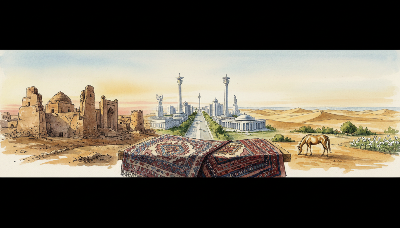
Where is Turkmenistan, why is it famous for natural gas and the Karakum Desert, and what makes its capital Ashgabat so unusual? Turkmenistan is an independent country in Central Asia, bordered by Kazakhstan, Uzbekistan, Afghanistan and Iran, with a western shoreline on the inland Caspian Sea. Its capital is Ashgabat, a city known for large white-marble public buildings and planned boulevards. Much of its land lies in the Karakum Desert, while ancient Silk Road cities such as Merv, distinctive Turkmen carpets and the Akhal-Teke horse reveal a long cultural history. Turkmenistan has substantial natural gas reserves and significant energy exports, but deposits underground do not automatically translate into high household incomes or diversified jobs.
Everything about Turkmenistan in one country guide: this nation is not only a dramatic photograph of the Darvaza gas crater. Its residents live in cities, villages, irrigation areas and desert-edge communities. Water from the Amu Darya and major canals is vital to farming and towns. Natural gas can finance state programmes but creates economic dependence and environmental questions. The country’s government places special emphasis on its internationally recognised permanent neutrality, while independent monitors document serious concerns about media freedom and civic rights. As of October 2026, President Serdar Berdimuhamedow leads the state and Gurbanguly Berdimuhamedow, his father and the former president, chairs the Halk Maslahaty. The official 17 December 2022 census counted 7,057,841 residents; later international estimates are not directly interchangeable with that count. The IMF’s June 2026 mission estimated 3.6% economic growth in 2025 and projected approximately 2.4% for 2026, while stressing the need for better statistical transparency. This guide connects geography, history, administration, energy, water, heritage, schools, trade and ordinary life.
Turkmenistan at a glance: the key facts
- Official name: Turkmenistan (Türkmenistan).
- Where is it? Central Asia, east of the Caspian Sea.
- Capital: Ashgabat (Aşgabat).
- Land neighbours: Kazakhstan, Uzbekistan, Afghanistan and Iran.
- Caspian coastline: yes; the Caspian is an inland sea or lake, so Turkmenistan is geographically landlocked in standard ocean-access classifications.
- Area: approximately 491,210 square kilometres.
- Population: 7,057,841 in Turkmenistan’s official 2022 national population and housing census, as of 17 December 2022.
- Languages: Turkmen is the official language; Russian, Uzbek and other languages are used in some communities and contexts.
- Currency: Turkmen manat (TMT), divided into 100 tenge.
- Time zone: UTC+05:00, with no usual seasonal clock change.
- Government: presidential republic with a Mejlis parliament, executive institutions, courts and a separate Halk Maslahaty national council.
- President in October 2026: Serdar Berdimuhamedow, in office since 2022.
- Chair of the Halk Maslahaty: Gurbanguly Berdimuhamedow, former president and designated National Leader.
- Major administrative divisions: five provinces called welayats—Ahal, Balkan, Daşoguz, Lebap and Mary—plus the capital with separate status.
- Independence: declared 27 October 1991 following the Soviet period; Independence Day is now celebrated on 27 September.
- 2026 national anniversary: 35 years of independence, celebrated on 27 September 2026.
- Neutrality: the United Nations General Assembly recognised Turkmenistan’s permanent neutrality in 1995; it remains a major official foreign-policy principle.
- Major economic activities: natural gas, petroleum, public and private services, farming, textiles, construction, transport and manufacturing.
- GDP estimates: the IMF mission estimated 3.6% growth in 2025 and projected 2.4% in 2026 as of June; a September country-page figure differs, so the source, edition and reference date matter.
- World Heritage: five UNESCO-inscribed properties, four cultural and one natural.
- Famous landscapes and places: Ashgabat, Merv, Kunya-Urgench, Nisa, Karakum Desert, Darvaza gas crater, Akhal-Teke horse heritage and Caspian coast.
- Important systems question: how do a largely desert country, river irrigation, a hydrocarbon export economy and highly centralised institutions work together?
The primary sources are the Turkmenistan State Statistics Committee’s 2022 census, the IMF’s 22 June 2026 assessment, UNESCO World Heritage: Turkmenistan, the official Halk Maslahaty website and current official government announcements. When claims about the economy conflict, identify who produced the estimate rather than silently merge figures.
1. Where exactly is Turkmenistan on the map of Central Asia?
Locate the Caspian Sea between the Caucasus, Iran and Central Asia. Turkmenistan lies along its eastern shore, with Kazakhstan to the northwest, Uzbekistan to the north and northeast, Afghanistan to the southeast and Iran to the south. The country’s huge arid interior extends toward river valleys, oases, towns and mountains. Transport connections also link it to the Caucasus and other regional economies through the Caspian, even though the Caspian is not part of the open ocean.
Central Asian countries share some geography and historical trading relationships without being one state. Turkmenistan is independent from Uzbekistan, Kazakhstan, Iran and Afghanistan. Its people, government, official language and modern policy choices are distinct. Using “a former Soviet republic” as the only description hides its older history and current institutions.
Is Turkmenistan in Europe or Asia?
It is in Asia, generally classified as Central Asia. The Caspian Sea is associated with a wider Europe–Asia regional boundary in some geographic conventions, but Turkmenistan itself is east of the Caspian. Its diplomatic and cultural networks reach Iran, Afghanistan, Russia, China, the Caucasus and Europe without changing its continental location.
Is Turkmenistan landlocked if it borders a sea?
Yes, in standard geographic classification. The Caspian Sea is an inland body of water without a natural navigable outlet to the world ocean. Its navigation, ports and resources are important, but having a Caspian shoreline is not the same as an Atlantic or Pacific coastline. A vessel travelling from Turkmenbashi across the Caspian still needs additional transport or waterways and border arrangements to reach global seaports.
Does it border Pakistan or China?
No. Turkmenistan borders Afghanistan but not Pakistan or China directly. Its commercial connections with China are significant through natural gas pipelines crossing other Central Asian states. That shows why geography should distinguish an actual land border from a long-distance economic relationship.
Why does the Karakum cover so much of the country?
The Karakum is an extensive desert landscape across much of Turkmenistan. Climate, geology and long-term natural processes have produced arid plains, sands and other desert surfaces. Rainfall is limited and uneven, which strongly affects farming, settlement and water engineering. A desert is not empty: it contains habitats, transport routes, energy deposits and community histories.
What does the Köpetdag or Kopet Dag mountain region mean?
The Kopet Dag range extends along much of the Turkmen–Iranian border and influences local landforms and climate. Ashgabat lies near its foothills. The range creates environments distinct from the desert interior, including areas with different vegetation and settlement patterns. Mountains are also engineering constraints and natural hazard contexts, not merely scenic backgrounds.
Worked example: why one national map cannot explain delivery time
Imagine a business in a desert town ordering imported equipment. The shipment may need a Caspian port, rail or truck routes, border clearances and a long final journey. Two places can look close on an atlas but have different access costs. The hypothetical shipment illustrates why roads, customs and reliable logistics matter to economic opportunity.
2. Why is Ashgabat known for white-marble buildings?
Ashgabat, the capital, has become internationally recognisable for monumental white-marble buildings, broad boulevards and planned public spaces. This visual character reflects decisions about state architecture, urban development and the projection of national identity. It does not mean the entire country consists of marble palaces, or that every resident lives under the same urban conditions.
The capital is a centre of national administration, business, education and transport. It also has local infrastructure and social needs, including water, electricity, healthcare, housing, maintenance and reliable routes. An impressive building is a physical asset; its usefulness depends on the activities and services inside it.
Is Ashgabat an ancient Silk Road city?
The region has older historical connections and settlement, but the current national capital’s development is strongly shaped by modern administrative and urban history. Ancient Merv and Nisa are separate archaeological sites with different historical trajectories. Confusing the white-marble centre of Ashgabat with a restored medieval city creates inaccurate history.
What is Arkadag City?
Arkadag is a planned modern city in the Ahal region, developed under major state investment and named in connection with Gurbanguly Berdimuhamedow’s public title. It illustrates contemporary urban planning and the government’s emphasis on high-profile construction and institutions. A new city’s formal opening does not establish that every advertised facility operates at full capacity for every household.
Why should an urban development plan include water and energy?
A desert-edge city requires reliable drinking water, drainage, cooling, electricity and transport. Buildings can be completed rapidly, but utilities and maintenance must be sustained for decades. A city’s quality cannot be judged solely from aerial photographs or public opening ceremonies.
Worked example: measuring a public building’s success
Suppose a new civic building opens with a large ceremony. To evaluate its usefulness, ask whether staff and residents can reach it, whether services function on normal workdays, whether maintenance budgets exist and whether the intended public can use the facility. This is a hypothetical example of project evaluation, not a claim about a named Turkmen government building.
3. What is the Karakum Desert, and why is water scarce?
The Karakum covers a very large part of Turkmenistan and includes sand, plains, vegetation, settlements and economic activity. Its arid climate and high summer temperatures help explain the importance of water management. But the country is not one continuous dune sea and not every local climate is identical. Oasis areas, river valleys and mountain foothills have different ecological and farming conditions.
For many communities, rainwater alone is insufficient for large-scale irrigated agriculture, making the Amu Darya and engineered channels essential. A canal can bring water to productive land yet also create new risks through leakage, inefficient use, salinity and downstream environmental pressure. Water engineering therefore belongs at the heart of the country’s national story.
Does Turkmenistan have permanent rivers?
The Amu Darya is especially important, while other rivers and seasonal watercourses serve different regions. Much of the country is arid, so permanent and seasonal water need to be distinguished. A line on a map cannot establish whether a particular town has safe, continuous household supply.
What is the Karakum Canal?
A major artificial waterway carrying water from the Amu Darya through arid areas to support irrigation, cities and other demands. It was developed under Soviet-era planning and remains central to Turkmenistan’s water system. Its scale demonstrates how engineering can reshape agriculture and settlement, but it also creates obligations concerning water distribution, maintenance and environmental effects.
How can irrigation produce salt-affected soils?
In hot, dry environments, irrigation water can evaporate and leave salts in the soil if drainage is inadequate. Over time, soil salinity can affect crop growth and require more careful management. Water quality, soil type, crops and drainage differ by place, so a project should measure actual conditions rather than treat all irrigated land as equally productive.
Why do canals affect the Aral Sea region?
The Amu Darya is one of the great rivers historically supplying the Aral Sea. Large withdrawals for irrigation, especially during the Soviet era, contributed to the disastrous reduction in water reaching the sea. Turkmenistan is part of this wider river-basin history alongside neighbouring countries, not an isolated water user. See How Uzbekistan Works | Why Did the Aral Sea Dry Up? for the regional environmental chain.
Worked example: a town and a farm need the same water source
Imagine a reservoir or canal supplying household water and irrigation. During a dry period, the demands may compete, while poor maintenance wastes additional water. Planning requires actual flow measurements, water-quality checks, fair allocation and emergency arrangements, not simply declaring both uses important. The example is hypothetical, showing a typical public resource-management challenge.
4. Who built Ancient Merv, Kunya-Urgench and Nisa?
These places are evidence that Turkmenistan’s present territory was part of complex ancient and medieval civilisations long before the modern state. Merv was a major urban centre and trading crossroads in the region of the Silk Roads. Kunya-Urgench preserves the monuments and urban history associated with historical Khorezm. Nisa includes fortresses linked with the Parthian Empire. Their builders, languages and political relationships changed through time; none can accurately be described simply as “modern Turkmenistan’s first capital.”
UNESCO lists State Historical and Cultural Park “Ancient Merv”, Kunya-Urgench and Parthian Fortresses of Nisa as distinct World Heritage properties. They provide a way to study architecture, trade and regional histories without forcing today’s borders onto every earlier civilisation.
Why was Merv important to the Silk Roads?
Its location and access to resources helped sustain urban trade and scholarship over many centuries. Caravan routes were networks rather than a single fixed highway; travellers needed water, lodging, merchants, food and authorities capable of maintaining order. A famous city could prosper at one period and change dramatically at another as routes, governments and environments evolved.
What is significant about Kunya-Urgench?
The heritage includes historic monuments, mausoleums and other structures associated with the culture of Khorezm. The material record tells researchers about political authority, craftsmanship, religious practice and urban networks. A mausoleum should not be treated as the whole historical city; people also needed farms, markets, water and housing.
What was Nisa?
Nisa was an important site associated with the Parthian realm, a major power in ancient Iran and surrounding regions. Its archaeological remains can illuminate architecture, art, administration and international contacts. Its history is not identical to that of the later Silk Road city of Merv.
Were these always Islamic cities?
No. Different parts of the region had older religious and political histories before Islam became dominant in many Central Asian societies. Religious change and urban development occurred across centuries. Archaeology can document earlier periods while later manuscripts and buildings reveal additional traditions.
Why does protecting an archaeological site involve ordinary infrastructure?
Visitors and researchers need safe access, conservation expertise, monitoring and responsible management. Water damage, uncontrolled building, inappropriate repairs or theft can threaten archaeological evidence. A UNESCO listing creates responsibilities; it does not mean every conservation problem has already been solved.
Worked example: an archaeologist finds a coin
Suppose an excavator discovers a coin in a historic town. The discovery can help with dating or trade-network analysis, but it does not prove the person who minted it personally visited the exact location. Goods move through intermediaries. This hypothetical example illustrates why evidence should support limited, precise historical claims.
5. How did Turkmenistan’s history develop through independence?
Turkmenistan’s present territory has been shaped by different peoples, languages, trading networks and empires. Ancient Parthian sites and cities of the Silk Roads existed long before the modern Turkmen state. Turkic and other communities formed distinctive regional identities over many centuries, while the geography encouraged both settled oasis life and mobile pastoral traditions. Russian imperial expansion and Soviet rule transformed the region’s administration, borders, agriculture and economic connections before independence in 1991.
A historical timeline must distinguish the political state that existed at a particular time from the present-day nation. A modern country may inherit traditions associated with several polities but is not identical to any one ancient empire.
- Ancient eras: settlements and important political centres developed along Central Asian routes, including the Parthian-related site of Nisa.
- Late antiquity and medieval centuries: oasis towns and trading networks connected the region with Iran, South Asia, the steppe and wider Eurasia.
- Islamic centuries: Islam and scholarly traditions grew alongside continuing local cultural and linguistic changes.
- Silk Road era: Merv and Khorezm-linked settlements became important centres of trade, learning and politics in different periods.
- Thirteenth century: Mongol conquest had devastating and lasting consequences for parts of Central Asia.
- Later centuries: Turkmen groups and different neighbouring states participated in complex local political and commercial relationships.
- Nineteenth century: Russian imperial expansion and military conflict reshaped the area’s political control.
- 1920s onward: Soviet administrative reorganisation produced the Turkmen Soviet Socialist Republic and changed public institutions, agriculture and industrial development.
- 1991: Turkmenistan proclaimed its independence as the Soviet Union dissolved.
- 1995: the UN General Assembly recognised Turkmenistan’s permanent neutrality, an important foreign-policy principle.
- 2006: the presidency of Saparmurat Niyazov ended with his death, after a long period of highly personalised rule.
- 2007–2022: Gurbanguly Berdimuhamedow held the presidency.
- 2022: Serdar Berdimuhamedow became President.
- 2023: institutional changes reorganised the relationship between the Mejlis and Halk Maslahaty.
- 2026: the 35th independence anniversary was celebrated in September, alongside updated economic and foreign-policy programmes.
Historical accounts should recognise that industrial development or new infrastructure can coexist with coercive government practices, environmental harm and unequal access to decision-making. Understanding a country involves evidence about public institutions and human experiences, not only official national anniversaries.
When did Turkmenistan become independent?
It declared independence on 27 October 1991 during the Soviet Union’s dissolution. Its main Independence Day public holiday is now celebrated on 27 September. The government celebrated 35 years of independence on 27 September 2026, as documented by official anniversary reporting and a September holiday decree. The declaration date and present holiday date should not be confused.
Who was Saparmurat Niyazov?
Niyazov led Soviet Turkmenistan and then independent Turkmenistan, establishing a highly personalised political system. His legacy is associated with state-led construction, national symbolism and significant restrictions on political and civic life. A full account should compare official narratives with documented experiences and independent historical research rather than treat one leader’s speeches as proof of all outcomes.
Why does the Soviet era matter for water and farming?
Large irrigation projects and state production targets changed the use of river water and the organisation of agriculture. Those decisions shaped today’s canal infrastructure and aspects of the environmental pressures affecting the wider Aral Sea basin. They also expanded formal education and industrial capacity, though the distribution of opportunity and political control varied.
Why is the 35th anniversary in 2026 important?
It marks 35 years since the 1991 declaration of independence. The country organised commemorations and adopted a national annual theme referencing independence, neutrality and the Akhal-Teke horse. The official Mejlis decision on the 2026 theme is evidence of how national history, public ceremony and equestrian heritage are linked in government communication.
6. How does Turkmenistan’s government work in 2026?
Turkmenistan is a presidential republic with a strong central executive, a national parliament called the Mejlis, a Halk Maslahaty council, courts, ministries and territorial administrations. President Serdar Berdimuhamedow holds the presidential office. Gurbanguly Berdimuhamedow, the former president, chairs the Halk Maslahaty and retains an influential public position. These are different institutional titles, even though their holders are closely related.
The political system is highly centralised. Formal constitutional provisions should be read together with independent evidence about political competition, press freedom, civic rights and institutional checks. Independent organisations including Human Rights Watch and Reporters Without Borders have documented extensive restrictions. The existence of government elections or constitutional text should not automatically be described as equivalent to unrestricted competitive politics.
Is the Halk Maslahaty the same as Parliament?
No. The Mejlis is the legislative parliament under current arrangements, while Halk Maslahaty is a separate national representative institution headed by Gurbanguly Berdimuhamedow. Its present role followed reorganisation in 2023. A reader should not use older descriptions of a bicameral legislative system without checking the revised institutional structure. The official Halk Maslahaty website and Mejlis website provide formal descriptions.
Who is Serdar Berdimuhamedow?
Serdar Berdimuhamedow became President in 2022 and remains President in October 2026. His father, Gurbanguly Berdimuhamedow, served as the previous President and retains a senior institutional role. Official government releases dated September 2026 identify the President in announcements relating to the 35th independence anniversary and other decisions.
What is Turkmenistan’s permanent neutrality?
It is the country’s declared foreign-policy status, recognised by a UN General Assembly resolution in 1995. It emphasises a particular position toward international conflicts and diplomatic relations. Neutrality does not mean Turkmenistan lacks trade partners, never votes on international issues, or has no responsibilities under international law. It is a policy and legal framework that must be interpreted alongside actual conduct.
What happened with neutrality policy in September 2026?
On 23 September 2026, the Turkmen government announced approval of a national concept concerning international law and neutrality. The document was presented as a framework for state ministries and agencies to coordinate relevant diplomatic and legal work. See the government’s dated announcement. A concept’s approval does not by itself establish the later performance of every implementation measure.
What are the five provinces?
Ahal, Balkan, Daşoguz, Lebap and Mary are the five welayats, alongside Ashgabat’s separate status. Provinces, districts and municipalities perform different tasks under current administrative law. The existence of a provincial office does not tell a resident which agency controls a school curriculum, local road or water utility.
Why does media freedom matter to interpreting national statistics?
If independent scrutiny is restricted, it can be harder for readers to verify policy success, price changes and service conditions. Official statistics remain useful evidence but may require comparison with international datasets and transparent methods. The IMF’s 2026 mission called for improvements in the availability, quality and reliability of economic statistics. Transparent information helps policymakers, residents and businesses, not only outside researchers.
Worked example: how a new industry programme reaches a household
Imagine government adopts a plan for new manufacturing. A family may see a new plant announced, but benefit depends on training, actual vacancies, competitive supply chains, wages, reliable utilities and a market for the products. Approval of a programme is an early milestone, not proof of sustainable employment. This is an illustrative economic case rather than a claim about a particular Turkmen factory.
7. Why is natural gas so important to Turkmenistan’s economy?
Turkmenistan has substantial natural gas deposits and has long depended on gas exports and associated energy activities for a large share of foreign-exchange earnings and public revenue. Gas extraction involves wells, processing facilities, compressor stations, pipelines, contracts and environmental controls. Countries buy energy based on market conditions, transit arrangements and physical capacity, so a reserve estimate does not guarantee an identical export amount every year.
Natural gas has helped finance important infrastructure and industry. But dependence on hydrocarbon revenues can leave an economy vulnerable to production constraints, price shifts or concentrated markets. The IMF’s June 2026 mission estimated total real GDP growth at 3.6% in 2025, with hydrocarbon activity still weak, and projected 2.4% growth in 2026. It recommended better incentives for a more competitive private economy and significant improvements in statistical transparency. Read the IMF statement.
What is a natural gas reserve?
A reserve is a geological and economic estimate of recoverable resources under specified assumptions, not a pile of cash ready for public spending. Production requires investment, time, equipment and access to buyers. Changes in markets or policy can alter profitability, and independent comparisons need a clear reference year and definition.
Why does China matter to Turkmen gas?
Central Asia–China gas pipelines connect the region’s producing countries with the Chinese market through cross-border infrastructure. China has been a major buyer of Turkmen gas, making transit stability and contract conditions strategically important. A pipeline crosses territory beyond Turkmenistan; a gas export therefore depends on diplomacy, technical operations and other countries’ infrastructure as well as extraction.
What is the TAPI gas pipeline?
TAPI refers to a proposed gas corridor from Turkmenistan through Afghanistan and Pakistan to India. Its development involves engineering, finance, security, transit and political arrangements. Announced construction or progress on one segment does not mean gas is already flowing commercially along the completed four-country route. Current operating status needs a dated operator or government source before a business acts on it.
Can gas revenue guarantee higher living standards?
No. Revenue is one input into an economy. Public spending priorities, import access, inflation, employment, productivity and accountability affect what households experience. A country can export large volumes of energy while facing everyday difficulties in other sectors. The useful measure is whether people have reliable services and sustainable opportunities, not simply how much resource lies below the ground.
Why are methane leaks an environmental issue?
Methane is a powerful greenhouse gas, and losses from production, processing or transport can have significant climate impacts. Proper measurement, leak detection, maintenance and controls are important. The presence of a flame at a gas site shows burning gas but does not measure all emissions from the wider system.
Worked example: one pipeline repair and a whole budget
Imagine a pipeline needs lengthy maintenance. The operator may reduce output temporarily, affecting revenue and supply arrangements; the government may then have to adjust cash-flow expectations, while local workers and suppliers face uncertainty. A good response plans maintenance safely and avoids assuming every interruption means the country’s entire economy stops. This is a hypothetical illustration.
8. What is the Darvaza gas crater, and is it still burning in 2026?
The Darvaza gas crater, often called the Door to Hell, is a large gas-burning depression in the Karakum Desert. It is widely associated with Soviet-era gas exploration and an incident generally dated to around 1971, although accounts of the exact origin differ. For decades, the fire became a striking and unusual feature in international photographs and tourism discussions.
The government has undertaken efforts to reduce or eliminate gas burning, both to recover resources and to address emissions. Reports from 2025 described substantially reduced flame intensity in connection with gas diversion and field work. But a photograph from a previous decade or an undated internet claim cannot establish the exact condition of the crater on 22 October 2026. It is safest to say that its activity has been a changing technical and environmental issue, not promise visitors a permanently raging fire.
Why was the gas lit?
Widely repeated accounts say gas was ignited to prevent uncontrolled release following an exploration-related ground collapse. However, details of how the crater formed and when it was set alight have varied across retellings. A careful historical account treats the precise origin as uncertain unless original technical documentation is available.
Is the crater a natural volcano?
No. The burning is associated with natural gas and human industrial activity, not a conventional volcanic eruption or molten lava. A gas flame and volcano can both look dramatic, but they involve very different geological and industrial processes.
Is it environmentally beneficial for the flame to go out?
Reducing uncontrolled gas release and waste can be beneficial, but a complete environmental assessment asks what happens to the gas, whether it is safely captured or flared elsewhere, and how methane emissions change. Extinguishing a visible flame is not automatically equivalent to eliminating the entire field’s greenhouse-gas impacts.
Can tourists approach the crater safely?
Safety depends on current access rules, ground stability, heat, gas conditions, travel restrictions and reliable local arrangements. A country heritage guide cannot guarantee the crater’s operational state or visitor access on any particular date. Check current official travel and site information before planning.
9. What is the Turkmen manat, and why do exchange rates matter?
The national currency is the Turkmen manat (TMT). Exchange rates influence the domestic price of imported machinery, food and other goods, while foreign exchange availability can determine whether firms can pay suppliers abroad. Turkmenistan’s banking and exchange arrangements have been heavily influenced by government controls and other administrative policies.
The IMF’s June 2026 assessment identified a large gap between the official exchange rate and parallel-market rates, describing serious distortions for private-sector activity, imports and productivity. That assessment is evidence of a structural issue rather than a live quote for any particular currency trade. It also recommended reforms to make exchange systems more transparent and consistent with wider monetary objectives.
What is an official exchange rate?
It is a rate established or published under the monetary authority’s rules. It may differ from rates actually available for particular transactions when exchange controls and rationing apply. A conversion using a nominal official rate does not prove that a traveller or importer can exchange an unlimited amount at that price.
What are parallel exchange rates?
They are rates arising outside the officially designated exchange arrangements, sometimes reflecting shortages or controls. Their existence can affect imports, household purchasing power and business incentives, but quoting a parallel rate without a source and date is unreliable. This is a conceptual explanation, not advice to use unlicensed financial channels.
Why would an importer care about the difference?
Suppose a machine costs US$1,000 abroad. Calculating its cost in manat requires knowing which exchange rate can legally and practically be used, relevant fees and the availability of payment channels. A paper price may not match the effective cost faced by the buyer. This hypothetical example explains why foreign-exchange rules can matter even when an economy has energy export revenue.
What does the Central Bank do?
Monetary and banking authorities have responsibilities concerning financial stability, banking supervision and payment arrangements under law. The IMF has recommended reducing distortions associated with directed lending and improving independent monetary-management capacity. An announced bank product or government scheme should be judged by whether actual customers can use it safely and transparently.
10. Why did the IMF question Turkmenistan’s economic statistics in 2026?
Economic data from Turkmenistan require careful interpretation because different sources report different measures and the IMF has explicitly highlighted concerns about data availability and consistency. The IMF’s June 2026 staff statement says the narrative behind some official growth estimates is hard to reconcile with available economic indicators. Its staff estimated 2025 growth of 3.6% and projected 2026 growth of approximately 2.4%, while its country-page indicators from a later edition can show different projections.
Those differences do not mean that every statistic is automatically useless. They mean the user must identify the producer, reference year, date, estimation method and the indicator’s definition. An official population count, an IMF model estimate and a development programme target answer different questions.
Why might two population sources disagree?
Turkmenistan’s Statistics Committee reports 7,057,841 residents in the December 2022 census, while the IMF’s current country page displays a different population estimate. The census is a dated national enumeration; an international estimate can use different demographic methods or reference periods. It would be inaccurate to silently present those two numbers as if they were the same population counted on the same day.
Is real GDP growth the same as household incomes?
No. Real GDP measures the economy’s inflation-adjusted output, subject to measurement methods. Household living conditions depend on wages, available goods, access to services, prices and the distribution of opportunities. A country can report positive growth without proving that every family receives a raise or has easy access to suitable housing.
What does the IMF recommend?
Its June 2026 staff statement discusses financial and exchange-rate reform, more transparent statistics, stronger private-sector incentives, better digital and transport infrastructure, governance and anti-corruption measures and economic diversification. Recommendations are not the same as enacted policy; the reader should check which proposed reforms were implemented and their measured consequences.
Why does independent evidence matter?
Independent reporting, access to data and transparent methods make it easier to identify gaps, correct mistakes and test government programmes. Where information access is restricted, claims about an economy or an institution require particular caution. A responsible educational article distinguishes official goals, independent observations, published methodology and unresolved uncertainty.
11. How do trade, railways and Caspian ports connect Turkmenistan?
Turkmenistan is landlocked but has a Caspian coastline, railways, roads and pipelines connecting it to neighbours and wider networks. The port of Turkmenbashi (Türkmenbaşy) is an important Caspian maritime gateway, while border connections link Turkmenistan to Iran, Kazakhstan, Uzbekistan and Afghanistan. Gas pipelines create another set of long-distance connections; they are not substitutes for every form of cargo transport.
Transport routes are systems of handovers. A ship arriving at a Caspian port must connect with suitable rail, road, storage and customs processes. A train continuing across a border requires agreements, compatible equipment, operational scheduling and a buyer. Reliable infrastructure cannot be judged merely by counting kilometres of newly built track.
Why is Turkmenbashi important?
It is a Caspian port city associated with maritime freight, ferries and connections to other ports around the inland sea. Its commercial role depends on usable port facilities, route demand, weather, customs and onward rail or road transport. A Caspian crossing is a valuable option even though the sea has no direct open-ocean outlet.
What are the main overland challenges?
Desert heat, long distances, infrastructure maintenance, border procedures and shipment volumes affect costs. A freight line can support access to international trade but only if services are operational and commercially viable. A planned corridor should not be reported as an already functioning daily passenger network without verification.
Why do Caspian rules matter?
The Caspian is bordered by several states with different legal and resource interests. Shipping, fisheries, pipelines and environmental management require cooperation under applicable agreements and national rules. A map showing a coastline does not answer which state has rights over a particular offshore resource or installation.
Worked example: moving cotton fabric to an overseas market
A factory produces finished fabric, arranges packaging and shipping documents, moves it by rail to a border or port, and awaits onward transfer. Tariffs, costs, customs and delivery schedules can determine the final selling price. The hypothetical shipment illustrates why a country with abundant energy may still face logistical challenges when diversifying into manufactured exports.
12. What does Turkmenistan grow, and why is cotton important?
Agriculture includes irrigated cotton, wheat, vegetables, fruit and livestock activity across suitable environments. Cotton has had a particularly prominent role in modern Turkmenistan’s economy, with large-scale irrigation and processing tied to textile production. But growing crops in an arid climate requires careful allocation of river water, soil management and reliable markets.
The point of farming is not simply to report tonnes harvested. Crops need safe water, seed, labour, machinery, storage, processing and buyers. A high agricultural target can create pressure on groundwater, river ecosystems and labour, while a poor transport route may reduce the value farmers receive.
Why do cotton and water policy belong together?
Cotton cultivation often requires irrigation in arid conditions. Large water withdrawals may support production but can also reduce flows available to communities and downstream environments. More efficient canals, soil care and suitable crop choices can help, but environmental success depends on actual water savings and sustainable allocation, not only hectares of modernised farmland.
What happens after cotton is picked?
Raw cotton can be processed into fibre, yarn, fabric and finished textiles. Every stage needs equipment, labour, electricity, water and market connections. Processing more cotton within a country can create new kinds of employment, but firms must also meet quality and commercial standards. A state programme’s production target cannot guarantee profitable exports.
Are there concerns about labour conditions?
International and independent organisations have documented allegations and concerns concerning cotton-related labour and restrictions on civic freedoms in Turkmenistan. A responsible article does not assume every farmer experiences identical conditions or repeat unverified figures; it acknowledges documented concerns and directs readers to careful evidence. The fairness and safety of agricultural work matter alongside export targets.
Worked example: a crop improvement with a hidden cost
Imagine a farm increases yields by pumping additional groundwater. Short-term output may rise, but if the aquifer is depleted faster than it recharges, future households and farms may pay a substantial cost. A good agricultural policy measures productivity and long-term water conditions together. This is a hypothetical case.
13. How does Turkmenistan’s education system work from preschool to university?
Turkmenistan’s general school system includes a twelve-year sequence, with primary education in Grades 1–4, basic secondary stages and full secondary Grades 11–12. Early-childhood provision, technical and professional study, university degrees and research qualifications form additional routes. The awarding authority, programme, assessment and language of instruction matter for progression.
The existing Understanding the Education System of Turkmenistan guide examines compulsory education, subjects, the Grade 4 boundary, basic and upper-secondary assessment, secondary professional diplomas, university admissions and doctoral pathways. A national overview should retain the key structure while leaving specialised admissions details to the dedicated article.
When does school begin?
Formal school entry is governed by national requirements, with age and preschool arrangements needing the correct reference year. General schooling continues through the Grade 12 level, but actual programmes and institutions can differ. A family should consult the current Ministry of Education and the enrolling school for dates and eligibility rather than assume a past school-calendar notice remains valid.
What does a student learn in early primary school?
Literacy, numeracy, language skills and broad foundations are critical. A curriculum listing subjects does not prove the pupil has learned them; teaching quality, attendance, feedback and opportunities to practise matter. Students using more than one language may need explicit academic vocabulary while mastering the underlying concept.
What is basic secondary education?
It builds on primary foundations through increasingly demanding subjects and reasoning. Assessment and progression depend on the national curriculum and current school rules. The move into full secondary grades may require demonstrated subject knowledge and recognised documentation.
Can students pursue professional and technical education?
Yes, subject to programme and admission rules. Occupational training and professional colleges can lead to specific certificates or diplomas, while higher education leads to university awards and specialised study. A vocational award and a degree may serve different purposes and cannot automatically be treated as identical qualifications.
What is university admission like?
Admission can involve entrance examinations, programme-specific requirements, records and other steps under national rules. An applicant should verify the actual institution’s recognised status and current intake conditions. A promotional announcement about more university places is not proof that a named person has been admitted.
What changed in schools in 2026?
Government reporting on 1 September 2026 described new school buildings and reforms to teaching methods and education infrastructure. New facilities are relevant, but their effect on learning depends on staff, equipment, language, materials and continued operation. Future evaluation should examine outcomes as well as buildings.
Worked example: choosing a mathematics tutor
Imagine a student finds it difficult to solve algebra word problems. A good tutor checks whether the obstacle is reading the technical terms, choosing the mathematical representation or performing the calculations. Repeating more random worksheets may not address the actual gap. The tutor and pupil are hypothetical; the principle of precise diagnostic teaching applies across different education systems.
14. How do healthcare, housing, water and public services reach households?
An effective healthcare service needs more than a named hospital. It requires qualified professionals, medicines, functioning equipment, referral arrangements, transport, safe water and electricity. Residents of cities and remote desert areas may face different access requirements. A public system can be defined by national law while the practical journey to care varies with locality, availability and the individual’s circumstances.
Housing likewise needs safe construction, utilities, waste services and access to work or school. New settlements and roads can create opportunities but increase demand on water and energy systems. National programmes therefore need careful implementation and maintenance, not just ceremonial openings.
Does a hospital building establish universal access?
No. Access depends on operational capacity, staff, costs, eligibility and transport. A bed count is different from a completed treatment, and a distant specialist may require travel and documentation. An educational guide cannot establish an individual’s medical entitlement or recommend personal treatment.
Why are water and sanitation part of healthcare?
Safe water is necessary for hygiene, infection prevention and daily living. A hospital may struggle when water supply is interrupted even if doctors are present. Monitoring, treatment, storage and reliable pipes are essential. The same water infrastructure supports homes and schools.
What do public budgets need to cover?
Routine staffing, medicines, maintenance, transport, training and replacement equipment, as well as major construction. A government can build a large facility while failing to finance its operation effectively; conversely, modest but reliable maintenance can greatly improve daily service. The measure should be the outcome experienced by residents.
Worked example: a medical supply chain in an inland town
Imagine a rural clinic orders diagnostic equipment. The item must pass import rules, enter a suitable transport chain, be installed by trained staff and be maintained. A broken link can render the expensive equipment unusable. The scenario is hypothetical and illustrates why trade, skills and healthcare must be considered together.
15. What makes Akhal-Teke horses such an important cultural symbol?
The Akhal-Teke horse is closely associated with Turkmen history, breeding knowledge, art and national identity. The breed is often noted for its elegant form, endurance and distinctive coat qualities. Horses historically supported movement, herding, communication and prestige among different Central Asian communities. Their importance cannot be understood through appearance alone: breeding, care, training and the transmission of knowledge are central.
UNESCO inscribed the art of Akhal-Teke horse breeding and horse-decoration traditions on the Representative List of the Intangible Cultural Heritage of Humanity in 2023. That recognition concerns living skills and community practice, not a declaration that each individual horse has UNESCO status. The existing Akhal-Teke horse heritage vocabulary guide examines the specific words used to describe breeding and equestrian knowledge.
Why are horses in Turkmen national ceremonies?
They symbolise a long cultural association with mobility, skill and national history. Official public ceremonies in 2026, the 35th independence anniversary year, emphasised the Akhal-Teke heritage. But contemporary equestrian traditions exist in different communities and are not limited to state ceremonies. Cultural value and individual animal welfare both deserve serious attention.
Does a beautiful horse prove that breeding practices are ethical?
No. Coat appearance and a prize-winning image cannot establish the wellbeing of animals. Appropriate care, training, health monitoring and responsible breeding practices matter. A heritage tradition must be understood through practitioners and evidence about actual methods rather than only marketing images.
What can students learn from equestrian heritage?
Animal biology, measurement, movement, nutrition, veterinary care, history and the ethics of human-animal relationships are all relevant. A horse’s physical traits can be studied scientifically while traditional breeding knowledge is explored historically and culturally. The two perspectives can complement each other without being treated as identical forms of evidence.
16. Why are Turkmen carpets world famous?
Traditional Turkmen carpets and textiles are known for complex geometric motifs, colour patterns and weaving skills developed through generations. Carpets may carry cultural, family and regional associations in addition to their practical uses. Yarn preparation, dyeing, loom organisation, knotting, finishing and repair all require specialised knowledge and labour.
UNESCO’s Turkmenistan intangible heritage list recognises traditional Turkmen carpet-making among the country’s living cultural elements. A genuine understanding of a textile goes far beyond copying one motif: materials, process, context and responsible attribution matter.
What is a gul in carpet design?
The term gul is used for certain repeating emblematic or medallion-like patterns in Turkmen textile traditions. Designs can have associations with communities and historical styles. It is inaccurate to claim every pattern has one universally agreed meaning or that a single motif identifies every maker’s modern ethnic identity.
How does weaving relate to mathematics?
Repetition, symmetry, counting, spacing and geometric planning can be observed in the design and execution of patterns. The mathematical description helps readers analyse the work without reducing the weaver’s creativity and expertise to a formula. A tapestry or carpet also embodies labour and cultural knowledge.
Why does preservation depend on living artisans?
A finished carpet can be displayed in a museum, but the skill of weaving depends on people practising and teaching it. Craftworkers need access to materials, viable markets, documentation and recognition. Traditional knowledge may evolve through new designs and tools while remaining culturally important.
17. What are Turkmenistan’s five UNESCO World Heritage properties?
Turkmenistan has five inscribed World Heritage properties as of October 2026: four cultural and one natural. Some properties are shared with neighbouring states, so a cross-border site should not be treated as two different sites in Turkmenistan’s own count. UNESCO’s official Turkmenistan listing identifies each property:
- State Historical and Cultural Park “Ancient Merv” (1999, cultural) — ancient and medieval urban heritage.
- Kunya-Urgench (2005, cultural) — the historic monuments and urban landscape of Khorezm.
- Parthian Fortresses of Nisa (2007, cultural) — archaeological evidence of a major ancient political centre.
- Silk Roads: Zarafshan–Karakum Corridor (2023, cultural, transnational) — routes and settlements shared with Tajikistan and Uzbekistan.
- Cold Winter Deserts of Turan (2023, natural, transnational) — distinctive cold-desert habitats and conservation landscapes shared with Kazakhstan and Uzbekistan.
The listing also includes Tentative List proposals, such as landscapes, nature reserves and archaeological sites, but these are not additional inscribed properties. A heritage site may be famous and worthy of study without UNESCO inscription.
Are the Darvaza gas crater and Ashgabat’s marble buildings UNESCO World Heritage Sites?
Not as separate inscribed properties on the 2026 Turkmenistan World Heritage register. A famous photograph or a tourist list should not silently add them to the UNESCO total. The distinction between a landmark, a national heritage site and a UNESCO-inscribed property is important to accurate country research.
What are the Cold Winter Deserts of Turan?
They are a transnational natural World Heritage property recognising important desert ecosystems with strong seasonal climatic contrasts. The property illustrates that deserts are not ecologically empty and that conservation often requires cooperation across borders. The term “cold winter” distinguishes these environments from exclusively tropical deserts.
What does protecting an ancient site require?
Condition monitoring, archaeological expertise, trained conservators, careful visitor routes, protection from inappropriate building and reliable public funding. An inscription establishes international recognition but does not mean every individual structure can be safely entered or that all damage has been resolved.
18. What is everyday Turkmen culture like beyond monuments and official ceremonies?
Turkmen society includes family and community relationships, language, music, craft, food, celebrations, religious practices and regional differences. Many traditions connect with Central Asian and broader Eurasian histories without being identical across borders. Contemporary life also involves schools, businesses, digital communication, sport and work.
What is plov in Turkmen cuisine?
Rice-based dishes commonly grouped under plov or palaw are associated with many Central Asian food traditions. Preparations can include rice, vegetables, meat and seasonings, with household and regional variation. A famous national dish is not an official menu eaten by every person every day. The ingredients connect agriculture, markets, water and household income.
What is the dutar?
The dutar is a long-necked string instrument associated with several Central Asian musical traditions. The skills of crafting and playing the Turkmen dutar, together with its ceremonial uses and musical art, have been recognised by UNESCO. A musical instrument is more than its physical shape; performance, knowledge, teaching and community meaning are part of its heritage.
What is Nowruz?
Nowruz is a spring new-year celebration shared across various countries and communities. In Turkmenistan it is associated with seasonal and cultural festivities, though local practices differ. Its cross-border nature illustrates that modern national boundaries do not confine all traditions to one state.
Does everyone speak only Turkmen?
No. Turkmen is the official language, but multilingual practices include Russian, Uzbek and other languages in different contexts. A person’s language choices cannot by themselves determine their political identity or beliefs. Teaching and public-service access benefit from careful communication with the actual audience.
How can local culture coexist with rapid modernisation?
New construction, technology and work opportunities can change how people live, while traditional crafts and gatherings retain or adapt their meanings. The important question is whether communities have the ability to maintain practices that matter to them while accessing education, healthcare and economic opportunities.
19. Why is environmental protection important to a gas-rich desert country?
Turkmenistan faces environmental pressures involving water scarcity, soil salinity, desert ecosystems, hydrocarbon production and climate change. Methane management and efficient energy operations can affect global greenhouse-gas emissions. Irrigation choices can affect the Amu Darya basin and downstream environments. Growing cities require safe drinking water, waste management and reliable power.
The challenge is to evaluate environmental outcomes in concrete terms rather than present a country as inherently green or inherently destructive because of one industry. Gas extraction can finance investments while creating methane and other environmental risks. Cotton production can generate jobs and exports while demanding scarce water. Good policy needs data, regulation and monitoring.
Why does a new gas pipeline not prove lower emissions?
Transporting gas through a new route can change losses and operational efficiency, but outcomes depend on leak detection, compressor stations, maintenance and how the gas is used. An announced project is not the same as an audited emissions reduction.
Can better irrigation reduce pressure on rivers?
It may, if actual withdrawals fall and benefits are not simply used to expand water-intensive production elsewhere. Irrigation efficiency and environmental recovery are different metrics. Basin management must consider all users and the long-term health of soil and ecosystems.
Why are deserts important for biodiversity?
Deserts contain plants and animals adapted to extreme heat, cold, limited rainfall and variable seasons. Some are fragile when vegetation or soil surfaces are disturbed. Protected areas and scientific monitoring can help conserve species and habitats even where landscapes appear sparse.
20. How does neutrality shape Turkmenistan’s international relationships?
Permanent neutrality is a defining theme in Turkmen foreign policy, recognised by the United Nations in 1995 and repeatedly emphasised in official programmes. It does not mean diplomatic isolation. Turkmenistan maintains relationships with neighbouring countries and major gas consumers and participates in international organisations. Its geography also gives it an interest in regional transport and trade routes.
A policy of neutrality needs to be distinguished from practical bilateral and multilateral agreements. Gas contracts, border procedures, health cooperation and cultural exchanges can take place under such a foreign-policy orientation. Evaluating them requires looking at their actual terms and outcomes.
Does neutrality mean Turkmenistan cannot export gas to other countries?
No. Energy trade is a commercial and diplomatic activity distinct from membership in a military alliance. A neutral country can participate in international business while maintaining particular foreign-policy commitments. The most relevant questions are contractual, technical, legal and economic.
What is the significance of the 2026 international-law concept?
The government’s September 2026 concept describes priorities for coordination and promotion of permanent neutrality in foreign policy. It should be reported as an approved framework; implementation needs later evidence. International legal principles, official declarations and actual policy results are separate things.
Why does Central Asian cooperation matter?
Rivers, railways, pipelines and cultural connections cross borders. Even a country emphasising neutrality needs working arrangements to manage shared resources and regional transport. A river does not stop flowing at a customs post, and gas exports need functioning transit infrastructure.
21. What should travellers know about Turkmenistan?
Travel to Turkmenistan involves current entry and visa requirements, official permissions, practical transport conditions, health needs and local rules. Ashgabat, Merv, Nisa, Kunya-Urgench and the Karakum Desert are distinct destinations with different access challenges. A travel brochure or old photograph cannot guarantee that a remote site or border crossing is open today.
Check current UK Foreign, Commonwealth and Development Office advice and the official Turkmen authorities for your nationality and itinerary. Tour operators and guides must respect local permissions and safety requirements. This reference article provides cultural and geographic context, not personalised travel or immigration advice.
Why is visiting a desert crater different from a museum?
Remote locations may involve heat, long distances, limited services, variable site conditions and restrictions. A museum in a city and a gas crater in desert terrain need different risk and transport arrangements. A past attraction’s fame does not establish present-day safety.
Can visitors see all five UNESCO properties easily?
Not necessarily. They are spread across varied locations, some with substantial journeys and heritage-management requirements. A meaningful visit requires transport, legal access, adequate time and respect for conservation needs. The Turkmenistan places guide offers background, while actual routes require updated information.
Why should photographers label their images carefully?
A photo of Ashgabat’s white buildings, Merv’s ruins or Darvaza’s flames captures a place at a specific time, not the whole country. The location, date, photographer and changes to the original image matter if the photograph is used to make a factual claim. A dramatic landscape cannot serve as evidence of an economic growth rate or political condition.
22. What can Turkmenistan teach us about how countries work?
The country shows how physical geography, state institutions, global markets and cultural heritage meet. The Karakum creates water and distance challenges, while gas fields provide export potential. Major canals bring water into arid landscapes but create environmental trade-offs. Heritage cities preserve centuries of scholarship and commercial connections. Schools build capabilities, while currency and business rules influence which opportunities firms can use.
Follow the chain from one public decision to a person’s experience. A ministry may approve a new school; the building needs a road, water, teachers, learning materials and functioning examinations. An energy exporter may earn foreign currency; businesses and families still need available goods and reliable financial services. A protected archaeological monument needs conservation rather than simply a name on a list.
Can Turkmenistan be compared with Singapore?
Yes, for analytical purposes, but their histories and constraints are very different. Singapore is a densely populated maritime city-state with high-capacity ports and a large international services sector. Turkmenistan is a vast, predominantly arid inland country with major gas resources, canals and dispersed communities. Their common problem is converting infrastructure and public institutions into reliable outcomes for people. How Singapore Works | Civilisation provides a separate comparison.
What is the best question for a student to ask?
Ask what must happen between a national resource or law and the benefit experienced by a household. A gas reserve needs wells and pipelines. Irrigated farmland needs sustainable river water. A school needs teaching and assessment, not only a building. An ancient city needs care and responsible research. Connecting those pieces produces a more useful portrait of Turkmenistan than memorising a list of landmarks.
Frequently asked questions about Turkmenistan
Where is Turkmenistan?
It is in Central Asia, east of the Caspian Sea, bordered by Kazakhstan, Uzbekistan, Afghanistan and Iran.
Is Turkmenistan an independent country?
Yes. It became independent in 1991 following the Soviet period and has its own government, currency and diplomatic relationships.
What is the capital of Turkmenistan?
Ashgabat, known for white-marble buildings and broad public avenues near the Kopet Dag foothills.
Why is Turkmenistan called a landlocked country if it has a Caspian coast?
The Caspian is an inland sea without a direct navigable outlet to the open ocean. Having a Caspian shoreline does not remove standard landlocked classification.
What language do people speak?
Turkmen is the official language. Some people use Russian, Uzbek and other languages depending on community and context.
What is the currency?
The Turkmen manat (TMT). Currency conversion and access may be affected by official exchange arrangements, so a price comparison needs the actual transaction conditions and a date.
How many people live in Turkmenistan?
The national population and housing census reported 7,057,841 people on 17 December 2022. International model-based estimates can differ; always label source and reference year.
Who is President of Turkmenistan in 2026?
Serdar Berdimuhamedow, in office since 2022. His father and predecessor Gurbanguly Berdimuhamedow chairs the Halk Maslahaty.
Does Turkmenistan have five provinces?
Yes: Ahal, Balkan, Daşoguz, Lebap and Mary, alongside Ashgabat’s separate administrative status.
What does permanent neutrality mean?
It is Turkmenistan’s declared foreign-policy status recognised by the UN General Assembly in 1995. It does not prohibit all international trade or diplomacy.
Why is Turkmenistan rich in natural gas?
Its geology contains substantial gas deposits developed through production facilities, pipelines and export relationships. Gas resources and export revenue are different from individual household wealth.
Does Turkmenistan sell natural gas to China?
Yes. Cross-border Central Asia–China pipeline infrastructure has made China an important market. Actual volumes and contractual arrangements must be checked for the relevant period.
Is the TAPI pipeline already fully operating?
A proposed Turkmenistan–Afghanistan–Pakistan–India corridor has been under development and discussion. Announced progress or construction is not proof that all four-country commercial deliveries are fully operational.
What is the Karakum Desert?
A vast arid region occupying much of Turkmenistan, with dunes, plains, ecology, communities, infrastructure and natural gas fields. It is not one uninterrupted, uninhabited sand dune.
Why is water scarce?
Arid climate conditions create limited rainfall in many areas, so rivers, reservoirs, groundwater and major irrigation systems are important to agriculture and settlements.
What is the Karakum Canal?
A major engineered waterway carrying Amu Darya water into dry parts of the country for farming and other uses. It also requires management to prevent waste, salinity and downstream environmental harm.
Did Turkmenistan contribute to the Aral Sea crisis?
Large-scale water withdrawal within the shared Amu Darya basin is part of the wider Central Asian irrigation system that contributed to the Aral Sea’s decline. Responsibility and remedies involve multiple countries and historical policies.
What is the Darvaza gas crater?
A large gas-burning crater in the Karakum, widely connected with Soviet-era industrial activity. Its flame intensity and management have changed; a historic photograph is not evidence of its exact 2026 condition.
Is Darvaza a volcano?
No. Its flames come from natural gas rather than a conventional volcanic eruption.
What is Ancient Merv?
A historic urban and archaeological landscape associated with important Central Asian trading, political and cultural history. UNESCO inscribed it in 1999.
Why are Turkmen carpets famous?
They preserve skilled weaving, geometric motifs, materials and cultural traditions passed among artisans and communities. The workmanship is part of recognised intangible heritage.
What is the Akhal-Teke horse?
A horse breed strongly associated with Turkmen cultural and equestrian traditions, including specialised breeding and decoration knowledge recognised by UNESCO.
How many UNESCO World Heritage properties does Turkmenistan have?
Five as of October 2026: four cultural and one natural. Ancient Merv, Kunya-Urgench, Nisa, the Silk Roads Zarafshan–Karakum Corridor and Cold Winter Deserts of Turan.
Is Ashgabat itself a UNESCO World Heritage Site?
Not as a separately inscribed property on the official 2026 World Heritage register. A famous city or landmark is not automatically a UNESCO inscription.
What is Turkmenistan’s school system?
Its general school ladder covers twelve grades, with professional, vocational and university routes beyond school. Assessment and qualification rules depend on the current institution and year.
When does Turkmenistan celebrate independence?
The state declared independence in October 1991 and now celebrates Independence Day on 27 September. In 2026, it commemorated 35 years of independence on that date.
What were the IMF’s 2026 findings?
In June, staff estimated real GDP grew by 3.6% in 2025 and forecast around 2.4% growth in 2026. They also called for improved data transparency, currency and financial reforms and economic diversification. A forecast must not be written as final completed-year performance.
Why do economic data sometimes disagree?
Different statistical methods, dates, reporting institutions and limited data transparency can produce varying estimates. The IMF has specifically expressed concern about reconciling some official growth narratives with other evidence.
Is Turkmenistan safe for tourists?
Safety depends on up-to-date entry rules, local permissions, transport and individual circumstances. Check current official advice for a real trip, especially for remote desert and border areas.
How is Turkmenistan different from Uzbekistan?
They are separate sovereign Central Asian countries. Both share parts of a regional history and water basin, but their languages, institutions, economies and geography differ. Turkmenistan has a Caspian coast and a strongly gas-linked economy; Uzbekistan is doubly landlocked and has other major trade and urban systems.
What is the most useful lesson from Turkmenistan?
The interaction of natural resources, desert geography, water systems, government institutions, global trade and human skills is more informative than any single photograph of the capital or gas crater.
Continue reading: Turkmenistan’s specialist articles
This broad country overview connects to existing eduKateSG articles that explore particular systems and subjects in more detail:
- How Turkmenistan Works | Government, Five Provinces, Natural Gas and Water — institutions and the practical administration of everyday services.
- How Turkmenistan Works | Natural Gas, Government, Water and Everyday Life — gas and public-service connections.
- How Turkmenistan Works | Quick Reference to Gas, Desert and Water — a concise topic index.
- Understanding the Education System of Turkmenistan — twelve-grade general school ladder, occupational study and qualifications.
- Top 100 Akhal-Teke Horse Heritage Vocabulary Words | Turkmenistan — heritage, craft and technical language.
- Top 10 Places to Visit When Touring Turkmenistan — geographical and heritage subjects, with actual travel conditions checked separately.
- How Uzbekistan Works | Why Did the Aral Sea Dry Up? — the regional water and environmental system.
- Everything About Countries — the broad 195-country atlas.
- How Countries Work — the international country-system guides.
- How Singapore Works | Civilisation — the separate Singapore comparison.
Primary sources and dated 2026 evidence
This guide is prepared for 22 October 2026. Claims about officeholders, economic statistics, census figures, project completion and travel conditions are date-sensitive. Primary sources include:
- State Committee of Turkmenistan on Statistics — Population and Housing Census 2022. The official 7,057,841 count and demographic tables.
- International Monetary Fund — 2026 Article IV mission conclusion, 22 June 2026. Growth estimates, inflation, currency distortions, development and transparency issues.
- IMF — Turkmenistan country profile. Other updated editions and projections, which need their own dates.
- Government of Turkmenistan — Official announcements. Current presidential documents and September 2026 independence events.
- Government decree — 2026 Independence Day holiday. The present celebration date.
- Government — International law and neutrality concept, 23 September 2026. Dated foreign-policy framework.
- Halk Maslahaty of Turkmenistan. Current institutional identity and chair.
- Mejlis of Turkmenistan. The national parliament and legal information.
- UNESCO World Heritage Centre — Turkmenistan. Five officially inscribed properties and separate tentative entries.
- UNESCO Intangible Cultural Heritage — Turkmenistan. Carpets, horses and other living cultural practices.
- Government — School-year developments, 1 September 2026. Education projects and their stated aims.
- Human Rights Watch — Turkmenistan country coverage. Independent reporting on political and human-rights conditions.
- UK FCDO — Turkmenistan travel advice. Present entry, security and health guidance.
Editorial maintenance: keeping Everything About Turkmenistan reliable
The purpose of the article is to answer what makes Turkmenistan distinctive, where it is, and how life is shaped by the environment, economy and institutions. Stable heritage and geography should be separated from changing trade figures, government appointments, exchange-rate conditions and school rules. A 2022 census is a dated enumeration; IMF growth is a model-based estimate or forecast; an approved programme is not necessarily a working public service.
For future updates, preserve those distinctions and check primary sources. Describe the Karakum without ignoring communities, explain gas wealth without assuming prosperity for every family, acknowledge political and human-rights concerns without erasing culture and history, and connect each new policy announcement with the question of whether ordinary people can use the intended service.
Turkmenistan becomes easier to understand when the full system is visible: cities and desert depend on water, gas exports depend on technology and cross-border trade, schools depend on skilled teaching, and cultural heritage depends on living practitioners and conservation. That connected view is more useful than a list of disconnected national facts.