
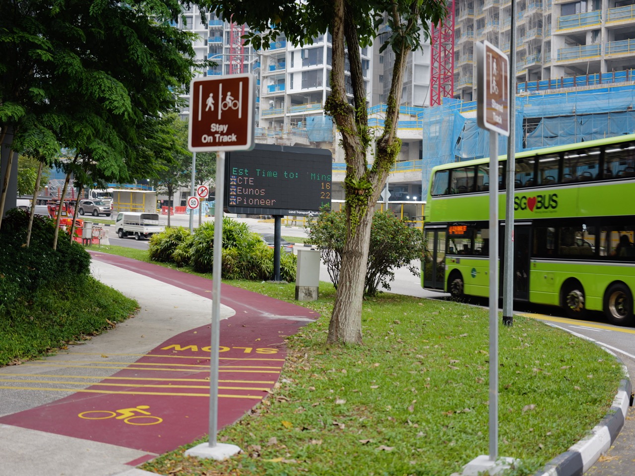
How Singapore connects is not only about roads and railways.
Did you know that a green path beside a canal can also behave like transport infrastructure?
Walkers use it. Runners use it. Cyclists use it. Families use it. Birds and other wildlife may move through the wider green corridor around it. A path that looks recreational on Sunday morning can become a practical route to work, school, a park, a town centre or the next neighbourhood on Monday.
That is the beauty of Singapore’s park connectors and green routes: they connect movement with nature.
This article follows that layer. It folds park connectors, cycling paths, canal edges, greenways, neighbourhood parks and island-wide routes into eduKateSG’s larger Singapore graph of transport, recreation, ecology, town planning and everyday life.
The canonical green-system owner remains How Singapore Works | Parks and Green Corridors. The HDB neighbourhood-movement owner remains How Playgrounds, Parks and Active Mobility Shape HDB Life. Here we ask the connection question: what happens when green spaces stop behaving like isolated destinations and begin behaving like a network?
Did You Know? A Park Can Be a Node Instead of an Island
Imagine two beautiful parks with a busy road system between them.
Each park is useful on its own.
Now connect them with a continuous route.
Suddenly the parks become more than two destinations. They become two nodes inside a larger journey.
Add another connector, another canal-side trail and another neighbourhood path, and the geometry changes again.
A network appears.
This is the same transformation that happens when railway stations are linked by tracks. The parts already existed. Connectivity changes what the parts can do together.
Singapore’s Park Connector Network
NParks describes the Park Connector Network as an island-wide network of linear green corridors linking major parks and nature areas across Singapore. Its current dedicated PCN site says the network includes more than 380km of trails.
That number is interesting, but the network idea is even more important.
A park connector is not simply a long park.
It is a route.
Routes create relationships between places.
Green Routes Do More Than One Job
- recreation for walkers, runners and cyclists;
- active travel between neighbourhoods;
- access to parks and nature areas;
- links to housing estates and town centres;
- connections along rivers, canals and coastlines;
- ecological connectivity in the wider landscape;
- space for exercise and family activity; and
- a different way of seeing Singapore at human speed.
When one corridor serves several functions, the city gets more value from the same land.
That is a recurring Singapore planning strategy: stack functions where possible.
The Canal Becomes a Route
Singapore’s drainage and water systems create long linear spaces.
Where conditions allow, paths beside canals and waterways can become movement corridors.
This is a lovely example of infrastructure layers meeting.
Water management occupies one system.
Walking and cycling occupy another.
Greenery adds ecological and recreational value.
The same geography supports several purposes without every purpose needing a separate corridor.
Did You Know? A Leisure Route Can Become a Commute
NParks’ current park connector guidance notes that the interlinked routes can move people from housing estates to regional parks and can also be used for daily commutes.
This matters because the boundary between recreation and transport is not fixed.
A person cycling for exercise and a person cycling to work may use the same path.
A student may walk part of a connector to school.
A family may use it to reach a playground.
A runner may use it to link several parks.
The infrastructure stays the same. The human purpose changes.
Why Continuity Matters
A pleasant cycling path that suddenly ends at a hostile junction is not a complete route.
A park connector that reaches a road without a clear crossing creates uncertainty.
A greenway that is beautiful but disconnected from nearby housing becomes harder to use for daily travel.
This is the same lesson we found in covered walkways: continuity matters more than isolated quality.
Read How Singapore Connects | Covered Walkways, Underpasses and Pedestrian Links and the principle becomes obvious. A network is made at the joints.
Cycling Changes the Radius of Everyday Life
Walking is wonderfully fine-grained.
Cycling extends the distance that can remain human-powered.
A trip that feels long on foot may feel ordinary on a bicycle.
That changes which parks, schools, shops, transit nodes and neighbourhoods feel reachable without a motor vehicle.
In systems terms, a bicycle expands the catchment area of local infrastructure.
But Shared Paths Require Shared Behaviour
A path that carries walkers, runners, cyclists, children and mobility-device users is a negotiated space.
Speed matters.
Passing distance matters.
Visibility matters.
Courtesy matters.
The infrastructure can create the opportunity for shared movement, but users still have to coordinate.
This is another recurring civilisation principle: rules and norms complete physical design.
Wayfinding Turns a Green Path into a Legible Network
NParks has been piloting colour banding on directional signage and lampposts along the Eastern Corridor to improve wayfinding and help users recognise their route. See the current Island-wide Routes page for official details.
That is a small but important idea.
A route is more useful when people can understand where they are and where it leads.
The path provides physical continuity.
The sign provides cognitive continuity.
Loops Change How People Explore
A linear path gets you from A to B.
A loop lets you leave, explore and return.
NParks publishes several PCN loops and island-wide routes that combine multiple connectors, trails and paths.
The network becomes an invitation.
Instead of asking, ‘Which park should I visit?’, a person can ask, ‘Which chain of places can I move through?’
That is the difference between destination thinking and network thinking.
The North-East Shows the Power of Chaining Places
A resident in Punggol or Sengkang can experience waterways, neighbourhood parks and longer recreational routes as connected pieces rather than separate attractions.
This matters to eduKate’s local-area graph.
Our Punggol and Sengkang articles describe places individually.
The connector network reveals the relationships between those places.
A map becomes a story of movement.
The East Shows How Water, Parks and Housing Interlock
NParks’ Siglap Park Connector page describes a route running partly along Siglap Canal and linking places including Bedok Reservoir Park, Bedok Town Park, Telok Kurau Park and East Coast Park.
That one route touches drainage geography, housing estates, parks, roads and the coast.
It is difficult to find a better example of Singapore’s layered urbanism.
Green Routes Connect to Public Transport
A cycling or walking journey does not need to replace the MRT or bus.
It can feed them.
A person may cycle to a station, walk from a connector to a bus stop or use a green route for the local portion of a longer journey.
This is multimodal transport at a human scale.
Different modes solve different distances.
Green Routes Connect to Play
The previous article, How Singapore Connects | Playgrounds, Fitness Corners and Shared Recreation, looks at recreation nodes inside neighbourhoods.
Park connectors are what allow some of those nodes to join a wider movement system.
A playground can become part of a family cycling route.
A fitness corner can become a stop on a walk.
A neighbourhood park can become one station in a longer green journey.
Green Routes Connect to Ecology
People see a path.
Ecologists may see a corridor.
NParks describes park connectors as contributing not only to recreational access but also to ecological connectivity between natural habitats.
The exact ecological value varies by location and design, but the broader principle is important: linear green spaces can help reduce the isolation of green patches.
Once again, connection changes what isolated pieces can do.
A Small Example: Home to Park
A family leaves an HDB block.
A barrier-free path reaches a neighbourhood walkway.
The walkway connects to a park connector.
The connector reaches a larger park.
The family never needed a car.
The journey links housing, pedestrian design, recreation and greenery in one continuous chain.
A Small Example: School to Home
A student uses part of a green route after school.
The path is away from heavy traffic, passes familiar landmarks and links into the estate.
The route becomes more than movement.
It becomes a repeated mental map of the neighbourhood.
Repeated journeys teach geography.
A Small Example: Sunday Exploration
A cyclist begins with no urgent destination.
One connector leads to another.
A canal opens into a park.
A park opens toward the coast.
A bridge leads into another district.
This is one of the most delightful effects of networked public space: movement becomes discovery.
What Can Break a Green Route?
- a missing crossing;
- a sudden end to a cycling path;
- confusing wayfinding;
- poor lighting where night use is expected;
- conflict between faster and slower users;
- narrow pinch points;
- construction detours;
- flooding or drainage issues;
- poor links from nearby housing; and
- routes that are technically connected but unpleasant to reach.
The connector name is a promise.
The user experiences whether the promise is true.
How to Read the PCN Like a Systems Thinker
1. Find the nodes
Which parks, estates, stations, waterways or town centres does the route connect?
2. Follow the continuity
Where does the path become a road crossing, bridge, underpass or local street?
3. Watch the user mix
Walkers, runners and cyclists may use the same corridor differently.
4. Notice the water
Many routes follow canals, rivers, reservoirs or coasts. Ask what other infrastructure shares the corridor.
5. Read the signs
Wayfinding turns long paths into understandable journeys.
6. Compare weekday and weekend use
The same route may behave like a commute one day and recreation the next.
7. Look for ecological edges
Notice how greenery links parks, waterways and habitat patches beyond the paved path itself.
The eduKate Singapore Graph: Green Lines Between Local Stories
eduKateSG has thousands of place-based articles.
The Park Connector Network gives us a way to connect those places physically.
Punggol links to Sengkang. Bedok links toward East Coast. Bishan links into river and park systems. Western routes connect estates to green corridors and nature edges.
This is exactly what the How Singapore Connects series is designed to do.
The local article tells you what a place is.
The connector article tells you what the place can reach.
Frequently Asked Questions
What is the Park Connector Network?
NParks describes the PCN as an island-wide network of linear green corridors linking major parks and nature areas. The dedicated PCN site says it currently includes more than 380km of trails.
Are park connectors only for recreation?
No. They support recreation, but some routes can also be useful for active travel and daily commutes.
Can I cycle on park connectors?
Many park connectors support cycling, but users should follow current signs, rules and local conditions and share paths considerately.
Why do many connectors follow waterways?
Canals, rivers and reservoirs create long linear corridors that can support recreation and movement alongside their water-management functions.
How do park connectors help public transport?
They can improve first- and last-mile access by linking neighbourhoods to stations and bus stops.
How do they help wildlife?
NParks states that the network also contributes to ecological connectivity between natural habitats.
Why does wayfinding matter on a green route?
Because long interlinked networks require signs and route identity so users know where they are and which connection comes next.
What is Singapore aiming for by 2030?
NParks’ current parks and PCN page states a goal of 500km of park connectors by 2030, with every household within a 10-minute walk of a park.
Is this the main eduKateSG article on parks and green corridors?
No. The canonical owner is How Singapore Works | Parks and Green Corridors. This page owns the connection lens.
What is the main systems lesson?
Green space changes character when it becomes continuous. A park is a destination; a connected sequence of parks and paths becomes a network.
Helpful Reading and Singapore Graph Connections
- NParks | Park Connector Network
- NParks | Island-wide Routes
- NParks | Parks and Park Connector Network
- How Singapore Works | Parks and Green Corridors
- How Playgrounds, Parks and Active Mobility Shape HDB Life
- How Singapore Connects | Playgrounds, Fitness Corners and Shared Recreation
- How Singapore Connects | Covered Walkways, Underpasses and Pedestrian Links
How Singapore Connects: Green Space Becomes a Network
Did you know that a path beside a canal can quietly connect housing, parks, exercise, ecology and transport?
That is what makes the Park Connector Network so interesting.
The route is not spectacular because it performs only one job.
It is powerful because it performs several jobs at once.
It lets people move.
It lets people play.
It lets people discover.
It helps green spaces meet.
And it turns Singapore’s parks from separate dots into lines, loops and journeys.
Once you start reading those green lines, the island looks less like a collection of neighbourhoods.
It looks like one connected landscape.