
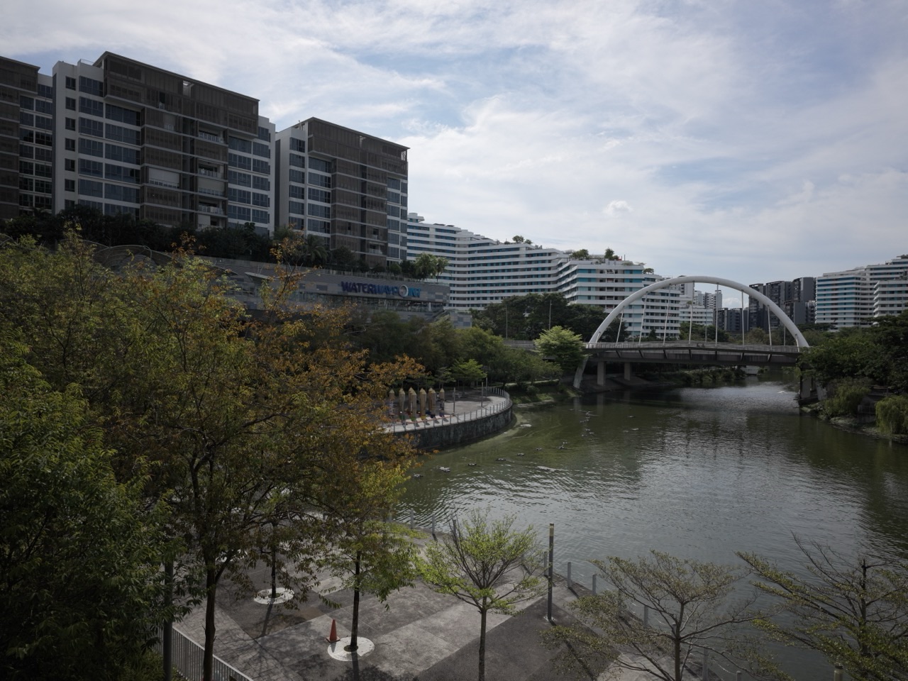
How does Singapore’s parks and nature network work? A neighbourhood park offers nearby space to walk and play. Park connectors link parks and waterways so people can travel farther on foot or by bicycle. Nature reserves protect important habitats, while nature parks, corridors, trees and green routes help wildlife and people move through a dense city. NParks plans and manages many of these layers as part of Singapore’s City in Nature vision, but not every green space has the same purpose or rules.
If you want to understand Singapore’s Park Connector Network (PCN), how many kilometres of park connectors exist, what the Round Island Route is, whether you can cycle in nature reserves, how Singapore protects wildlife or what the OneMillionTrees movement does, this guide brings the answers together. It links the original How Singapore Works parks chapter with more specific eduKateSG articles on cycling paths, ecological corridors, tree care, community gardens, flood resilience and ActiveSG.
The useful distinction is between a park you visit, a route that connects places and a habitat that needs protection. A pleasant cycling path and an ecological corridor can share greenery without serving identical functions. Designing both well is how Singapore’s green network becomes infrastructure rather than decoration.
Quick answer: how Singapore connects its green spaces
- Parks and gardens: local and destination spaces for rest, recreation, nature appreciation and community activities.
- Park Connector Network: walking and cycling corridors connecting parks, waterways, residential areas and other destinations.
- Nature reserves: legally protected ecosystems with conservation rules and sensitive habitats.
- Nature parks and buffers: suitable spaces around and between biodiversity-rich areas that can reduce pressure on reserves.
- Nature corridors and Nature Ways: ecological connections supporting habitat and movement for plants and wildlife.
- Urban trees and greenery: shade, habitat, cooling, landscape quality and ongoing maintenance obligations.
- People and stewardship: route sharing, accessibility, gardening, wildlife respect, maintenance and community participation.
NParks’ Parks and Park Connector Network identifies over 400 parks and four nature reserves under its care. Its 2025/26 annual report records 424 km of park connectors by the end of FY2025 and a 500 km target by 2030. These are measured progress and future targets, not interchangeable numbers.
1. Start from an HDB front door
Imagine a family living in Punggol. They can walk to a neighbourhood green area, follow a path beside the waterway and eventually connect to a longer recreation route. At first glance, these may look like separate landscaping projects.
But the usefulness comes from connection. A park is valuable when it is accessible; a green corridor becomes more useful when it reaches a school, home or another park. A disconnected path ending beside a dangerous road can leave a good-looking map unfinished.
This is why Singapore’s green spaces must be understood together with walking access, transport, drainage and town planning. The root How Singapore Works | Parks and Green Corridors explains the civilisational meaning.
2. What is NParks responsible for?
The National Parks Board is a public agency responsible for many aspects of Singapore’s parks, gardens, nature conservation, urban greenery and related stewardship. It manages different kinds of green spaces and works with other agencies and communities.
That does not mean all green-looking land is a public park or that NParks owns every tree. A private condominium garden, a protected nature reserve and a Town Council-managed planting strip can have different owners and rules.
Understanding responsibility matters when a tree needs inspection, a path is closed or a resident wants to hold an event. Start with NParks. The urban operations link is Urban Trees and Arborists.
3. What counts as a park?
A park is generally a designed and managed green space intended for appropriate public recreation, leisure and nature appreciation. Some are small neighbourhood facilities with playgrounds; others contain larger lawns, trails or significant vegetation.
Parks vary in their purpose and ecological sensitivity. A city park with event lawns should not be assumed to follow the same access rules as a protected forest habitat. Opening hours, cycling permissions and facility conditions depend on the actual site.
NParks’ parks directory is the place to check what exists, which facilities are available and any current advisories. The specialist Playgrounds and Shared Recreation looks at the neighbourhood layer.
4. What is the Park Connector Network?
The PCN is a system of linear green routes that connects major parks, nature areas and urban places. It helps people walk, jog or cycle through the island using a network more pleasant than relying entirely on busy road corridors.
NParks distinguishes park connectors from individual park trails and other types of public routes. Some connectors follow canals, coastlines or road reserves; the physical environment and allowed activities can vary.
Park connectors can also provide ecological connectivity, although they do not automatically replace protected habitats or serve as safe routes for every animal. Read Park Connectors, Cycling Paths and Green Routes.
5. How long is Singapore’s Park Connector Network?
Published figures refer to different reporting dates and scopes. NParks’ latest 2025/26 annual reporting shows 424 km of park connectors cumulatively at end FY2025, while some public description pages still use the broader phrase ‘over 380 km’.
The important thing is to keep dates and measurement definitions attached to the figure. A route that is planned or partly constructed should not be represented as fully open to every walker or cyclist.
Singapore’s City in Nature targets include 500 km of park connectors by 2030. It is a future target, not a claim of current completion. Use NParks annual reporting for the reported progress.
6. Why the route is more important than its length
A connector that links a residential area with a park, train station or public facility can help people make real journeys. One kilometre of disconnected path may offer little utility compared with a shorter link that closes a critical gap.
Imagine a child cycling with a parent from home to a nearby nature area. The route’s safety depends on crossings, surface conditions, signs and sharing arrangements. A long headline network length says little about those final decisions.
Route planners therefore need to connect physical infrastructure to actual people and purposes. For the surrounding transport system, read MRT, Roads, Walking and Cycling.
7. What is the Coast-to-Coast Trail?
Singapore’s Coast-to-Coast Trail is a curated route crossing parks and park connectors, linking the west and northeast of Singapore. NParks describes the 36 km trail from Jurong Lake Gardens to Coney Island Park.
It offers a different experience from a small loop inside one neighbourhood park. Users should plan for travel time, heat, weather, crossing points, rest and the condition of the route rather than assume the entire distance is suitable for every person or bicycle.
NParks provides Coast-to-Coast information and current route guidance. The lesson is how separate green spaces combine into one longer recreational experience.
8. What is the Round Island Route?
The Round Island Route is an ambitious recreational connection planned to extend around Singapore. NParks describes the planned full route as approximately 150 km, with operational sections and further delivery arranged in phases.
A map of a planned route should never be used to guarantee every segment is open or suitable for a specific activity today. Construction, maintenance, safety and site restrictions can affect the journey.
The intended benefit is broader access to coastal scenery, parks and natural spaces while enhancing ecological connectivity where possible. Read NParks — Round Island Route for current section information.
9. What is the Rail Corridor?
Singapore’s Rail Corridor follows the legacy of a former railway alignment, now adapted into a green and recreational space. It combines ecological and historical value with public access through a route crossing different parts of the island.
Because its character changes along the length, visitors should check the specific section, path conditions and any closures. Some stretches support leisurely walks, while others may require more preparation or involve sensitive habitats.
The project illustrates a broader planning idea: infrastructure from one era can acquire a new civic purpose without losing its history. The related Legacy and Public Memory guides explain this connection.
10. Can you cycle everywhere on a park connector?
Not automatically. Cycling rules, sharing arrangements, speed expectations and permitted activities depend on the actual route. Some pedestrian or nature paths are not equivalent to designated cycling infrastructure.
Park connectors are shared spaces, so cyclists must consider walkers, children, older residents and animals. Slowing at junctions and crowded areas protects everyone and makes the network more usable.
NParks publishes a code of conduct and route guidance through its PCN portal. The specialist Park Connectors and Cycling Paths covers the technical differences.
11. How are park connectors different from ordinary pavements?
A pavement next to a street primarily provides pedestrian access along the road network. A park connector may provide a landscaped shared route designed to link parks and destinations while offering a distinct recreational experience.
The two can meet. A route may include road crossings or short sections that require users to follow general traffic and pedestrian rules. The quality of the overall journey depends on safe transitions between them.
A visitor should not assume every green path is a protected off-road cycling route from start to finish. Road-junction design and signage remain important. Read Pedestrian Links and Crossings.
12. Why nature reserves need different protections
Nature reserves safeguard ecosystems and biodiversity-rich habitats with stronger conservation protections. They are not simply city parks with more trees. Some species or ecological processes can be harmed by disturbance, trampling or inappropriate human activity.
Singapore has four nature reserves under the NParks framework. Different reserves protect different ecosystems and may impose restrictions on cycling, entering sensitive areas or using particular trails.
Check the specific reserve’s current rules before a visit. The wider ecological owner is Nature Reserves, Ecological Corridors and Wildlife Crossings.
13. What is a nature park and why is it useful?
Nature parks can provide suitable recreation and ecological functions near important reserve areas. They may serve as buffers, allowing some lower-impact activities outside more sensitive habitats.
That creates a balance: residents gain nature access without every visit pressing directly into the most vulnerable ecosystem. Paths, educational features and visitor management can be planned with habitat needs in mind.
A nature park is still not immune to disturbance. Users should respect signs, remain on allowed paths and avoid feeding or collecting wildlife. See NParks — Nature Parks and Reserves.
14. What are nature corridors?
Nature corridors are intended to connect biodiversity-rich areas so plants and animals can persist across a landscape fragmented by development. NParks studies ecological profiles and connectivity before strengthening suitable habitat links.
A corridor may involve existing forest patches, nature parks, greenery along routes and improvements to gaps between them. Its value depends on the species and habitats it serves, not simply whether it looks green from above.
NParks describes the Bukit Batok Nature Corridor as part of a connection involving Bukit Timah Nature Reserve and the Tengah Forest Corridor. Read Nature Corridors and Nature Ways.
15. What is a Nature Way?
Nature Ways are enhanced green routes often developed along roads to support biodiversity and ecological connections within the city. They differ from park connectors focused on recreation, although green networks can overlap spatially.
Roadside planting can provide shade and habitat, but a strip of trees alone does not automatically create a safe wildlife corridor for every species. Plant selection, vegetation layers, surrounding barriers and maintenance affect its actual function.
NParks reports 260 km of Nature Ways by the end of FY2025, towards a 300 km target by 2030. See its annual report for the measurement context.
16. Why nature connectivity matters for wildlife
An isolated habitat can make it harder for animals to reach suitable food, breeding opportunities or other habitat areas. Connections may help support movement and genetic exchange, depending on species and environmental conditions.
Not every animal needs the same corridor. A bird may cross some barriers that a small ground-dwelling animal cannot. A noisy, illuminated road crossing may remain dangerous even when vegetation surrounds it.
Therefore, effective ecological planning requires species knowledge and monitoring rather than an attractive line on a map. The specialist Ecological Corridors and Wildlife Crossings owns the details.
17. What do urban trees contribute?
Urban trees can provide shade, aesthetic value, habitat and localized cooling. Their benefits depend on tree species, canopy, planting density and conditions around them. Mature trees can also shape the identity of a familiar street or park.
Trees require more than planting. Arborists and maintenance teams inspect health, structural condition and site safety; weather and changes in the surrounding environment can affect risk.
The correct approach balances conservation, safety and long-term care rather than assuming every tree can be left untouched or removed whenever someone worries. Read Urban Trees, Arborists and Tree Management.
18. What is the OneMillionTrees movement?
NParks launched the OneMillionTrees movement to plant a million more trees between 2020 and 2030 as part of City in Nature. Trees are being added across suitable urban, industrial and other landscapes.
NParks’ annual reporting states that more than 855,000 trees had been planted by March 2026. This is cumulative progress towards the target, not a claim that all trees are mature or provide their eventual canopy immediately.
Good assessment looks at survival, suitable species, growth, site conditions and how planting contributes to broader habitat and cooling goals. Follow NParks’ 2025/26 report.
19. Can planting trees make Singapore cooler?
Trees create shade and can help moderate local microclimates, particularly when combined with sensible landscape and building design. The benefit varies with canopy cover, species, wind, built surfaces and the time of day.
Planting a small seedling today does not instantly deliver the shade of a mature tree. Landscapes need years of maintenance, water and space to develop. The suitability of underground services and surrounding buildings also matters.
NParks is studying urban heat impacts using environmental monitoring in areas such as Jurong. This is a practical example of combining greenery with evidence, rather than claiming a universal temperature reduction from a single planted tree.
20. Why Singapore’s Botanic Gardens matter
Singapore Botanic Gardens are both a major public green destination and a place of botanical, educational and heritage significance. The gardens support visits, research, horticulture and cultural experience within the city.
A family enjoying a path and an expert studying plant collections are using the same institution in very different ways. Effective management needs to accommodate appropriate public access while caring for valuable plant resources and the landscape.
Botanic Gardens show how nature, education, tourism and cultural memory can meet. Read How Tourism Works and Arts and Heritage Systems.
21. How do community gardens connect residents?
Community gardens and allotment spaces give residents opportunities to grow plants, learn horticulture and meet neighbours through shared work. They are not equivalent to an unrestricted right to plant anywhere on public land.
Suitable programmes have designated spaces and rules covering plots, maintenance and permitted activity. Participation can teach care, patience and an appreciation for soil, water and living things.
Community gardens are social infrastructure as well as greenery. The detailed guide is Community Gardens, Allotment Gardens and Urban Farming.
22. How do playgrounds and fitness corners fit?
A playground, outdoor fitness corner or exercise station lets residents use green space without requiring a formal sports-club membership. These facilities can support play, social life and appropriate physical activity near home.
Good design considers age, accessibility, maintenance and the surrounding environment. A space that looks attractive on opening day still needs inspections and repairs over its lifetime.
Recreation infrastructure also needs consideration for neighbours, including noise, safe circulation and shared use. Read Playgrounds, Fitness Corners and Shared Recreation and How Singapore’s Sports System Works.
23. Why green routes are important for older residents
Regular access to nearby parks and sheltered walking routes can help older residents remain active and socially connected. The useful question is whether a real person can reach the park safely, not simply whether a green area appears within a circle drawn on a map.
Seats, crossings, readable signs and barrier-free access influence comfort and safety. A steep or uneven path may be unsuitable for a person with limited mobility even when the walk is short.
Singapore’s 2030 target is for all households to be within a ten-minute walk of a park. NParks reports 96% coverage at the end of FY2025. The ageing connection is Supporting Older Residents.
24. How do parks interact with stormwater?
Parks, rivers, canals and catchments often occupy connected spaces. Suitable landscape design can slow or manage some runoff, while drainage infrastructure carries stormwater through designated routes.
A green space does not automatically act as a flood basin, and a scenic canal should not be mistaken for a sanitary sewer. Actual hydraulic capacity, land levels and maintenance determine how stormwater moves.
During intense rain, certain paths can be slippery or unsafe. Park users should check warnings and avoid entering floodwater. The city systems link is How Singapore Prevents Floods and Rising Seas.
25. Why water quality matters in green spaces
Reservoirs and watercourses are part of Singapore’s water-management system as well as its landscape. Activities around them may be regulated to protect safety and water quality.
Visitors should not assume that a waterbody is suitable for swimming, fishing or other recreation just because it looks clean. Permitted activities vary by site and authority.
Public enjoyment must coexist with the purposes of reservoirs, drainage and conservation. Read Water Supply, Reservoirs and Drainage and How Singapore Works | Water.
26. What about mosquitoes and public health?
Greenery and water are not inherently unhealthy, but poor maintenance, stagnant water in unsuitable places and other conditions can create problems relevant to mosquitoes and public health.
Singapore’s mosquito-control system involves surveillance, source reduction and other operations rather than simply removing every plant. Public behaviour, estate maintenance and environmental management all contribute.
Residents can support prevention by avoiding stagnant water in suitable containers and following official advice without unnecessarily damaging ecological habitats. Read Mosquito Surveillance and Dengue Control.
27. What should people do when they encounter wildlife?
Singapore’s nature network brings residents closer to birds, mammals, reptiles and other wildlife. Most encounters are opportunities to observe from an appropriate distance rather than invitations to handle or feed the animal.
Feeding wildlife can change behaviour and create risks for animals and people. A visitor should avoid approaching, cornering or attempting to capture wild animals and follow NParks’ guidance for any safety concern.
The correct response depends on the species and circumstance. Nature appreciation works best with respect for the animal’s habitat and other park users. Read NParks’ wildlife information and Ecological Corridors.
28. Why route signs and closures matter
A long park connector journey can involve junctions, branches, underpasses and areas undergoing maintenance. Signs and official route maps help visitors understand where they are and how to continue.
NParks has trialled colour-banded wayfinding on part of the Eastern Corridor, with further expansion dependent on evaluation. That is a practical example of improving an existing system through user feedback.
Users should not assume an old map reflects every closure or route adjustment. The latest island-wide route guidance and connector listing are safer starting points.
29. Worked example: from home to a long green route
Imagine a resident leaving a HDB block, using a safe street crossing to reach a park connector and following the route past a waterway towards another park. The trip depends on the apartment’s lift, local pavement, junction signs, path surface and accessibility of the destination.
A cyclist on the same route has additional responsibilities to slow near walkers and follow the applicable shared-path rules. A bird in the adjacent planted area experiences the place differently again: its habitat connections and disturbances do not follow the visitor’s route map.
Three different users therefore share one planned landscape. The success of the green network depends on satisfying their needs without pretending they are identical.
30. What makes Singapore’s City in Nature successful?
Counting kilometres of park connectors and planted trees is useful, but the human and ecological outcomes matter too. Can residents reach green space conveniently? Are wildlife habitats healthier? Are trees appropriately maintained? Can visitors understand where cycling is permitted? Do older users find routes accessible?
NParks’ annual targets provide one evidence layer: park-connectors length, trees planted, Nature Ways and household access. Other evidence includes biodiversity monitoring, maintenance conditions, visitor feedback and the real experience of communities.
Good green planning is a long-term service rather than a one-off beautification project. That connects Resilience and Future Upgrade with The Whole Machine.
Singapore nature and park network: article directory
These detailed eduKateSG pages own their specific topics. This article serves as the island-level connection map.
Park connectors, nature and green routes
- How Singapore Works | Parks and Green Corridors
- Park Connectors, Cycling Paths and Green Routes
- Nature Reserves and Ecological Corridors
- Urban Trees and Arborists
- Community Gardens and Urban Farming
- Playgrounds, Fitness Corners and Recreation
What green space connects to other systems
- ActiveSG, Sport and Recreation
- Age Well SG and Older Residents
- Floods, Drainage and Resilience
- Water Supply, Reservoirs and Drainage
- Mosquito Surveillance and Public Health
- URA Land-Use Planning
- Tourism and Attractions
- HDB Towns and Daily Services
Frequently asked questions about Singapore parks
What is Singapore’s Park Connector Network?
A network of linear green routes connecting parks, waterways, nature areas and destinations for recreation and suitable mobility.
How long is Singapore’s park connector network?
NParks’ 2025/26 annual report records 424 km at end FY2025, while the long-term target is 500 km by 2030.
How many parks does Singapore have?
NParks’ current overview describes over 400 parks under its care.
How many nature reserves are there?
NParks identifies four nature reserves protected under the relevant framework.
Is a park connector the same as a nature reserve?
No. Park connectors chiefly link routes and destinations, while nature reserves have a primary conservation purpose and specific rules.
Can I cycle in every nature reserve?
No. Check the actual reserve and route restrictions; permitted activities vary.
What is the Coast-to-Coast Trail?
A roughly 36 km curated route from Jurong Lake Gardens to Coney Island Park.
What is the Round Island Route?
A planned approximately 150 km recreational connection developed in phases; check which sections are currently open.
What is a Nature Way?
A planted route intended to improve ecological connectivity and biodiversity, often associated with urban road corridors.
What is the OneMillionTrees movement?
NParks’ programme to plant a million additional trees between 2020 and 2030.
How many trees had been planted by March 2026?
NParks reported over 855,000 trees planted under the movement by March 2026.
Will every household be near a park by 2030?
The government target is all households within a ten-minute walk of a park by 2030; NParks reported 96% as of end FY2025.
Are park connectors always safe during thunderstorms?
No. Lightning, heavy rain, flooding, fallen branches or maintenance can create risks; follow current warnings.
Can residents feed wildlife in parks?
Feeding wildlife is generally discouraged and can be restricted or unlawful; follow NParks’ site-specific guidance.
Where can I find the latest PCN routes?
Use NParks’ current Park Connector Network portal, list of connectors and route notices.
Read the other Singapore systems explainers
- How Singapore Arts and Heritage Works
- How Singapore Tourism Works
- How Singapore Sport and Recreation Works
- How Singapore Public Libraries Work
The series parent is the How Singapore Works Civilisation Atlas.
Official sources and route information
- NParks — Parks and Park Connectors
- NParks — City in Nature 2025/26 Progress
- NParks — Recreational Connectivity
- NParks — List of Park Connectors
- NParks — Round Island Route
- NParks — Island-Wide Routes
- NParks — Nature Corridors and Nature Ways
- NParks — Nature Parks and Reserves
Reader note: Network lengths and national targets are given with their reporting dates. Park, wildlife, weather and route conditions change; follow current NParks notices and site rules for a real visit. This is an educational overview rather than a live route-safety advisory. Editorial review: 20 October 2026.