
Hydrogeology studies groundwater and the geological materials through which it moves. Its questions begin below the visible landscape: where is water stored, what connects one part of the subsurface to another, what drives movement, and how confidently can those relationships be established? A river, spring or well can reveal part of that system without revealing the whole of it.
The gold standard of hydrogeology is a defensible explanation of groundwater conditions, supported by appropriate observations and explicit limits. A coloured subsurface diagram is not sufficient evidence. Neither is a single water-level reading, a clear-looking sample or a model that produces a precise number. Geological interpretation, measurement quality, physical reasoning and uncertainty must agree well enough for the question being asked.
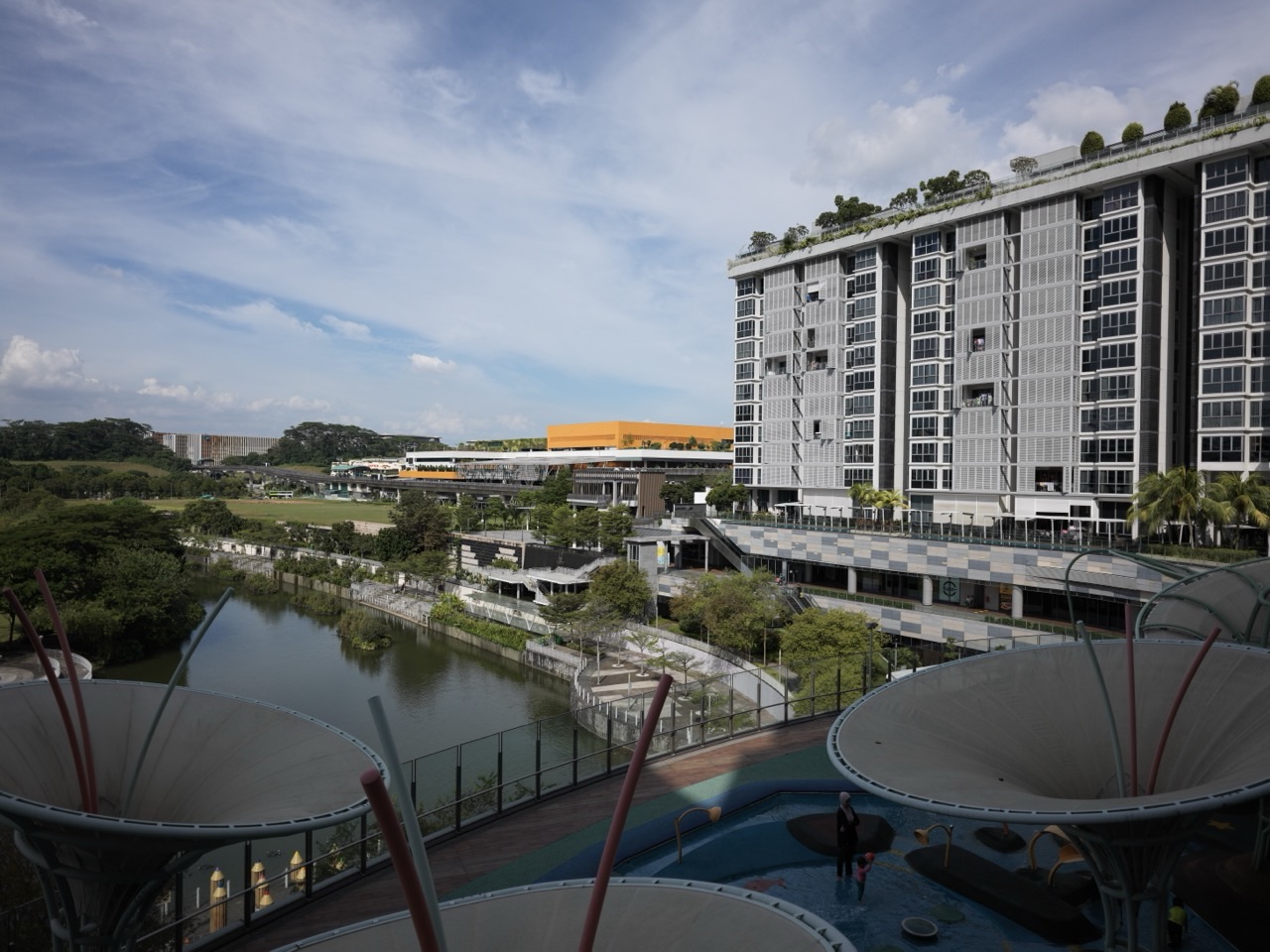
This root guide connects the science to its neighbouring branches: geology, hydrology, geophysics, water quality, engineering and teaching. All numerical examples are fictional learning cases, not site assessments. The featured surface-water photograph provides landscape context; it does not show an aquifer or establish a groundwater connection. Site-specific investigation, abstraction and water-safety decisions require suitably qualified specialists and the relevant local requirements.
eduKate · Hydrogeology
Find the part you need
Choose a route through the subject, or read all eighteen chapters in sequence. The worked example separates a hydraulic gradient, Darcy flux and average pore-water velocity; later chapters explain why those quantities do not remove field uncertainty.
Full chapter index · Connected articles · Learning that transfers into life
Chapter index
Build the groundwater picture · Chapters 1–4
Explain movement and calculate · Chapters 5–8
Connect water and consequences · Chapters 9–12
Test the evidence · Chapters 13–16
Teach and connect · Chapters 17–18
CHAPTER 1 OF 18 · Build the groundwater picture
1. Understand what hydrogeology studies
Groundwater occupies saturated openings in geological materials: pores between grains, fractures in rock and, in some settings, larger dissolution openings. It is not generally a continuous underground lake. The arrangement and connection of those openings influence how water can be stored and transmitted. The rocks and sediments therefore belong inside the explanation, not merely behind a water-flow arrow.
Hydrogeology overlaps with hydrology, but the terms are not interchangeable. Hydrology addresses water across the wider cycle; hydrogeology concentrates on groundwater in its geological setting. Hydrogeological engineering applies related knowledge to practical design and management questions. One project can require all three perspectives without making them the same discipline.
A useful starting question is not simply “Is there water below this place?” It is “What saturated units may be present, how are they connected, what observations support that interpretation, and what changes over time?” That wording makes evidence and scale visible. A shallow wet patch does not, by itself, establish the behaviour of a deeper water-bearing formation.
CHAPTER 2 OF 18 · Build the groundwater picture
2. Build a conceptual model before a numerical one
A conceptual groundwater model is an organised explanation of the system. It identifies relevant geological units, recharge areas, discharge areas, possible barriers and pathways, and the boundaries of the question. It may begin as a cross-section, a map and a short written account. Its value lies in making assumptions inspectable.
Separate observation from interpretation. A borehole log records conditions interpreted at a particular location; extending that unit across an unobserved area is a further inference. A measured water level is an observation at a particular time and installation. An arrow connecting two water-bearing zones expresses a hypothesis about movement that needs support.
Include competing explanations where the evidence permits them. A low-permeability layer may be continuous, interrupted or differently oriented from the initial sketch. Each possibility changes the proposed connection between locations. A defensible model states which differences matter to the decision and which additional observations could distinguish them. Its first purpose is to guide investigation, not to make the subsurface look tidier than the evidence allows.
A helpful discipline is to label each important element as observed, inferred or assumed. For instance, the existence of a unit at one borehole can be observed through a log, its continuity between holes inferred, and a distant model boundary assumed for a scenario. The labels can change when new evidence arrives; keeping them visible prevents an assumption becoming an unquestioned fact through repetition.
CHAPTER 3 OF 18 · Build the groundwater picture
3. Distinguish porosity from permeability
Porosity describes the proportion of a material’s bulk volume occupied by void space. Permeability concerns the ability of the connected structure to transmit fluid. A material can contain substantial pore space while transmitting water slowly if the connections are very small or poorly linked. Storage space and ease of movement are different properties.
Effective porosity concerns the pore space participating in flow under the relevant definition and conditions. It should not automatically be substituted with a total-porosity figure. Nor should either term be treated as the amount of water that will drain freely from a formation. Drainage and storage behaviour require their own appropriate quantities and assumptions.
Consider a teaching comparison between two unspecified samples. Sample A has more total void space, but sample B has better-connected flow paths. Without further measurements, the greater porosity of A does not prove greater hydraulic conductivity. Ask what was measured, at what scale and under what conditions. A hand specimen, a laboratory core and a field-scale fractured formation can support different conclusions about the effective pathways.
CHAPTER 4 OF 18 · Build the groundwater picture
4. Read aquifers, confining units and water levels correctly
An aquifer is a geological unit capable of storing and transmitting usable quantities of groundwater in the context under discussion. That description does not promise a particular yield or drinking-water quality. A relatively low-permeability unit can restrict exchange between adjacent units without being an absolutely impermeable seal.
In an unconfined aquifer, the water table forms the upper boundary of the saturated zone. In a confined aquifer, the water-bearing unit lies beneath a confining unit and water is under pressure. The water level in a suitably completed well can rise above the top of the confined aquifer. It need not rise above ground level.
| Term | What it describes | What it does not establish |
|---|---|---|
| Water table | Upper surface of an unconfined saturated zone | The top of every deeper aquifer |
| Confined water level | Hydraulic head indicated by an appropriate installation | The physical top of the water-bearing rock |
| Confining unit | A unit that restricts transmission relative to neighbouring units | A perfect barrier everywhere |
Installation details matter. A well open across several units may mix their responses rather than represent the head in one intended interval. A number without that construction information is an incomplete observation.
CHAPTER 5 OF 18 · Explain movement and calculate
5. Use hydraulic head to explain a driving difference
Hydraulic head expresses mechanical energy per unit weight of water. In a common constant-density groundwater treatment, elevation head and pressure head are combined, while velocity head is usually negligible. A groundwater-level elevation measured in an appropriate observation installation can represent head for its monitored interval.
Compare heads against the same elevation datum. Two depths measured down from different ground surfaces cannot be compared directly as if they were elevations. A shallow depth below a hilltop can correspond to a greater head elevation than a deeper reading in a valley. Survey and reference-point errors can therefore alter an inferred flow direction.
For a simple constant-density setting, groundwater movement follows decreasing hydraulic head, subject to the material’s hydraulic properties and geometry. It does not necessarily follow the ground-surface slope. Where density varies substantially, such as some saline systems, the interpretation requires an appropriate density-aware treatment. State the assumptions before turning a pair of readings into an arrow, and avoid implying that two points resolve the complete three-dimensional flow field.
Suppose one installation’s measuring point is higher than another’s. The shorter depth-to-water reading does not necessarily identify the lower or higher hydraulic head. Learners should first convert both readings to elevations using their respective reference points. Only then should they compare the numbers. This is a reference-system problem before it is a subtraction problem.
CHAPTER 6 OF 18 · Explain movement and calculate
6. Understand conductivity and uneven ground
Hydraulic conductivity describes how readily a specified fluid moves through a material under a hydraulic gradient. It depends on both the material and fluid properties. It is not interchangeable with intrinsic permeability, which characterises the porous medium independently of those fluid properties. Units help expose confusion: hydraulic conductivity has dimensions of length divided by time.
Heterogeneity means properties vary from place to place. Anisotropy means behaviour depends on direction. Layered sediments or oriented fractures can transmit water differently along and across their structures. A single convenient conductivity value may therefore describe an effective approximation rather than every part of the ground.
A field interpretation should explain the scale and method behind an estimate. A laboratory measurement on an intact sample can miss larger fractures; a field test can integrate several features without identifying each one separately. Neither observation is automatically wrong. They may describe different scales. The question is whether the chosen property representation is adequate for the prediction, and whether plausible alternatives change the decision.
CHAPTER 7 OF 18 · Explain movement and calculate
7. Separate Darcy flux from pore-water velocity
Darcy’s law relates flow to hydraulic gradient and hydraulic conductivity under its applicable conditions. In a simple one-dimensional saturated example, the magnitude of specific discharge is q = K × i, where K is hydraulic conductivity and i is the magnitude of the head gradient. The signed form expresses movement down the head gradient.
Specific discharge, also called Darcy flux, is volumetric flow rate divided by the full cross-sectional area of the porous material. That area includes solid material as well as openings. Consequently, q is not the speed of water moving only through the connected pores.
An illustrative average linear pore-water velocity can be estimated as v = q / nₑ, where nₑ is effective porosity. This relationship depends on the interpretation and scale of the quantities. It does not imply that every water parcel has that speed or follows a straight route. Darcy’s law also has limits; flow dominated by some large conduits or other non-Darcian behaviour needs appropriate treatment rather than automatic use of a familiar equation.
CHAPTER 8 OF 18 · Explain movement and calculate
8. Work through a bounded groundwater calculation
Assume a fictional, saturated, homogeneous and isotropic porous medium with steady one-dimensional constant-density flow. Two representative head observations, aligned with the assumed flow direction, are 32 metres and 30 metres, separated by 100 metres. Assume K = 0.00001 m/s and effective porosity nₑ = 0.25. These are supplied teaching values, not field measurements.
The gradient magnitude is (32 − 30) / 100 = 0.02. Multiplying by K gives q = 0.0000002 m/s. Dividing that flux by 0.25 gives v = 0.0000008 m/s. Multiplying by 86,400 seconds per day converts the illustrative pore-water velocity to 0.06912 m/day.
| Quantity | Calculation | Result |
|---|---|---|
| Gradient magnitude | 2 m / 100 m | 0.02 |
| Darcy flux magnitude | 0.00001 m/s × 0.02 | 0.0000002 m/s |
| Average pore-water velocity | 0.0000002 m/s / 0.25 | 0.0000008 m/s |
| Daily velocity equivalent | 0.0000008 m/s × 86,400 s/day | 0.06912 m/day |
The dimensional check matters: gradient and porosity are dimensionless, leaving velocity units. The calculation does not forecast contaminant arrival. Heterogeneous pathways, dispersion, chemical reactions and different boundary conditions have not been represented. A correct multiplication cannot compensate for a conceptual model that does not fit the ground.
A further check is proportional reasoning. Under these unchanged assumptions, doubling K would double q and v. Halving effective porosity would leave q unchanged but double the illustrative v. Changing actual geology, however, may change several quantities together. The exercise isolates inputs for learning; it does not claim that natural formations permit each property to be varied independently.
CHAPTER 9 OF 18 · Connect water and consequences
9. Connect recharge, storage and response time
Recharge adds water to a groundwater system. Rainfall is not automatically recharge: some water evaporates, is used by vegetation, runs off or remains in unsaturated storage before any portion reaches the saturated zone. A rainfall total alone does not establish the amount or timing of recharge.
Storage describes how the system gains or releases water as conditions change. The relevant storage quantities differ between unconfined and confined conditions. A head change should not be converted into a water-volume change without an appropriate storage relationship and area or geometry. In a confined system, pressure change can be important without implying that the aquifer is draining like an open tank.
Responses can be delayed and distributed. A wet week, a seasonal water-level rise and a long-term groundwater trend need not operate on the same timescale. Compare observations across suitable intervals and distinguish the immediate response from the cumulative balance. An apparent recovery after rainfall does not prove that all previous abstraction effects have disappeared or that every connected part of the system has recovered equally.
CHAPTER 10 OF 18 · Connect water and consequences
10. Read groundwater and surface water together
Streams, lakes and wetlands can exchange water with groundwater. A gaining reach receives groundwater; a losing reach supplies water to the subsurface under the relevant conditions. The direction and amount of exchange depend on heads, connection and the properties of the intervening materials. They may vary along a watercourse and through time.
The presence of water beside a river is not sufficient to determine the exchange direction. Nor does a regional map prove that a particular reach is directly connected at every season. Appropriate observations might include groundwater heads, stream conditions and geological evidence, interpreted together rather than separately.
This is where the hydrogeology root connects with hydrology and rivers. The distinction matters when a decision about groundwater can influence surface flows or habitat conditions. A useful account specifies the reach, interval, evidence and uncertainty instead of declaring an entire river permanently gaining or losing from a single visit.
CHAPTER 11 OF 18 · Connect water and consequences
11. Understand pumping as a changing system response
Pumping changes groundwater heads and can alter flow patterns. Drawdown is a reduction in head relative to an appropriate reference condition. Its magnitude and distribution depend on the aquifer, pumping history, boundaries and other influences. A measured decline should be interpreted with those conditions, rather than attributed automatically to the nearest visible well.
Water supplied to a pumped well can involve release from storage and changes in recharge or discharge. Pumping may reduce groundwater discharge to a stream or induce additional infiltration from surface water where a connection exists. Those effects can be delayed and can continue after pumping changes.
USGS Circular 1376 explains why streamflow depletion needs analysis across time, not just an instantaneous comparison at the well. This guide does not provide an abstraction rate or a sustainable-yield rule. Such a decision requires site-specific evidence and the applicable management framework. A well that continues producing water has not, merely by doing so, demonstrated acceptable consequences for neighbouring users, surface waters or the wider groundwater system.
CHAPTER 12 OF 18 · Connect water and consequences
12. Keep water quality separate from appearance and yield
Groundwater can contain naturally occurring constituents as well as substances introduced through human activities. Geological reactions, residence conditions and introduced sources can all influence composition. Clear water, a productive well or an apparently protected depth does not by itself establish suitability for drinking or another particular use.
A quality claim needs a defined purpose, representative sampling, appropriate analytical methods and a justified interpretation against the relevant requirements. The location, monitored interval, sampling procedure, preservation, laboratory handling and detection limits can all affect what a result means. A single sample is a record of a bounded observation, not a permanent guarantee.
Connect this chapter with water quality monitoring and the laboratory branches below. The standard here is not to supply a do-it-yourself safety test. It is to explain why responsible decisions require suitable sampling and specialist interpretation. A result described as “not detected” also requires its method and reporting limit; it is not a universal statement that a substance is entirely absent.
CHAPTER 13 OF 18 · Test the evidence
13. Explain transport without promising an arrival date
Groundwater movement and dissolved-substance transport are related but different questions. Advection carries dissolved material with moving water. Dispersion spreads a solute distribution through differences in movement, while diffusion can move dissolved substances along concentration gradients. Reactions and interactions with geological materials can further change concentration and mobility.
An average groundwater velocity is therefore not automatically a contaminant-front velocity, a first-arrival time or the date a sampled concentration will peak. Different substances can behave differently within the same groundwater system. A calculation that ignores reactions is not a prediction of every dissolved constituent.
The worked example earlier intentionally stopped at an illustrative velocity. Extending it to a travel-time claim would add assumptions about pathway length, connected effective porosity and transport behaviour. A defensible assessment states which processes were included, which were omitted and which observations constrain them. Monitoring results should be compared with that stated model rather than treated as confirmation merely because a detected substance appears somewhere downstream of a suspected source.
CHAPTER 14 OF 18 · Test the evidence
14. Investigate the subsurface with complementary evidence
Hydrogeological investigation may combine geological mapping, borehole records, water-level monitoring, hydraulic testing, water chemistry and geophysical observations. Each method answers some questions more directly than others. The objective is not to collect the largest number of datasets, but to reduce uncertainty that matters to the defined problem.
A geophysical contrast is not automatically an aquifer boundary or a unique lithology. Borehole information can help test an interpretation, while the geophysical survey can suggest how conditions might extend between observation points. Well construction and monitored intervals are necessary context for water-level and chemical data.
Keep an auditable chain from field record to interpretation. Distinguish directly measured values, processed results and inferred surfaces. Record changes in equipment, reference points and methods that could affect comparisons. The related geophysical engineering branch makes the same essential point: subsurface evidence has limits, and interpretation gains strength when independent observations constrain the same explanation.
Draw the investigation as a sequence of questions. What uncertainty remains after mapping? Which observation could distinguish the competing interpretations? What would count as an inconsistent result? This sequence makes the purpose of a test clearer than a checklist of instruments. It also provides a reason to revise the investigation if the initial model proves inadequate.
CHAPTER 15 OF 18 · Test the evidence
15. Use models to test explanations, not erase uncertainty
A numerical groundwater model translates a conceptual model into equations, discretisation, properties and boundary conditions. Calibration adjusts selected inputs so simulated behaviour agrees sufficiently with chosen observations for the stated purpose. A close fit can be useful, but it does not establish that the model is uniquely correct.
Different combinations of conductivity, recharge and boundary assumptions can sometimes reproduce similar observations. Sensitivity analysis asks how results change when inputs or assumptions change. Uncertainty analysis considers the implications of imperfect knowledge. Neither task is satisfied by reporting additional decimal places on one preferred result.
A useful model report separates observations used for calibration from other checks where available, identifies scenarios and states the range of applicability. A model fitted to one regime may not support an extreme scenario without further examination. Return to the conceptual model if residual patterns suggest missing processes. Model complexity should serve the question; detail that cannot be constrained by evidence may increase apparent precision without improving the decision.
CHAPTER 16 OF 18 · Test the evidence
16. Make monitoring and handover decision-ready
Monitoring should be linked to a question and an intended response. A record of head, chemistry or discharge becomes useful when its location, interval, method, timing and reference conditions are clear. Repeated observations need enough consistency to distinguish environmental change from a change in the measurement system.
Define the baseline and comparison carefully. Seasonal variation, rainfall history, other abstraction and installation changes can complicate a trend. An unusual value should trigger an appropriate quality check and interpretation, not automatic deletion or instant certainty about its cause. Keep the original record and document any justified correction.
A responsible handover includes the current conceptual model, key evidence, unresolved alternatives, model assumptions and the implications for future observation. It should distinguish a measured condition from a forecast and a forecast from a management decision. This is the practical connection to hydrogeological engineering: the recipient needs to understand what the evidence can support, what remains uncertain and what would require reassessment.
CHAPTER 17 OF 18 · Teach and connect
17. Teach groundwater reasoning so it transfers
Begin with a misconception, not a formula recital. Ask learners to draw where they think groundwater is stored. Compare an underground-lake picture with water occupying connected pores and fractures. Then ask which parts of a simple container demonstration resemble the ground and which important features it leaves out.
Use the worked example in stages: identify the head difference, calculate gradient, calculate flux and only then discuss pore-water velocity. Ask learners to explain why division by effective porosity changes the numerical value. Change one input at a time and require a reasoned prediction before recalculation. The explanation reveals understanding that a copied numerical answer can hide.
The Teaching Earth Science branch supports the wider geological reasoning. The Secondary 1 mathematics learning approach connects to units, proportion, diagnosis and independent explanation. Both return to the parent principle: learning transfers into life when a learner can recognise a changed assumption and adjust the conclusion, not merely repeat a familiar procedure.
For an independent transfer task, replace the numerical calculation with two competing cross-sections and a small set of labelled observations. Ask which interpretation is better supported and what remains unresolved. A strong answer can favour one model while acknowledging that additional evidence might change it. That combination of commitment and qualification is central to scientific reasoning.
Is groundwater always in underground rivers?
No. Much groundwater occupies connected pores or fractures. Some geological settings contain larger conduits, but that is not a universal model.
Does high porosity mean water moves quickly?
No. Connectivity, opening size, fluid properties and hydraulic gradient also matter. Porosity alone does not establish hydraulic conductivity.
Is the water table the top of every aquifer?
No. It describes an unconfined saturated zone. Confined aquifers require a different interpretation of formation boundaries and head.
Does groundwater always flow downhill?
Ground-surface slope alone is insufficient. Hydraulic head and subsurface properties govern the appropriate flow interpretation.
Is Darcy flux the speed of water in pores?
No. It uses the full bulk cross-sectional area. An illustrative average pore-water velocity requires an effective-porosity relationship.
Can the example predict pollution arrival?
No. It omits pathway variability, dispersion and reactions, among other processes, and uses fictional supplied values.
Does clear groundwater mean safe drinking water?
No. Suitability requires appropriate sampling, analysis and interpretation against the applicable requirements, not visual inspection.
What makes a hydrogeological conclusion strong?
A coherent geological model, suitable observations, correct physical reasoning, traceable calculations and explicit limits that fit the decision.
Connected articles across the eduKate ecosystem
Earth materials and subsurface interpretation
Read the groundwater system within its geological setting. These roots explain the materials, physical evidence, chemical processes and landscape context that constrain a groundwater interpretation.
The connected water system
These branches extend the root into catchments, rivers and engineered water questions. A groundwater calculation is only one part of the wider account of water movement and use.
Professional investigation and application
Follow these specialist branches for the transition from a conceptual subsurface model to evidence-led investigation, engineering and environmental decisions.
- Hydrogeological Engineering | Groundwater Pathways with Evidence
- Geologists | Rock Records, Ground Truth and Defensible Interpretation
- Geophysical Engineering | Subsurface Evidence with Known Limits
- Environmental Remediation Engineering | Cleanup with Evidence and Lasting Protection
Sampling, quality and defensible results
These articles connect the water-quality discussion to representative observations, laboratory traceability and environmental interpretation. A sample result needs a documented chain of evidence.
- Water Quality Monitoring
- Environmental Laboratory Testing | Representative Samples, Defensible Results and Clear Limits
- Laboratory Technicians | Correct Samples, Safe Methods and Traceable Results
- Environmental Scientists | Measurement That Informs Responsible Decisions
Teaching and learning transfer
Use these teaching branches to connect units, particles, geological time and map evidence. The immutable mathematics page and parent education article anchor the progression from guided explanation to independent transfer.
- Teaching Earth Science | Read Rocks, Time and Earth Systems
- Teaching Geography | From Maps to Evidence-Based Decisions
- Teaching Chemistry | Particles, Reactions and Safe Investigation
- Secondary 1 Mathematics Tutor Clementi | Small Groups Tutorials
- Education | Learning That Transfers into Life
Sources and scope
USGS Water Science School explains aquifers and groundwater and groundwater flow within the water cycle. These are starting references for the physical setting, not site-specific findings.
The Groundwater Project’s open textbook provides distinct chapters on hydraulic head, hydraulic gradient, hydraulic conductivity, effective porosity, Darcy’s law and its applicability. Its separate groundwater-velocity treatment supports the distinction between flux and pore-water movement.
USGS Streamflow Depletion by Wells explains pumping-related effects and their timing. Ground Water and Surface Water: A Single Resource provides the connected-system perspective. The USGS groundwater-quality monitoring framework supports representative, purpose-led monitoring.
All numerical values and sample comparisons in this guide are fictional teaching assumptions. No aquifer yield, abstraction permission, water-safety certification or site-specific contaminant prediction is supplied.
USGS references on effective groundwater model calibration and calibration and prediction non-uniqueness support the distinction between fitting observations and constraining a reliable prediction.
“Gold standard” describes the educational benchmark explained in this guide. It is not an official accreditation or certification.
Back to contents · Explore the Gold Standard article directory