
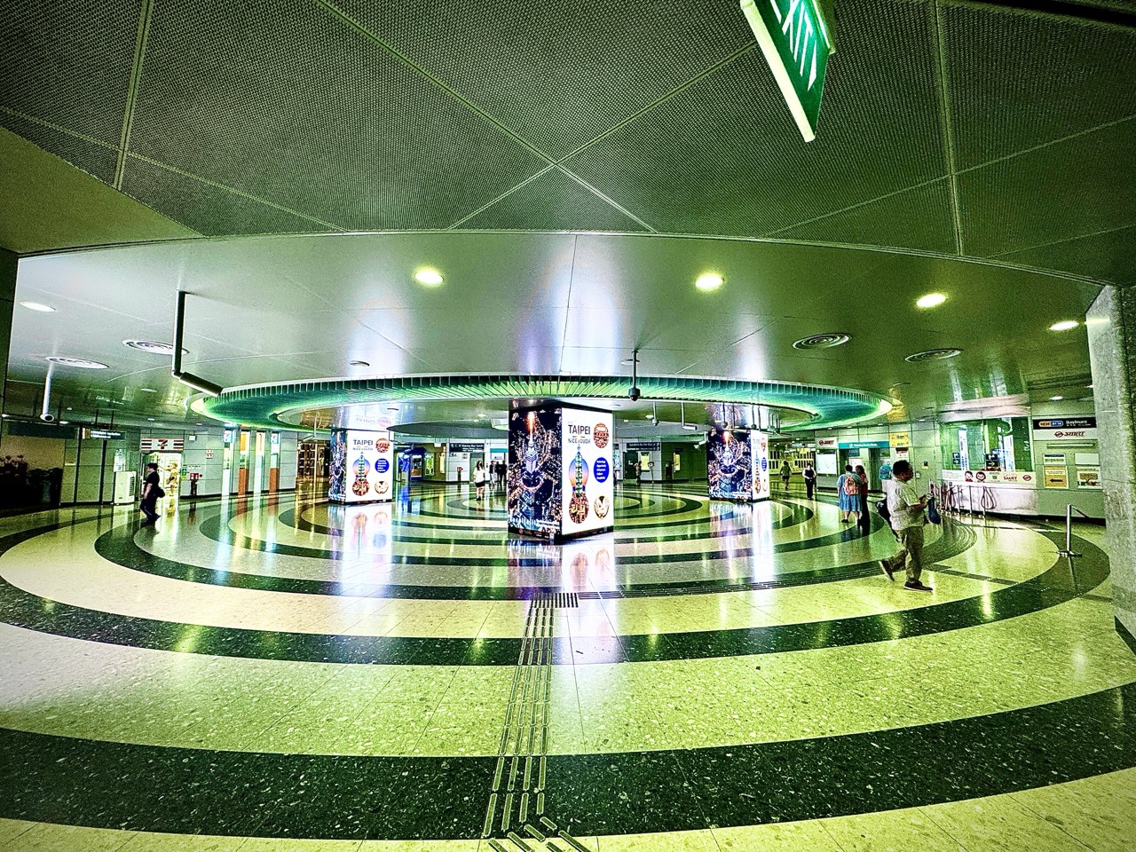
The gold standard of Navigation is knowing where you are, understanding where you need to go and following a suitable route with enough reliable information to recognise when the plan needs review. Maps, coordinates, positioning, route choice and wayfinding work together. A precise-looking dot or a confident instruction is useful only when it answers the traveller’s actual question.
This root guide connects navigation with cartography, geospatial and surveying engineering, satellite systems, accessible maps, signage, orientation and mobility, outdoor recreation and transport across the eduKateSG ecosystem. It helps students understand spatial reasoning and helps readers distinguish a location, a route and an assurance that a journey is usable.
The worked examples are fictional educational cases. This page explains concepts and evidence; it is not an operational guide for a particular voyage, flight or outdoor expedition. Those activities require their appropriate current information, competence and procedures. The common learning task is to connect a representation of a place with the real conditions under which someone moves through it.
Find the part you need
Begin with the uncertainty: your position, the map’s meaning, the route’s suitability or the information at a decision point. Follow the learning chapters or move into the specialist library.
Chapter index
Understand the spatial task · Chapters 1–5
Relate position to movement · Chapters 6–10
Design usable guidance · Chapters 11–15
Work through examples · Chapters 16–19
Choose the next route · Chapters 20–23
CHAPTER 1 OF 23 · Understand the spatial task
1. Define the journey before selecting the tool
A navigation task has an origin, a destination, a mode of movement and relevant constraints. A person looking for a classroom needs different information from a surveyor identifying a reference point or a vessel planning a passage. The tool should fit the task.
Make the destination specific. A building, an entrance, a reception desk and a room inside the building are different spatial targets. A map may correctly identify one while leaving the next part of the journey unresolved.
Describe the traveller’s needs without assuming that one route suits everyone. Walking, wheeled mobility, public transport and specialist operations involve different conditions. The purpose determines which distances, connections and access details matter.
Begin with a plain sentence: ‘This person needs to reach this place from this starting point under these conditions.’ That sentence gives a map, instruction or route estimate a clear job. It also makes missing information easier to recognise before someone relies on an unsuitable answer.
CHAPTER 2 OF 23 · Understand the spatial task
2. Separate location, orientation and route choice
Location concerns where something is. Orientation concerns how a person or representation relates to surrounding directions and features. Route choice concerns how to move between places. These are connected questions, but success at one does not establish success at all three.
A person may know their location but face the wrong direction when interpreting a turn. Another may recognise a landmark without knowing which entrance reaches the intended room. A navigation system needs enough information for the next actual decision.
Ask which uncertainty is present before offering more detail. A clearer location marker may not solve an unclear entrance instruction. A longer route description may not help if the traveller has not established the correct starting point.
For learning, use a small familiar setting. Identify a position, describe its orientation and compare two possible routes. Then change one element. This reveals how spatial decisions depend on relationships rather than on memorising a sequence of turns detached from their starting conditions.
CHAPTER 3 OF 23 · Understand the spatial task
3. A map is a purposeful representation
A map selects and organises spatial information. Its symbols, labels, scale and omissions reflect a purpose. A simplified transit diagram, a building plan, a historical map and a specialist chart can all be useful without representing the same details in the same way.
Read the title, legend, source and date before interpreting the picture. Ask which features are intended to be accurate in position or proportion and which are simplified for clarity. A line that explains connectivity may not be suitable for measuring distance.
High visual resolution does not by itself establish source accuracy. A sharply drawn feature can still be outdated, mislabelled or positioned using unsuitable information. Attractive design should help communicate the evidence rather than replace it.
The Cartographers guide develops this professional responsibility. For a reader, the useful habit is to ask what the map was made to support and whether that purpose matches the decision now being made.
CHAPTER 4 OF 23 · Understand the spatial task
4. Coordinates need a reference and an interpretation
Coordinates locate a point within a defined reference system. The numbers need an understood order, units and spatial reference. A pair of values without that context can be ambiguous even when it contains many decimal places.
Latitude and longitude are not the same as local grid coordinates. Different coordinate systems and reference frameworks require appropriate handling. A software import that accepts two columns has not necessarily interpreted them correctly.
Keep coordinate information connected to its source. Record the reference system and relevant metadata rather than relying on a filename or a colleague’s memory. When combining datasets, check that their spatial references are understood before comparing positions.
The Geospatial Engineering and Surveying Engineering guides provide deeper technical routes. A public navigation map and an authoritative survey serve different purposes. A convenient coordinate readout should not be treated as evidence for a property-boundary or engineering decision beyond its scope.
CHAPTER 5 OF 23 · Understand the spatial task
5. Scale connects representation with distance
A representative fraction such as 1:25,000 means that one unit on the map represents 25,000 of the same units on the ground, subject to the map’s projection and intended use. Units must be consistent when converting a measured distance.
A graphic scale bar can remain useful when an entire map and its scale bar are resized together. A printed representative fraction can become misleading if the image is resized while the stated ratio remains unchanged.
Distance also needs a definition. A straight-line measurement between points is not automatically the length of the usable route. Paths may turn, cross barriers or require access through a particular connection.
For a classroom exercise, first calculate a simple map distance, then trace the actual represented route and compare the two. The point is to connect arithmetic with the meaning of the measurement. A correct conversion cannot repair measuring the wrong feature or using a map that was not intended for that level of detail.
CHAPTER 6 OF 23 · Relate position to movement
6. Direction needs a stated reference
North can refer to different references in spatial work, including true, magnetic and grid north. They should not be treated as interchangeable without understanding the context. A direction has meaning relative to its reference.
A map displayed on a phone may rotate, while a printed map has a fixed orientation on the page. A person facing a different direction from the map can misinterpret a relative instruction such as ‘turn left’. Establish the relevant orientation before interpreting the next movement.
Use landmarks and direction language appropriate to the task. A school visitor may benefit from a named corridor and a visible sign, while a specialist navigation operation requires its own formal methods and instruments.
Learning the distinction does not require an expedition. Rotate a simple classroom plan and ask students which relationships remain unchanged and which screen-relative descriptions change. The exercise shows why a direction should be connected to the place and reference rather than inferred from the top edge of an image.
CHAPTER 7 OF 23 · Relate position to movement
7. Position estimates have conditions and uncertainty
A positioning device estimates location using available information. The quality of the estimate depends on the system, receiver and conditions. The display may appear precise even when the underlying position is uncertain.
The official GPS accuracy overview explains that receiver performance is affected by factors including satellite geometry, signal blockage, atmospheric conditions and receiver design. It also identifies reflected signals, or multipath, as a source of difficulty near structures. A single universal accuracy promise would hide those conditions.
Distinguish a positioning problem from a map problem. A receiver estimate, the base map, the destination record and the routing software contribute different information. An incorrect place label is not necessarily corrected by improving satellite reception.
Ask what the position is being used to decide. Choosing between nearby entrances may require information that a general location marker cannot provide. The sensible response is to clarify the relevant uncertainty through suitable sources, rather than assume that more displayed digits establish the needed confidence.
CHAPTER 8 OF 23 · Relate position to movement
8. A usable route needs more than connected lines
A route is a sequence of usable connections under the traveller’s conditions. A line between two places may show a modelled path without establishing that every segment is currently open, permitted or suitable for the intended mode.
Look at the transitions. Crossing a road, changing level, transferring between services or entering a building can control the journey. The difficult part may be the short connection between otherwise well-described sections.
The Networks root provides a related way of reasoning about nodes, links, direction and dependencies. Navigation adds the traveller’s position, the spatial environment and the conditions of movement.
To evaluate a route explanation, trace the whole task rather than checking a convenient middle section. Can the person start at the actual origin, identify each relevant decision and reach the actual destination? A missing final connection can matter as much as an error in the longest part of the route.
CHAPTER 9 OF 23 · Relate position to movement
9. The shortest route may not fit the traveller
Shortest can mean least distance, least time or another chosen cost. Those measures are different. A route optimised for one may involve a transfer, stairway, surface or access condition that makes it unsuitable for a particular person.
State the criteria before comparing alternatives. A visitor may need a step-free route, a particular entrance or a path that remains available during the intended visit. A delivery operation may face different constraints. These are part of the problem rather than optional details added after optimisation.
Do not infer accessibility from a short line or a generally accessible building. The route between places needs its own information. Local features and temporary changes can affect the result.
A useful explanation names the relevant trade-off: this route is shorter in distance, while another meets the traveller’s stated access requirement. It avoids declaring a universal winner. Navigation quality lies in a route that fits the actual journey, with its basis and limits made understandable.
CHAPTER 10 OF 23 · Relate position to movement
10. Travel-time estimates are conditional
A travel-time estimate depends on assumptions about movement, waiting, transfers, access and current conditions. Distance is only one input. The same route can take different times for different people or at different moments.
Describe the estimate appropriately. A modelled walking time is different from an observed time for a particular journey. Neither should be presented as a guarantee for every traveller. The source and update context help readers interpret the number.
Separate fixed and variable parts where that helps. Walking to an entrance, waiting for a service and finding a room are different stages. An estimate covering only the transport segment may leave important parts of the real task uncounted.
Use uncertainty to improve planning information rather than bury the reader in vague cautions. Say which stage is estimated or unresolved and point to the appropriate current source. A clear conditional estimate is more useful than a precise-looking total whose assumptions remain hidden.
CHAPTER 11 OF 23 · Design usable guidance
11. Wayfinding supports the next decision point
Wayfinding is the process of understanding a place and choosing how to move through it. Signs, landmarks, layout, maps and staff instructions can work together. Their effectiveness depends on what information a person needs at the moment of choice.
Place guidance where it can influence the decision. A sign after a turning may confirm an error rather than prevent it. A label meaningful only to regular staff may be unclear to a first-time visitor.
Keep names consistent across the appointment message, map, doorway and local directions. If one source says ‘North Reception’ and another says ‘Block B Welcome Desk’, visitors need a clear connection between those names.
The School Campus Wayfinding guide develops this in an educational setting. The Signage Companies guide follows production and installation responsibilities. The outcome to check is whether the intended person can make the next decision correctly.
CHAPTER 12 OF 23 · Design usable guidance
12. Accessible guidance provides equivalent essential information
A map can be visually attractive while remaining difficult for someone to use. Small labels, colour-only distinctions, inaccessible controls or missing text directions can prevent essential information from reaching the traveller.
The W3C Web Accessibility Initiative’s complex-images guidance discusses maps among images whose essential information can require fuller text alternatives. The relevant task is to communicate the information needed, not simply announce that a map exists.
Consider how different people obtain directions and identify decision points. Clear written information, appropriate tactile or other formats and usable interactions may support different needs. These choices should be developed with relevant users and expertise rather than assumed from a generic label.
The specialist routes on Accessible Interactive Maps, Accessible Signage and Orientation and Mobility Training address distinct responsibilities. Access quality should be judged through usable information and the person’s actual task.
CHAPTER 13 OF 23 · Design usable guidance
13. Outdoor navigation connects the plan with the site
Outdoor movement adds terrain, route condition, weather, daylight and site rules to the spatial task. A line on a general map does not describe all those factors. The appropriate level of preparation depends on the activity and the participants.
A beginner learning spatial reasoning can use a defined, appropriate setting with suitable supervision. The lesson can focus on matching landmarks, reading a simple plan and recognising decision points. More demanding activities need their own competence and current authoritative information.
Keep observation connected to the route. A landmark may change appearance with viewpoint or season. A familiar path may have a temporary closure. Record which information is current rather than assuming an earlier successful visit proves present conditions.
The Hiking, Walking and Nature guides offer related reading. Navigation contributes the relationship between position, route and changing conditions; respectful participation also considers the people and living systems sharing the place.
CHAPTER 14 OF 23 · Design usable guidance
14. Marine navigation uses a specialised information system
A nautical chart is designed for marine navigation and includes information different from a general road map. Its purpose, symbols, references and update process need to be understood within the professional or recreational activity using it.
NOAA’s nautical cartography overview describes the specialised work of designing, compiling, updating and distributing nautical charts. That source illustrates why a navigation product should be judged against its intended operating use.
This root article does not turn chart-reading vocabulary into a passage plan. Actual marine navigation depends on appropriate current charts and publications, vessel conditions, environmental information and the applicable operational responsibilities.
The Marine Engineering and Marine Surveying guides provide neighbouring specialist routes. They concern systems and condition evidence rather than replacing the navigator’s work. The useful connection is that a dependable journey relies on both appropriate information and a suitably managed vessel.
CHAPTER 15 OF 23 · Design usable guidance
15. Navigation technology depends on information and handovers
A navigation service can combine positioning, mapping, destination data, routing and interface design. Each part has a separate responsibility. A correct coordinate can be paired with the wrong place name; a current map can be paired with an unsuitable route assumption.
The Satellite Engineering guide provides a route into the systems behind some positioning capabilities. The wider service still depends on receivers, data and the way information reaches the user.
In Singapore, SLA’s OneMap information page provides an official route to the national map platform. It is useful to distinguish an authoritative source from a copied screenshot whose date and alterations are unknown.
When a navigation result is wrong, locate the first mismatch. Was the starting position uncertain, the destination misidentified, the route data unsuitable or the instruction misunderstood? A precise diagnosis makes correction more useful than treating every error as a failure of the same technology.
CHAPTER 16 OF 23 · Work through examples
16. Worked case: resizing changes the printed scale
A fictional classroom map is drawn at 1:25,000. A five-centimetre line on that original map represents 125,000 centimetres on the ground, or 1,250 metres. A teacher then enlarges the whole map to twice its original linear size while leaving the printed ratio unchanged.
On the enlarged map, the same ground segment now measures ten centimetres. Five centimetres on the enlarged version corresponds to half that ground distance, or 625 metres. Using the unchanged 1:25,000 label would therefore produce the wrong result.
The arithmetic assumes uniform enlargement and the same represented segment. It is a teaching exercise about scale, not a claim about a particular mapping product. A graphic scale bar resized together with the map would enlarge consistently and provide a useful check.
The repair is to identify which version is being measured and use its correct scale information. The learning target is the relationship between the representation and the measurement. A correct multiplication can still answer the wrong question when the map’s version or scale has been misunderstood.
CHAPTER 17 OF 23 · Work through examples
17. Worked case: the floor is missing from the directions
A fictional visitor reaches the correct building and stands beside the room number printed on an appointment message. The room is on a different level, but the message gives no floor and the building repeats the same numbering pattern on several levels.
The street location and building identification are correct. The navigation task nevertheless remains unresolved because the destination requires an additional dimension. A two-dimensional map has answered only part of the spatial question.
Review the complete visitor journey. Include the building, level, room identifier and any relevant arrival instructions using consistent names. Check that the information agrees with current local signs and the responsible host’s instructions.
The revised explanation should be tested with someone unfamiliar with the setting. Staff who already know the building may silently supply missing context. The lesson is that a direction is complete relative to a traveller’s task, not merely because it contains an accurate address and a room number.
CHAPTER 18 OF 23 · Work through examples
18. Worked case: the destination record is wrong while positioning works
A fictional visitor’s device correctly estimates their position near a group of buildings. The selected destination, however, is an old listing for an organisation that has moved. The route leads accurately to the obsolete location.
The positioning estimate, map geometry and route calculation may each be working as designed. The error sits in the destination’s descriptive record. Improving satellite reception would not by itself update that record.
Identify the responsible source for the destination information and compare it with current authoritative details from the organisation or relevant provider. Correct the record through the appropriate process and preserve enough information to understand what changed.
This case separates technical accuracy from task accuracy. A system can produce a precise route to a place that no longer answers the user’s need. Navigation quality therefore includes the identity and currency of the destination, alongside the accuracy of coordinates and the logic of the path.
CHAPTER 19 OF 23 · Work through examples
19. Worked case: a closure breaks one essential connection
A fictional campus route uses a short covered passage between two blocks. A temporary closure removes that connection. The existing map still shows the passage, and directions continue to rely on it.
The rest of the route may remain accurate. The error is concentrated in one segment but affects completion of the whole journey. A percentage of correctly mapped distance would not adequately describe the visitor’s problem.
Update the relevant information through the responsible campus process. Describe an appropriate alternative only after its suitability has been established for the intended users. Ensure that the message, map and signs agree so visitors do not encounter conflicting instructions.
The learning question is about dependency. Which part of the journey relies on the closed connection, and who maintains that information? A useful navigation system has a way to respond when conditions change. It should not require every visitor to discover the same broken link independently.
Start with the intended traveller and task. Are the actual origin, destination, mode and important access conditions known? If the answer is incomplete, more detailed directions may only make the uncertainty harder to see.
Check the representation. Does the map have an appropriate purpose, source, date, scale and spatial reference? Is the destination a building, entrance, level or room? Are the labels consistent with the information the traveller will encounter?
Then trace the route. Which connections and decision points control completion? What current information supports their availability and suitability? Which part is measured, estimated or unresolved? A route should not inherit certainty from the visual neatness of its line.
Finally, choose the right correction. It may involve a location record, a missing level, clearer signage, an accessible alternative or specialist spatial advice. This is an educational diagnostic, not an operational clearance. It helps identify the question that must be answered before the directions can be relied on for their stated purpose.
CHAPTER 21 OF 23 · Choose the next route
21. The Navigation specialist reading library
Maps, coordinates and spatial evidence
Begin with Cartographers for the professional responsibility of communicating places accurately. Geospatial Engineering develops coordinate systems and spatial evidence. Surveying Engineering follows measurements, levels and authoritative technical records.
Geography provides the broader subject setting. Teaching Historical Cartography develops scale and source criticism in historical maps. A historical document can be valuable evidence of how a place was represented without serving as current directions.
Satellite Engineering offers a route into the infrastructure behind some positioning systems. Networks connects paths, direction and dependencies. These guides support navigation from different angles and should be read for their particular responsibilities.
Finding places and designing accessible guidance
School Campus Wayfinding connects room names, levels and signs with a visitor’s journey. Signage Companies follows the production and installation service, while Accessible Signage Design focuses on usable information.
Accessible Interactive Maps addresses digital location information and equivalent directions. Tactile Graphics Production develops another form of spatial communication. Orientation and Mobility Training follows learner-centred skill development.
These are connected fields rather than interchangeable services. A better visual map cannot automatically replace mobility training, and a tactile graphic still needs an appropriate purpose and verified information. Begin with the person’s task and select the relevant support.
Outdoor movement and transport systems
Walking and Hiking connect route information with practical participation. Nature adds attentive observation and care for the setting. Transportation widens the route into movement systems and service.
Marine Engineering and Marine Surveying address vessel systems and condition. They are related to marine journeys while remaining distinct from navigation practice and operational passage planning.
Architecture and Infrastructure connect wayfinding with the design and operation of places. Read them when the source of confusion is a physical layout or a missing connection that information design alone cannot resolve.
CHAPTER 22 OF 23 · Choose the next route
22. Questions about the gold standard of Navigation
Does an accurate position guarantee good directions?
No. The destination record, route data, access conditions and instruction design also matter. A correct current position can be paired with the wrong destination or an unsuitable path.
Why does a map sometimes disagree with the place?
The map may represent a different date, purpose, scale or reference. It may also contain a source or labelling error. Identify the particular mismatch before assuming that every part of the navigation system is wrong.
Is the shortest path always the fastest?
No. Movement conditions, crossings, transfers, waiting and access can affect time. Distance and time are different criteria. A route should be evaluated against the intended mode and the traveller’s actual requirements.
Can an enlarged map keep the same printed ratio?
A representative fraction describes a particular linear scale. Resizing the image changes that relationship unless the stated scale is adjusted. A graphic scale bar resized consistently with the map can help preserve a usable distance reference.
What makes directions accessible?
Essential information must be available in forms the intended person can use, with appropriate detail at decision points. Accessibility also depends on the route’s actual conditions. A readable map does not by itself establish that every path is suitable.
Which parts of this guide are externally sourced?
GPS.gov supports the positioning-conditions discussion; NOAA supports the description of nautical cartography; W3C WAI supports the complex-image accessibility discussion; and SLA provides the official OneMap route. The numerical and campus cases are original teaching examples. Specialist eduKate links offer onward reading, not operational authorisation.
CHAPTER 23 OF 23 · Choose the next route
23. Connect spatial knowledge with the next decision
Choose a small familiar journey and identify one uncertainty. It might be the starting orientation, a missing floor, the meaning of a symbol or the condition of a connecting route. Explain which information would resolve it and where that information should come from.
Check the explanation with someone who does not already know the place. Their questions can reveal assumptions that a regular user supplies automatically. Improve the instruction at the point where it changes the next decision.
This is the diagnostic learning principle illustrated in the Secondary 1 Mathematics Clementi guide: make the relationship visible, locate the unstable point and check independent use. Navigation applies that habit to position, representation and movement.
The wider purpose is learning that transfers into life. Return to the Navigation specialist reading library as the question becomes more precise. Good spatial understanding helps a person explain where they are, why a route fits and what evidence would make them reconsider it.
Contents · Previous chapter · Learning that transfers into life