
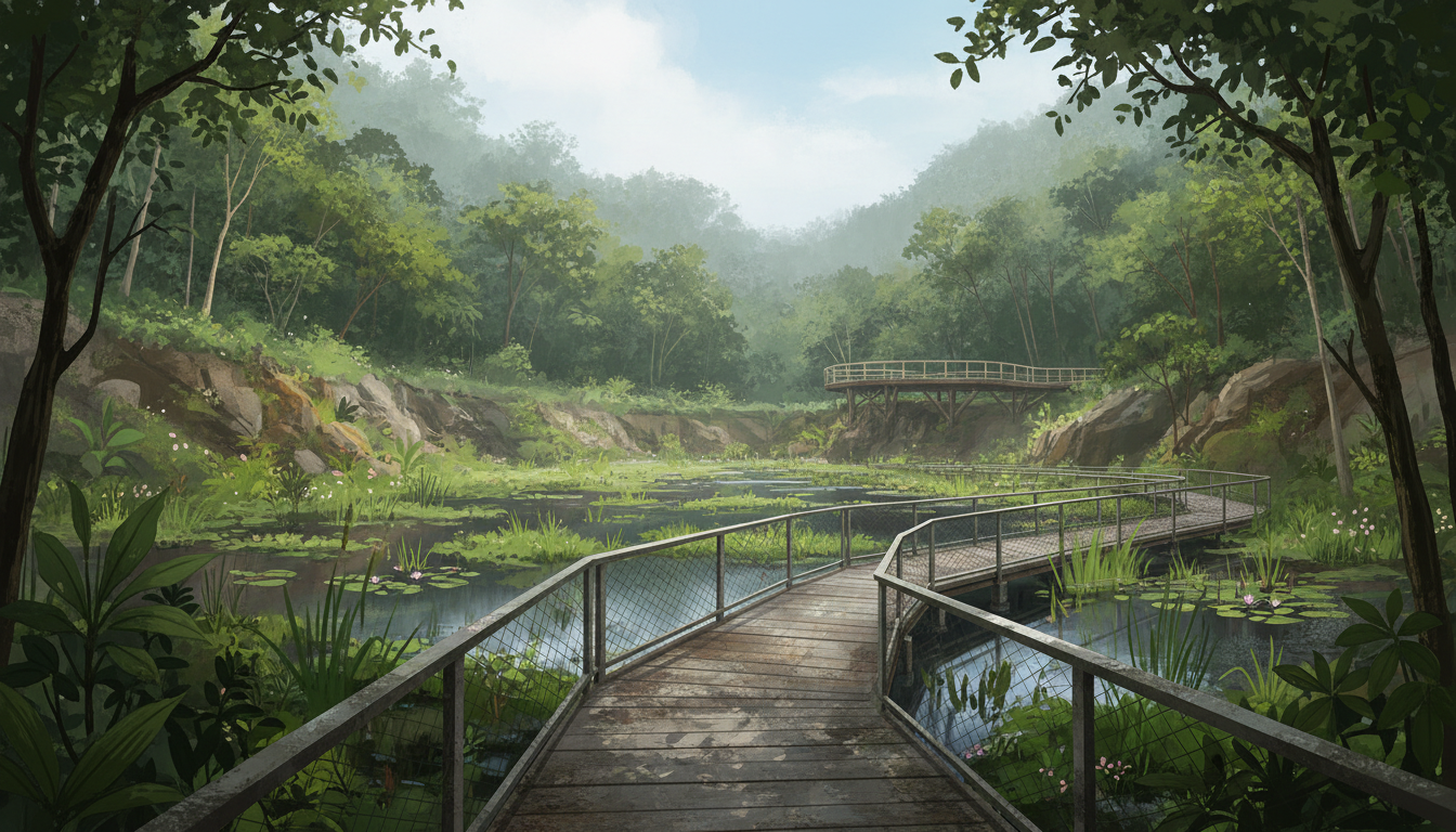
Is Rifle Range Nature Park worth visiting, and how do you get to Colugo Deck? Yes—this is one of Bukit Timah’s most useful free nature outings because it combines an accessible quarry wetland boardwalk with a separate, steeper walk to a high viewing deck. Rifle Range Nature Park, 126 Rifle Range Road, is open 7am to 7pm daily. Beauty World MRT is the nearest station listed by NParks; enter via one of six official access points. The Gliders Boardwalk is 411m, while the Colugo Trail is 582m and climbs to the Colugo Deck, 31m above ground. Both are measured trail sections, not complete return-trip distances from the MRT.
For Rifle Range Nature Park directions, Colugo Deck trail difficulty, free Bukit Timah quarry views, Quarry Wetland, Waterhen Hide, Gliders Boardwalk, Rambai Boardwalk, family nature trails, wheelchair-friendly walks near Beauty World MRT and Malayan colugo sightings, the important distinction is that this park has several different kinds of route. The 700m barrier-free link from Visitor Pavilion to Quarry Wetland offers a more inclusive outing; the steep Colugo Trail is a different challenge. Young children aged five to 12 may enjoy the purpose-built Forest Exploration Trail, but not every section suits a stroller or wheelchair.
Our easiest visit: start with the Visitor Pavilion, follow the accessible route towards the wetland and observe birds from the hide. Add Colugo Deck only if everyone in your group is comfortable with a steep climb. Pets, fishing and cycling are prohibited in this protected nature park. Book a free NParks guided walk ahead if you prefer an educator-led introduction; the published guided activity has limited places and explicitly does not accept walk-ins.
Quick answer: choose a route suited to your group
| Park feature | Official distance or fact | Who should consider it |
| Quarry Wetland barrier-free route | 700m from Visitor Pavilion to wetland | Wheelchair users and gentler walkers; ask about individual access |
| Gliders Boardwalk | 411m | Accessible-style forest and quarry viewing |
| Rambai Boardwalk | 535m | Arriving from the Beauty World side |
| Forest Exploration Trail | 113m; designed for ages 5–12 | Children who enjoy balance and nature play |
| Colugo Trail | 582m; steep climb | Visitors seeking the 31m-high Colugo Deck |
| Banyan Trail | 647m | Rustic trail and freshwater stream observation |
| Gaharu Trail | 826m | Longer forest walking from Jalan Kampong Chantek side |
| Park hours | 7am–7pm | Arrive and exit within published opening hours |
Contents: from the wetland to the viewing deck
- Park location and entrances
- What makes the former quarry special
- The gentler accessible route
- Rambai and Gliders Boardwalk
- Waterhen Hide and birdlife
- Colugo Trail and lookout safety
- The children’s exploration trail
- Banyan and Gaharu routes
- Free guided walks and conservation
- Rain, wildlife, group permits, transport and FAQs
1. Where is the park?
NParks gives the park address as 126 Rifle Range Road and describes it as a 66-hectare nature park forming part of Singapore’s Central Nature Park Network. Its main landscape developed around the former Sin Seng Quarry.
The park is in the broader Beauty World–Upper Bukit Timah area, but it is not part of a shopping mall. Plan the exact entrance from your desired route rather than typing only ‘Bukit Timah quarry’ into a map and arriving at a completely different quarry.
2. Six entrances mean six different starting experiences
The official park page lists entrance approaches from Rifle Range Road, Upper Bukit Timah Road, Hindhede Drive, Jalan Kampong Chantek and the Rail Corridor, distributed across six access points. The route from your chosen entrance determines which activity is nearest.
Visitors seeking a gentle wetland walk may prefer the pavilion approach. People coming from Beauty World can investigate Rambai Boardwalk. Serious walkers using the Gaharu and Banyan trails should first consult the park map because a shortcut through a forest reserve is not automatically a permitted connection.
3. Why Beauty World MRT is a good transport reference
NParks identifies Beauty World MRT as the nearby station. That is useful for parents who want an MRT-accessible outing, but the station is not beside Colugo Deck. Walking from the MRT, reaching the correct entrance and completing a trail are separate pieces of the outing.
Download the official map and allow extra time for road crossings, uneven surfaces and rest. Do not treat a trail’s published 582m length as a guaranteed 582m walk from the station exit.
4. Parking is available at the Senapang side
The official park information lists 68 regular car lots and two accessible parking lots, plus 13 motorcycle lots. It also identifies 10 bicycle parking lots at Senapang Entrance along Rifle Range Road.
Parking capacity is not a guarantee of a vacant space during busy weekends. Importantly, parking a bicycle outside the park does not give permission to cycle inside the protected area.
5. A quarry landscape that became a wetland
The park occupies the former Sin Seng Quarry, once a modified working landscape. Habitat restoration has transformed parts of the quarry area into a freshwater wetland supporting plants and wildlife.
This is different from the dramatic open-water lakes found at some other Singapore quarry viewpoints. Instead of expecting a recreational swimming basin, look for the way water, vegetation and birdlife now occupy the reclaimed ground.
6. What is the Quarry Wetland?
NParks describes the Quarry Wetland as a freshwater ecosystem in the heart of Rifle Range Nature Park. Boardwalks and viewing points help visitors observe without entering fragile habitats.
A useful family question is: why is the wetland more than an attractive pond? Notice vegetation around water, birds at different heights and the possibility that small insects sustain other animals. Stay on official routes, particularly where muddy edges look inviting.
7. A barrier-free route is the park’s strongest inclusive feature
NParks specifies a 700m barrier-free route between the Visitor Pavilion and Quarry Wetland for wheelchair users. It is the most important planning detail for a group with mobility needs.
Do not extend the claim to the whole park. Dirt trails, the steep Colugo Trail and steps near certain features have different accessibility. Wheelchair users may need a shorter out-and-back rather than attempting to complete every named trail.
8. The Gliders Boardwalk is 411m
NParks lists the Gliders Boardwalk at 411m, connecting the visitor area towards the wetland and allowing views of wildlife crossing infrastructure. The elevated structure is designed to reduce disturbance to habitat while giving visitors an enjoyable perspective.
This is a good starting point for nature lovers who prefer a defined path. A short boardwalk can still feel adventurous when you observe the tree layers and changing light, without needing a steep hill climb.
9. Why the boardwalk has poles and rope connections
NParks explains that some poles and rope bridges serve as animal crossings for species such as long-tailed macaques and Malayan colugos. These structures help wildlife navigate a fragmented landscape.
Look at them as functional habitat infrastructure rather than playground equipment. Visitors should never climb or touch wildlife crossings, and the absence of an animal on a bridge does not make the structure unimportant.
10. The Rambai Boardwalk is a different way in
The 535m Rambai Boardwalk is described as a convenient entry point near Beauty World MRT, crossing a vegetated area and displaying information about the former quarry and gun-club history.
A family arriving by MRT might enjoy reading its signs before choosing whether to continue towards the wetland. Its 535m official distance refers to the boardwalk section, not the whole station-to-station itinerary.
11. Rambai is also a plant name
The boardwalk refers to the Rambai plant, which produces clustered fruits that provide food for local wildlife. This is a small but worthwhile example of how a walking route can carry a natural-history lesson in its name.
Ask children to notice whether the sign describes a tree, animal or historic use of the land. Do not pick fruit or assume any unfamiliar plant is safe to eat.
12. The Waterhen Hide is for quiet observation
NParks describes the Waterhen Hide as a nest-like viewing structure in the Quarry Wetland. It gives birdwatchers a place to pause and watch without standing at the water’s edge.
The best technique is simple: sit or stand quietly, let the scene settle and scan gently. Loud conversation, tapping on railings and attempts to attract birds with food defeat the purpose.
13. Which birds might you notice?
The official park overview mentions species such as the Yellow Bittern and Common Kingfisher, as well as migratory visitors. Wetlands can draw birds seeking food and shelter.
Specific sightings depend on time, weather and luck. A visit without a photograph of a kingfisher is not a failure; try noting flight patterns, calls or movement among vegetation instead.
14. Colugo Deck is the dramatic viewpoint
The Colugo Deck rises 31m above ground and overlooks the wetland and surrounding woodland. NParks says its form evokes the body shape of a Malayan colugo in flight.
This is the feature many visitors see in photographs, but the trail leading to it is explicitly classified as steep. Treat the viewpoint as a separate physical commitment, not an extension of the wheelchair-accessible wetland route.
15. The steep Colugo Trail is 582m
The 582m Colugo Trail provides access to the deck. Its distance may sound short, yet gradient, steps and humid weather can make a brief ascent feel demanding.
Bring water and suitable shoes, go at the pace of the least confident person, and turn back if the climb is too uncomfortable. An enjoyable visit does not require reaching the highest platform.
16. Keep the lookout safe for everyone
On Colugo Deck, leave space for people approaching and exiting, hold children close, and keep phones and loose objects secure. Do not lean beyond the guardrail or climb the edges to create a more dramatic picture.
The viewing area is for observing a protected landscape. A photograph is not worth putting your weight against a barrier in a way it was not designed to support.
17. What is a Malayan colugo?
The Malayan colugo is a gliding mammal with a skin membrane connecting much of its body. NParks describes flights that can span up to around 200m between trees. It is mainly nocturnal.
That means a daytime visit may offer a better view of the deck than of an active gliding colugo. Wildlife cannot be scheduled and should not be disturbed in the hope of producing an encounter.
18. Colugos do not truly fly like birds
A colugo glides using its membrane and gravity after launching from a height; it does not perform powered wingbeats like a bird. Its body shape is a useful subject for explaining adaptation.
Ask an older child why a broad membrane helps cover distance while losing altitude. You can explore the physics through conversation without imitating wildlife or throwing objects from the deck.
19. The Forest Exploration Trail is built for ages five to twelve
NParks lists a 113m Forest Exploration Trail developed for children aged five to 12, using logs, pebbles and boulders to encourage coordination, balance and a direct relationship with natural materials.
This is nature play, not an indoor soft-play facility. Supervise carefully, assess your child’s ability and use proper shoes. A four-year-old or an older child may have different needs; the age band helps you decide whether the setting is suitable.
20. Playing in nature still has limits
Children can learn to step carefully, balance and observe textures, but should not break branches, move rocks from protected areas or chase wildlife. The landscape is both a learning environment and living habitat.
If you need an activity with predictable padded flooring and air-conditioning, choose a purpose-built indoor children’s venue instead. Nature play involves weather, terrain and supervision.
21. Banyan Trail adds a freshwater stream
The 647m Banyan Trail passes one of Singapore’s few natural freshwater streams. Its rustic sections provide a different experience from the elevated boardwalks around the quarry wetland.
Stay on the marked trail and do not enter the stream to collect specimens or take photographs. Even a shallow-looking watercourse is part of a sensitive ecosystem and may have slippery banks.
22. Gaharu Trail is longer and more rustic
The 826m Gaharu Trail runs through forest from the Jalan Kampong Chantek-side access, parallel to the Banyan route. Dirt and stone surfaces make it better suited to walkers comfortable with natural terrain.
Do not plan the route by adding 826m to 647m and assuming that gives an official completed loop. The total depends on connectors, start point and return direction; the park map is the correct reference.
23. Choose the route according to the person coming
For a mixed-age family, the visitor area and wetland may be enough. For a keen walker, the Colugo Deck or longer wooded trails can provide a more energetic visit. A wheelchair user might focus on the 700m barrier-free route.
A good itinerary has one clear priority. Trying to check every trail name in the park in a single hot afternoon can make a beautiful environment feel rushed.
24. How to spot wildlife without creating a problem
Watch quietly, keep a respectful distance and use binoculars where appropriate. Never feed macaques, birds or other animals. Food can alter their behaviour and increase the chance of conflict with people.
If a macaque approaches, remain calm and keep belongings secured without provoking it. Follow NParks’ official guidance on wildlife encounters rather than approaching for a close-up selfie.
25. Why fig trees matter here
The park’s biodiversity notes highlight fig trees including Weeping Fig, Malayan Banyan and Common Yellow-Stem Fig. Such trees support birds and mammals through shelter and food availability.
A useful observation game is to notice fruit, leaf shape and creatures using different parts of a tree without trying to identify every individual species. Remain on paths even when a branch looks interesting.
26. Insects are part of the experience
NParks reports more than a hundred insect species, including butterflies, dragonflies and spiders. A wetland can offer fascinating moments with small animals that many walkers normally overlook.
Use an ordinary camera zoom instead of capturing and handling animals. A dragonfly’s flight and a butterfly’s resting posture can lead to questions about life cycles and habitats.
27. Free guided walks require registration
NParks advertises a free one-hour guided nature walk at Rifle Range Nature Park, requiring advance registration and explicitly disallowing walk-ins. Its online calendar listed a 21 November 2026, 9.30–10.30am session when checked on 22 October.
The date is a published event listing, not a promise that places remain available. Select the actual programme page and complete registration before travelling; future sessions may have different dates or arrangements.
28. Larger organised groups need a permit
NParks requires organisers of group activities involving more than 30 people to apply for a permit at least one month in advance. A class excursion, corporate walk or large interest-group meetup should not be treated as the same activity as a family outing.
Allow time for the permit process, staffing and a suitable route. Park rules exist partly to prevent cumulative disturbance to habitats that are sensitive to crowding.
29. No pets and no cycling inside the nature park
The official park page forbids pets, fishing, cycling and riding a motorised mobility device. Parking a bicycle in the provided racks and walking into the park are different from riding it on the boardwalk.
An otherwise convenient neighbourhood dog walk needs a different destination with appropriate pet rules. This park protects wildlife, so its access restrictions take precedence over general assumptions about public park paths.
30. Is the wetland a place to swim or paddle?
No. It is managed as a freshwater habitat for wildlife, not a recreational lake. Do not enter the water, fish, release pets or bring boats to the quarry wetland.
People may see a former quarry and imagine an open swimming hole. That interpretation ignores the conservation purpose and site rules. Enjoy the water from designated viewpoints.
31. Why the park closes at 7pm
The official opening time is 7am–7pm. These hours help protect the park and visitors after dark while nocturnal wildlife remains active.
Do not confuse a nearby Rail Corridor stretch that permits wider access with this protected park’s opening hours. Plan your final trail segment so you can exit comfortably before closing.
32. Thunderstorms change the plan
Singapore’s wet weather can make dirt trails and decking slippery, while lightning creates significant risk in exposed sections. Seek a substantial safe building during a thunderstorm and follow park closures or staff instructions.
An umbrella can help with light rain, but it does not make an open viewing deck lightning-safe. Turn around or reschedule if the conditions become unsafe.
33. A good family packing list
Bring water, suitable covered shoes, sun protection and a compact raincoat. A small bag helps keep rubbish contained until you find an appropriate disposal point. If the family enjoys wildlife, binoculars and a notebook can be more useful than a large quantity of snacks.
Keep food secured and do not feed animals. Before setting off, check the official park map and weather rather than relying solely on an older social-media route.
34. What to do if a trail is closed
Temporary works, fallen branches or unsafe conditions can affect parts of a nature park. Follow signs and official NParks notices rather than trying to bypass a barrier through the forest.
If Colugo Trail is unavailable, the quarry wetland route may still be a rewarding option if open. An alternative should never involve trespassing into a restricted area.
35. A simple half-day itinerary
Begin with the nearest appropriate entrance, spend a little time at the visitor area, walk towards the Quarry Wetland and pause at Waterhen Hide. If everyone has the energy and terrain confidence, choose the Colugo Trail and deck as a second segment.
Return by an official route using the current map, and enjoy a meal around Beauty World afterwards if desired. The food stop is outside the protected park; plan the journey and overall duration separately.
36. Why this park is different from Bukit Timah summit hiking
Bukit Timah Nature Reserve is well known for an uphill summit experience. Rifle Range Nature Park emphasises a restored quarry wetland, boardwalks, wildlife infrastructure and a separate forest lookout. The two destinations can complement each other but are not identical routes.
If your group wants a gentler experience, the wetland is often a better starting point than a steep summit hike. If it wants a view, Colugo Deck offers a distinctive objective without turning the day into a race.
Frequently asked questions about Rifle Range Nature Park
Is Rifle Range Nature Park free?
NParks lists walking and guided nature activity without a general admission fee. Special organised programmes may require advance registration even when free.
What time does the park open?
7am to 7pm daily, according to NParks. Check temporary advisories before travelling.
Where is Rifle Range Nature Park?
The official address is 126 Rifle Range Road, Singapore, with entrances also connected to other roads and the Rail Corridor.
Which MRT station is nearest?
Beauty World MRT is the station named by NParks. Choose the correct entrance and allow for walking beyond the MRT exit.
How many entrances are there?
NParks lists six official entrances distributed along Rifle Range Road, Upper Bukit Timah Road, Hindhede Drive, Jalan Kampong Chantek and the Rail Corridor.
How do I reach Colugo Deck?
Follow the official park map to Colugo Trail, a steep 582m section leading to the deck. It is not the barrier-free wetland walk.
How high is Colugo Deck?
NParks describes the viewing platform as rising 31m off the ground.
Is the Colugo Trail easy for a beginner?
The official trail description calls it steep. Choose it based on fitness, footwear and conditions, not just its relatively short length.
Is there a wheelchair-accessible route?
Yes. NParks identifies a 700m barrier-free route from Visitor Pavilion to Quarry Wetland. The whole park is not necessarily barrier-free.
How long is Gliders Boardwalk?
411m, according to NParks’ detailed trail guide.
How long is Rambai Boardwalk?
535m. It is one of the convenient approach routes from the Beauty World side.
Is the children’s Forest Exploration Trail suitable for toddlers?
NParks designs its 113m nature-play section for ages five to twelve. Ask whether a younger child’s abilities and supervision make it appropriate rather than assuming so.
What is Waterhen Hide?
A nest-like bird-observation structure at the quarry wetland, designed to allow visitors to watch without entering habitat.
Can you swim at the quarry?
No. The quarry wetland is protected habitat, not a bathing facility.
Are dogs allowed?
No. NParks explicitly lists pets as prohibited at Rifle Range Nature Park.
Can you cycle on the boardwalk?
No. Cycling is prohibited inside the nature park; bicycle parking is provided at Senapang Entrance.
Can I bring a fishing rod?
No. Fishing is prohibited under the park’s current rules.
Is the park lit for a night walk?
The park’s official visiting hours end at 7pm. Do not use it as an after-dark hiking route.
Where can I park?
The official carpark has 68 regular car lots and two accessible lots, as well as motorcycle and bicycle parking.
Can I see a Malayan colugo in daytime?
Possible sightings cannot be guaranteed; colugos are mainly nocturnal. The deck’s name and design are not promises of a live encounter.
What wildlife can I look for?
NParks names birds such as kingfishers and bitterns, as well as insects, macaques and colugos. Observe without feeding or touching.
Are there guided walks?
Yes. NParks advertises free one-hour guided walks with required registration; no walk-ins.
Is a 21 November 2026 walk scheduled?
The NParks calendar displayed a 9.30–10.30am guided walk for 21 November when checked on 22 October. Confirm a place through the live registration page.
Can a school bring 40 children without permission?
No. NParks says group activities involving more than 30 persons require a permit application at least one month ahead.
Is the park the same as Hindhede Quarry?
No. Rifle Range Nature Park includes the former Sin Seng Quarry wetland; Hindhede and Singapore Quarry are different nearby destinations.
Can I visit when it rains?
Light rain may alter comfort, but slippery trails and lightning can make walking unsafe. Obey official advisories and seek proper shelter during thunderstorms.
How should I plan an outing for grandparents?
Consider the 700m barrier-free pavilion-to-wetland route if appropriate, avoid assuming Colugo Trail is accessible, and build in rest stops.
Can I combine the park with Beauty World lunch?
Yes, by exiting the park and travelling to a suitable food venue. The restaurant or hawker centre has its own hours, separate from the nature park.
What should I do if I find a monkey close to the path?
Keep a respectful distance, do not feed it, secure food and follow NParks’ wildlife-encounter advice.
Where can I download an accurate map?
Use NParks’ current Rifle Range Nature Park page and hiking-trails page for the official map and trail distances.
Explore related Bukit Timah activities
- Compare Bukit Timah hiking trails, easy walks and quarries
- Bukit Timah viewpoints and photography spots
- Wildlife watching, birds and macaque etiquette
- Family activities and nature play
- Free guided walks and nature volunteering
- Rainy-day alternatives around Beauty World
Official visitor information and verification
Visitor details checked on 22 October 2026. NParks’ trail lengths measure individual features; they do not include the MRT approach or the complete return trip. Check the current map, closures and guided-walk registration before travelling.
- NParks — Rifle Range Nature Park address, hours, access, barrier-free route and wildlife
- NParks — Gliders, Rambai, Colugo, Forest Exploration, Banyan and Gaharu trail details
- NParks — nature park etiquette and conservation rules
- NParks — responsible wildlife encounters
- NParks — separate Bukit Timah Nature Reserve visitor information
- Meteorological Service Singapore — weather radar and lightning updates