
Looking for the best photo spots in Bukit Timah, Singapore? Start with the landscapes that make this part of the island distinctive: Hindhede Quarry’s rock walls and water, Rifle Range Nature Park’s Quarry Wetland and Colugo Deck, Singapore Quarry near Hillview, and the restored Bukit Timah Railway Station. For different pictures, walk through the leafy Wallace Trail, find details on the conserved railway bridges or photograph the older shopfronts around Beauty World.
This guide is for visitors searching for things to do in Bukit Timah, scenic walks, photography locations, Instagram-worthy spots and quarry viewpoints. It tells you which MRT station to use, whether an outing is gentle or physically demanding, what a phone camera can capture, and why one nice view is often better than rushing through every green space. You will also find the important 2026 photography rules, including restrictions on drones and the different requirements for commercial shoots.
The quickest first visit: go to Beauty World MRT and choose either Hindhede Nature Park for a quarry viewpoint or Rifle Range Nature Park for boardwalks, a wetland and an optional steeper lookout. For railway photographs, use King Albert Park MRT. For Singapore Quarry and Wallace Trail, make a separate Hillview outing. The places are not all beside one another, even though the name Bukit Timah appears throughout the district.
Quick answer: ten Bukit Timah scenic and photo locations
- Hindhede Quarry lookout: dramatic former granite quarry cliffs above still water; near Beauty World MRT and suitable for a relatively manageable nature outing.
- Rifle Range Quarry Wetland: water, vegetation, boardwalk lines and wildlife from designated public routes; near Beauty World MRT.
- Colugo Deck: an elevated viewpoint over the Rifle Range wetland, reached by a steep trail rather than a level boardwalk.
- Bukit Timah Nature Reserve: rainforest layers, roots, textures and a meaningful summit journey; for hikers prepared for slopes and stairs.
- Bukit Timah Railway Station: a restored 1932 station, conserved staff quarters, signage, railway objects and heritage gardens; use King Albert Park MRT.
- Bukit Timah Truss Bridges: historic railway engineering, repeating steel geometry and restored walking surfaces along the Rail Corridor.
- Upper Bukit Timah’s 9 Mile Platform: a useful railway-themed stop near the northern truss bridge, approached from the Hillview side.
- Singapore Quarry: a lake landscape inside Dairy Farm Nature Park, open during its own shorter visitor hours.
- Wallace Trail and Dairy Farm Quarry: forest compositions and rock cliffs at a former quarry that has been filled with earth rather than a lake.
- Beauty World’s older streets and the Former Bukit Timah Fire Station: shopfronts, civic architecture and everyday neighbourhood photography rather than rainforest scenery.
These are different subjects, not one uninterrupted walking route. Some are suitable for a short visit with a phone; others demand proper hiking shoes and a realistic return plan. None is a reason to cross a safety barrier, approach quarry water or disturb an animal for a better picture.
Contents: choose a route, then learn how to capture it
- Pick the right location for the picture you want
- Hindhede Quarry: the classic rock-and-water composition
- Rifle Range: wetland, Waterhen Hide and Colugo Deck
- Bukit Timah Nature Reserve: photograph a forest, not an imaginary skyline
- Bukit Timah Railway Station: architecture and small heritage details
- Truss bridges, 9 Mile Platform and the Hillview side
- Singapore Quarry, Dairy Farm Quarry and Wallace Trail
- Beauty World shopfronts, local streets and conserved buildings
- The Botanic Gardens option on the Bukit Timah side
- Three realistic routes you can follow by MRT
- Best daylight, weather and camera settings
- Photography with a phone, camera or binoculars
- Photograph wildlife without disturbing it
- Commercial shoots, permits and the drone rules
- Accessibility, children and sensible trail safety
- Frequently asked questions
- Continue exploring and official reference links
Choose the photo you want before choosing the park
Bukit Timah is unusually good for an urban photography day because a relatively small region contains rainforest, former industrial landscapes, railway engineering and ordinary street life. The mistake is imagining that they can all be photographed in one short circuit. The most useful first question is simpler: what should the photograph tell someone?
If you want large shapes, choose a quarry viewpoint. You will have rock walls, water, trees and reflections to arrange inside the frame. If you want repeating lines, a railway bridge, track or boardwalk gives you a clear structure. If you want plants and details, a shaded trail provides leaves, roots, bark and filtered daylight. If you prefer people and neighbourhood life, the Beauty World shop rows and MRT approaches tell a different story.
The next question is how much you want to walk. Hindhede is a more manageable short outing than a hill-summit hike. Rifle Range offers barrier-free wetland access on one route, but its Colugo Trail is steep. The railway-station community node is a relatively compact heritage visit, whereas continuing far along the Rail Corridor creates a longer linear journey. Dairy Farm has several separate attractions with their own access and closing times.
Finally, think about the people coming with you. A parent with a stroller, a photographer carrying a long lens, a couple on a casual date and a teenager wanting a vigorous hike should not automatically choose the same path. A beautiful photo is a welcome outcome. A safe, enjoyable outing is the priority.
The quickest way to decide
Choose Hindhede for a big quarry scene without making a summit climb the main challenge. Choose Rifle Range if you want a mix of wetland, boardwalk and potential wildlife frames. Choose King Albert Park for station signs, old railway objects and conserved buildings. Choose Hillview for forest textures and the Singapore Quarry side. Choose Beauty World streets for everyday urban stories and shopfront compositions.
Do not promise a particular sunset, rainbow or animal sighting. Singapore’s clouds, rain, foliage and wildlife are not predictable photography props. Treat the location as a place to explore rather than a guaranteed image generator.
1. Hindhede Quarry: Bukit Timah’s classic scenic viewpoint
Hindhede Nature Park sits beside Bukit Timah Nature Reserve and is one of the clearest choices for a visitor asking where to take scenic photos in Bukit Timah. NParks explicitly names Hindhede Quarry among its recommended places for photography, highlighting the former quarry’s dramatic rock cliffs.
The scene works because of contrast: rough exposed rock against softer forest vegetation, steep vertical surfaces above horizontal water and a narrow relationship between wild-looking greenery and the landscape altered by past quarrying. Even a phone can make an effective composition because the large features are already clearly separated.
The park normally opens 7am to 7pm and lists Beauty World MRT as its nearby station. It has relatively easy nature paths and a public quarry viewpoint. Access to certain routes may change after maintenance or bad weather, so check the latest park map and notices rather than relying on an old visitor photograph.
How to compose the quarry photograph
Begin with a wide landscape frame from the official viewing area. Keep part of the surrounding vegetation in the composition; it provides context for the quarry instead of making the rock wall appear to float against a blank sky. Then take a second picture with a more deliberate crop, using the cliff shapes or their reflections as the main subject.
On a still morning, the water may reflect the rock and trees. That can make a beautiful image, but reflections are not guaranteed. Wind, rain and changing surface conditions affect the scene. Avoid treating mirror-smooth water as something every visitor will see.
If the lighting is harsh, look for softer detail along the forest edge or try a composition with less bright sky. You do not need to climb higher or push beyond the railing to solve a lighting problem. Sometimes moving half a step along an allowed viewing area is enough to remove a distracting branch or improve balance.
For a vertical phone photograph, use the height of the rock walls and surrounding trees. For a horizontal image, include a broader slice of the quarry basin. Take both orientations if you are unsure how the picture will be used. The composition can later suit a family album, phone background or article cover.
What makes the place different from Singapore Quarry?
Hindhede and Singapore Quarry are both former quarry landscapes, but they sit in different parks. Hindhede is near the Beauty World side of the nature reserve. Singapore Quarry is in Dairy Farm Nature Park, approached more naturally from the Hillview side. Do not use a picture of one to label the other.
The surrounding routes also differ. Hindhede is known for a compact nature-park experience and family features. A trip to Singapore Quarry is better considered within a separate Dairy Farm outing. If you have only half a morning, the best photograph may come from doing one place well.
See Hindhede Nature Park | Quarry Views, Beauty World MRT and Family Walks and Hindhede Quarry History for more local context.
2. Rifle Range Nature Park: quarry wetland, boardwalks and Colugo Deck
Rifle Range Nature Park is a different kind of photo outing. Its quarry was transformed into a freshwater wetland, and the surrounding facilities invite visitors to observe water, vegetation, birds and the shape of the restored landscape. The park is protected as part of the Central Nature Park Network and normally opens 7am to 7pm.
The park has several entrances and trails with very different terrain. From the Beauty World side, NParks describes the Rambai Boardwalk as a convenient entrance. The Gliders Boardwalk provides barrier-free access towards the Quarry Wetland from the visitor pavilion. The Colugo Trail climbs steeply to a high viewpoint.
Before you visit, decide which kind of photograph you want. A wetland-level composition can use the water, vegetation and boardwalk. A height-and-landscape composition at the Colugo Deck has a different perspective but requires a physically demanding approach. The two should not be described as the same easy stroll.
The Waterhen Hide: a quieter observation frame
NParks identifies the Waterhen Hide as a nest-like structure by the Quarry Wetland. This is a place to be patient: look for movement around the water’s edge, small birds in vegetation or the changing shapes of the wetland. A good frame might be mostly habitat with a small bird rather than a close-up portrait of an animal.
Do not expect wildlife to appear on cue. The birds may be hidden, the light may change and the water may be busy with reflections. Enjoy the observation regardless. The quietness required for wildlife photography can become the nicest part of the visit.
If using a camera with a longer lens, keep yourself and your equipment within designated public space. A large lens does not permit you to lean over a barrier or move into protected habitat. Where another visitor is observing, be considerate and avoid monopolising the viewing position.
The Colugo Deck: a high perspective with a real climb
NParks describes the Colugo Trail as 582 metres of steep hiking to a deck that rises 31 metres above the Quarry Wetland. From that elevation, the surrounding green landscape can appear as a broad arrangement of canopy and basin, rather than just a close-up view of water.
A photograph from here tells a different story. Look for the shape of the quarry in relation to surrounding forest, not only a far-off skyline. Use the railings and permitted viewpoints to frame the scene without blocking other people. Never attempt to stand on an edge or barrier for a better angle.
If your companion has limited stamina, is wearing inappropriate footwear or prefers level paths, choose the wetland route instead. The high view is optional. Calling a hike a "photo stop" does not remove the effort required to reach it.
Boardwalk photography without crowding the path
Boardwalks provide strong leading lines: the path enters from the foreground and takes the eye into a green background. Try a lower phone viewpoint while holding the device safely, or simply stand at eye level and allow the railings to lead towards trees and wetland.
Wait for a gap in pedestrian traffic rather than stopping abruptly or arranging a lengthy session across the route. The boardwalk is a shared path and, in places, an important accessibility connection. People walking with mobility aids or children should never have to negotiate around a staged shoot.
The Rambai Boardwalk is 535 metres and Gliders Boardwalk is 411 metres, according to NParks. These are individual trail measurements, not a promise about how far you will travel from the MRT or return to it. Use the official map to estimate your total outing.
For deeper reading, see Rifle Range Nature Park | Quarry Wetland and Family Walks, Gliders Boardwalk, Colugo Deck and Waterhen Hide.
3. Bukit Timah Nature Reserve: photograph the forest itself
A visit to Bukit Timah Nature Reserve is often described as a hike to the highest natural point in Singapore. That is accurate as geography, but it can create unrealistic photography expectations if someone imagines a completely open mountain panorama. Much of the experience is dense tropical rainforest, with greenery, roots, filtered light and an uphill route.
The reserve covers 163 hectares and forms an important part of Singapore’s remaining forest landscape. NParks lists daily access from 7am to 7pm, with the visitor area at the end of Hindhede Drive and Beauty World as the nearby MRT station. It is a protected reserve, so any attempt to reach a supposed "secret photo ledge" off trail is inappropriate.
A photographer who loves large open skies might find the forest more challenging than a quarry lookout. But those challenges are part of its character. Instead of searching for a skyline, look for the relationships between forest layers, roots, leaf textures and changes in light as you walk.
What to photograph on a shaded forest trail
Begin with a layered frame. Include one dark tree trunk close to you, a middle band of vegetation and a lighter background. The eye can read the distance between them without a dramatic viewpoint. This approach works surprisingly well with a standard phone camera.
Look for contrasts in form: smooth versus rough bark, broad versus narrow leaves, straight trunks versus twisted roots. You can build a photo sequence around these differences and let the forest tell a more detailed story than a single summit shot.
After rain, water on leaves can add texture, but the park may be unsafe during or immediately after bad weather. Do not enter just to capture droplets during a dangerous storm. Wait until conditions are suitable and official access permits.
Forest wildlife is another potential subject, though sightings vary. Use patience, keep a respectful distance and stay on marked paths. Photographs of rare or sensitive species should not require sharing exact locations if that could encourage disturbance.
Decide if the climb suits you
The reserve’s paths include steep sections and uneven terrain. Bring footwear suitable for walking, drinking water and enough time to return well before closing. A bag full of heavy camera equipment can change how tiring the route feels. If you are new to the hike, start with one compact setup rather than carrying every lens you own.
The reserve’s wheelchair access is limited to the vicinity of its exhibition halls and toilet blocks. That is not a route to the summit. Visitors who need a barrier-free wetland view can investigate the Gliders Boardwalk at Rifle Range instead.
The main lesson is simple: you can make meaningful forest pictures without reaching the top. The landscape itself is worth noticing.
Read Bukit Timah Nature Reserve | Opening Hours and First-Visit Guide and Bukit Timah Hill Summit | Routes Compared.
4. Bukit Timah Railway Station: details that make better photographs
If you’re interested in heritage photography in Bukit Timah, begin with the restored Bukit Timah Railway Station rather than attempting a long railway walk. Its 1932 station building, conserved former Railway Staff Quarters, railway-related objects and gardens offer several compositions within a more compact public precinct.
The easiest approach is King Albert Park MRT, Exit A. NParks describes turning left along Bukit Timah Road and walking approximately five minutes to a landscaped entrance into the Rail Corridor. There is no dedicated car park at the railway community node, so public transport is a natural option.
A good photograph here does not need every landmark in one frame. The old station nameboard, a stretch of track and the proportions of the building can communicate the railway story separately. The restored details matter because they let visitors understand how the site once worked.
Start with a building, then move closer to details
First take a wide establishing picture of the conserved station and its surrounding green setting. Aim to show where the structure sits, not just the facade. Then make a second picture that concentrates on one historic detail.
Look for restored station signs, token poles, track features and the railway equipment displayed in permitted areas. Some features are replicas or carefully reinstated objects; captions should not claim every visible item is a completely untouched original from 1932.
The former Railway Staff Quarters offer a second architectural subject. They explain that a railway was a workplace as well as transport infrastructure. If the premises are being used commercially, follow the operator’s current entry and photography conditions. A public heritage setting does not make every interior available for an unrestricted shoot.
The Kampung Garden and Herb and Spice Garden provide smaller plant subjects. Try pairing a close-up of a familiar herb with a wider photograph of the station. The two frames tell a story of transport and everyday life without needing elaborate equipment.
Remember the Signal Room restriction
NParks says visitors may look into the restored Signal Room from its entrance but cannot enter it. Do not block the entrance or lean past any access barrier for a better photograph. Some interior displays may have separate rules, and signage on the day takes priority over a generic visitor article.
The station community node is described as wheelchair accessible, but individual paths and surfaces should still be checked. If you’re photographing with a large tripod or organising a commercial session, review the applicable NParks permissions separately.
Why the station belongs in a scenic guide
It is easy to think "scenic" must mean trees and water. The railway station is scenic in another sense: built structures have become part of a green corridor. Photographing the contrast between brick, timber, rails and leaves can be just as interesting as a quarry landscape.
If you want a single meaningful story from the station, take three pictures: one establishing view, one restored railway detail and one sign or garden element showing how the place is used now. That mini-sequence explains change over time better than many repetitions of the facade.
For access and history, see Bukit Timah Railway Station | MRT Directions and Heritage Guide.

5. Truss bridges and 9 Mile Platform: lines, geometry and railway heritage
The Bukit Timah Truss Bridges are among Singapore’s most photogenic historic infrastructure structures. There are two major conserved railway crossings in the area: one at Bukit Timah Road and another farther north at Upper Bukit Timah Road. Their steel frameworks are striking, but they are distinct places. Do not use a photograph of one bridge to label the other.
URA’s conservation material records their sensitive restoration for contemporary public use and recognises the bridges in the 2024 Architectural Heritage Awards. The designs combine old railway track elements with walking surfaces and safety improvements. That relationship between old and new is what makes the subject interesting.
Photograph the geometry rather than standing in everyone’s way
The triangular steel elements form repeated patterns that draw the eye into the distance. A straightforward photograph from a permitted bridge approach can make those lines visible. You do not need to stage someone in the middle of a shared walkway for a long portrait session.
Try including a small foreground area of track and allowing the truss to repeat behind it. If the sky is bright, exposure may need adjusting so that the dark steel does not disappear entirely. A phone’s exposure adjustment is often enough to keep the main subject legible.
For a closer study, look at how old sleepers, ballast, rails and new public-safety features relate to one another. Photograph these only from the allowed route. The bridge is part of a working public walking network now, so step aside when others need to pass.
What is the 9 Mile Platform?
9 Mile Platform is a visitor rest-stop reference near the Upper Bukit Timah Truss Bridge, in the northern Hillview-side section of the Rail Corridor. It is not the restored Bukit Timah Railway Station and it is not a functioning train platform.
For a Hillview-side photography walk, use Hillview MRT and the current Rail Corridor map. NParks describes a connection from Hillview MRT Exit B towards Hillview Bridge. That is a useful starting point, but the exact rest stop or truss bridge you want still requires a planned walk along permitted routes.
At the platform, a useful picture might juxtapose the historic railway line with a present-day rest point or surrounding vegetation. Avoid describing modern structures as part of the original operating railway unless the interpretive material says so.
The Rail Corridor is not a recommended night photo trail
NParks describes the Rail Corridor as open 24/7, but most of it is unlit at night for wildlife movement. Lighting exists only at certain access points and parts of the station community node. For an ordinary photo outing, visit in daylight and leave by nightfall instead of using the "24/7" label as a reason to remain on an unfamiliar dark route.
The Rail Corridor is also a no-drone area under NParks’ visitor rules. A striking aerial bridge view circulating online does not make drone flights permissible there.
Explore Bukit Timah Truss Bridge History and 9 Mile Platform | Upper Bukit Timah Truss Bridge for more information.

6. Singapore Quarry and Dairy Farm: two different photography moods
Dairy Farm Nature Park is a particularly rewarding next visit if you’ve already explored the Beauty World side. Near Hillview MRT, it offers forest trails, quarry scenery, a learning centre and different ways to look at how land changes over time.
The important distinction is between Singapore Quarry and Dairy Farm Quarry. They are not the same destination. Singapore Quarry is known for its lake and wetland landscape, while Dairy Farm Quarry has been filled with earth, leaving rock formations and cliff shapes visible. A photograph of one should never be used to illustrate the other without a clear label.
Singapore Quarry: water, distant cliffs and possible wildlife
NParks lists Singapore Quarry’s hours as 8am–6.30pm daily, while the wider Dairy Farm Nature Park opens 7am–7pm. That half-hour difference at closing is important if you’re planning the last photograph of the day.
Look at the lake from the designated public viewing position. The relationship between the waterline, surrounding rock and vegetation can make a calm composition. Birds and dragonflies may be present, but sightings and their positions cannot be promised.
For a wide landscape photo, let the water occupy part of the lower frame and use cliffs or treetops to provide a sense of scale. For a more intimate picture, observe a small area of reeds or the reflection of branches. Do not approach the shore or enter the water to create a dramatic foreground.
If you want to capture wildlife, patience and an appropriate lens matter more than getting physically closer. Never enter closed areas or disturb animals. The public viewing area is the appropriate place to enjoy the quarry.
Dairy Farm Quarry: rock faces without a lake
Dairy Farm Quarry tells a different story about former extraction and landscape change. NParks describes rock formations at a quarry filled with earth, not a water-filled basin like Singapore Quarry. That gives you a more geological subject: the outline of the old excavation and the visible rock against regenerating plants.
Try framing the rock formation between leaves or contrasting its straight exposed face with the irregular forms of trees. The effect comes from the difference between human-shaped and natural-looking elements. Avoid inventing a precise mining timeline merely because the rock face looks old.
This is not a place to scramble up cliffs for a better composition. Follow designated routes and keep away from steep edges. A public viewpoint can be beautiful without inviting risk.
Wallace Trail: the quieter forest subject
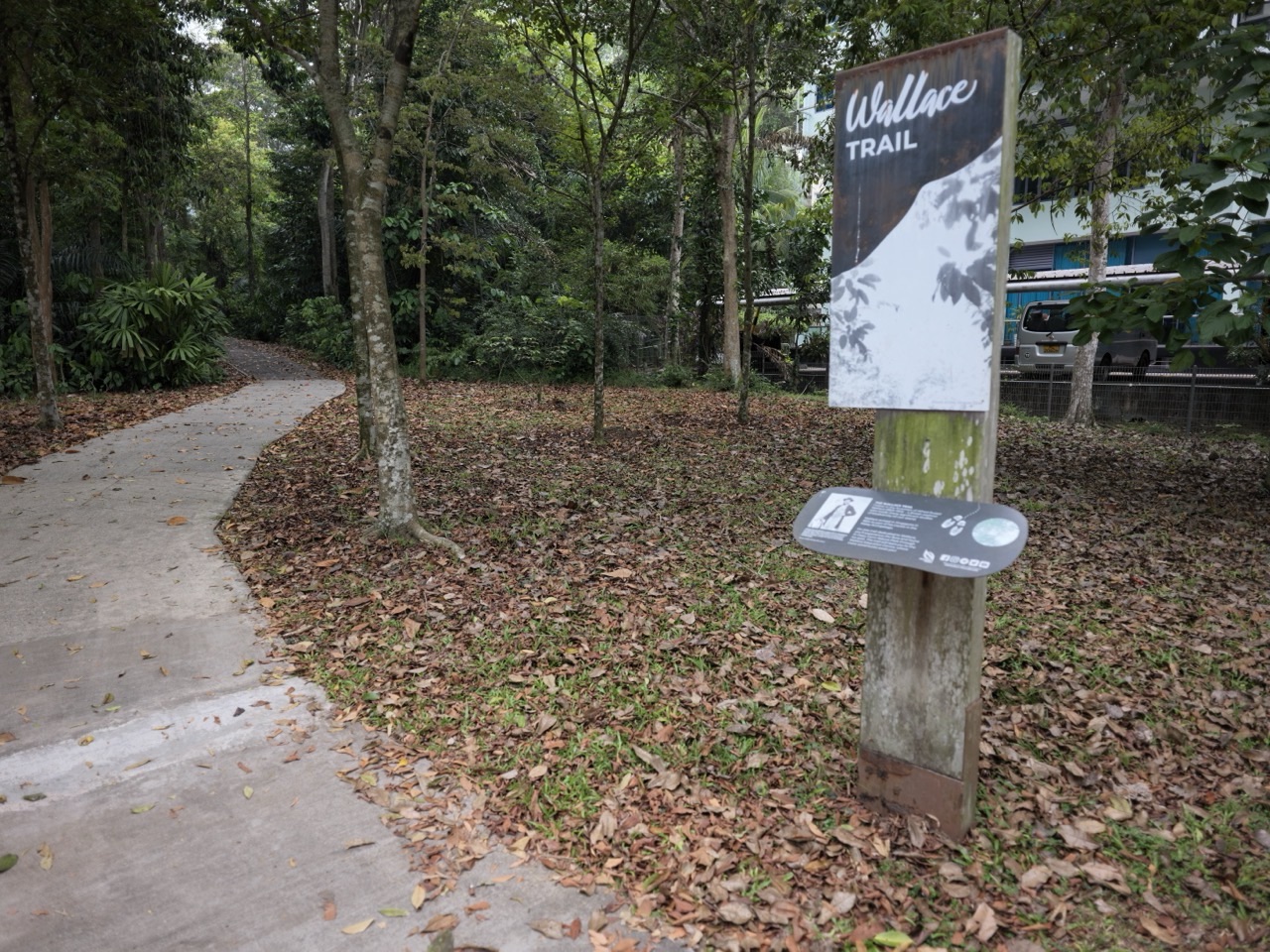
Wallace Trail runs through Dairy Farm Nature Park and honours naturalist Alfred Russel Wallace. Along its route, NParks highlights plants, animals and remnants of earlier settlements. It offers the sort of smaller forest details that reward moving slowly and looking closely.
For a photograph, try using a curve in the path to draw the eye through the trees. A vertical frame can emphasise the height of vegetation, while a horizontal frame can show the route disappearing into forest shade.
The Wallace Education Centre, inside a former cowshed, gives you an indoor natural-history context when it is open. Its own hours are 8.30am–5pm Tuesday to Sunday, with Monday closure. Do not assume the centre follows the 7am opening of the wider nature park.

A Hillview-side outing can feature one quarry, a stretch of Wallace Trail and a convenient meal, but it need not cover everything. Use the official map, choose a realistic distance and leave yourself an exit that works without relying on an unofficial shortcut.
Read Singapore Quarry | Hillview Directions and Scenic Walk, Dairy Farm Quarry | Rock Cliffs and Walking Plan and Wallace Trail | 2.2km Dairy Farm Walk.
7. Beauty World: photograph old and new neighbourhood life
A Bukit Timah photography day does not have to remain inside a park. The area near Beauty World MRT has older shopping complexes, shopfronts, food streets and newer developments standing near one another. It is well suited to everyday urban photography and a record of how the neighbourhood continues to change.
Start by looking at the contrast between Beauty World Centre, Beauty World Plaza, Cheong Chin Nam Road and the newer LINQ development. The buildings, signs and pedestrians tell a story of transport, shopping and food. That is a different subject from a former quarry and deserves its own approach.
Cheong Chin Nam Road and Chun Tin Road
The area around Cheong Chin Nam Road and Chun Tin Road contains restaurants and distinctive streetscapes close to Beauty World MRT. Try photographing the rhythm of shopfronts, older signs, a building corner or a wide street view that places people and businesses in context.
The key is to be considerate. Pavements are for movement, not equipment setups. Avoid standing in the road, blocking a restaurant entrance or making an identifiable stranger the main subject of an intrusive close-up. Do not photograph into private windows.
An interesting urban photo can be entirely architectural: old signage against a newer building, a sheltered shopfront next to a busy crossing, or a row of trees framing a commercial street. You can also use the location to explore how older place names remain visible in modern Singapore.

If you want to capture the liveliness of the neighbourhood, visit at a time when shops are active, then wait for a naturally clear composition. There’s no need to direct strangers or turn an ordinary lunch street into a set.
The Former Bukit Timah Fire Station
At 260 Upper Bukit Timah Road, the Former Bukit Timah Fire Station is a particularly interesting architectural subject. Built in 1956 and retired from firefighting in 2005, the conserved building now has community and commercial uses. Its public-service past can still be read in the structure.
A thoughtful photograph might show the conserved facade and newer activity without falsely implying the site remains an operational fire station. Keep the frame honest about the present. Use publicly accessible vantage points and observe the conditions of individual tenants.
URA’s 2026 information distinguishes the community space already in use from future-phase proposals, such as a visitor centre and an eco-pedestrian bridge. Do not describe proposed facilities as finished photo attractions until their actual opening is confirmed.

The station is useful for photographers interested in how cities retain old structures while giving them new purposes. A picture of an entrance, an old wall detail or the relationship between the historic building and modern uses can tell that story without access to restricted rooms.
Read Former Bukit Timah Fire Station | History, Conservation and What to Visit Today.
Everyday street photography is not a licence to invade privacy
You can enjoy observing public street life while respecting other people. Ask permission for posed portraits or when a person is clearly the main identifiable subject. Avoid persistent or intrusive photography of children, worshippers, shop staff or residents. A shopfront image need not require an unsuspecting person to become the focus.
Photography permits for commercial use are a separate question from everyday personal photography, and privately operated buildings may have their own rules. Always follow current signage and the venue’s instructions. A camera does not grant special access.
8. Singapore Botanic Gardens: a different photo outing on the Bukit Timah side
The Singapore Botanic Gardens extend across a large area, with the Bukit Timah Gate near Botanic Gardens MRT. This gives photographers a quite different collection of scenes: ornamental plants, rainforest sections, educational gardens and carefully managed landscapes. It is a worthwhile separate outing, rather than an automatic extension to Beauty World Quarry viewing.
If your subject is a particular plant or leaf, start with the garden map and choose one compact area. A close-up of a flower can need more patience than a wide landscape, especially when the background is busy. Moving slightly and waiting for a calmer moment often improves the picture.
The Gardens have their own rules for photography and using public spaces. Their official space-use guidance says casual photography sessions, including family portraits and graduations, do not require submission. Documentary, media, commercial and other organised uses may require advance permission. Check the specific use rather than assuming all photography follows one universal rule.
The Singapore Botanic Gardens also prohibit drone flights under NParks’ listed restrictions. Special arrangements, reserved spaces and commercial production need to be handled through their official application process.
For a full treatment of the Gardens’ subjects, light, permitted spaces and portraits, use Singapore Botanic Gardens Photography | Photo Spots, Light and Permit Planning. That separate article goes deeper into its specific collections.
Three simple Bukit Timah photo walks by MRT
A photography itinerary should start and finish sensibly. The shortest-looking sequence of destinations on a map is not always the easiest route on foot, especially when a quarry viewpoint involves paths, a station exit and changing terrain.
These three routes are editorial planning suggestions, not official turn-by-turn trails. Recheck entrances and closures against NParks’ current maps and onsite signs before visiting. Times are illustrative and depend on how often you stop to photograph.
Route A: a Beauty World quarry-and-forest morning
Begin at Beauty World MRT. Decide between Hindhede Nature Park and Rifle Range Nature Park as your main photo destination. Do not treat the two as one mandatory circuit. For a first visit or group with mixed fitness, choose the quarry viewpoint at Hindhede and leave time for a relaxed return.
At Hindhede, start with a wide view from the designated lookout. Take a vertical crop, then a closer study of rock or vegetation. If there are other visitors, give them space. Keep your photography equipment compact enough that you do not occupy the entire viewpoint.
After the park, return towards Beauty World for food. This gives a natural finish to the outing and allows you to review the photos in comfort. If you still have energy, you can take a few streetscape images near the commercial area, but don’t turn that into an additional strenuous walk.
If you choose Rifle Range instead, begin with the boardwalk and wetland. Consider the Colugo Deck only if your group intentionally wants its steep trail. You can produce a satisfying set of images without doing the longest or hardest route.
Route B: railway station and a short green heritage walk
Begin at King Albert Park MRT Exit A. Follow the signed approach to Bukit Timah Railway Station. Take one wide photograph of the station, then look for smaller restored details and garden features. This yields a visual story of transport and conservation.
Walk a short permitted stretch of Rail Corridor in daylight, choosing a sensible return point. Keep left, share the route with cyclists and leave bridges clear. Do not wander far along a linear trail without knowing where you will come out.
A reader may see a photograph of a different truss bridge and want to go there next. Check which bridge appears in the picture. The Upper Bukit Timah Truss Bridge and 9 Mile Platform belong to the Hillview-side area; they are not two minutes from the railway-station community node.
Finish at King Albert Park or another planned MRT destination. A half-day with a few strong photographs is preferable to being stranded far from your return station as the weather changes.
Route C: Hillview forest and quarry landscape
Begin near Hillview MRT and choose a route within Dairy Farm Nature Park using the official map. For a lake scene, make Singapore Quarry your main objective. For forest texture and a more geological subject, research Wallace Trail and Dairy Farm Quarry.
Allow for the distance to the actual viewpoint and the return. Singapore Quarry closes at 6.30pm, and the main park closes at 7pm. A "last-minute sunset" plan is not appropriate if it depends on remaining beyond closing or using an unlit forest path.
After the walk, the Hillview area or The Rail Mall provides options for a meal, subject to individual business hours. The food stop is part of a practical itinerary because it gives you somewhere to rest, rehydrate and organise the journey home.

If your goal is photography rather than completing a hiking challenge, a shorter walk with more time to observe will often produce a stronger set of pictures. Commit to one main area and leave the rest for another day.
Morning light, late afternoon and the limits of sunset planning
Light can change a familiar place more than a new camera lens. But a Bukit Timah sunrise or sunset photo should not be promised as an easy open-view spectacle. Many attractions are surrounded by forest, and most nature parks open at 7am and close at 7pm. Actual sunrise and sunset times vary across the year.
For quarry photography, gentler daylight can reduce the harsh contrast between pale rock, bright sky and dark foliage. You may find softer conditions after cloud cover or during suitable early and late daylight hours. Still water can create reflections, but wind and rain can change them quickly.
For a rainforest path, direct sun often creates small bright patches surrounded by deep shade. This can be beautiful, but it is easy to overexpose a pale leaf or make the forest floor almost black. Tap the brightest relevant part of the scene on your phone and reduce the exposure slightly if necessary.
The best light is not always the earliest possible minute
Choose a time that fits the attraction’s opening hours and your return route. You cannot assume a quarry is publicly accessible before the park opens just because sunrise occurs earlier that day. Also, forest slopes may remain dim after the sun rises because of the canopy.
A cloudy morning can work well for rock faces and greenery. Uniform light may reveal textures that disappear in direct midday sun. If the sky is featureless, you can exclude much of it from the composition and concentrate on the landscape.
Late afternoon may bring warmer colours, but it can also bring storms or a short window before closing. Keep a generous buffer for leaving the trail; do not wait until the final legal minute to start walking out.
Avoid inventing a scenic skyline
Bukit Timah Hill is Singapore’s highest natural point, but that does not mean every visitor will find an open panoramic city view. Forest foliage and trail alignments constrain the scene. The official maps and visitor information are a better guide than a social-media photograph taken from an unidentified or restricted location.
If you want a reliable view of rock and water, a designated quarry viewpoint is a clearer choice. If you want rainforest mood, a forest trail is ideal. Match the location to the composition rather than expecting one place to produce every possible image.
Simple smartphone settings for Bukit Timah photography
You don’t need a professional camera to photograph Bukit Timah well. A recent smartphone can create attractive landscapes, architecture studies and close-up plant images if you understand a few practical ideas. The biggest improvements often come from composition and patience, not from using a special filter.
Keep the lens clean and the horizon level
Tropical humidity, sunscreen and fingers can leave smudges on a phone lens. Before photographing a quarry view, gently clean the lens with a suitable cloth. Then turn on your camera’s grid if it helps keep the waterline or a building facade level.
A tilted horizon may be an intentional artistic choice, but an accidental tilt can distract from an otherwise calm landscape. Try taking one careful level photograph before experimenting with more dramatic angles.
Tap to focus and protect the bright areas
When photographing a quarry, the sky can be much brighter than the cliffs and water. Tap the main subject and adjust the exposure if your camera permits. Slightly reducing exposure can retain more detail in a bright sky, although the foreground may then need careful editing.
For a forest path, point the focus towards a tree trunk or the subject you want people to notice. A picture with no clear focus can feel busy even if the forest is beautiful. It helps to decide which element carries the story before pressing the shutter.
Use the wide lens sparingly
A wide-angle view can make a small clearing look larger and emphasise the depth of a path. It can also distort straight edges near the side of the frame, especially on historic buildings. Compare a standard-lens photograph with a wider one and choose the version that best represents the real place.
At a railway bridge, a wider lens can emphasise repeated steel lines. At a quarry, it can include more vegetation around the rock wall. But neither improvement is automatic. If too much of the picture becomes empty sky or unimportant foreground, try a tighter crop.
Take a sequence, not twenty nearly identical frames
A simple three-image sequence can tell a complete story: a wide establishing photo, a medium view and a close detail. Try this at each main location. At Hindhede it might be the quarry basin, the rock face and a close view of leaves framing the water. At the railway station it might be the whole building, a track segment and a sign.
This approach makes photo selection much easier later. It also encourages you to look for what makes the place special instead of taking the same photograph repeatedly until someone gets tired of waiting.
Edit honestly
You can crop, straighten and adjust brightness or colour to make a photograph easier to read. But don’t change the identity of the scene. Avoid adding animals, changing the water colour beyond recognition or inserting a sky that makes the photograph look like evidence of weather that wasn’t there.
When a photograph is used in a factual travel article, the caption should identify the actual location and date. If you use an illustration, call it an illustration. The goal is to help readers understand what they are looking at.
Camera equipment: what to carry and what to leave behind
A larger camera and interchangeable lenses can be useful, but Bukit Timah is not always the easiest place to carry heavy equipment. Steep paths, humidity and shared walkways make compact setups attractive. Choose the kit that suits your route.
A standard lens for the most versatile day
For a railway and street photography outing, a standard focal length gives you a natural-looking perspective without demanding excessive distance from the subject. It works for buildings, food streets and forest paths. A phone’s standard camera can do much the same job for a casual visit.
An ultra-wide lens is useful for big structures, but it can exaggerate nearby objects and distort edges. A longer lens can isolate details at a distance, especially wildlife, without requiring you to approach an animal. Use these as creative choices, not requirements.
A long lens for birds requires patience and ethics
At Rifle Range’s Waterhen Hide or Singapore Quarry, a longer focal length can be useful for small birds. But carrying a very heavy lens can reduce your comfort on a longer nature trail. Plan the shot before choosing equipment.
If the bird is too far away, accept a habitat photograph or enjoy watching it. Do not climb fences, lure it with food or play distress calls simply to bring it closer. The photograph is not more valuable than the animal’s safety.
A tripod is not automatically appropriate everywhere
A tripod may help with composition or slower exposures, but busy boardwalks, narrow viewing areas and shared routes can make it inconvenient for other visitors. NParks’ current commercial photography rules explicitly limit equipment and impose application requirements; special setups need checking in advance.
For casual photography, minimise your footprint. If a viewpoint is crowded, use a handheld camera or phone. Avoid trailing straps, bags and tripod legs where other people must walk.
If you are organising portraits or a commercial assignment, the permissions are different from an ordinary personal phone photograph. Read the permit section before setting up.
Weather-proof your day without treating rain as harmless
Bring a simple rain cover or suitable bag for camera gear, plus drinking water for yourself. Electronics may be replaceable; safety during a thunderstorm is not. NParks advises avoiding forested areas during and immediately after heavy rain. Put the camera away and seek suitable shelter when conditions change.
A cloudy forecast is not necessarily a failed photography day, but a severe-weather warning is a reason to postpone outdoor work. The best image is not worth staying in a hazardous place.
Wildlife photography: let the animal decide the distance
Bukit Timah’s nature parks support rich biodiversity, but wildlife photography must be based on observation rather than interference. You may spot birds, insects, squirrels or long-tailed macaques. None of these is a guaranteed subject.
NParks lists birds such as kingfishers and bitterns around Rifle Range’s wetland habitats. The Waterhen Hide is a particularly suitable place to watch quietly. At Dairy Farm and the nature reserve, listen and look carefully for movement, but remain on designated paths.
Don’t feed wildlife for a photograph
Feeding can change animal behaviour and create risks for animals and people. Do not offer food to attract a macaque, scatter crumbs for birds or approach a squirrel with a snack. Carry food securely, especially around wildlife-sensitive areas.
If an animal comes close, stay calm and give it room. Do not crowd it with cameras or attempt to make it pose. A photograph showing an animal behaving naturally is more informative than one showing a frightened creature reacting to a visitor.
Never use a nest as a photography prop
Bird nesting and roosting sites are sensitive. Avoid approaching nests, vegetation shelters or breeding locations to get a closer image. Do not cut branches or move plants to clear a view. A long lens and a public observation point are the better tools.
Also be thoughtful about publishing exact coordinates for rare or vulnerable wildlife. A photograph can be appreciated without encouraging a crowd to visit a sensitive site.
Try a habitat photograph instead of a close-up
A small bird inside a wider wetland scene can be a beautiful environmental photograph. It communicates where the animal lives, how the plants surround it and why protecting the habitat matters. It also reduces pressure to approach too closely.
That is particularly suitable for children and beginners. The goal can be to spot one bird, listen for two calls and record one question about the landscape, rather than chasing a long species checklist.
Read Birdwatching in Bukit Timah | Rifle Range, Hindhede and Zhenghua and Monkeys in Bukit Timah | How to Respond to a Macaque Encounter.
Photography permits, drones and respectful access in 2026
This is one of the most important parts of a Bukit Timah photography guide. A casual personal picture from a permitted visitor path is not the same thing as a commercial photoshoot, organised production, media assignment or drone flight. Different rules apply, and the distinction matters more than the size of the camera.
Casual personal photographs
Ordinary visitors may photograph scenery from permitted routes while observing park etiquette. Stay within opening hours, respect barriers, avoid obstructing others and comply with any restrictions shown onsite. A sign restricting a particular gallery, building or path takes priority over a generic article.
Singapore Botanic Gardens states that casual family and graduation photography sessions do not require a submission under its published space-use guidance. This should not be read as blanket permission for a commercial production or a privately reserved area.
If you’re simply photographing the view from an official quarry lookout, keep the activity low-impact. Do not set up equipment across a narrow boardwalk, block a path or interfere with wildlife.
Commercial photography and filming require advance permission
NParks’ September 2026 on-location filming permit page says that filming and commercial photography in its parks and nature reserves require a permit and asks applicants to apply at least one month in advance. Different application paths apply to different scales and venues. Nature reserve and nature park projects are reviewed particularly carefully.
Other NParks information pages and older guides may mention shorter notice periods. For an actual project, follow the latest application page and its live form, not an older simplified rule. Do not assume a last-minute permit can be issued simply because a public park is open.
Singapore Botanic Gardens has a separate space-use application process. Its current page identifies at least fourteen days for the relevant filming and photography applications and distinguishes casual photography from projects requiring permits. If your project involves media, commercial clients, large groups or reserved locations, clarify the rules directly with the relevant authority.
These are not abstract requirements. Permits help manage wildlife disturbance, crowding, protected habitats and safe public access. A camera crew, reflectors, large props or lighting setup can affect other visitors far more than a person with a phone.
Drones are not permitted in the relevant nature areas
NParks’ visitor rules prohibit drone flying in all nature reserves and nature parks and specifically include the Rail Corridor and Singapore Botanic Gardens among restricted areas. That means you should not bring a drone expecting to launch it at Bukit Timah Nature Reserve, Rifle Range Nature Park, Dairy Farm Nature Park, Hindhede or a Rail Corridor bridge.
Separate aviation rules may also apply to any other proposed flight. Do not infer that a location is flyable because an aerial photograph exists online. If you want an elevated view, use a designated public deck or viewpoint on foot.
Weddings, portraits, schools and large organised groups
A few family photos on a normal visit are different from reserving space, directing a large crowd or conducting a paid shoot. Group activities in nature park networks can require permits, especially above the relevant participant thresholds. Educational groups should check their own requirements in advance.
For a family portrait, avoid blocking access or expecting other visitors to leave the background. For engagement and wedding photography, decide whether the activity counts as an organised or commercial shoot and seek permission where required. For a school outing, prioritise supervision and route safety over the planned image count.
There is no reason to test a rule or slip into a closed area for a special photograph. Bukit Timah offers enough public views to work creatively within the boundaries.
Families, accessibility and staying safe with a camera
A photography guide can be particularly useful for people who want attractive scenes without a demanding hike. But "easy" means different things for a parent with a stroller, somebody carrying heavy equipment and a visitor who has limited mobility. Choose the route, not merely the landmark name.
Hindhede Nature Park has comparatively easy trails and a wheelchair-accessible approach by a ramp near the visitor-centre area, according to NParks. Still, the exact route and surface to your chosen viewpoint may matter. Check the official map and current conditions.
Rifle Range Nature Park provides barrier-free access between the visitor pavilion and Quarry Wetland along the designated boardwalk, but its Colugo Trail is steep. Do not take someone expecting a level route onto that climb without discussion.
The Bukit Timah Railway Station community node is described as wheelchair accessible. That makes it a useful option for people who enjoy heritage photography but do not want a long nature trail. Yet the adjacent Rail Corridor can contain different surfaces and distances, so plan only the section that suits your group.
Dairy Farm Nature Park has more limited wheelchair access, specifically around the route between Carpark B and Wallace Education Centre. Its quarry and forest routes should not be described as universally step-free.
Be careful when photographing with children
Set a simple rule that children stay with the adults and do not run towards water, cliffs or wildlife for a photo. Let them use a phone camera from designated safe spots and find their own composition. A child’s photograph of a leaf or path can be just as meaningful as the adults’ landscape image.
For a family outing, make photography one part of the experience rather than the whole purpose. Children will often enjoy a short trail and an unhurried meal more than waiting while adults repeatedly try the same shot.
Respect the weather and the clock
Nature reserves and nature parks around Bukit Timah generally open 7am–7pm, with Singapore Quarry closing at 6.30pm. Leave enough time to exit, especially when the trail itself is long or unfamiliar. Do not attempt to capture a sunset by remaining in a protected park after closing.
NParks advises avoiding forested areas during and immediately after bad weather. During a thunderstorm, head for suitable shelter and stop the photoshoot. A single piece of camera equipment should never become a reason to remain in an unsafe location.
For guests planning an accessible route, see Bukit Timah Stroller and Wheelchair Walks | Accessible Routes. For weather alternatives, see Things to Do in Bukit Timah When It Rains.
Frequently asked questions about Bukit Timah photo spots
What are the best photo spots in Bukit Timah?
Hindhede Quarry, Rifle Range Nature Park’s Quarry Wetland and Colugo Deck, Bukit Timah Railway Station, the conserved truss bridges and Singapore Quarry are strong choices. They offer different subjects: rock and water, elevated forest scenery, railway architecture and wetlands. The best one depends on whether you want a short walk or a more physically demanding route.
Where can I take scenic photos near Beauty World MRT?
The most convenient nature options are Hindhede Nature Park and Rifle Range Nature Park, each with official trails and public viewpoints. You can also photograph the Beauty World street and shopfront landscape if you prefer urban scenes. Check the exact park entrance before leaving the MRT.
Is Hindhede Quarry good for photography?
Yes. NParks specifically recommends Hindhede Nature Park for its dramatic quarry rock cliffs. The water and surrounding greenery can create interesting compositions and reflections. Use the authorised lookout and do not approach the quarry basin or cross a barrier for a better angle.
Is Hindhede Quarry easy to reach?
Hindhede is a relatively manageable nature-park outing from the Beauty World side, with comparatively easy trails. Still, the full walk from the MRT to the viewpoint takes more time than the trail length alone might suggest. Check the park map and consider the needs of anyone using a stroller or walking aid.
Where is the Colugo Deck in Bukit Timah?
It is inside Rifle Range Nature Park, reached by the steep Colugo Trail. NParks lists the trail at 582 metres and the deck at 31 metres above the Quarry Wetland. It is not the same as the barrier-free wetland boardwalk, and a visit requires suitable footwear and fitness.
Is Rifle Range Nature Park suitable for phone photography?
Yes. A phone can capture wetland landscapes, boardwalk lines, foliage and the relationship between forest and former quarry. Choose an official route suited to your group and keep the phone secure near railings and on uneven ground. Wildlife photographs may require more patience or a longer lens.
Can I see birds at Rifle Range’s Waterhen Hide?
You may see birds and other wildlife, but no sighting is guaranteed. NParks identifies the hide as a viewing area at the Quarry Wetland. Remain quiet and observe from the public structure without feeding or disturbing animals.
Can I take sunrise photos at Bukit Timah Hill?
Only within the reserve’s opening hours and permitted routes. NParks lists the reserve as open 7am–7pm. Sunrise timing changes across the year, and forest cover can limit an open view. Do not enter before opening or follow an unofficial trail to chase a sunrise composition.
Is there a panoramic view from Bukit Timah Hill?
The reserve includes Singapore’s highest natural point, but dense tropical forest and route alignments mean you should not expect a wide unobstructed skyline panorama everywhere. For a clearly defined quarry landscape, Hindhede or Rifle Range’s designated viewpoints may be more suitable.
Can I take sunset photos at Singapore Quarry?
Singapore Quarry normally closes at 6.30pm, with the wider Dairy Farm Nature Park closing at 7pm. You must finish and exit within the applicable opening hours, whatever the sunset time. Plan a daytime landscape photograph rather than relying on a last-minute sunset scene.
Where is Singapore Quarry, and which MRT is nearest?
Singapore Quarry is within Dairy Farm Nature Park on the Hillview side of the wider Bukit Timah region. Hillview MRT is a useful transport reference. Use the current park map for the actual path, distance and return route rather than assuming the lake starts at the station exit.
Are Singapore Quarry and Dairy Farm Quarry the same?
No. Singapore Quarry is a former quarry with a lake and wetland features. Dairy Farm Quarry was filled with earth and retains visible rock formations. They sit in the same wider nature park but offer different subjects and require different route planning.
Where is Bukit Timah Railway Station?
The conserved railway station is best approached from King Albert Park MRT Exit A, according to NParks. Follow the landscaped entrance to the Rail Corridor. The station is separate from the Upper Bukit Timah Truss Bridge and 9 Mile Platform near Hillview.
Can I photograph the old railway station’s Signal Room?
You may view the interior from the entrance, but NParks does not allow visitors to enter the Signal Room. Respect signs and restrictions, and avoid blocking the entrance. Some other heritage features are visible from the public precinct and make excellent photo subjects.
Are the Bukit Timah Truss Bridges good for photographs?
Yes. Their steel framework creates strong geometric lines, and the conservation work has retained important railway features. There are two distinct crossings, so plan for the correct bridge. Stay on the permitted public walking surface and let other visitors pass.
Is 9 Mile Platform the same as Bukit Timah Railway Station?
No. 9 Mile Platform is a rest-stop reference near the Upper Bukit Timah Truss Bridge on the Hillview side, while the conserved railway station is closer to King Albert Park MRT. The two sites are connected by railway history, but they are not interchangeable map destinations.
Can I photograph the Rail Corridor at night?
Although the Rail Corridor is described as open around the clock, most sections are intentionally unlit at night for wildlife. NParks encourages visitors to leave by nightfall. For an ordinary photography outing, choose daylight and plan a safe return rather than an unfamiliar night walk.
Do I need a permit for casual photos in Bukit Timah parks?
Ordinary low-impact personal photos from permitted visitor paths are different from commercial or organised shoots. Always follow onsite park rules. NParks requires applications for on-location filming and commercial photography, and specific venues may have additional conditions. If the shoot involves clients, crew, large equipment or commercial use, check the current permit requirements before proceeding.
What is the permit lead time for commercial photography?
NParks’ updated September 2026 on-location filming guidance asks for permit applications at least one month before the planned filming or commercial photography. Singapore Botanic Gardens has its own process and published lead times. Always follow the current form for the exact location and project type rather than relying on an older article.
Can I fly a drone over Bukit Timah’s nature parks or the Rail Corridor?
No. NParks prohibits drone flying in all nature reserves and nature parks and specifically includes the Rail Corridor and Singapore Botanic Gardens among prohibited areas. Separate aviation restrictions can apply elsewhere too. Use public ground-level or designated elevated viewpoints.
Are there good Bukit Timah photo spots without a serious hike?
Yes. Bukit Timah Railway Station offers heritage scenes in a comparatively compact area. Hindhede is generally an easier nature option than a summit climb. Rifle Range has a barrier-free wetland route, though not all its trails are easy. Beauty World street photography is another option with no forest hike.
Where can I photograph old buildings in Bukit Timah?
The restored Bukit Timah Railway Station and former Railway Staff Quarters are good heritage subjects. The conserved Former Bukit Timah Fire Station on Upper Bukit Timah Road is another distinctive building. Beauty World’s older shopfronts and street names offer everyday urban subjects from public areas.
Is Bukit Timah photography free?
Ordinary self-guided visits to many public nature parks and heritage precincts do not have general admission fees, but transport, parking and food cost extra. Commercial photography or organised shoots may require permits, and privately operated attractions or interiors have their own conditions.
What should I do if it rains during a photography walk?
Stop outdoor photography during unsafe weather and seek suitable shelter. NParks advises avoiding forested areas during and immediately after heavy rain. Do not approach wet cliff edges or attempt to get a reflection photograph during lightning. Postpone or choose an appropriate open indoor destination.
How much time do I need for a Bukit Timah photography outing?
Allow a relaxed half-day for one principal scenic destination and a meal. A railway-station visit can be relatively compact, while a longer Rail Corridor or Dairy Farm route needs more planning. If you want several quarries in one outing, use the official Scenic Quarries hiking map and consider the significantly greater total distance.
Is the 11km Bukit Timah Scenic Quarries Trail suitable for a short photo walk?
No. NParks’ 11km Scenic Quarries route is a longer multi-location walking itinerary. It is not one compact viewpoint. For a short photography visit, choose Hindhede, Rifle Range’s wetland or Singapore Quarry as a single destination and plan the entrance and return.
One good picture, one good outing
Bukit Timah rewards the photographer who pays attention. A quarry can be dramatic, a railway bridge can be precise and a forest trail can reveal quiet detail. The same place may look different when clouds move or when an unexpected bird appears along the water. None of that requires chasing a perfect picture at the expense of the landscape.
Choose one subject, the right MRT station and a permitted route. Leave time to observe, share public spaces and return before a park closes. Bring the simplest equipment that suits your plan. If the photograph turns out beautifully, that is a bonus. If you come away with a better understanding of Bukit Timah, the visit was already worth making.
Continue exploring Bukit Timah with eduKateSG
- Things to Do In Bukit Timah | Best Free Attractions, Food & One-Day Itinerary
- Things to Do In Bukit Timah | Hidden Gems, Quiet Walks & Heritage Spots
- Things to Do In Bukit Timah | Date Ideas, Cafés & Nature Walks for Couples
- Things to Do In Bukit Timah | Kids’ Activities, Playgrounds & Water Play
- Things to Do In Bukit Timah | Best Cafés, Brunch & Hawker Food Guide
- Hindhede Nature Park | Quarry Views, Beauty World MRT and Easy Family Walks
- Rifle Range Nature Park | Quarry Wetland and Family Walks
- Bukit Timah Hill Summit | Routes Compared
- Bukit Timah Railway Station | MRT Directions and Heritage Guide
- Bukit Timah Truss Bridge History | Restoration and Heritage
- Singapore Quarry | Hillview Directions and Scenic Walk
- Bukit Timah Quarry Walk | Planning the 11km Scenic Quarries Route
- Singapore Botanic Gardens Photography | Photo Spots, Light and Permit Planning
- Things to Do in Bukit Timah When It Rains
Official sources, photography rules and visitor checks
Updated and checked on 20 October 2026. Park hours, trail access, permit rules and closures can change. Before travelling, read the latest official visitor pages and follow onsite restrictions. Photography suggestions and compositions in this guide are editorial advice, not an official permit or a guaranteed photo route.
- NParks — Photography in Singapore’s parks, including Hindhede Quarry
- NParks — Hindhede Nature Park
- NParks — Rifle Range Nature Park, Quarry Wetland and Waterhen Hide
- NParks — Rifle Range trails and Colugo Deck details
- NParks — Bukit Timah Nature Reserve
- NParks — Dairy Farm Nature Park and Singapore Quarry hours
- NParks — Wallace Trail and Dairy Farm Quarry features
- Our Rail Corridor — Bukit Timah Railway Station and MRT access
- Our Rail Corridor — Visitor rules, access maps and notices
- URA — 2024 conservation awards for Bukit Timah Railway Station and Truss Bridges
- NParks — On-location commercial photography and filming permits, updated September 2026
- NParks — Park etiquette and drone restrictions
- Singapore Botanic Gardens — Use Our Space, casual photography and permit requirements
- Meteorological Service Singapore — Official forecasts and weather information