
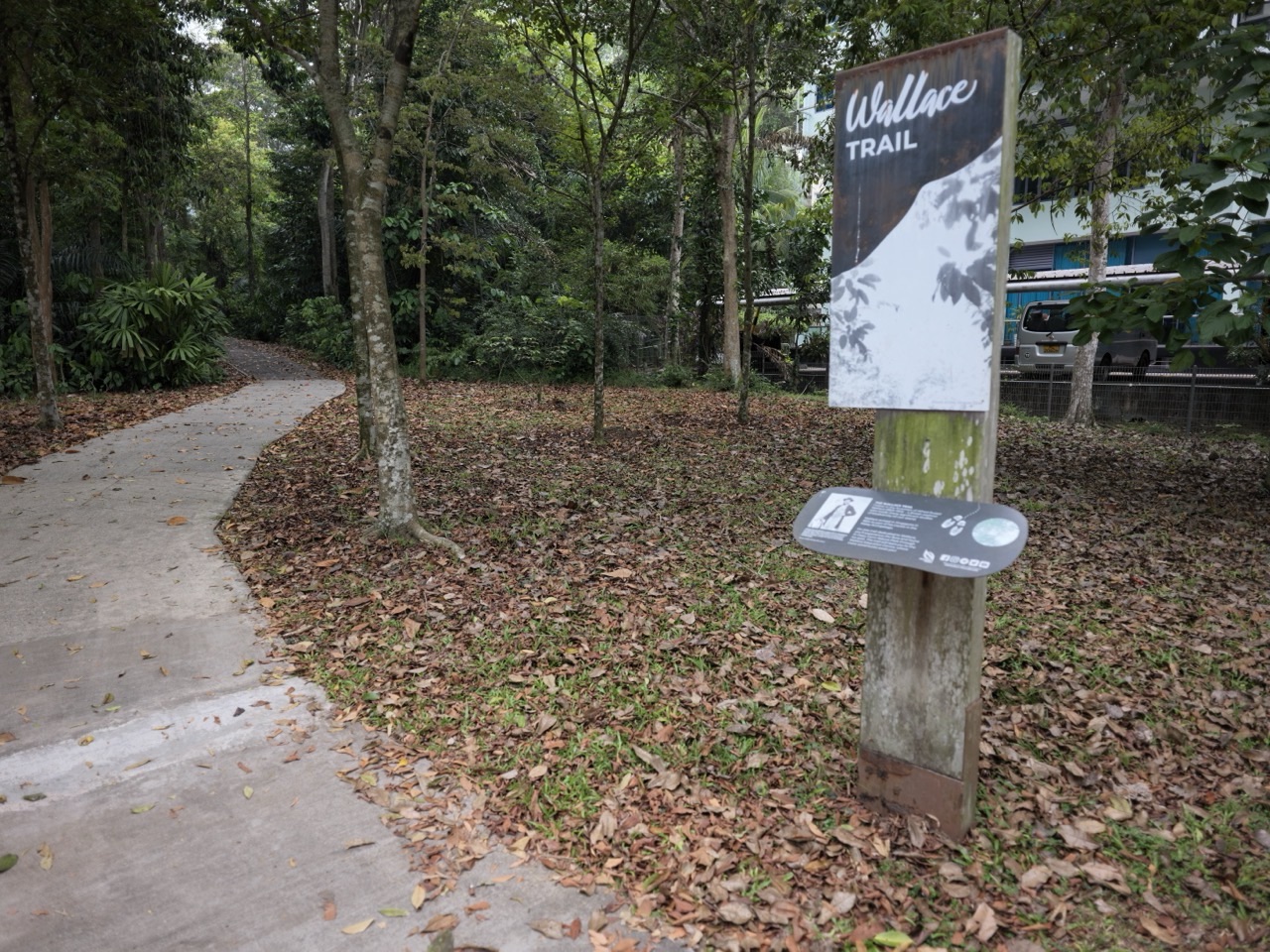
Looking for the best hiking trails in Bukit Timah, Singapore? Begin by choosing the effort you actually want. Hindhede Nature Park offers comparatively easy walks and a quarry viewpoint. Rifle Range Nature Park has the 411-metre Gliders Boardwalk towards its Quarry Wetland, plus a steeper route to Colugo Deck. For the classic Bukit Timah Hill summit hike, NParks lists Route 1 at 1.2 kilometres as moderate, Route 3 at 1.8 kilometres as difficult and Route 4 at 3 kilometres as difficult. All three reach the summit; Route 2 does not.
This guide compares things to do in Bukit Timah for hikers, beginners, families and nature lovers without confusing a short named trail with the full journey from an MRT station and back. It covers walking difficulty, trail distances, where to start, safe turnaround choices, forest and quarry scenery, opening hours, weather warnings and food after a hike. For a gentle first visit, choose one park from Beauty World MRT; for Wallace Trail and Singapore Quarry, plan a separate outing from the Hillview side.
The most useful distinction is simple: a trail’s published distance is not always your total walking distance. A 1.2-kilometre route to a hilltop may require walking back down; a 2.2-kilometre one-way nature trail may require another exit or return; a boardwalk’s length does not include the approach from the station. Reading those differences before leaving makes hiking more enjoyable, especially in Singapore’s warm, humid conditions.
Quick answer: which Bukit Timah trail should you choose?
- Easiest scenic introduction: Hindhede Nature Park, with short nature walks and a public viewpoint overlooking Hindhede Quarry.
- Best gentler wetland route: Rifle Range Nature Park’s Gliders Boardwalk, an individual trail measuring 411 metres, leading from the visitor pavilion towards the Quarry Wetland.
- Best first summit attempt for reasonably fit walkers: Bukit Timah Nature Reserve Route 1, rated moderate, 1.2 kilometres from its Visitor Centre via the main road.
- Best for stronger hikers wanting forest variety: Route 3, rated difficult, 1.8 kilometres, via South View Path and Cave Path to the summit.
- Best for those intentionally choosing a longer summit route: Route 4, rated difficult, 3 kilometres, incorporating the additional Dairy Farm loop.
- Best easy-rated longer nature trail: Wallace Trail, 2.2 kilometres one way, starting from Dairy Farm Nature Park.
- Best rail-and-pavement alternative: Bukit Timah Park Connector, a 1.6-kilometre wheelchair-friendly park connector linking the Hindhede Drive side to Bukit Batok Nature Park.
- Best optional elevated lookout near Beauty World: Rifle Range’s Colugo Trail, 582 metres, but steep rather than an easy boardwalk.
- Best for wider northern nature-park exploration: Chestnut Nature Park’s Northern Trail, 3.5 kilometres (easy), or Southern Trail, 2.1 kilometres (moderate).
- Best ambitious multi-quarry day: NParks’ Scenic Quarries route, 11 kilometres, which is a long multi-location walk rather than an easy first-hike shortcut.
The ratings and measurements above come from NParks’ named routes. They are not personal fitness diagnoses or predicted door-to-door distances. Check the current park maps and closure notices before travelling, particularly after heavy rain. The full route comparison below helps you decide.
Bukit Timah hiking trails at a glance
| Trail or destination | Published length / difficulty | Why choose it | Useful station | Hours |
|---|---|---|---|---|
| Hindhede Nature Park | Easy nature walks | Quarry viewpoint; gentle first outing | Beauty World | 7am–7pm |
| Rifle Range: Gliders Boardwalk | 411m; barrier-free segment | Quarry Wetland and waterbirds | Beauty World | 7am–7pm |
| Rifle Range: Rambai Boardwalk | 535m | Treetop approach and park history | Beauty World | 7am–7pm |
| Rifle Range: Colugo Trail | 582m; steep | Colugo Deck elevated wetland view | Beauty World | 7am–7pm |
| Summit Route 1 | 1.2km; moderate | Most direct summit route | Beauty World | 7am–7pm |
| Summit Route 2 | 0.8km; moderate | Telecomm Tower; NOT summit | Beauty World | 7am–7pm |
| Summit Route 3 | 1.8km; difficult | Summit via South View/Cave Paths | Beauty World | 7am–7pm |
| Summit Route 4 | 3km; difficult | Summit plus Dairy Farm loop | Beauty World | 7am–7pm |
| Wallace Trail | 2.2km one way; easy | Forest and natural-history walk | Hillview | 7am–7pm |
| Singapore Quarry | Route varies by entry | Lake and quarry landscape | Hillview | 8am–6.30pm |
| Bukit Timah Park Connector | 1.6km; wheelchair friendly | Paved connection to Bukit Batok Nature Park | Beauty World area | Connector-specific |
| Chestnut Northern Trail | 3.5km; easy | Longer northern nature trail | Bangkit/Pending LRT | 7am–7pm |
| Chestnut Southern Trail | 2.1km; moderate | Southern nature trail | Bangkit/Pending LRT | 7am–7pm |
| Scenic Quarries itinerary | 11km; long regional route | Multiple quarry landscapes | Several possible | Check every park |
Read the table this way: "moderate" and "difficult" in NParks’ own trail guide are not the same as someone’s description of a "short walk". A park may contain both accessible facilities and steep routes. Similarly, one boardwalk may be barrier-free without making all adjoining paths wheelchair accessible.
If you have a child, an older relative, a stroller or someone new to hiking with you, begin with the gentler specific route, not just the park’s name. A pleasant trip means choosing what suits the people who actually came.
Contents: find the right route and plan it properly
- 1. How to choose a Bukit Timah hike
- 2. Why the published trail length is not your total distance
- 3. Hindhede Nature Park for a gentle quarry walk
- 4. Rifle Range boardwalks and Quarry Wetland
- 5. Colugo Trail, Banyan Trail and Gaharu Trail
- 6. Bukit Timah summit Routes 1, 2, 3 and 4
- 7. Wallace Trail: an easy-rated but longer one-way walk
- 8. Singapore Quarry versus Dairy Farm Quarry
- 9. Bukit Timah Park Connector to Bukit Batok Nature Park
- 10. Chestnut Nature Park’s Northern and Southern Trails
- 11. Scenic Quarries, history trail and long walks
- 12. MRT stations, entrances and return routes
- 13. A first-timer’s weather and safety checklist
- 14. Family, seniors and accessibility choices
- 15. Four ready-to-use day plans
- 16. Where to eat and rest after a hike
- 17. Frequently asked Bukit Timah hiking questions
- 18. Related guides and official route maps
1. Choose the kind of hiking day you actually want
Visitors often search for Bukit Timah hiking trails as though there is one definitive route. In reality, several parks and connectors sit around the reserve, and they have different purposes. Some are protected rainforest trails, some are raised walkways, some provide lake or quarry scenery, and some are practical links between built-up areas and other parks.
A quarry walk is a good option if you want an attractive destination and a manageable outing. The rock walls and water at Hindhede make the effort feel rewarding even when you don’t climb the hill. A wetland boardwalk is better if you want to observe birds, plants and water without turning the day into a strenuous climb.
A summit hike is a different commitment. You are choosing gradients, sustained effort and a hilltop destination. Singapore’s highest natural point is only around 163 metres above sea level, but that figure is not the distance you must climb along a path, nor does it describe the slope under your feet. Short, steep sections can be harder than longer, nearly level walks.
A longer nature trail such as Wallace Trail asks for endurance over a greater distance. A park connector prioritises moving through connected landscapes on a more built walking route. A multi-quarry itinerary joins several destinations over kilometres and may involve very different terrains and route decisions.
The best question is therefore not, "Which hike has the biggest number?" It is, "Do we want a lookout, a forest experience, exercise, a family walk or a long-distance challenge?" Choose one clear purpose and let that guide the trail.
Five questions before you select a route
Think about who is coming. Has everyone comfortably completed a similar walk in Singapore’s humidity? Is anyone wearing shoes intended mainly for shopping? Do you have a child who will need to be carried if they tire? How much time is available before the park closes, and what will the weather be like?
The next question is how the walk ends. A linear route without a nearby return station can be more difficult to manage than a short climb with a clear path back. People often spend a great deal of time choosing the attractive part of a walk and almost none planning the way home.
Finally, ask what would make you happy to stop early. Reaching a quarry lookout can be a complete outing. A walk that ends at the visitor centre because the weather changes can still be a good decision. The ability to adjust is a sign of a thoughtful plan, not a failed expedition.
2. Trail distance versus the real journey: read the numbers correctly
Hiking articles often repeat a number like 1.2km, 411m or 2.2km without explaining what the number measures. That is one reason visitors arrive expecting a fifteen-minute stroll and discover a longer outing. NParks usually reports the length of an individual named trail or route, while your day also includes transport approaches, connections, pauses and the exit.
Consider Bukit Timah summit Route 1. NParks lists it as 1.2 kilometres from the Visitor Centre to the summit via the main road. If you walk the same route back, you will be covering roughly another 1.2 kilometres, so a simple out-and-back estimate becomes around 2.4 kilometres within that route. It still excludes the walk between the MRT and the Visitor Centre, plus any detours.
The amount of time required cannot be derived accurately from distance alone. The main hill road includes a steep section, Singapore is humid, and individual fitness levels differ. An old NParks self-guided trail booklet suggests around 45 minutes to one hour to reach the summit at a leisurely pace and further time for the return. Treat that as an illustrative historical estimate, not a guarantee.
Now consider the Gliders Boardwalk at Rifle Range. Its named trail length is 411 metres, while NParks identifies a 700-metre barrier-free visitor-pavilion-to-wetland route through the area. These figures describe different scopes. Neither tells you how far a particular person must walk from Beauty World MRT, which entrance they will use or whether they intend to return by the same way.
Wallace Trail is listed at 2.2 kilometres one way. If you choose to retrace the whole trail, the trail portion alone becomes about 4.4 kilometres, before adding station access and other walking. A different approved exit may change that calculation. This is why the word "one way" is just as important as the number.
A simple route-distance example
Imagine two friends who choose a 2.2-kilometre one-way nature trail because it sounds short. One expects to exit at the far end and take transport home. The other expects to go back to the same entrance. They have unintentionally planned different walks: one covers the published length, while the other may cover twice that trail distance.
Before starting, agree on the start, turnaround or exit, and return journey. Open the official map and look at the whole route, not only the highlighted segment. That simple conversation prevents a great deal of tiredness later.
Why a moderate 1.2km hill route can feel harder than a 2.2km easy trail
Distance measures how far you go along the ground, but does not capture everything you experience. Gradient, steps, uneven surfaces, weather and fatigue all affect effort. NParks rates summit Route 1 moderate despite its short distance, while Wallace Trail is rated easy even though it is longer and listed one way.
The classifications are useful starting points but not promises that every individual can complete a particular path comfortably. Take the nature of the surface seriously. A hike through tropical forest is a different activity from walking the same number of metres inside a shopping mall.
For an exact comparison of the summit trails, see Bukit Timah Hill Summit | Routes 1, 3 and 4 Compared. For a longer route, use Wallace Trail | 2.2km Dairy Farm Walk and Return Planning.
3. Hindhede Nature Park: the gentle Bukit Timah quarry walk
Hindhede Nature Park is an excellent answer to "Where can I walk in Bukit Timah without hiking to the summit?" It is beside Bukit Timah Nature Reserve, has comparatively easy paths and offers a viewpoint over Hindhede Quarry, a former granite quarry with cliffs, water and surrounding forest.
NParks lists the park at 9.5 hectares, open 7am to 7pm, with Beauty World MRT as the nearby station. It is also described as elderly-friendly and has a wheelchair-accessible approach by a ramp in front of the nature reserve Visitor Centre. These are useful features, although the suitability of the specific path you want still needs checking.
What is worth seeing?
The quarry view is the obvious highlight. Rock walls rise above calm water, framed by green vegetation. It is an impressive sight without a long mountain route, especially for visitors who have not realised that this part of Singapore was shaped by quarrying.
The park is not simply a photograph. Its paths may reveal squirrels, birds and changes in plant growth as you walk. Wildlife sightings are not scheduled; watching quietly often gives you more than rushing towards an imagined guaranteed animal encounter.
Families may appreciate the playground features, including ziplines and climbing nets that NParks describes. A nature visit can mix movement, play and a scenic goal without turning into a long exhausting hike. Keep children supervised and select play elements suited to their ability.
How should first-time visitors plan it?
Arrive at Beauty World MRT, follow the current park map towards Hindhede Drive and the Visitor Centre area, and allow additional time for the outdoor approach. Once inside the appropriate park entrance, choose the quarry viewpoint as the main destination.
Stay on the marked routes. Do not approach quarry edges, cross barriers or enter the water. A viewpoint exists so people can appreciate the landscape from a safe position. If you are using a stroller or wheelchair, verify the exact path rather than assuming every branch is equally accessible.
You can finish after the quarry view or add a short spell at the playground if the group still has energy. A meal back at Beauty World is a natural end. There is no need to combine the visit with an exhausting summit attempt unless everyone planned that separately.
When is Hindhede better than the main nature reserve?
Choose Hindhede when you mainly want quarry scenery, an easier outing or a child-friendly nature walk. Choose the nature reserve when the forest and the physical challenge of climbing the hill are what you actually want. One is not a lesser version of the other.
A visitor can enjoy Hindhede three times for different reasons: once as a family playground outing, once for quarry photography and once for quiet wildlife observation. A short trail can still reward repeated attention.
Read Hindhede Nature Park | Easy Family Walks and Quarry Views for entrance and family-planning details.
4. Rifle Range Nature Park: choose boardwalks before steep viewpoints
Rifle Range Nature Park offers a more varied menu of trails. It occupies 66 hectares around the former Sin Seng Quarry and helps protect ecological connectivity around Bukit Timah Nature Reserve. It is open 7am to 7pm, lists Beauty World MRT as a nearby station and has multiple entrances.
The most important beginner tip is that not all Rifle Range routes are equally easy. A barrier-free wetland connection and a steep viewpoint trail exist in the same park. If you arrive without choosing a route, somebody may think they agreed to a gentle stroll while someone else expects a hill challenge.
The Rambai Boardwalk: 535 metres of raised pathway
NParks identifies the Rambai Boardwalk as a convenient approach from Beauty World MRT. It is 535 metres long and takes visitors through greenery with interpretation of the park’s previous uses, including the former Singapore Gun Club and quarry landscape.
For a first visit, a raised boardwalk can make it easier to enjoy the forest setting without navigating every rough ground surface. But the published 535 metres is the boardwalk itself, not the full distance from MRT to its entrance, through the park and back.
The elevated view is interesting because it places people close to the tree canopy and lets them notice the forest from a different angle. Stop where there is space rather than blocking a narrow path for photographs.
Gliders Boardwalk: 411 metres towards the wetland
The Gliders Boardwalk is another specific trail, 411 metres long. NParks calls it a barrier-free connection from the Visitor Pavilion to the Quarry Wetland. The broader barrier-free corridor is described as around 700 metres, which is a different measurement from the named boardwalk segment.
This is an attractive option for visitors who want water, vegetation and the possibility of birds without choosing the park’s steeper routes. You may also notice structures that help wildlife move through the landscape. The park’s approach combines visitor access with habitat-conscious design.
If someone uses a wheelchair or stroller, check the entrance and entire intended route, not just the word "barrier-free". The path from public transport to the Visitor Pavilion also matters. Check current closures and onsite signs for any maintenance restrictions.
Waterhen Hide and Quarry Wetland
At the restored Quarry Wetland, the Waterhen Hide provides a public observation point. This is a place for patience. You might notice a small bird moving among plants, reflections on water or the quiet activity of a recovering wetland habitat.
There is no guarantee of a particular bird. The experience is still worthwhile if you spend five minutes quietly noticing the scene. Nature is not an exhibition in which each animal appears at a fixed time.
The quarry’s transformation is itself a lesson: a former extraction landscape is now managed for recreation and biodiversity. That is why some visitors may prefer the wetland walk to a summit. The destination explains something about how Singapore’s environment has changed.
Forest Exploration Trail for children
Rifle Range also includes the Forest Exploration Trail, an 113-metre nature-play route designed for ages five to twelve, with logs, pebbles and boulders. It is best described as nature play, not a general-purpose distance hike or an accessible shortcut to the viewpoint.
This is useful for families whose children like climbing and balancing. It also underlines the importance of choosing a route by purpose: the Forest Exploration Trail is different from the wetland boardwalk, which is different again from the steep Colugo Trail.
For focused guides, see Rifle Range Nature Park | Quarry Wetland and Family Walks, Gliders Boardwalk | 411m Accessible Wetland Route and Forest Exploration Trail | Nature Play for Children.
5. Colugo, Banyan and Gaharu: when Rifle Range becomes a real hike
Rifle Range isn’t limited to boardwalks. Visitors who want more physical effort can choose trails with steeper sections and different surfaces. These may be more satisfying for experienced walkers, but they require honest planning.
Colugo Trail to Colugo Deck
NParks describes Colugo Trail as a steep 582-metre hike. It leads to Colugo Deck, a viewpoint rising 31 metres above the Quarry Wetland. That height provides a different perspective over the former quarry, but it does not make the trail an effortless family walk.
Someone may see a beautiful deck photograph and imagine the approach is similar to a flat promenade. This is exactly the sort of misunderstanding a good trail comparison should prevent. The trail’s short distance is not proof that the slope is gentle.
If you choose this route, wear appropriate shoes, allow for pauses and be ready to turn around if the effort does not suit the group. Keep children near you at the viewpoint and respect all barriers. A deck is a public lookout, not an invitation to climb the railing.
Gaharu Trail and Banyan Trail
The Gaharu Trail is 826 metres, while the Banyan Trail is 647 metres, according to NParks. These parallel dirt-and-stone paths begin at the Gaharu Entrance along Jalan Kampong Chantek and wind through denser forest. On the Banyan side, a natural freshwater stream is among the landscape features.
The entry point matters. These are not automatically the easiest routes from Beauty World MRT, and they should not be mixed into a wetland-focused outing without studying the park map. Walking to the correct entrance can be a significant part of the plan.
Dirt-and-stone surfaces differ from a raised boardwalk. They can be uneven and slippery after rain. A person wearing casual sandals for a neighbourhood café visit may need to choose a simpler walk or come back another day with suitable footwear.
Which Rifle Range route should a first-timer pick?
For a gentler experience, begin with the Rambai or Gliders Boardwalk and the Quarry Wetland. For a deliberate steep challenge, consider Colugo Trail. For a forest-focused walk with dirt and stone paths, research Gaharu and Banyan. If you’re with children aged five to twelve, the Forest Exploration Trail is a distinct nature-play option.
Do not combine all the park’s named trails merely because each is individually less than one kilometre. Connecting them requires extra distance, navigation and effort. Select the experience rather than adding route lengths as if they were supermarket items.
Read Colugo Deck | Rifle Range Lookout and Trail Guide and Banyan and Gaharu Trails | Jalan Kampong Chantek Routes.
6. Bukit Timah Nature Reserve: Routes 1, 2, 3 and 4 explained
For the classic Bukit Timah summit hike, start with the official route map rather than a social-media description such as "easy 20-minute walk". NParks identifies four named routes beginning from the Visitor Centre, with different distances and difficulties.
The important fact is that only Routes 1, 3 and 4 lead to the summit. Route 2 goes towards the Telecomm Tower and should not be chosen under the assumption that all numbered paths end at the same summit marker. This distinction is useful for visitors who want to complete a particular destination rather than simply walk somewhere in the forest.
Route 1: moderate, 1.2km, the most direct summit route
Route 1 follows the main road towards the summit. NParks rates it moderate and lists 1.2 kilometres from the Visitor Centre. It is the most direct of the three official summit routes.
This is often the starting point for reasonably fit first-time hikers who specifically want to reach Bukit Timah Hill’s top. The path is well-defined, but the gradient can be steep. Moderate does not mean a completely flat stroll. A parent carrying a small child or an older visitor with mobility limitations may find it unsuitable.
Take water, wear closed walking shoes and set a pace at which you can still talk comfortably. If someone needs a long rest early in the climb, use that information to decide whether to continue. There is no reason to push towards the summit simply because it is a familiar local milestone.
If you return by the same Route 1 path, remember that the total hike portion is longer than 1.2 kilometres. Account for the downhill journey, which may strain knees differently from the ascent, plus the approach from Beauty World MRT.
Route 2: moderate, 0.8km, but not a summit route
Route 2 is rated moderate and measures 0.8 kilometres. NParks identifies its destination as the Telecomm Tower via the main road, not the summit.
Why mention it so prominently? Because route numbering can mislead. Someone who assumes Route 2 must be a shorter version of the summit trail may set off with the wrong destination. If the summit is your goal, choose one of the routes NParks identifies as actually leading there.
A walk that doesn’t reach the summit can still be a useful nature outing if you deliberately choose it. Just be clear about its endpoint and check any route-specific restrictions or signs on the day.
Route 3: difficult, 1.8km, via South View and Cave Path
Route 3 is a difficult, 1.8-kilometre route that leads to the summit by way of South View Path and Cave Path. It is a different experience from the more direct main-road approach.
For stronger walkers, the extra route complexity may be appealing. It brings more trail variety and makes forest observation a greater part of the journey. But it should not be advertised as a gentler option just because the distance remains under two kilometres.
Understand the trail markings before starting, allow extra time and avoid treating it as a timed challenge. The name of a path is a route reference, not permission to enter a cave or any closed area. Use only the designated trail.
This option suits a group that has already assessed its fitness and understands the environmental conditions. If you’re new to forest hiking, Route 1 may be a more predictable first summit experience, depending on your own ability.
Route 4: difficult, 3km, with an additional Dairy Farm loop
Route 4 is difficult and 3 kilometres long. According to NParks, it begins with the same path as Route 1 and includes an additional Dairy Farm loop after the summit.
This is a meaningful upgrade in route length and planning. A person who wants only the summit may not gain much from extending the hike through another loop. A person who enjoys the physical and environmental experience may prefer the longer option.
Do not interpret the name Dairy Farm as evidence that Route 4 conveniently finishes beside every Dairy Farm attraction, such as Singapore Quarry or Wallace Education Centre. Check the official route map for the exact trail connection and where your route ends.
If your companions have different stamina levels, agree before beginning which route you intend to use. A midway proposal to add the extra loop should be a genuine group decision, not pressure on the least experienced person.
Which is best for a first Bukit Timah summit hike?
For a reasonably fit adult who wants the summit and prefers a direct official trail, Route 1 is the simplest starting choice among the summit routes. It is still moderate, and it has steep sections. Routes 3 and 4 suit hikers who deliberately want difficult alternatives.
Anyone who simply wants a pleasant nature walk should feel free to choose Hindhede or the Rifle Range wetland instead. Reaching the summit is one type of outing, not a compulsory qualification for enjoying Bukit Timah.
Use the official Bukit Timah Nature Reserve hiking guide, which has the current route map, together with the detailed eduKateSG comparison of Summit Routes 1, 3 and 4.
7. Wallace Trail: 2.2km easy one way, not an instant loop
Wallace Trail starts from Dairy Farm Nature Park and is listed by NParks as easy, 2.2 kilometres one way. It is one of the most appealing routes for walkers who want rainforest scenery, a connection to natural history and more distance than a short boardwalk.
The word easy describes the route’s published difficulty, not a promise that anyone can stroll it in fifteen minutes. A one-way 2.2-kilometre walk requires a plan for where you finish. If you retrace it, the trail portion alone is around 4.4 kilometres. If you use a different exit, your total may be more or less depending on the route.
For people who enjoy botanical detail, the trail can be especially rewarding. Look for changes in light under the canopy, leaf shapes, fruit trees associated with the area’s old kampong landscapes and traces of how the site was used before it became a nature park.
Why is it named after Alfred Russel Wallace?
Alfred Russel Wallace was a naturalist who studied the Malay Archipelago and independently developed important ideas related to natural selection. The trail and nearby Wallace Education Centre connect the landscape with the history of scientific observation.
That does not mean the park is an outdoor museum where every species comes with a guarantee of being seen. It means the visitor has a theme: notice, compare and ask how plants and animals interact with their environment.
A child might examine two leaf shapes. An older student might ask why one place is wetter than another. An adult might simply enjoy a long green walk away from traffic. All are legitimate reasons to visit.
Wallace Education Centre: different hours from the park
The Wallace Education Centre is housed in a former cowshed and contains displays about nature and biodiversity. NParks lists it as open Tuesday–Sunday, 8.30am–5pm, with Monday closure.
The wider Dairy Farm Nature Park opens 7am–7pm. Do not arrive at 7am expecting the education centre to be open, or assume that a Monday walk includes gallery access. Match the timetable to what matters most to your group.
For someone who enjoys learning, the centre makes a thoughtful optional finish to the hike when open. For someone mainly seeking exercise, the trail itself may be enough.

Getting there and choosing the return
Hillview MRT is a useful transport reference for Dairy Farm Nature Park, but it is not the start of every internal trail. Use the current NParks map and choose your precise park entrance. Some visitors arrive via a car park, while others approach on foot using public transport and connectors.
Save your intended exit before entering a longer path. If you plan to return to the same place, calculate the extra distance. If your group is unsure about its stamina, pick a shorter turning point instead of committing to the full one-way trail.
Wheelchair access in Dairy Farm Nature Park is limited to the route from Carpark B to Wallace Education Centre, according to NParks. Do not read the easy rating of Wallace Trail as proof that the entire nature path is barrier-free.
Explore Wallace Trail | 2.2km Dairy Farm Walk and Return Planning and Wallace Education Centre | Opening Hours and Family Guide.
8. Singapore Quarry and Dairy Farm Quarry: choose the landscape you want
Dairy Farm Nature Park covers around 75 hectares and has two notable former quarry landscapes. Singapore Quarry is now a scenic lake, while Dairy Farm Quarry has been filled with earth and retains prominent rock cliffs. They are different places with different visual character.
A visitor who searches "Bukit Timah quarry hike" may see both described in travel guides. Choosing the wrong one can be disappointing if you expected a lake and found a dry quarry, or if you wanted rock walls and instead reached a wetland lookout.
Singapore Quarry: a lake landscape
NParks identifies Singapore Quarry as a former quarry that became a lake, with opportunities to observe birds and dragonflies. Its visitor hours are 8am to 6.30pm daily, shorter than the wider Dairy Farm Nature Park’s 7am–7pm schedule.
For a gentle-looking destination, a lake viewpoint is appealing. But you still need to walk from an appropriate entrance, follow the approved trail and allow time for the return. A photo of calm water does not tell you how far it is from the MRT or whether the ground is level throughout.
Stay at the designated viewing area. Do not enter the water, approach steep edges or feed wildlife. The quarry is a protected natural setting, not a swimming or fishing destination.
Dairy Farm Quarry: rock walls and an earth-filled basin
Dairy Farm Quarry is distinguished by its earth-filled condition and exposed rock formations. The lack of a lake is part of the story. Former quarries can be treated differently as landscapes recover or are managed for new uses.
Choose this if you’re interested in rock forms and the physical traces of granite extraction. A visitor who enjoys geology may find the cliffs every bit as compelling as the lake setting at Singapore Quarry.
Access remains through designated park paths. Rock walls and cliff edges are not climbing features for casual visitors. Keep to public routes and respect any barriers or closure notices.
Why the two quarries make a good second visit
Rather than trying to cover both in a hurried morning, consider visiting Singapore Quarry on one occasion and the Dairy Farm Quarry area on another. You will have more time to notice the difference between water, rock, vegetation and the changing land.
If you deliberately plan both, use the official park map, check distances and finish before the earlier of the relevant facility closing times. Don’t add the route purely because the two names share the word quarry.
Read Singapore Quarry | Hillview Directions and Walking Guide and Dairy Farm Quarry | Rock Cliffs, Park Hours and Walking Plan.

9. Bukit Timah Park Connector: the 1.6km paved alternative
A park connector is not automatically the same experience as a forest hiking trail. For visitors who prefer a more built-up path, the Bukit Timah Park Connector provides a 1.6-kilometre connection between the Hindhede Drive side and Bukit Batok Nature Park.
NParks’ Park Connector Network page, updated in September 2026, describes the route along Upper Bukit Timah Road and Old Jurong Road, passing the Former Bukit Timah Fire Station before reaching Bukit Batok Nature Park. It is listed as wheelchair friendly.
That makes it a different way to explore the area. You can see how a green network links places across ordinary streets and roads without asking everyone to complete a nature-reserve summit. It may suit someone who enjoys walking between neighbourhood landmarks or wants a more predictable paved environment.
Does wheelchair-friendly mean every onward attraction is accessible?
No. The connector itself is identified as wheelchair friendly. That does not establish that every path inside Bukit Batok Nature Park, Bukit Timah Nature Reserve or the surrounding slopes has the same accessibility.
Plan the connector as one route and evaluate each park destination separately. If someone needs a step-free return, check where the route finishes and how they will connect to public transport. A short connector can become a longer outing once you add both ends.
The official connector page also lists lighting hours from 7pm to 7am, distinguishing it from the forest trails that close at 7pm. That is a route-specific fact, not permission to enter the nature reserve or every adjacent park after their closing hours.
A useful architecture stop: the Former Bukit Timah Fire Station
The conserved former fire station at 260 Upper Bukit Timah Road has a history as a public emergency-service building. Its changing role gives walkers an additional heritage point to notice along the wider corridor.
Observe it from permitted public areas without assuming every tenant, building or future planned facility is open. A structure being historic does not make it a public passageway.

For the route details, see Bukit Timah Park Connector | 1.6km Route to Bukit Batok Nature Park and the current NParks Park Connector Network listing.
10. Chestnut Nature Park: the Northern and Southern walking trails
For walkers willing to explore the wider Bukit Timah and Bukit Panjang green network, Chestnut Nature Park adds another pair of clearly rated hiking trails. NParks lists a Northern Trail of 3.5 kilometres, easy, and a Southern Trail of 2.1 kilometres, moderate.
This nature park is not a short side path immediately outside Beauty World MRT. Its official nearby public-transport references are Bangkit and Pending LRT on the Bukit Panjang side. Check the entrance and route map before travelling rather than assuming the word Bukit Timah in a regional walking guide makes it a Beauty World attraction.
Chestnut Nature Park covers about 81 hectares and is managed for both walking and mountain biking, with separate designated routes. Hikers must keep to the hiking trails, while riders must use cycling tracks. Do not treat a mountain-bike trail as an optional shortcut.
Northern Trail: an easy rating with a longer distance
At 3.5 kilometres, the Northern Trail is significantly longer than a short boardwalk, even though NParks rates it easy. It may suit a walker comfortable with sustained distance and nature-park surfaces but not seeking a steep hill-summit challenge.
The total return and station approach still need planning. If you will not complete the whole trail, identify a suitable turning point or exit from the map. The easy rating should never be used to pressure a child or older companion into covering the whole distance.
The park’s Chestnut Observation Tower offers views across greenery and the surrounding landscape. Reaching it requires following the correct approved route. A photograph of the tower alone doesn’t tell you how long the approach is.
Southern Trail: shorter but moderate
The Southern Trail measures 2.1 kilometres and is rated moderate. This is a useful example of why distance isn’t everything: a shorter trail can still have a higher difficulty rating than a longer one.
If you’re new to hiking, compare the route and terrain on NParks’ map before deciding whether to start with the northern or southern option. Consider weather and the group’s energy, and avoid treating the two trails as automatically identical.
Opening hours and park etiquette
Chestnut Nature Park opens 7am–7pm, and pets are not allowed. It is protected as part of the broader nature park network. Follow hiking-specific signs and do not walk onto designated biking tracks.
For detailed entrance information and its separate trails, read Chestnut Nature Park | Opening Hours, Hiking Trails and First-Visit Guide and Chestnut Observation Tower | Northern Hiking Route.
11. Longer Bukit Timah routes: Scenic Quarries, heritage and the 4.5km option
NParks offers several themed walks across the wider Bukit Timah landscape. These are useful for experienced walkers who want a longer journey with more than one destination, but they should not be confused with short loop trails within a single park.
Scenic Quarries: 11km of landscape history
The Scenic Quarries route is 11 kilometres, according to NParks’ hiking resources. It connects former quarry landscapes including Dairy Farm Quarry, Singapore Quarry, Hindhede Quarry, Sin Seng Quarry and Poh Kim Quarry.
This is a long multi-location hiking idea, not a single 11-kilometre path with identical surfaces throughout. Entrances, park boundaries, connector sections and current closures matter. The total route requires advance map study and more preparation than visiting one quarry lookout.
If you mainly want to see striking rock and water, choose one quarry instead of attempting the entire itinerary. You can learn just as much by spending time observing the difference between cliff, forest and wetland at a single place.
For the full route concept, see Bukit Timah Quarry Walk | Planning the 11km Scenic Quarries Route.
Pieces of Bukit Timah’s History: 6.6km
NParks also lists a 6.6-kilometre history-themed walk connecting places associated with Singapore’s mining, manufacturing, war and transport histories. Sites may include the Former Ford Factory, Bukit Timah Railway Station, former gun club areas and other relevant landmarks.
The route is appealing if you like interpreting the landscape as well as walking. But it should not be undertaken without a plan. Some buildings are museums or active businesses with their own hours, and some heritage features are best viewed from public paths.
Think of the history route as a structured day in which each stop adds a new part of the story. It is not necessarily a better choice for a first-time forest visitor who only wants an hour outdoors.
Easy Walking: 4.5km as a family-themed option
NParks describes an Easy Walking route of 4.5 kilometres in the broader Bukit Timah network, intended as a more family-friendly themed walk. Its list of possible landscape and heritage features is extensive, so read the guide and current map for the actual path.
The label easy does not remove the need to walk 4.5 kilometres or handle transitions between locations. A family with a young child may still prefer the much shorter Hindhede outing or one Rifle Range boardwalk.
For an older child who enjoys maps, however, a longer planned walk can be rewarding. Give them a route-reading role and let them help calculate how far is left.
Murnane Trail: 3km, difficult and not a beginner shortcut
Murnane Trail is another named NParks route, 3 kilometres and rated difficult. It starts from Rifle Range Link in the MacRitchie area and ends at Rifle Range Nature Park. This is an important orientation detail.
Do not assume its 3-kilometre figure describes a short loop beginning and ending at Beauty World MRT. It is a route across a wider connected landscape. A longer-distance hiker may deliberately plan it, but a first-timer seeking an easy quarry walk should look elsewhere.
Read Murnane Trail Bukit Timah | 3km Difficult Hike for more detailed planning.
How far can you go? More than 12km
NParks’ "How far can you go?" itinerary extends beyond 12 kilometres across the Central-to-Northern Singapore green network. That is a full long-walk undertaking, not a spontaneous extension after lunch.
Only attempt such a route with good fitness, suitable weather, adequate daylight, water and a clear plan for the endpoints. If you are unfamiliar with the area, shorter marked routes provide a better starting point.
12. MRT directions: Beauty World, Hillview, King Albert Park and the LRT
The right starting station depends on your chosen attraction. A phrase such as "Bukit Timah hiking trails near me" can return places spread across the region. Reading the nearest station first is the easiest way to prevent unnecessary backtracking.
Beauty World MRT: the main reserve, Hindhede and Rifle Range
Beauty World MRT (DT5) is the most useful general rail starting point for Bukit Timah Nature Reserve, Hindhede Nature Park and Rifle Range Nature Park. But each has its own entrance, and Rifle Range has several.
Before leaving the station, open the official park map to identify the entrance that serves your planned trail. Do not navigate to a generic "Bukit Timah" map pin and assume it will direct you to Colugo Deck, the Visitor Centre and Hindhede Quarry equally well.
The main Visitor Centre area is reached via the Hindhede Drive side. The Rifle Range boardwalk approaches are different. Once you have a clear entrance in mind, the walk from the station becomes easier to manage.

Hillview MRT: Dairy Farm, Wallace Trail and the upper green network
Hillview MRT (DT3) is the nearest MRT reference for Dairy Farm Nature Park and its Wallace Trail and quarry features. The journey from the station to your selected entrance still needs planning, especially if you are aiming for Wallace Education Centre rather than the nearer parts of the park.
The Rail Corridor is another nearby green route around Hillview, with modern pedestrian connections. It is not the same as Dairy Farm’s internal forest paths, and its rules and night-lighting differ.
Save your intended exit from the park. A simple out-and-back walk can finish naturally where it began; a one-way forest trail needs a different decision.

King Albert Park MRT: railway heritage rather than a summit shortcut
King Albert Park MRT (DT6) is the convenient approach to Bukit Timah Railway Station and the associated public Rail Corridor community node. It is useful for a heritage and green-route walk, but is not the best general station for every nature-reserve trail.
A railway-themed stroll and a hill summit hike are different activities. If your group has agreed to climb the hill, start with the reserve’s official entrance and map rather than assuming every green corridor will take you there easily.
Read Bukit Timah Railway Station | MRT Directions and Heritage Guide for that separate outing.
Bangkit or Pending LRT: Chestnut Nature Park
Bangkit and Pending LRT are named by NParks as nearby rail references for Chestnut Nature Park. Which is most useful depends on the entrance and walking route you choose. Check the local map, particularly if you are beginning at the Northern Trail rather than another facility.
Do not simply take Beauty World MRT because it is a familiar Bukit Timah stop. Choosing the correct transport approach is part of choosing the right hike.
13. Hiking safely: weather, heat, wildlife and park rules
A successful hiking day begins with the conditions, not the route’s name. Bukit Timah is a tropical forest environment in a city. Humidity, wet surfaces, thunderstorms and animal encounters can affect the experience even on comparatively short walks.
Check the weather before departure and again if it changes
NParks advises not entering forested areas during and immediately after bad weather. Heavy rain may leave steps and earth paths slippery; wind and storms can create falling-tree and branch hazards. A dry patch after a downpour does not guarantee that the forest is immediately safe.
Use Meteorological Service Singapore forecasts and warnings before setting out. If severe weather develops, leave the forested area safely or seek suitable shelter according to current conditions. Do not continue simply because you have already travelled to the station.
A short indoor meal or a postponed hike is often the better outcome. There will be another opportunity to enjoy the scenery.
Start in the cooler part of the day
Many Bukit Timah nature parks open at 7am. An earlier permitted start can reduce exposure to midday heat, although shaded trails can still be humid and tiring.
Bring water and drink at reasonable intervals. Wear suitable footwear, breathable clothing and sun protection where appropriate. Don’t treat a relatively short published route as a reason to arrive without basic preparations.
If someone experiences dizziness, unusual weakness or signs of heat illness, stop and address the situation promptly. Avoid pushing through distress to meet a time target. Seek medical assistance when symptoms are concerning.
Stay on designated walking paths
Hiking paths exist to protect visitors and the forest. NParks warns that leaving trails can damage sensitive plants and increase the risk of getting lost. Take nothing from the nature reserve and leave no litter behind.
Do not use mountain-bike trails as a hiking shortcut. In places such as Chestnut Nature Park, the cycling and hiking routes are separate. Follow the signs for the activity you are actually doing.
Avoid going beyond railings at quarry viewpoints. The water is not a swimming area and rock faces can be hazardous. A photograph from an official lookout is the right way to enjoy the scenery.
Wildlife: observe without feeding or approaching
Bukit Timah’s green spaces are home to long-tailed macaques, birds, insects and other animals. They are not pets and do not need food from visitors.
Keep snacks and plastic bags securely stored, stay calm around animals and don’t try to touch them or obtain dramatic close-up photographs. NParks explicitly warns about food attracting monkeys along the nature reserve routes.
If you encounter a snake, do not provoke it. Give it space and back away calmly. Children should be supervised and taught to observe wildlife from a respectful distance. Quiet walking is usually the best way to see natural behaviour.
Do not bring pets into protected nature parks
Bukit Timah Nature Reserve, Hindhede Nature Park and Rifle Range Nature Park do not allow pets. Chestnut Nature Park has the same broad restriction. Dairy Farm Nature Park has route-specific pet rules, including restrictions on Wallace Trail.
Check the exact park’s current policy rather than extrapolating from a dog-friendly café or park connector. A dog-friendly neighbourhood does not make every nearby nature reserve a dog-walking destination.
Respect hours and group permits
The main nature reserve, Hindhede, Rifle Range, Chestnut and Dairy Farm nature parks list 7am–7pm opening hours. Singapore Quarry has its own 8am–6.30pm schedule. Other facilities may operate for shorter periods.
For organised activities involving more than thirty people in these nature reserves and parks, NParks lists a permit requirement, generally with advance notice. If you are planning a school, workplace or community event, read the actual current policy rather than treating the visit as a group of independent walkers.
14. Families, seniors and accessible nature outings
The best family hike is not always the easiest route on paper. A child who loves climbing may enjoy parts of a nature park, while a child who tires quickly may prefer a quarry viewing point and a playground. An older relative who enjoys a long flat pavement may not be comfortable on a short steep forest path.
The important habit is to ask about specific routes and surfaces, not only the park’s overall accessibility label.
Young children and primary-school families
Hindhede Nature Park is a practical choice when your family wants a quarry view, a manageable walk and play features. Rifle Range’s Forest Exploration Trail is specifically designed for ages five to twelve, and its Gliders Boardwalk offers a different kind of nature encounter.
Neither option means you must complete a summit hike. You can choose a shorter visit, give the children time to explore and finish with a meal near Beauty World.
Older children who enjoy a physical challenge may be ready for Bukit Timah Nature Reserve, but the route should match the individual child and the adults accompanying them. Nobody needs to complete Route 3 or Route 4 just to say they went hiking.
For playgrounds and waterplay in the wider neighbourhood, see Things to Do In Bukit Timah | Kids’ Activities, Playgrounds and Water Play.
Older walkers and people with reduced stamina
A shorter nature park visit may feel better than a steep hill route. Hindhede is listed by NParks as elderly-friendly, and the Rifle Range wetland route can be adapted depending on the chosen entrance and individual needs.
Start with the least strenuous person’s comfort in mind. Choose an easy return, avoid hiking in the hottest hours and allow rest stops without embarrassment or pressure.
If anyone has a medical limitation affecting safe exertion, they should follow appropriate medical advice rather than relying on a trail’s general difficulty label. A guide can describe a route, but it cannot assess a particular person’s fitness.
Strollers and wheelchairs: the crucial differences
At Bukit Timah Nature Reserve, wheelchair access is limited to the vicinity around exhibition halls and toilet blocks. The summit routes are not described by NParks as wheelchair trails.
At Hindhede Nature Park, a wheelchair-accessible ramp exists near the reserve Visitor Centre, but families should check the whole intended route, including the path to the feature they want to see.
At Rifle Range Nature Park, the visitor-pavilion-to-wetland route includes approximately 700 metres of barrier-free access, incorporating the relevant boardwalk connection. This does not make the steep Colugo Trail accessible.
At Dairy Farm Nature Park, wheelchair access is limited to the route from Carpark B to Wallace Education Centre. Wallace Trail’s easy rating does not imply that the trail itself is suitable for wheelchairs.
At Bukit Timah Park Connector, NParks lists the 1.6-kilometre connector as wheelchair friendly, but that applies to the connector, not every onward park path.
A route-specific approach is kinder and more accurate than saying the entire Bukit Timah district is accessible or inaccessible. Read Bukit Timah Stroller and Wheelchair Walks | Accessible Routes to Check for a deeper planning guide.
15. Four ready-to-use Bukit Timah walking plans
A practical itinerary is easier to follow when it includes one main destination, a clear return and an optional extra. The suggested times below are broad planning examples, not an official guarantee of hiking duration. Weather, crowds, fitness and the final MRT approach will change them.
Plan A: a first nature walk without the summit
Best for: first-time visitors, families and people who want a scenic outing but not a demanding hike.
Start at Beauty World MRT in the morning. Make Hindhede Nature Park your only essential destination. Follow the signed approach towards the Visitor Centre and Hindhede entrance, then walk to the quarry viewpoint and enjoy the scene.
Pause when you need to. Observe the cliffs, listen for birds and use the playground if that fits your group. There is no need to turn every pause into a photograph. A short visit can still reveal a great deal about the landscape.
Return to Beauty World for lunch. If you have a little extra energy, look around the public shopping streets. If the group is tired, take the MRT home. The outing is complete.
Plan B: boardwalk, wetland and lunch at Beauty World
Best for: people who like nature observation, and groups deliberately avoiding steep summit paths.
Start at Beauty World MRT, look at the Rifle Range Nature Park map and choose an entrance leading to the appropriate boardwalk. Make the Quarry Wetland the main destination via the relevant Gliders Boardwalk connection.
Spend a short period near the wetland observing plants and birds from designated places. If a small bird appears, enjoy the moment. If not, the landscape remains interesting.
Do not add Colugo Trail unless everyone wants a steep hike and conditions allow it. Return along a planned route and finish with a meal near Beauty World.
This is a useful reminder that hiking need not mean climbing as far as possible. A walk that allows observation, conversation and a safe return can be the ideal day.
Plan C: one clear summit attempt
Best for: reasonably fit walkers who deliberately want to reach Bukit Timah Hill’s summit.
Start in the cooler permitted hours, arriving from Beauty World MRT and reaching the reserve Visitor Centre. Choose Route 1, the 1.2-kilometre moderate main-road route, if that matches your fitness and you want the most direct official summit route.
Take the uphill section at a comfortable pace, stop for water and enjoy the forest rather than watching a stopwatch. Remember that reaching the summit is only the halfway point if you are returning by the same route.
Return before closing and enjoy a proper break afterwards. If the conditions worsen or anyone feels unwell, turn back. Save Route 3 or Route 4 for another day when you deliberately want a harder path.
Plan D: Hillview forest and an optional quarry
Best for: walkers who prefer a longer easy-rated nature trail and want to explore Dairy Farm Nature Park.
Use Hillview MRT as the general transport reference and follow the map to your chosen Dairy Farm entrance. Decide whether the main purpose is Wallace Trail, Singapore Quarry or Wallace Education Centre. Do not try to make all three compulsory.
If choosing Wallace Trail, remember 2.2 kilometres one way. Check your endpoint and return plan before starting. If choosing Singapore Quarry, remember its 6.30pm closing time. If including Wallace Education Centre, remember that it closes on Mondays.
Finish with an optional meal in the Hillview or Rail Mall area, depending on where you exit. Keep the afternoon flexible, especially if forest paths are wet or the weather changes.

What about a full 11km quarry walk?
Only choose the full Scenic Quarries itinerary if you are prepared for a longer multi-location outing and have studied the official map. It is not the default extension to a half-day plan. You can enjoy one or two quarries over separate visits and learn just as much.
16. Where to eat after hiking Bukit Timah
A meal after a walk can be a welcome part of the day, but it makes sense to choose somewhere near your actual exit, not simply a popular food venue that uses the same neighbourhood name.
After Hindhede, the reserve or the Beauty World side of Rifle Range
Beauty World is the practical starting point. You can find food at Beauty World Centre’s fourth-floor food centre, restaurants around Cheong Chin Nam Road, and cafés near Jalan Jurong Kechil.
Be careful not to confuse the original Bukit Timah Market, which closed for redevelopment, with the interim market at 2A Jalan Seh Chuan. These are different from the food centre inside Beauty World Centre.
If you are sweaty and tired after a hill climb, choose somewhere convenient with water, a comfortable seat and the food you want. You do not have to make a second long journey for a famous meal.
After Dairy Farm, Wallace Trail or the Hillview side
The Hillview and Rail Mall area is more naturally placed for a meal after a Dairy Farm Nature Park outing. The Rail Mall has several restaurants and other food options with different schedules. HillV2 is a separate dining development closer to Hillview Rise.
Do not assume a park trail exits directly outside a restaurant. Choose the actual route back to a street or transport stop and then decide on food. A café or restaurant’s opening hours also have no effect on nature park closing times.
After Bukit Timah Railway Station or a Rail Corridor heritage walk
The King Albert Park area has some food options, and Beauty World is another Downtown Line stop away. If you walk a longer Rail Corridor stretch, choose a meal near the specific exit rather than the station where you originally entered.
For detailed comparisons, read Things to Do In Bukit Timah | Best Cafés, Brunch and Hawker Food Guide.
17. Frequently asked questions about Bukit Timah hiking trails
What is the best hiking trail in Bukit Timah for beginners?
If you want a gentle scenic introduction, Hindhede Nature Park is a strong choice because of its comparatively easy walking paths and quarry viewpoint. If you want the forest and a wetland, consider the appropriate Gliders Boardwalk route at Rifle Range. If your goal is specifically to reach the summit and you are reasonably fit, Route 1 is the most direct official option, but it is rated moderate and contains steep terrain.
How long is the Bukit Timah Hill hike?
NParks lists Route 1 as 1.2km, Route 3 as 1.8km and Route 4 as 3km. These are published route distances from the Visitor Centre, not the entire journey from MRT and back. If you ascend Route 1 and return the same way, the route portion alone is about 2.4km, excluding other walking.
Which Bukit Timah trails reach the summit?
Only Routes 1, 3 and 4 reach the summit under NParks’ current named-route scheme. Route 2 is the moderate 0.8km route towards the Telecomm Tower, not a summit trail.
Is Bukit Timah Route 1 easy?
NParks rates Route 1 moderate, not easy. It is the shortest and most direct official summit route but includes a steep uphill section. Its suitability depends on the individual walker’s fitness and conditions, not only its 1.2km distance.
Are Routes 3 and 4 harder than Route 1?
Yes. NParks rates Route 3 difficult at 1.8km and Route 4 difficult at 3km, while Route 1 is moderate. Route 3 uses South View and Cave Paths; Route 4 includes a further Dairy Farm loop.
Does the Bukit Timah summit trail have many stairs?
The reserve includes steep gradients and steps depending on the route. The best way to assess your intended path is to read NParks’ official map and trail information. A person with walking difficulties should not assume a short kilometre figure makes the summit suitable for them.
How long does it take to reach the summit?
NParks’ older self-guided trail booklet suggests around 45 minutes to one hour for the main trail at a leisurely pace, with further time needed for descent. Actual times vary with heat, fitness, rests and conditions. Do not treat any published estimate as a guaranteed completion time.
Can I hike Bukit Timah for free?
NParks lists self-guided hikes in the reserve and surrounding nature parks as free of charge. Transport, food, parking and optional programmes may still cost money. Group activities and organised projects can be subject to separate permits or rules.
Can I take the MRT to Bukit Timah Nature Reserve?
Yes. Beauty World MRT (DT5) is the nearby station identified by NParks. Use the current park map to reach the Visitor Centre near Hindhede Drive and allow for the walk from the station. Other parks in the wider Bukit Timah area have different best entrances.
Where is the easiest quarry walk in Bukit Timah?
Hindhede Nature Park is a good first choice for an easier quarry-view outing near Beauty World MRT. Rifle Range Quarry Wetland also has a barrier-free connection from its Visitor Pavilion, although the approach from the MRT and your planned return must still be checked.
Is Hindhede Nature Park the same as Bukit Timah Nature Reserve?
No. Hindhede sits next to the reserve but offers its own easy trails, playground and quarry viewpoint. The reserve contains the summit routes and protected rainforest. Choose the park that matches your purpose rather than treating both names as interchangeable.
How long is Gliders Boardwalk at Rifle Range Nature Park?
The Gliders Boardwalk is 411 metres. NParks also describes an approximately 700-metre barrier-free route between the Visitor Pavilion and Quarry Wetland. These measurements refer to different parts of the visitor experience and do not include the walk from the MRT.
Is Colugo Deck easy to reach?
The Colugo Trail is steep and measures 582 metres. It leads to Colugo Deck, a viewpoint 31 metres above the Quarry Wetland. Despite its short length, it is not the same difficulty as a flat wetland boardwalk.
Can I walk to Rifle Range Nature Park from Beauty World MRT?
Yes. NParks identifies Beauty World MRT as a nearby station and calls Rambai Boardwalk a convenient approach from that side. Rifle Range has several entrances, so choose the one appropriate for the trail you want.
How long is Wallace Trail in Bukit Timah?
NParks lists Wallace Trail at 2.2km one way, rated easy. If you walk the full trail and retrace it, the trail distance may be about 4.4km before the station approach and other detours. Plan your exit or return explicitly.
Is Dairy Farm Nature Park close to Hillview MRT?
Hillview MRT is NParks’ nearby station reference. But the nature park has different entrances, quarry routes and the Wallace Education Centre, so the actual distance depends on your chosen destination. Check the current park map.
What is the difference between Singapore Quarry and Dairy Farm Quarry?
Singapore Quarry is a former quarry now containing a scenic lake, while Dairy Farm Quarry has been filled with earth and displays rock cliffs. They are separate features within Dairy Farm Nature Park, with different walking approaches.
What are Singapore Quarry’s opening hours?
NParks lists 8am–6.30pm daily, while the wider Dairy Farm Nature Park is open 7am–7pm. Plan your walk to finish in time for the earlier quarry closure as well as the park’s closing time.
Is Chestnut Nature Park good for beginners?
NParks rates the Northern Trail (3.5km) easy and Southern Trail (2.1km) moderate. The Northern Trail may suit walkers who can comfortably manage a longer nature-park route. Check the map and the additional approach from Bangkit or Pending LRT before setting off.
Are hiking and cycling trails separate at Chestnut?
Yes. Chestnut Nature Park has distinct routes for hiking and mountain biking. NParks instructs visitors to stay on the correct trail for their activity. Hikers should not use cycling tracks as shortcuts.
How long is the Bukit Timah Scenic Quarries route?
NParks lists a Scenic Quarries route of 11km across several former quarry sites. It is a longer regional hiking itinerary, not a single short quarry visit. Choose one quarry for a gentler outing or study the official map if you deliberately want the full route.
Is Bukit Timah Park Connector suitable for wheelchairs?
NParks describes its 1.6km park connector as wheelchair friendly. The connector links the Hindhede Drive side towards Bukit Batok Nature Park. That designation does not guarantee wheelchair access to every adjoining forest trail or quarry viewpoint.
Can I hike with a stroller at Bukit Timah Nature Reserve?
Wheelchair access at the reserve is limited to the vicinity of its exhibition halls and toilet blocks, so do not assume the summit paths are stroller-friendly. Investigate Hindhede’s accessible approach or the specific barrier-free wetland route at Rifle Range instead.
Are dogs allowed on Bukit Timah trails?
Dogs are not allowed in Bukit Timah Nature Reserve, Hindhede or Rifle Range Nature Park. Chestnut Nature Park also prohibits pets. Dairy Farm Nature Park has specific route-dependent restrictions. Check the individual destination before travelling with a pet.
Can I hike Bukit Timah at night?
The main nature reserve and nearby nature parks generally open 7am–7pm. They are not night-hiking venues. Some park connectors have different lighting arrangements, but that does not extend the reserve’s opening hours. The Rail Corridor is largely unlit, even where its general access is described as around the clock.
What should I do when it rains during a Bukit Timah hike?
Do not enter or remain on forested trails during severe weather. NParks advises avoiding forested areas during and immediately after bad weather, and the Meteorological Service Singapore provides current rain and lightning information. Seek suitable shelter, change the plan or postpone the hike.
Is the 11km quarry walk harder than Route 1?
It is a very different undertaking: an 11km multi-location itinerary versus a 1.2km moderate summit route. Distance, terrain, transitions and effort all matter. Route 1 includes a steep climb, while the long quarry walk requires sustained distance and navigation across several sites. Neither can be reduced to one simple comparison number.
Can I combine Bukit Timah hiking with food or a day out?
Yes. For Hindhede, Rifle Range or the summit, Beauty World is a practical food area after the walk. For Dairy Farm or the Hillview side, The Rail Mall or Hillview eateries may be more convenient. Choose the food stop after identifying the trail exit and return route.
18. Continue exploring: related guides and official trail information
Start with the official sources for trail ratings, current closures, exact entrances, weather advisories and park rules, then use the more focused eduKateSG guides for individual destinations. The information here was checked on 20 October 2026, but trails, entrances and notices can change. NParks signage and current maps take precedence over printed travel plans.
Official route maps and visitor guidance
- NParks — Bukit Timah Nature Reserve hiking and nature walks: Routes 1–4, Wallace and Murnane
- NParks — Bukit Timah Nature Reserve details and accessibility
- NParks — Hindhede Nature Park, easy trails and quarry
- NParks — Rifle Range Nature Park, hours, entrances and barrier-free route
- NParks — Rifle Range boardwalks and trail lengths
- NParks — Dairy Farm Nature Park, quarry and Wallace Education Centre hours
- NParks — Chestnut Nature Park details and access
- NParks — Chestnut Northern and Southern trail difficulty
- NParks Park Connector Network — Bukit Timah Park Connector, 1.6km
- NParks — Hiking etiquette and weather precautions
- NParks — Nature parks and reserves rules
- Meteorological Service Singapore — Current weather forecasts and warnings
Other Bukit Timah visitor guides
- Things to Do In Bukit Timah | Best Free Attractions, Food and One-Day Itinerary
- Things to Do In Bukit Timah | Best Photo Spots, Quarries and Scenic Walks
- Things to Do In Bukit Timah | Hidden Gems, Quiet Walks and Heritage Spots
- Things to Do In Bukit Timah | Kids’ Activities, Playgrounds and Water Play
- Things to Do In Bukit Timah | Date Ideas, Cafés and Nature Walks for Couples
- Things to Do In Bukit Timah | Best Cafés, Brunch and Hawker Food Guide
- Bukit Timah Hill Summit | Routes 1, 3 and 4 Compared
- Hindhede Nature Park | Quarry Views and Family Walks
- Rifle Range Nature Park | Quarry Wetland and Family Walks
- Wallace Trail | 2.2km and Return Planning
- Chestnut Nature Park | Hiking Trails and Opening Hours
- Bukit Timah Quarry Walk | Planning the 11km Scenic Quarries Route
- Bukit Timah Park Connector | 1.6km to Bukit Batok Nature Park
- Bukit Timah Stroller and Wheelchair Walks | Route-Specific Accessibility
- Things to Do in Bukit Timah When It Rains
A first Bukit Timah hike does not need to be complicated. The most useful place to begin is with one route that matches your energy, one official map and a clear plan to finish comfortably. Once you know which sort of walk you enjoy, the wider network of quarries, forests and park connectors offers plenty of reasons to return.