
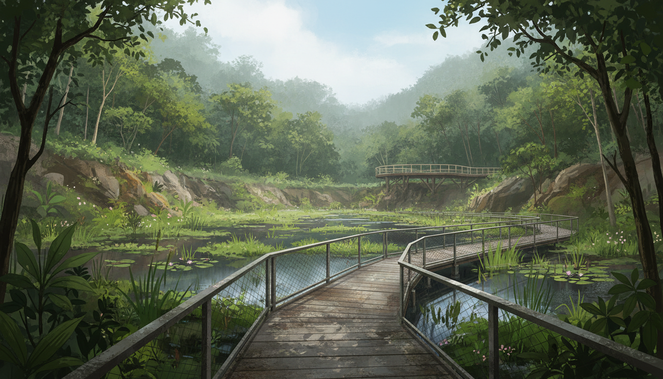
Two relatively small but important Bukit Timah pedestrian improvements deserve attention during 2027. The local Town Council has listed a barrier-free ramp at Rifle Range Road and a footpath near an Esso petrol station, described in its 2025 future-plan booklet as being on “Yarrow Ave”. There is an important naming issue: other authoritative road and drainage records use the established name Yarwood Avenue.
The connection to 2027 becomes more specific when we look at PUB’s drainage work: its 9 October 2025 project register gives Q2 2027—April through June—as the then-targeted completion period for roadside drainage work at Yarwood Avenue. That is a real published target, but does not prove the footpath and drain works are one contract or that both will finish on the same day. Similarly, the planned Rifle Range Road ramp must not be confused with the 700-metre accessible route already available inside Rifle Range Nature Park.
For residents near Rifle Range Road, Yarwood Avenue, Dunearn Road, King Albert Park and the western Bukit Timah estates, the most useful information is which route is genuinely step-free, which project needs a newer notice and how to travel safely around work. This guide is based on government information checked 4 November 2026, with proposed infrastructure kept separate from completed facilities.
In this guide
- The essential 2027 facts
- Why two small projects deserve one careful guide
- What exactly is planned at Rifle Range Road?
- Why the final location of the ramp matters
- What counts as barrier-free access?
- The existing Rifle Range Nature Park is not waiting for the ramp
- The existing 700-metre accessible park route
- Park entrances are not all interchangeable
- The Quarry Wetland as a learning destination
- Why cycling and pets are restricted
- The Rifle Range ramp is not the Truss Bridge staircase
- A ramp is not automatically a bridge or lift
- The other project: a footpath near an Esso station
- Is the road called Yarrow Avenue or Yarwood Avenue?
- Why one letter in a road name matters
- What is the connection with the Esso station?
- Does a footpath need to be sheltered?
- What does the national footpath standard say?
The essential 2027 facts
- Future-plan item 33: a barrier-free ramp at Rifle Range Road.
- Future-plan item 16: a footpath labelled “Yarrow Ave, near Esso Station” in the local Town Council’s 2025 publication.
- Naming caution: official road and PUB drainage records refer to Yarwood Avenue; the intended exact location should be confirmed with the project authority rather than treat the spelling difference as an engineering drawing.
- PUB Yarwood drainage: the October 2025 register shows a Q2 2027 indicative completion target for the separate roadside-drain project.
- No exact footpath date: the Town Council list does not specify a confirmed 2027 opening day or length for the proposed footpath.
- No exact ramp date: the list also does not establish the Rifle Range roadside ramp’s final design, contractor or public-opening date.
- Existing Rifle Range Nature Park: open 7am–7pm, with the 700m barrier-free Visitor Pavilion–Quarry Wetland route.
- Park address: 126 Rifle Range Road, with multiple official entrances across the surrounding area.
- Park restrictions: no pets, cycling, fishing or motorised mobility devices in Rifle Range Nature Park under its current published rules.
- Footpath design: the national LTA response from 2 March 2026 explains minimum widths for new standalone footpaths and those beside cycling paths, subject to site constraints.
- Practical task: identify the exact path and whether it is available, safe and continuously accessible before relying on it.
The primary evidence comes from the Town Council’s Bukit Timah future plans, PUB’s drainage improvement register, and NParks’ Rifle Range Nature Park information.
Why two small projects deserve one careful guide
A path may look like a short piece of pavement on a map, but its value depends on what it connects.
A resident may need to reach public transport, a nearby shop, a recreation area or the home of a family member. A high kerb or an interrupted path can make an otherwise manageable journey difficult.
The Rifle Range and Yarwood proposals concern different locations and different kinds of work. They share a broader purpose: making everyday movement safer and more practical.
Residents should be able to follow them without assuming that both form one continuous walking route or that progress at one automatically tells us the status of the other.
What exactly is planned at Rifle Range Road?
The local future-plan list includes “Barrier-free ramp at Rifle Range Road” as item 33.
That is a specific accessibility intention, but the short listing does not show an approved ramp footprint, the exact affected road segment or the final crossing arrangement.
A barrier-free ramp generally helps people overcome a change in level without using steps.
It can be valuable for wheelchair users, people using walking aids and parents moving with strollers.
However, a project labelled barrier-free must be evaluated through the actual finished route; one ramp cannot guarantee all nearby paths are accessible.
Why the final location of the ramp matters
Rifle Range Road connects different destinations and outdoor recreation areas.
A ramp near one particular access point does not automatically help every person trying to reach the park, a residential street or the Rail Corridor.
The final alignment must relate to where people start and where they need to go.
Until a detailed notice or updated map identifies the actual location, it is unwise to recommend the proposed ramp as an already available entrance.
The original one-line plan is sufficient evidence of intent, not a public walking instruction.
What counts as barrier-free access?
A route should allow a person to move between its relevant endpoints without an unavoidable staircase or unsafe obstacle.
Important considerations can include surface, slope, sufficient clear width, turning space, kerb ramps and safe crossings.
A feature may look accessible in a photograph but become unusable when the route ends at a high step.
That is why parents and residents should check the entire journey.
An official accessible facility listing is useful, but the details of a proposed new route still require confirmation.
The existing Rifle Range Nature Park is not waiting for the ramp
Rifle Range Nature Park officially opened in 2022 and is already an operating public nature park.
NParks lists its address as 126 Rifle Range Road, with opening hours 7am to 7pm.
The park occupies about 66 hectares on land that includes the former Sin Seng Quarry site.
It has walking routes, viewpoints and ecological features that visitors can enjoy now, subject to current closure and weather conditions.
The 2025 neighbourhood ramp proposal does not mean the entire nature park remains unopened until 2027.
The existing 700-metre accessible park route
NParks expressly lists a 700m barrier-free route between the Visitor Pavilion and Quarry Wetland for wheelchair users.
This is a concrete existing feature.
It does not prove every trail in the 66-hectare park is wheelchair accessible. Some trails have steps, uneven terrain or more demanding walking conditions.
A family with a wheelchair user can plan around the specified accessible segment, using the correct entrance and current map.
The proposed Rifle Range Road ramp would require its own public status and connection information.
Park entrances are not all interchangeable
NParks identifies entrances serving Rifle Range Nature Park from Rifle Range Road, Upper Bukit Timah Road, Hindhede Drive, Jalan Kampong Chantek and the Rail Corridor.
Different entrances lead to different parts of the trail network and may have different surface and slope conditions.
A visitor should not assume that every entrance directly connects to the same barrier-free path.
For anyone needing step-free access, the starting entrance is as important as the destination.
Use NParks’ current visitor map and any local signs rather than a general navigation pin alone.
The Quarry Wetland as a learning destination
The park has transformed a former quarry setting into a nature and recreation landscape.
The Quarry Wetland provides opportunities to observe plants and wildlife from designated accessible areas.
A child can learn about how a site previously used for extracting rock changes when it is restored for ecological and public purposes.
That educational value does not depend on entering restricted terrain or collecting wildlife.
Visitors should stay on marked routes, avoid feeding animals and respect the conservation role of the park.
A nature park is not the same as an unrestricted playground.
Why cycling and pets are restricted
NParks lists pets, fishing, cycling and riding a motorised mobility device as prohibited activities in Rifle Range Nature Park.
These restrictions support the safety and ecological management of the area.
A resident should not assume that a new barrier-free roadside ramp grants permission to cycle through the protected park or bring a dog along every trail.
Different nearby spaces have different permitted uses.
For a bicycle outing, use authorised roads, park connectors or Rail Corridor sections where cycling is allowed under their particular rules.
The new ramp’s public-use arrangements must also be confirmed when opened.
The Rifle Range ramp is not the Truss Bridge staircase
Another two future-plan items concern temporary railings and lighting for an existing staircase on Bukit Timah Road and a new temporary staircase at Rifle Range Road leading towards Bukit Timah Truss Bridge.
Those are staircase projects.
The separate barrier-free ramp at Rifle Range Road is its own listed item and should not be reported as the same thing.
A staircase can improve access for people able to climb steps while remaining unsuitable for a wheelchair user.
The separate Bukit Timah 2027 Truss Bridge access guide explains those historic railway approaches.
A ramp is not automatically a bridge or lift
A ramp, lift and staircase solve different physical movement problems.
A ramp provides a sloped passage. A lift transfers people vertically through mechanical equipment. A staircase allows pedestrians to negotiate levels using steps.
A proposal for one does not establish that another is included.
Residents sometimes encounter a headline about a new lift at Binjai Bridge and assume it applies to every accessible feature in Bukit Timah.
These are separate locations with their own works. An accurate guide names the actual asset and the people who can use it.
The other project: a footpath near an Esso station
The Town Council’s local future-plan list includes “Footpath along Yarrow Ave, near Esso Station” as item 16.
A footpath can provide pedestrians with a clearer route alongside a residential street where cars, deliveries and driveway movements also occur.
However, the original item does not show the exact length, which side of the road is involved or any approved sheltered structure.
A resident should not describe it as a complete, fully sheltered linkway until the official design and finished condition establish that.
The correct local place name requires particular attention.
Is the road called Yarrow Avenue or Yarwood Avenue?
This is one of the most useful pieces of information in the entire guide.
The 2025 Town Council future-plan list uses “Yarrow Ave”.
But established road references and PUB’s drainage-project records use Yarwood Avenue near Dunearn Road. A related local article notes the project landmark as the Esso station.
The most responsible wording is that the council’s Yarrow-labelled footpath entry appears to refer to the Yarwood Avenue locality, but the exact worksite alignment must be verified with the authority.
Do not silently rewrite a source quote or claim that a one-line plan provides an exact map.
Why one letter in a road name matters
A street name directs delivery vehicles, school transport, residents and emergency responders.
If an article mixes up two similar names, it can lead someone to the wrong location or create confusion about a scheduled road closure.
The distinction is more important when discussing technical projects, because a drain contract and a footpath construction notice may refer to their own authoritative road identifiers.
Whenever a newer worksite notice is published, use its officially recorded street name and location.
Careful naming is part of reliable local reporting, not a minor editorial detail.
What is the connection with the Esso station?
The local future-plan entry uses an Esso station as a landmark.
Older local reporting and listings associate Esso Yarwood at 870 Dunearn Road with the relevant area.
This helps residents understand the locality, but a landmark does not establish the proposed footpath’s start and end points.
The exact approach near a petrol station can involve pedestrian and vehicle movements that require careful separation.
Do not cross a private forecourt or use a station driveway as a shortcut simply because a proposed public footpath is nearby.
Follow current public crossings and authorised routes.
Does a footpath need to be sheltered?
A footpath and a covered linkway are not identical.
The council’s listed item says footpath. It does not explicitly promise a roof, complete rain shelter or special lighting.
The final design may be affected by roadside space, utilities and trees.
An article should not advertise a sheltered walkway simply because nearby estates have received sheltered paths under other projects.
The correct update would cite a new official drawing or site notice naming the final features.
This is another reason to preserve the original project’s precise terminology.
What does the national footpath standard say?
In a 2 March 2026 parliamentary reply, the Ministry of Transport stated that new standalone footpaths have a standard minimum clear width of 1.8 metres since 2018.
For footpaths next to cycling paths, the corresponding clear-width standard is 1.5 metres.
MOT also explained that old footpaths are widened towards those standards when renewed unless site constraints prevent it, for example where roadside space is limited.
These are national design guidelines, not proof that the particular Yarwood project will have a precise finished width.
Read MOT’s barrier-free access reply for its exact wording.
Why site constraints can change a footpath design
An existing residential street may have trees, drain lines, driveways, utility boxes or narrow road reserves.
Adding or widening a footpath can require decisions about these existing features.
The correct engineering response is not necessarily to remove everything or reduce every nearby road lane.
A qualified project team must consider safety, utility protection and available public land.
Residents can describe obstacles they experience, but should not treat the national standard as a guarantee that an old narrow road can always accommodate a full-width path without trade-offs.
Roadside drainage at Yarwood Avenue: a real Q2 2027 target
PUB’s drainage improvement register updated 9 October 2025 lists “Drainage work at Yarwood Avenue” with an indicative Q2 2027 target completion.
Q2 means April, May and June.
This is a more specific published time window than the footpath item, which gives no individual completion date.
But it remains a dated target, not a confirmed 2027 final handover or road reopening.
A newer PUB bulletin or the project team’s on-site notice should take precedence if the schedule changes.
Are the footpath and drainage the same contract?
The Town Council’s footpath proposal and PUB’s roadside-drain project are recorded under different programme names.
They may affect related geography, and some public footpath improvements can be coordinated with drainage works.
But the sources reviewed do not establish that these two specific items have been contracted as one inseparable project.
Do not automatically apply the Q2 2027 drain completion target to the footpath’s opening.
A later official notice could clarify coordination, scope and access. Until then, track the two independently.
How drainage works can influence walking comfort
A roadside drain collects runoff from the road and adjacent surfaces.
If drainage is poor, water may pond in a pedestrian route after intense rainfall.
A renovated drain and an appropriate walkway design can complement each other when properly planned.
However, an improved local drain does not make every route flood-free or remove the need for warning signs.
The real system includes smaller inlets and larger downstream infrastructure.
PUB says no drainage system can eliminate every flood risk.
The completed Upper Bukit Timah Canal is separate
On 23 October 2026, PUB announced completion of the 2.3km Upper Bukit Timah Canal upgrading, including the final stretch from Rifle Range Road to Jalan Kampong Chantek.
It reports approximately 30% greater stormwater conveyance capacity.
That achievement does not mean Yarwood Avenue’s separate roadside drains were completed on the same day.
Nor does a canal upgrade confirm the new footpath or Rifle Range Road ramp is open.
Residents should keep each project name and agency source distinct.
The wider Bukit Timah 2027 drainage guide provides further background.
What should parents do around temporary roadworks?
A parent should check the actual school-time walking route when worksite barriers appear.
A path can be open during one stage and diverted during another.
Children should use designated crossings and avoid stepping into the road to bypass fencing.
Do not assume a project announcement means a particular school bus stop has moved.
Check the responsible transport or road authority’s current notice and discuss any necessary changes with the child.
A short practice journey can help reduce confusion during busy mornings.
Older residents and people using walking aids
A person using a wheelchair or walking frame may find a brief diversion more difficult than a healthy adult.
The entire route should be assessed for surface, kerbs, slope and safe crossing points.
If the designated path is unusable for a mobility aid, describe the exact barrier to the relevant project authority.
A resident should not have to rely on an informal shortcut through vehicle traffic merely because an ordinary path is closed.
Accessibility is about the continuous journey, not an isolated ramp or a wheelchair icon beside a park listing.
Why a petrol-station entrance needs care
Petrol stations have vehicles entering and leaving, sometimes turning across pedestrian approaches.
A new footpath near an Esso station must be understood in relation to the approved crossings and driveway arrangements.
But the Town Council’s brief item does not provide an engineering plan that establishes an individual crossing geometry or relocation.
Residents should obey current traffic and pedestrian signs and avoid standing in vehicle access lanes.
If a genuine visibility issue is observed, report it with the correct location rather than speculate that the project must close the station.
Do cyclists use the same path?
Singapore distinguishes footpaths, cycling paths and pedestrian-only paths under its active-mobility rules.
The permitted use of a particular new or renewed public path should follow its actual classification and signs.
A project labelled simply “footpath” does not promise a new cycle lane or permission for every device.
MOT’s national guidance includes standards and enforcement responsibilities for different path types.
Parents should teach children to understand the path actually available, rather than assume all paved routes serve the same users.
For wider 2027 policy, see Bukit Timah cycling and mobility-scooter rules.
What about pets in the Nature Park?
The current Rifle Range Nature Park rules say pets are not permitted.
A dog owner may have suitable walking routes in other approved public areas, but should not treat an accessible road or park entrance as permission to take a dog into a protected nature park.
Similarly, public-space rules can vary between parks, nature reserves and neighbourhood footpaths.
Check the authority’s actual signs before entering.
The existence of a new barrier-free ramp would not by itself change the nature park’s protected-area rules.
Wet weather, slippery paths and flooding
Roadworks can create temporary surface conditions that require extra care during rain.
Residents should avoid floodwater, follow official warnings and not move barriers.
A proposed ramp should have suitable drainage and a safe surface, but those attributes must be assessed from the final design.
A project whose construction target is Q2 2027 cannot tell a resident what the water depth is during a storm this morning.
For live danger, use PUB’s current Get Flood-Wise information.
How to report a specific access concern
A useful report identifies the actual road or park entrance, approximate time and nature of the problem.
For example, a resident might describe a blocked footpath that forces a wheelchair user towards moving traffic.
A photo can help where taken safely.
Avoid disclosing another person’s health or identity details unnecessarily.
The responsible agency needs observable information to investigate.
A vague message that all Bukit Timah paths are inaccessible is less useful than a clear account of one precise obstruction.
What a proper new project notice should include
For the Rifle Range Road ramp, a strong notice would identify its actual alignment, access function, work period and public-opening arrangements.
For the Yarwood footpath, it would identify the exact road stretch, safe pedestrian diversion and any coordination with drainage works.
For the separate PUB project, a later completion notice should state what work has been finished and when.
A proposal, an active site, a contractor handover and a publicly open path are different stages.
A reader should not treat them as interchangeable.
A family nature outing without using the proposed ramp
Rifle Range Nature Park already has an accessible 700m Visitor Pavilion–Quarry Wetland route.
A family can plan a suitable visit using the official operating entrances and posted conditions now, without waiting for an unconfirmed future roadside connection.
Check the weather, park closing time and whether the route meets the needs of the group.
A parent can invite a child to observe how a former quarry landscape supports nature and recreation.
The outing should remain respectful of protected wildlife and safe marked paths.
Teaching children about real-world place names
The Yarrow/Yarwood spelling difference provides a useful example of information literacy.
A child can compare two official documents, note the difference and ask which source is identifying an actual legal road name.
That teaches the value of verification rather than copying the first word seen in a screenshot.
The child can also learn that a project can be real even when one document contains a typographical variation.
The appropriate response is to confirm the precise site, not invent a new road from a spelling discrepancy.
A Secondary-school planning exercise
Students can compare three kinds of public information: a local future-plan list, a national drainage work register and an NParks operating-facility page.
The local plan establishes intention. The PUB register provides a dated target for a particular drain. The NParks page describes an already operating park and accessible route.
Ask students why it would be wrong to combine all three into a statement that a new 700-metre public ramp opens in June 2027.
This develops the ability to recognise source scope, chronology and unsupported inference.
Those skills are useful far beyond geography or transport.
A practical 2027 monitoring checklist
- Identify the Rifle Range Road barrier-free ramp as its own future-plan item.
- Keep it separate from the Rifle Range Road temporary staircase to Truss Bridge.
- Use the current NParks route map for the existing 700m barrier-free park segment.
- Note the Yarrow spelling in the council document and verify the intended Yarwood Avenue road stretch.
- Track PUB’s Q2 2027 drainage target separately from the footpath.
- Check whether any worksite gives new road, pedestrian or bus-stop instructions.
- Follow current path and cycling rules, including NParks’ protected-area restrictions.
- Do not enter a fenced, unfinished or flooded area.
- Report inaccessible diversions with the exact location.
- Wait for a genuine public-opening notice before telling neighbours a proposed ramp or path is complete.
Frequently asked questions
Is a barrier-free ramp planned at Rifle Range Road?
Yes. It is listed separately in the Town Council’s April 2025 future plans.
Is Rifle Range Nature Park already open?
Yes. NParks lists the operating park at 126 Rifle Range Road, generally open 7am to 7pm.
Is there an existing wheelchair-friendly route inside the park?
NParks confirms a 700m barrier-free route between the Visitor Pavilion and Quarry Wetland.
Does that mean all park trails are accessible?
No. The specified route does not automatically cover every trail or entrance.
Is the new roadside ramp the same as the Truss Bridge staircase?
No. They are separate projects with different access characteristics.
Is the road called Yarrow or Yarwood Avenue?
The Town Council’s 2025 footpath item says Yarrow Ave, while official road and PUB drainage records use Yarwood Avenue. The exact intended construction site should be confirmed by the project authority.
When is Yarwood Avenue drainage expected to finish?
PUB’s October 2025 register gives an indicative Q2 2027 completion target, subject to later updates.
Does that set the footpath’s opening date?
No. The footpath and drainage appear in separate records and should not be assumed to share one contract or schedule.
Is the planned footpath fully sheltered?
The public future-plan item says footpath, not a confirmed covered linkway.
Can residents cycle in Rifle Range Nature Park?
NParks’ current rules say cycling is not permitted in the nature park.
Official sources and related Bukit Timah guides
- Town Council: Bukit Timah future plans, items 16 and 33
- NParks: Rifle Range Nature Park, hours, accessible route and restrictions
- PUB: October 2025 drainage works list, Yarwood Avenue Q2 2027
- MOT: 2 March 2026 response on new and renewed footpath widths
- PUB: Completed Upper Bukit Timah Canal upgrade, October 2026
- PUB: Flood-Wise information
- OneMotoring: Roadworks and current traffic notices
- eduKateSG: Earlier Yarrow footpath proposal
- eduKateSG: Yarwood spelling and PUB drainage guide
- eduKateSG: Rifle Range Road accessibility guide
- eduKateSG: 2027 Truss Bridge temporary staircases
- eduKateSG: Bukit Timah 2027 Eng Kong, Yarwood and Watten drainage
The takeaway: The Rifle Range Road ramp and the Yarwood-area footpath near Esso are legitimate but separately listed local improvement intentions, while PUB has a specific Q2 2027 drainage target for Yarwood Avenue. An existing 700m accessible park route is already available. For residents, the priority is to identify the correct road, project and access status rather than turn a 2025 plan into an unverified 2027 opening.