
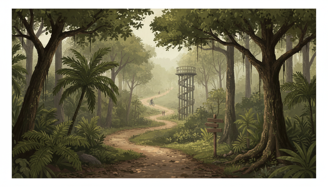
How do you visit Chestnut Nature Park, and is its hiking trail the same as its mountain-bike trail? Chestnut Nature Park, along the eastern end of Chestnut Avenue near Bukit Panjang and Upper Bukit Timah, is an 81-hectare free public nature park open 7am–7pm daily. NParks identifies two designated hiking choices: the 3.5km Northern Loop, graded easy, and the 2.1km Southern Loop, graded moderate. Separately, it provides 8.2km of mountain-bike trails with easy through extremely difficult sections, plus a Pump Track and Bike Park. The park is protected under the Central Nature Park Network: pets are not allowed, trails must be respected, and large organised groups need permits.
If you’re searching for Chestnut Nature Park opening hours, Chestnut observation tower, hiking trail difficulty, north loop, south loop, mountain bike trail, pump track, bike park, birdwatching, Bangkit LRT directions, Pending LRT access, Chestnut Point, nature photography or MTB safety in Bukit Timah, the key is choosing your activity first. The Observation Tower offers a raised viewpoint over the green surroundings, while hikers should stay on signed walking tracks and cyclists on designated bike routes. Bangkit and Pending LRT are nearby rail references named by NParks, but neither station is the trailhead itself; use the current map for the full last-mile approach and return.
Suggested first visit: take the easier Northern Loop if your group is new to natural-surface hiking, or the shorter but moderately difficult Southern Loop if comfortable with gradients. For cycling, inspect the difficulty symbols and choose an appropriate section; the Pump Track is designed for practising bike control, while the advanced Bike Park is not a beginner playground. Allow enough time to leave before 7pm, avoid forest trails during or just after severe weather, carry water and keep a respectful distance from wildlife. The park may be free, but an organised skills session, gear hire or specialist coaching can have separate charges.
Quick answers: the trails at a glance
| Experience | Official description | Important distinction |
| Northern hiking loop | 3.5km; easy | Walking, not a mountain bike route |
| Southern hiking loop | 2.1km; moderate difficulty | Shorter need not mean easier |
| Mountain biking trails | 8.2km across north and south | Graded easy to extremely difficult |
| Chestnut Pump Track | Banked turns, rollers and a fast bowl | Progressive riding practice, bicycle required |
| Chestnut Bike Park | Drop-offs, jumps, four progressive skill lines | Advanced technical riders |
| Observation Tower | Spiral viewing tower | Scenic views; obey barriers and weather |
| Park admission | Free for ordinary hiking and biking | Some classes and gear cost separately |
| Hours | 7am–7pm daily | No nighttime trail riding |
| Rail reference | Bangkit LRT and Pending LRT | Check last-mile directions |
| Pets | Not allowed anywhere in this protected park | Unlike leashed-dog routes at Bukit Batok Nature Park |
| Groups | Permit for activities involving more than 30 people | Apply at least one month ahead |
Contents: hiking, biking, wildlife and safety
- Where Chestnut Park is relative to Upper Bukit Timah
- The northern and southern hiking loops
- Mountain-bike trail grading and preparation
- Pump Track, Bike Park and observation tower
- Plants and threatened birds
- Separate hiking and cycling etiquette
- Families, beginners and accessibility
- Weather, closing time and group permits
- Frequently asked questions and official maps
1. Chestnut belongs to the wider Bukit Timah forest network
Although visitors may approach from Bukit Panjang, NParks places Chestnut in the Central Nature Park Network alongside forest landscapes surrounding Bukit Timah Nature Reserve.
That makes it a relevant nearby option for people exploring the wider Bukit Timah green corridor, but the park is not the Bukit Timah Hill summit and does not share its Hindhede Drive trailhead.
2. The official location is Chestnut Avenue
NParks describes Chestnut Nature Park as lying along the eastern end of Chestnut Avenue. Its walking and biking trails are distributed across the north and south portions of a sizable park.
Do not type only ‘Chestnut Road’ or assume that every point named Chestnut is the official trail entrance. Match your start to a current park map and the activity you intend to do.
3. Bangkit and Pending are LRT access references
The park information names Bangkit LRT and Pending LRT as nearby stations. These are on the Bukit Panjang LRT system, not on the Downtown Line itself.
Arriving at one of these stations still leaves a walk or other travel to the actual park entrance. Plan the final leg from a map rather than promising a five-minute transfer.
4. Public transport directions can change
The NParks park page links a video showing public transport access, while official maps show the relevant approaches from surrounding roads and connections.
A rail station and a park map are more reliable starting points than an undated blog’s bus number. Check current transit before travelling, especially if carrying a bicycle.
5. Park hours are 7am to 7pm
The 81-hectare nature park is open 7am–7pm. Those hours are specific to Chestnut and should not be confused with the 24-hour public Rail Corridor nearby.
An evening ride should end with enough time to leave every protected trail before closing. Do not plan an unlit technical descent after dark.
6. Ordinary park access is free
NParks lists both hiking and mountain biking at Chestnut as free public park activities. Visitors do not need a general ticket simply to walk a designated trail.
Specialist coaching, bike rental, equipment repair or group events can have their own fees. Free entry is not a promise of complimentary bikes or instructors.
7. The park covers 81 hectares
NParks identifies Chestnut as 81 hectares, creating enough room for distinct hiking, biking and biodiversity areas.
Its scale is one reason to download a map before entering. A short loop choice and a long technical riding plan may begin near similar facilities but lead to different parts of the park.
8. The Northern hiking loop is 3.5km
The current NParks hiking activity page labels the Northern Loop 3.5km, easy. It is the longer but gentler of the two officially summarised hiking choices.
‘Easy’ refers to a relative trail grade, not necessarily paved or wheelchair-accessible terrain. Uneven earth, tree roots and heat can still demand care.
9. The Southern hiking loop is shorter but moderate
NParks lists the Southern Loop at 2.1km and moderate difficulty. A person comparing only distance might incorrectly assume this must be easier than the longer loop.
Consider terrain and fitness together. A shorter route with steeper sections may be more demanding than a longer gentle one.
10. Trail lengths are for designated loops
The official lengths refer to hiking loops, not door-to-door journeys from home or LRT. Travel from the chosen station, entrance and return must be added separately.
When planning with grandparents or children, calculate walking before and after the official loop as part of the day’s effort.
11. The 8.2km mountain-bike trail is separate
NParks gives a total 8.2km of mountain-bike trails with different difficulty levels. This is not an alternative description of the two hiking-loop distances.
Hikers should not follow a bike route because it looks shorter, and cyclists should not ride a footpath merely because it appears on the same map.
12. MTB difficulty runs from easy to extremely difficult
The mountain-bike activity page explicitly describes sections ranging from easy to extremely difficult, including technical terrain. The Northern and Southern portions do not have identical grades.
Riders should choose a trail appropriate to verified experience, not a route based solely on its length or the promise of an impressive video.
13. The Northern MTB loop has the widest grading range
NParks describes the Northern biking loop as combining easy, moderately difficult, very difficult and extremely difficult sections. It also contains the Pump Track and Bike Park.
A first-time mountain biker should identify the beginner-appropriate route on the official map instead of entering an advanced technical line from the wrong junction.
14. The Southern MTB loop is not a novice shortcut
The Southern biking portion is graded with moderately difficult and extremely difficult sections. That makes it unsuitable to present as an easy family cycling alternative.
Less-experienced riders can focus on controlled practice and choose simpler routes. Turning around is preferable to attempting a feature beyond your ability.
15. Chestnut Pump Track teaches movement
The Pump Track is made of banked turns and shaped features that riders negotiate by moving their weight up and down, rather than relying only on pedalling.
Balance, timing and control matter. A rider should wear appropriate protective equipment, observe the line and avoid collisions with others practising.
16. Four pump-track subsections offer progression
NParks describes the Pump Track as having one easy area, two intermediate areas and one fast bowl, which can be linked by riders ready for a continuous circuit.
Progression should be deliberate. A newcomer does not need to enter the fastest section during a first lesson.
17. The suggested pump bike is specific
The official guidance says the Pump Track is best enjoyed with a jump-specific hard-tail mountain bike. Other bikes may not have the same handling for a given feature.
A rider should confirm their bike is suitable and in good mechanical condition. Do not assume a road bicycle with thin tyres can safely perform a dirt-track jump.
18. The Bike Park is for seasoned riders
Chestnut Bike Park contains advanced drops and jumps, four progressive skill lines and a dedicated skills area. NParks explicitly describes it as a place for seasoned mountain bikers.
A visitor watching experienced riders should not imitate a jump without preparation. A difficult feature can cause serious injury when attempted beyond a rider’s ability.
19. Full-suspension bikes are recommended for the Bike Park
NParks states that the advanced Bike Park is best enjoyed with a full-suspension mountain bike. That is equipment guidance, not a guarantee that owning one makes every jump safe.
Technique, terrain inspection, brakes, tyres, helmet and experience still matter. The correct response to a risky feature is to skip it until properly trained.
20. Trails are designed for two different user groups
The park deliberately distinguishes hiking trails, mountain-bike trails and some shared connections. A hiker moves slowly and may stop to watch wildlife; a cyclist needs stopping distance and line visibility.
Respect every signed trail classification. Shared-use courtesy is not permission to enter bike-only or walking-only habitat sections.
21. How to behave on shared paths
Slow down near other users, yield safely according to posted etiquette, give warning before passing and keep enough space. Riders should anticipate walkers stopping unexpectedly.
A family walking side by side should also avoid blocking an entire narrow trail. Cooperation reduces conflict and preserves access.
22. Check the route before crossing a junction
Park maps show many intersections among paths, huts and vegetation. A hiker who follows tyre marks may end on a technical descent.
Use route colours and current signs, then return to a known junction when uncertain. Do not cut through forest to rejoin another trail.
23. The Chestnut Observation Tower provides a scenic goal
NParks lists a spiral Observation Tower among the park’s special features, offering views of the surrounding green landscape.
Check any temporary tower or access restrictions before relying on the viewpoint. The raised feature requires ordinary height and railing safety.
24. Scenic viewpoints are not places for dangerous photos
The observation tower is for looking out, not climbing its exterior or balancing over the rail. Visitors should move politely on staircases and platforms.
If severe wind, rain or lightning develops, leave exposed elevated structures and seek substantial safe shelter.
25. Birdwatchers can look for threatened forest birds
NParks highlights the Straw-headed Bulbul and Brown-chested Jungle Flycatcher as globally threatened species associated with Chestnut Nature Park.
These are possible wildlife subjects, not scheduled sightings. Observe quietly and do not broadcast calls or chase birds into closed habitat.
26. The Straw-headed Bulbul is worth protecting
Its distinctive song and threatened status make it of particular interest to birdwatchers. Illegal collection and habitat threats have affected wild populations in the region.
Never approach nests, collect eggs or disclose sensitive nesting locations carelessly. Conservation matters more than obtaining a perfect photograph.
27. The Singapore Walking-Stick Palm is unusual
NParks describes this palm as reaching about five metres and having leaflets arranged in two rows. It is one of the named plants visitors can learn about.
Read a label and observe the whole form before guessing an identity. A plant name in an official species list doesn’t mean it grows at every trail entrance.
28. Braided Chestnut is a rare native tree
The park highlights the critically endangered Braided Chestnut, which can reach roughly 30 metres at maturity. Its presence adds significance beyond the park’s recreational function.
Do not remove nuts, seeds, leaves or bark. A rare tree’s reproductive material may be important to ongoing ecological processes.
29. Jelutong adds another native forest example
NParks identifies Jelutong by its whorled leaves and pale five-petalled flowers. It can be interesting to compare with familiar planted roadside trees.
A forest trail isn’t an organised botanical garden with every tree labelled. Take notes and leave uncertain identifications open.
30. The area is part of the Central Nature Park Network
Chestnut is intended to help protect and buffer the biodiversity of Singapore’s central forests while allowing managed recreation.
That explains trail separation, no-pet rules and limitations on large activities. Access and conservation must coexist.
31. Pets are not permitted
The official park page clearly says no pets to protect wildlife. That includes dogs on a leash; it is not a general dog-walking path.
Choose nearby Bukit Batok Nature Park if a leashed dog outing is central to the plan, noting that park has different rules.
32. The park is not a place to release animals
Releasing turtles, fish or unwanted pets can disrupt natural ecosystems and harm the released animal. NParks’ trail etiquette prohibits such actions.
Seek appropriate animal welfare advice instead. A green forest is not an automatic suitable home for a captive pet.
33. Do not feed monkeys or other wildlife
Wild animals can associate humans with food if visitors feed them. That may encourage approaches and conflict, especially around visible snacks and plastic bags.
Keep food packed away, watch from a safe distance and follow NParks’ encounter guidance. A monkey is not a trained photo companion.
34. Leave sensitive forest floor undisturbed
Off-trail walking damages small plants, roots, fungi and soil. A tempting shortcut can become an eroded path when repeated by others.
Use marked walking routes even if a natural obstacle makes you slow down. Do not rearrange rocks or break branches to create a path.
35. Thunderstorms change every outdoor plan
Uneven soil, roots and rock surfaces can become slippery after rain. Lightning raises the risk on open trails and especially elevated towers.
NParks hiking guidance recommends avoiding forested areas during and immediately after bad weather. Reschedule rather than pushing through for exercise.
36. Carry water but secure food
Singapore’s heat can be tiring even under a rainforest canopy. Bring drinking water, suitable footwear and an up-to-date route map.
Do not leave rubbish on trails, and keep food out of sight around macaques. Pack light enough to walk and exit safely.
37. A sensible 60–90-minute introductory visit
Choose a reachable section of the easier Northern Loop, spend time observing the forest and turn around based on the group’s ability and the official connections.
Do not guarantee that a complete 3.5km loop plus the LRT approach takes one hour for everyone. Travel and rest vary.
38. A full easy Northern Loop outing
For walkers with appropriate fitness, the 3.5km designated loop can make a satisfying nature excursion. Allow extra time to read signs, look for birds and navigate the chosen entrance.
The ‘easy’ grade should be understood in relation to natural walking trails, not an indoor treadmill. If anyone is uncomfortable, shorten the plan.
39. A more challenging Southern Loop outing
The 2.1km Southern Loop may suit walkers who want a moderate natural-surface route. Choose it because the grade fits, not because the shorter number looks easy.
Plan a careful pace, keep space on slopes and obey any diversion. A moderate grade can feel more difficult after rain.
40. Beginner mountain biking requires realistic assessment
A person comfortable cycling on a flat PCN may still be new to loose dirt, banked turns and steep descents. Basic braking and line selection matter.
Begin only on an appropriate easy route and consider a qualified coached lesson if necessary. A trail sign cannot replace skill development.
41. Children need age-appropriate outdoor choices
A child may enjoy a short guided nature observation more than a long technical mountain-bike ride. The park’s MTB facilities are not a general playground.
Keep younger children with supervising adults, stay away from technical bike lines and decide the turnaround distance together.
42. Older walkers should choose the terrain, not just distance
An older adult in good hiking shape may manage the Northern Loop, while someone with limited balance might prefer a defined urban garden path elsewhere.
A nearby station or park amenity does not make Chestnut’s entire trail system wheelchair-accessible. Ask NParks about current suitable access when needed.
43. A school-group outing requires a permit above 30
The park requires organisers of activities involving more than 30 people to apply for a permit at least one month in advance.
Large groups should plan route choice, supervision, weather fallback and trail etiquette instead of overwhelming narrow wildlife paths.
44. Volunteering is a different way to know the park
NParks mentions a Friends of Chestnut Nature Park initiative. Interested visitors can learn about conservation beyond ordinary hiking.
Participation depends on current programme availability; an information page doesn’t guarantee an open volunteer slot on a specific date.
45. Can the hike be combined with another nearby park?
Chestnut lies near Zhenghua and Dairy Farm in Singapore’s green network, but crossing between parks can involve considerable distance, roads and different trail rules.
Choose one park for a first visit and use a current map before promising a continuous walking loop across multiple destinations.
46. A bike rental is not guaranteed at the entrance
The park’s free biking facilities do not establish a permanent, open rental counter or a bike suitable for every rider at the trailhead.
Bring a properly maintained suitable bicycle or verify a provider before travelling. Protect your helmet, repair kit and water supply.
47. Avoid improvised riding after the gates close
The protected nature park closes at 7pm, so finishing a difficult descent after dark is not a safe or authorised plan.
Work backward from sunset and the length of the route. Choose a shortened, easier path when the group is running out of time.
48. Why the park deserves a focused guide
Chestnut brings together unusually distinct official activities: two separate hiking loops, progressive MTB routes, a pump track, an advanced Bike Park and an observation tower.
That is far more precise than telling every visitor to ‘go cycling in Bukit Timah’. The right choice depends on the visitor, the activity and current site conditions.
49. A good visit ends with a safe exit
Before leaving, check that everyone has their belongings, all food and rubbish are removed, and that the group is returning by the correct signed route.
A trail’s environmental and safety rules make the recreation sustainable for the next person and the wildlife that lives there.
50. The essential 2026 takeaway
Chestnut Nature Park is free, 81 hectares, open 7am–7pm, and has hiking trails of 3.5km easy and 2.1km moderate plus 8.2km of separate cycling trails.
Keep pets out, respect trail grades and wildlife, and plan from the actual Chestnut Avenue access rather than confusing the park with Bukit Timah Nature Reserve.
Frequently asked questions: Chestnut Nature Park
Is Chestnut Nature Park free?
Yes. NParks lists its hiking and biking routes as free for ordinary public park visitors.
How large is Chestnut Nature Park?
81 hectares, according to NParks’ current page.
What time does the park open?
7am–7pm daily, subject to site advisories.
Is the park in Bukit Timah itself?
It lies along Chestnut Avenue near Bukit Panjang in the wider Bukit Timah/Central Nature Park Network, not at the Bukit Timah summit.
What is the northern hiking loop distance?
3.5km, graded easy by NParks.
How long is the southern hiking loop?
2.1km, graded moderate difficulty.
Is the shorter loop easier?
Not necessarily. The shorter Southern Loop is officially graded moderate while the longer Northern Loop is easy.
How long are the mountain-bike trails?
8.2km in total, with different difficulty sections.
Can beginners cycle at Chestnut?
Some cycling sections are graded easy, but choose a route suited to actual experience and equipment.
Is the Southern mountain-bike loop easy?
No. NParks describes moderately difficult and extremely difficult sections.
What is the Pump Track?
A circuit of banks and rollers for practising riding control through pumping movement.
Can children try the pump track?
Only if they have suitable skills, equipment and supervision and choose a section appropriate to their ability.
Does Chestnut have a Bike Park?
Yes. Its advanced park includes drops, jumps and four progressive skills lines.
Is the Bike Park for beginners?
NParks expressly describes it as intended for seasoned technical riders.
What bike suits the Pump Track?
NParks recommends a jump-specific hard-tail mountain bike.
What bike suits the advanced Bike Park?
NParks recommends a full-suspension mountain bike, combined with sufficient skill and protective gear.
Is there an observation tower?
Yes. NParks lists the spiral Chestnut Observation Tower as a special feature.
Can I photograph from the tower?
Use permitted public viewpoints and keep behind safety railings; leave during severe weather.
Are dogs allowed?
No. The park prohibits pets to protect wildlife.
Can I walk on the mountain-bike trails?
Follow the exact walking, riding and shared-use signs. Bike-only trails should not be used as walking shortcuts.
Can cyclists ride anywhere in the park?
No. Use designated bike routes and respect their grades.
Which railway stations serve the park?
NParks lists Bangkit and Pending LRT as nearby stations; the final connection still needs planning.
Is the park next to Beauty World MRT?
No. Beauty World is associated with Bukit Timah Nature Reserve and Rifle Range Park; Chestnut has separate Bukit Panjang-side access.
Is there parking?
The map marks Chestnut Point and parking areas. Check current access and charges directly before driving.
Can I hike at night?
No. The nature park closes at 7pm.
Is it safe to hike after heavy rain?
Wet natural paths can be slippery; NParks advises avoiding forested areas during and immediately after bad weather.
Can I feed birds or monkeys?
No. Wildlife feeding disrupts behaviour and can create conflict.
What endangered birds are listed?
NParks names Straw-headed Bulbul and Brown-chested Jungle Flycatcher as examples; sightings cannot be guaranteed.
What are the special plants?
Singapore Walking-Stick Palm, Braided Chestnut and Jelutong are highlighted by NParks.
Can I collect chestnuts?
No. Do not remove plant material from protected nature areas.
Do organised groups need permission?
Activities involving more than 30 persons require a permit at least one month in advance.
Is it stroller friendly?
Do not assume a natural hiking loop is suitable for a stroller; assess route surfaces and current accessibility.
How long should I set aside?
Allow sufficient time for the selected loop, transit, water breaks and return before 7pm; no one fixed duration suits all visitors.
Are bicycles provided free?
Free trail entry does not mean bike rental is included. Confirm any equipment provider independently.
Is the Observation Tower the same as Colugo Deck?
No. Colugo Deck is at Rifle Range Nature Park; Chestnut has a separate observation tower.
Where can I download the official map?
Use NParks’ Chestnut Nature Park page and its separate hiking and mountain-biking activity guides.
Explore related Bukit Timah nature experiences
- Bukit Timah Nature Reserve summit hiking
- Dairy Farm Nature Park and Wallace Trail
- Rifle Range Nature Park and Colugo Deck
- Bukit Timah biking routes and trail etiquette
- Bukit Timah birdwatching and nature walks
- Free and inexpensive outdoor visits
Official maps, trail grading and conservation sources
Last editorial review: 23 October 2026. All route distances, difficulty grades and opening rules are sourced from NParks; maps should be checked again before travelling for closures or revised trail alignments.
- NParks — Chestnut Nature Park, 81ha, 7am–7pm, species, tower and pet rules
- NParks — Northern 3.5km easy and Southern 2.1km moderate hiking loops
- NParks — 8.2km bike routes, Pump Track and advanced Bike Park
- NParks — hiking safety and poor-weather etiquette
- NParks — respectful wildlife encounters
- NParks Friends of the Parks — volunteering and stewardship initiatives
- Meteorological Service Singapore — current rain and lightning warnings