
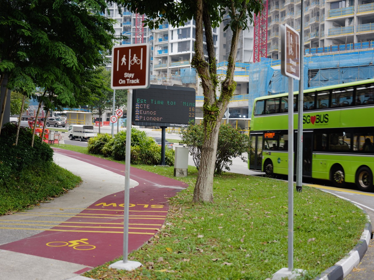
Where can you cycle in Bukit Timah? For a relaxed shared-path ride, start with the Rail Corridor or one of the official park connectors near Hillview. For more demanding off-road cycling, the Bukit Timah Mountain Bike Trail is a 7km intermediate-to-advanced technical route, while Chestnut Nature Park offers 8.2km of dedicated mountain-bike trails and separate skills features. They are not interchangeable. A path that is pleasant for a family bicycle ride is very different from a narrow off-road trail with steep technical descents.
This guide answers the practical questions people ask when searching for things to do in Bukit Timah, cycling routes, bike trails, mountain biking and the Rail Corridor. Which paths actually allow bicycles? What is suitable for beginners? How far are the rides? Can you cycle over a historic railway bridge? Can you bring a bicycle on the MRT? Which parks prohibit riding? We will separate the official rules from the easy assumptions that can send a cyclist onto the wrong trail.
The most important details for 2026 are these: the Rail Corridor has a 10km/h cycling limit, and cyclists must dismount and push their bikes across its bridges. Only designated mountain-bike trails allow mountain biking in the protected Bukit Timah area. Cycling on Hindhede Nature Park, Rifle Range Nature Park, Singapore Botanic Gardens, Wallace Trail and Chestnut’s hiking trails is prohibited. For an enjoyable first outing, choose a route that matches the least experienced rider, verify the latest access map and plan where to turn around.
Quick answer: the best Bukit Timah cycling routes
- For a relaxed railway heritage ride: Use an open and permitted portion of the Rail Corridor around King Albert Park and Hillview. Keep left, observe the 10km/h maximum, give way to pedestrians and dismount at bridges.
- For a challenging technical mountain-bike ride: Choose the 7km Bukit Timah Mountain Bike Trail, which NParks rates intermediate to advanced. Expect technical climbs, fast descents, rocks and blind corners.
- For a graded MTB trail network: Chestnut Nature Park has 8.2km of dedicated mountain-bike trail, with a Northern Loop, Southern Loop, pump track and advanced bike park features.
- For an approachable park connector by Hillview: The Hillview Park Connector is 2.05km, connecting the Dairy Farm Road side towards Bukit Batok Nature Park.
- For a waterway-style green ride: The Dairy Farm Park Connector is 2.1km, connecting Zhenghua Nature Park with Dairy Farm Road opposite Hillview MRT.
- For a shorter connector with local history: The Bukit Timah Park Connector is 1.6km, from Hindhede Drive along Upper Bukit Timah Road and Old Jurong Road to Bukit Batok Nature Park.
- For cycling with younger or inexperienced riders: Start on a suitable designated cycling path or park connector and practise turning, controlled braking and yielding to pedestrians.
- For wildlife-sensitive protected parks: Check the no-cycling list before you go. The fact that a park has a boardwalk or path does not mean bicycles may use it.
- For a partial train-and-ride trip: Only compliant folded bicycles are allowed on MRT or buses, subject to the 120 × 70 × 40cm folded-size requirement and carriage rules.
- For longer rides beyond Bukit Timah: Read current Rail Corridor closures and diversion maps. Its planned full length is not evidence that every stretch is open for through-cycling now.
This is a guide to selecting the right riding environment, not a promise that every named trail is open at every moment or safe for every rider. Check the official map, current trail notices and your equipment before leaving.
Compare Bukit Timah cycling options at a glance
| Location or route | Route type | Official length | Rule / difficulty | Suitable for | Important detail |
|---|---|---|---|---|---|
| Rail Corridor (open Bukit Timah sections) | Shared recreation | Varies by chosen segment | 10km/h; yield; push bike at bridges | Beginners with shared-path confidence | Check surface and current closures |
| Bukit Timah Mountain Bike Trail | Dedicated technical MTB | 7km, 23 sections | Intermediate–advanced | Experienced mountain bikers | Rock gardens, drops, technical climbs |
| Chestnut MTB Trail Network | Dedicated mountain biking | 8.2km, North and South Loops | Easy through extremely difficult segments | Mountain bikers matching graded lines | Pump Track and advanced Bike Park |
| Hillview Park Connector | Public park connector | 2.05km | Shared-path and crossing etiquette | Neighbourhood leisure cycling | Dairy Farm Road to Bukit Batok Nature Park |
| Dairy Farm Park Connector | Public park connector | 2.1km | Shared-path and crossing etiquette | Greenway and waterway ride | Zhenghua to Dairy Farm Rd / Hillview |
| Bukit Timah Park Connector | Public park connector | 1.6km | Shared-path and crossing etiquette | Short local connector ride | Hindhede Drive to Bukit Batok Nature Park |
| Hindhede Nature Park | Nature walking park | Various | Cycling prohibited | Walkers only | Do not ride to quarry viewpoint |
| Rifle Range Nature Park | Nature walking park | Various | Cycling prohibited | Walkers only | Colugo, Rambai and Gliders not bicycle trails |
| Wallace Trail, Dairy Farm | Nature walking trail | 2.2km one way | Cycling prohibited | Hikers only | Do not confuse with designated MTB track |
| Chestnut hiking trails | Nature walking paths | Various | Cycling prohibited | Hikers only | Use separate MTB loops |
| Singapore Botanic Gardens | Botanical garden paths | Various | Cycling prohibited | Walkers only | Use external permitted cycling routes |
A route’s published length describes that route, not necessarily the distance from your home, the MRT or a car park and back. Some are point-to-point connectors; others are loops or technical circuits. Choose an exit and turnaround plan before treating a distance as the total ride.
Contents: choose your route and ride responsibly
- How to choose between shared cycling and mountain biking
- Bukit Timah Mountain Bike Trail: the 7km technical challenge
- Chestnut Nature Park: the 8.2km MTB network
- Rail Corridor: cycling speed limit, bridges and etiquette
- Hillview and King Albert Park: railway heritage access
- Hillview Park Connector: a 2.05km alternative
- Dairy Farm Park Connector: 2.1km along the waterway
- Bukit Timah Park Connector: 1.6km and the former fire station
- Places where cycling is not permitted
- Which route is best for beginners, children and families
- Bicycles on MRT trains and public buses
- Cycling safety, equipment and trail courtesy
- Bad weather, wildlife and trail closures
- Four ready-to-use cycling itineraries
- Cycling, food stops and bike parking
- History, photography and the Rail Corridor
- Frequently asked Bukit Timah cycling questions
- Official sources and further reading
1. Start with the kind of bicycle ride you want
The phrase Bukit Timah cycling route covers several experiences that have little in common beyond two wheels. One person may be looking for a peaceful path where a child can ride a bicycle. Another may want the physical challenge of an off-road mountain bike loop. A third might be planning a longer journey that combines public paths, railway heritage and a practical meal stop.
The best way to begin is by naming the ride type, not simply the neighbourhood. A shared cycling route is used by pedestrians as well as riders and requires slow, considerate movement. A park connector provides a marked link among parks and neighbourhoods, sometimes with different path types. A mountain-bike trail is built for technical riding and requires equipment, skills and risk assessment beyond ordinary commuting.
Those differences affect the bike you should use. A commuter or folding bicycle may be suitable for a paved cycling path, but it is not automatically appropriate for steep, rocky singletrack. A mountain bike with suitable tyres and suspension can handle rougher terrain, but its owner still needs the handling skills to descend safely. Buying a capable bicycle does not automatically make a person a capable mountain biker.
For a mixed-ability group, choose the experience that every rider can do safely. The strongest rider should not quietly turn a leisurely outing into a technical ride because a more exciting trail is nearby. Agree on the route, distance and turnaround before meeting, and make it acceptable to shorten the day.
A quick decision test
Ask three questions. Can everybody stop and turn confidently? Does the route require technical skills or only ordinary cycling control? Can everybody understand the return plan? If the answers are uncertain, start on a suitable, clearly marked shared path rather than a forest MTB trail.
The same principle applies to adults who have not cycled for years. Balance and braking may return quickly, but confidence around pedestrians, crossings and slopes needs time. A short safe route is a better reintroduction than an ambitious map trace.
Why the word "trail" can mislead
Not all routes called trails permit cycling. The Wallace Trail in Dairy Farm Nature Park is a walking route where NParks prohibits cycling. Chestnut Nature Park has separate hiking and mountain-biking routes, and its hiking trails are off limits to cyclists. Likewise, a scenic boardwalk inside Rifle Range Nature Park is not a cycle path.
Start with the permission to cycle before deciding whether a route looks attractive. A beautiful forest photograph is not evidence that the photographer rode a bicycle to the location.
2. Bukit Timah Mountain Bike Trail: 7km and genuinely technical
Singapore’s Bukit Timah Mountain Bike Trail is a dedicated off-road riding route associated with Bukit Timah Nature Reserve and the Dairy Farm side of the area. NParks describes it as the oldest mountain-biking trail in Singapore, measuring 7km and suitable for intermediate to advanced riders.
This is not a gentle nature walk with a few bumps. The official description warns of fast descents, rock gardens, rock drops, blind corners and technical climbs. Those features require a rider to make controlled decisions in a changing environment, sometimes before the next part of the trail is fully visible.
The trail is divided into 23 sections, and NParks notes that there are multiple exit points which allow riders to skip certain sections and resume elsewhere. That is useful flexibility, but it is not permission to create a shortcut through protected forest. Use the official mountain-bike map and designated exits only.
Why 7km here is different from a 7km park connector
Distance tells you only one part of the challenge. On a paved path, seven kilometres might be a comfortable recreational ride for somebody with suitable fitness. On a trail with rocks, technical climbs and narrow corners, the same distance can feel very different.
The challenge is not just the strength needed to pedal uphill. It includes line choice, anticipating a corner, controlling speed on a descent, managing traction and knowing when to stop before a feature that is beyond your skill. A technical trail punishes overconfidence in ways an ordinary shared path usually does not.
If you are a novice who has only cycled on smooth pavements, the Bukit Timah MTB route is not a recommended first experience. Build basic control elsewhere and consider appropriate training before tackling advanced features.
How to reach the mountain-bike trail
NParks identifies the Hindhede Drive and Dairy Farm Road car parks as access options for riders who drive to the area. It also notes multiple permitted entry points for those riding in. Use its official mountain-bike trail map to choose the actual entry.
Do not navigate to Bukit Timah Hill’s public summit hiking trail and assume it doubles as the MTB entrance. The technical biking trail and the hiking routes are distinct facilities with different permitted uses. Riding on non-designated forest trails is not allowed.
A precise meeting point is important if you are riding with friends. "At Bukit Timah" can refer to the reserve visitor area, Dairy Farm, the MTB trail or the nearby railway corridor. Send the actual trail access and agree on the section where the group will begin.
What bike and equipment should you have?
Use a mountain bike suitable for off-road terrain and in sound mechanical condition. Check brakes, tyres, wheel security and shifting before setting out. Wear a helmet and appropriate safety gear. Carry drinking water, a phone and basic repair or first-aid items.
NParks recommends not riding mountain-bike trails alone. Riding with a companion improves your ability to manage a puncture, injury or navigation problem, especially on a more secluded technical route.
Do not begin with a group whose speed and skill greatly exceed your own. A good mountain-bike companion will agree on which features to avoid, where to regroup and what to do if anyone feels uncertain.
How to handle a difficult feature
A good rider knows when to stop. If a rock drop or blind descent is beyond your control, do not attempt it merely because other riders have done so. Use a designated alternative or exit if the official trail provides one. Never create a new track around an obstacle.
Give way to riders climbing uphill when the relevant trail etiquette requires it and follow any directional signs. Do not race into blind corners. Keep noise low, respect wildlife and remember that a protected forest is not a place to reshape the landscape for convenience.
The goal is to complete an enjoyable ride without damaging the trail or creating unnecessary danger. For the official 7km route and map, see NParks Mountain Biking at Bukit Timah Nature Reserve.
Why a nature-reserve no-cycling rule still matters
The dedicated mountain-bike trail is a specific exception within a protected-area network. It does not mean that general cycling is permitted on every hiking path, boardwalk or hilltop route. NParks’ active-mobility guidance restricts cycling on ordinary nature-reserve and nature-park trails unless a designated biking route permits it.
That distinction protects hikers from bikes where riding is not expected, and protects fragile habitat from improvised wheel tracks. Do not ride from a legitimate MTB segment onto the nearby hiking trail simply because the path appears broad enough.
3. Chestnut Nature Park: 8.2km of mountain-biking routes
For mountain bikers who want another technical environment, Chestnut Nature Park offers an 8.2km MTB trail network. NParks describes a Northern Loop and Southern Loop with differing difficulty, as well as a pump track and an advanced bike park.
The park itself is approximately 81 hectares, on the Chestnut Avenue side of the wider Bukit Panjang and Central Nature Park Network region. It normally opens 7am–7pm, with Bangkit and Pending LRT as the nearby transit references for general visitors.
Chestnut is not a simple add-on to the Bukit Timah summit. It is a distinct destination that deserves its own map and appropriate transport plan. Even if both appear in the same green network, that does not make every link a legal cycling route.
The Northern MTB Loop
NParks describes the Northern Loop as a mix of trail sections ranging from easy to extremely difficult. That is useful for riders who want to understand progression, but it does not mean they can ride the entire Northern Loop safely simply because one short section is labelled easy.
Look at the official colour and difficulty classifications for the segments you actually intend to use. Confirm where the easier parts begin, how to exit before advanced obstacles and whether a particular line is temporarily closed. If you are still building basic off-road control, keep your ride within an appropriate section.
The northern area also contains the Chestnut Pump Track and Chestnut Bike Park. They serve different purposes and should not be confused.
The Pump Track: practise the movement, not just speed
A pump track uses banked turns and changing ground contours so riders can gain momentum by moving their body up and down rather than relying only on continuous pedalling. NParks describes Chestnut’s track as offering different subsections, including an easier area, intermediate areas and a faster bowl.
This can help cyclists practise balance, weight transfer, looking through turns and controlling the bicycle at changing speeds. But beginners still need to choose the appropriate section, wear safety gear and respect other riders. A pump track may be more structured than a natural descent, yet an uncontrolled crash is still possible.
Do not treat the presence of an easier pump-track section as proof that the whole park is a beginner mountain-bike destination. A controlled practice area and a difficult forest trail are different environments.
Chestnut Bike Park: advanced features require advanced decisions
The Chestnut Bike Park includes advanced skills lines, drop-offs and jumps intended for experienced mountain bikers. NParks describes progressive skills areas and technical features, with full-suspension mountain bikes generally better suited to the more demanding elements.
If you cannot already control speed, braking and landing on easier terrain, don’t attempt a feature because it is nearby or looks manageable from a distance. Build skills progressively and use the official difficulty classifications.
For a visit with a range of cycling abilities, it may be better to agree on separate appropriate activities rather than forcing everyone into an advanced feature area.
The Southern MTB Loop
The Southern Loop is described by NParks as containing moderately difficult and extremely difficult MTB sections. A rider who wants a gentle leisure circuit should not interpret the word "southern" as implying easier terrain.
Review the specific trail map and avoid riding after heavy rain. Some sections may be closed for maintenance or ecological recovery; the map and signs on the day determine what is available.
Keep hiking and riding routes separate
Chestnut Nature Park has designated hiking trails and separate mountain-bike trails. NParks prohibits cycling on the hiking paths. If you encounter a sign directing hikers one way and cyclists another, follow the correct route without improvising a shortcut.
This is especially important where trails run close together. Two paths may look similar in photographs, but they are managed for different activities and different user expectations.
Read NParks Mountain Biking at Chestnut Nature Park and Chestnut Nature Park | Opening Hours, Hiking Trails and First-Visit Guide.
4. Rail Corridor cycling: 10km/h and push bicycles at bridges
The Rail Corridor is one of Singapore’s most appealing shared green routes for a leisurely bicycle outing. The former railway alignment now connects communities, railway heritage and ecological spaces. NParks describes its overall planned corridor as around 24km, but that does not mean every metre is necessarily open for a continuous ride in October 2026.
The current visitor guidance is specific about cycling. The speed limit on the Rail Corridor is 10km/h. Cyclists should keep left, give way to pedestrians, use the bell when overtaking and dismount and push bicycles across bridges.
Those rules are not optional niceties. The corridor is used by families, runners, walkers and people who come to appreciate the old railway setting. A recreational bicycle should not make it feel unsafe for somebody walking slowly with a child.
Why the 10km/h speed limit matters
A cyclist who is accustomed to faster PCN sections may assume the same speed is acceptable on the Rail Corridor. It isn’t. The official corridor page expressly gives the 10km/h maximum, regardless of a rider’s ability or the apparent width of an open section.
At that speed, a person can slow for unexpected pedestrians, loose surfaces and narrow shared features. The goal is not to complete a training effort at pace. It is to share a green transport heritage landscape considerately.
For harder training or technical cycling, choose a designated cycling environment suited to it. Do not attempt to convert a shared heritage path into a racecourse.
Push your bicycle across bridges
The Rail Corridor crosses several structures, including conserved railway truss bridges. NParks explicitly requires riders to dismount and push bicycles across bridges. A bridge that looks wide in a photograph may still have pedestrian movement, rail features and limited space for passing.
A cyclist who obeys the rule gets the chance to appreciate the structure at walking pace. The railway engineering, track features and restoration work can become part of the outing rather than a blur.
If you want a photograph, pull fully aside where permitted and never leave a bike obstructing the crossing. The bridge is a shared route, not a private photography platform.
The route is not a continuous smooth asphalt path
The Rail Corridor includes rustic grass and gravel sections, particularly in the north, and more developed porous-path sections in other areas. These surfaces can behave differently after rain, and a narrow-tyred bicycle may feel less stable on loose gravel.
Read the surface description for the section you intend to ride. A city commuter may prefer smoother sections, while an appropriate gravel bike can handle more variable surfaces. Neither choice overrides the speed limit or pedestrian priority.
A trail’s overall 24km concept is not an instruction to ride the entire thing. A 30- to 60-minute partial outing can be more enjoyable than a long excursion that ends far from where you expected.
Rail Corridor closures in 2026
NParks reports phased improvement works on Rail Corridor (South). Its updated notice describes the Henderson Road–Spooner Road section as closed during Phase 2, with an expected completion around July 2027. Earlier phases have reopened, but the remaining closure interrupts some longer journeys.
This does not mean the Bukit Timah-side Rail Corridor is closed in its entirety. It means somebody planning a very long north-to-south ride must look at the live closure and diversion map rather than an old article describing a continuous route.
Don’t bypass works barriers or assume you can ride through a restricted construction area because the railway alignment continues on a map. Follow posted diversions and use lawful public routes.
Official resources: Rail Corridor Visitor Information, Rail Corridor Northern Access and September 2026 Closure FAQ.
5. King Albert Park and Hillview: where to begin a Rail Corridor ride
The two most useful Bukit Timah-side railway reference points are Bukit Timah Railway Station near King Albert Park and Hillview Bridge on the northern side. They belong to different points along the old railway and should not be confused when arranging to meet riding companions.
King Albert Park MRT (DT6) is NParks’ recommended train approach for the conserved railway-station community node, with Exit A and a short walk to the Rail Corridor access. Hillview MRT (DT3) is relevant to Hillview Bridge and the nearby upper railway landscape.
These are location references, not an invitation to cycle through an MRT station. Full-size bicycles are not allowed aboard regular MRT services. Only bicycles folded within the permitted dimensions may be carried under the transport rules described later in this guide.
Bukit Timah Railway Station: heritage is part of the ride
The station building dates to 1932 and was restored as a community heritage node, with the former staff quarters, railway objects and gardens. It is a reason to stop, observe and learn more about the route you are travelling through.
If you’re travelling by bicycle, keep within the shared Rail Corridor’s rules. Do not assume every outdoor heritage area or indoor building permits bicycle riding or storage. Where you need to explore a building, park the bike only in a designated or expressly permitted location and secure it.
You may find it enjoyable simply to dismount, see the conserved station, then continue slowly along an appropriate open section. A historic place is best experienced at the pace that lets you notice details.
Hillview Bridge and the upper railway setting
NParks describes an approach from Hillview MRT Exit B to Hillview Bridge, with a lift and ramp connection. The bridge provides an important link in the reconstructed northern Rail Corridor landscape.
For a rider, the bridge rule still applies: dismount and push. Lift or ramp access may help you reach it, but check any onsite restrictions relating to carrying or wheeling bikes. Do not assume a lift at one crossing means every subsequent connector is uniformly accessible.
The Upper Bukit Timah Truss Bridge and 9 Mile Platform are additional railway features along the Hillview side. The former is a conserved steel crossing, while the latter is a contemporary rest-stop reference. They are separate from the Bukit Timah Railway Station building.

How far should a first-timer ride?
Instead of choosing a long linear route, start with one known access point, ride an open section at the permitted speed and turn back before the group is tired. Agree on a turnaround reference in advance.
A family travelling with younger riders may benefit from an even simpler choice: a suitable park connector with more predictable surfaces. The Rail Corridor is beautiful but still contains shared pedestrian sections, varied path materials and narrow places requiring control.
See the 9 Mile Platform and Upper Bukit Timah Truss Bridge Guide and Bukit Timah Railway Station Visitor Guide.
6. Hillview Park Connector: a 2.05km green link
The Hillview Park Connector is one of the most useful alternatives to technical mountain biking. NParks lists it as 2.05km long, following roads and residential developments around Hillview Avenue and Hillview Road.
Its official route begins near Dairy Farm Road, at the exit of the Dairy Farm car park, and continues towards Bukit Batok East Avenue 2 at the entrance to Bukit Batok Nature Park. It belongs to the Western Adventure Loop and connects visitors with other green routes in the west.
The connector is listed as wheelchair accessible, with a published lighting period of 7pm–7am. That is different from a protected forest park’s usual 7am–7pm visitor hours. Do not transfer the connector’s lighting schedule to a forest trail that closes after daylight.
Who would enjoy this route?
A rider seeking a neighbourhood cycling connection rather than a technical off-road challenge may find it useful. It links residential, road and park settings; the attraction is moving through a green network rather than reaching a single spectacular lookout.
The route is still shared with other users, and there may be road crossings, junctions and attention zones. Slow down where required and give way to pedestrians. The total distance from your actual starting point may be longer than 2.05km.
This is also useful if you’re combining cycling with a separate visit to an appropriate park or café. But check whether your planned destination permits cycling within its grounds. A connector arriving at a park does not make every park trail suitable for bicycles.
Take a break without assuming storage is available
NParks mentions The Rail Mall as a nearby place where people can stop after exercising. It offers several eateries and businesses along Upper Bukit Timah Road.
Before making a stop, consider where your bicycle will be secured. A restaurant directory does not guarantee a bike rack, and bikes should not block entrances, accessibility routes or shopfronts. Confirm any permitted parking location before leaving the bike unattended.

For the exact route, see Hillview Park Connector on NParks PCN and The Rail Mall Visitor Guide.
7. Dairy Farm Park Connector: 2.1km beside the waterway
The Dairy Farm Park Connector measures 2.1km and connects Zhenghua Nature Park towards Dairy Farm Road opposite Hillview MRT station, according to NParks’ updated Park Connector Network guide.
It weaves through the Dairy Farm residential area along a waterway, making it attractive for a relatively gentle ride with a neighbourhood landscape rather than a steep forest challenge.
The PCN page also mentions Chestnut Close Park, which has rain gardens, play features and a deck looking across the waterway. Such stops can give an outing more interest, especially if family members want breaks. But don’t assume every feature is a cycling area: follow signage and dismount where required.
What makes a connector different from an MTB trail?
Here the challenge is mainly safe shared-path cycling and practical navigation, rather than technical rock drops and steep off-road descents. You still need to manage pedestrians, attention zones and other path users.
The 2.1km figure measures the connector itself. If you ride to the end and return by the same route, your connector distance is around 4.2km, before any approach from a car park, residential street or other cycling path.
For a family, a short out-and-back section may be enough. Agree on a manageable distance and allow for water breaks. There is no need to reach the other end purely because an official page gives a number.
Be careful at nearby nature-park entrances
Dairy Farm Nature Park and Chestnut Nature Park are nearby, but their internal hiking routes are not general cycling connectors. A mountain bike may be allowed on a dedicated biking trail, while nearby Wallace Trail prohibits cycling.
This is one of the best examples of why a cycling map should be read alongside a park rules map. You may use the connector lawfully and still need to stop or turn back at an adjacent park’s no-cycling sign.
The official Dairy Farm Park Connector page includes the endpoints, length and current amenities. For context, see Dairy Farm Park Connector | Zhenghua to Hillview Route.
8. Bukit Timah Park Connector: 1.6km and the former fire station
The Bukit Timah Park Connector is an official 1.6km route connecting the Hindhede Drive side of the Bukit Timah Nature Reserve area towards Bukit Batok Nature Park.
NParks’ September 2026 description places the connector along Upper Bukit Timah Road and Old Jurong Road, past the Former Bukit Timah Fire Station. It is identified as wheelchair friendly, with lighting hours 7pm–7am.
It can be a useful shorter choice for a cyclist seeking a built route or a way to connect neighbourhood green spaces. But keep its purpose clear: the connector is not permission to ride up the Bukit Timah summit path or cycle into Hindhede Nature Park.
What can you see on the route?
The conserved Former Bukit Timah Fire Station at 260 Upper Bukit Timah Road is an interesting heritage landmark associated with Singapore’s suburban public services. It began as a working fire station in 1956 and later entered a newer phase of conserved use.
You can appreciate the structure from a permitted public viewpoint without entering private or closed areas. A cycling stop to take a photograph should not block another path user or a property entrance.
The connector continues to Bukit Batok Nature Park, which has its own quarry landscape. If the aim is specifically to visit a viewpoint, research the park’s rules and access rather than assuming the cycling connector runs right to every attraction.
Does a wheelchair-friendly connector guarantee a bike-friendly onward path?
No. The accessibility designation is for the connector, and cycling permission is route-specific. The adjoining nature park may have separate walking paths, restricted boardwalks or other visitor limitations.
Use the PCN as a link and evaluate the next destination independently. A cycle route can finish at a park entrance, where the rider may need to dismount and walk.
Read Bukit Timah Park Connector | 1.6km to Bukit Batok Nature Park and the current NParks PCN page.
9. Where cycling is not allowed around Bukit Timah
A good cycling guide must be clear about places where bicycles are not permitted. Singapore’s green network includes parks, nature reserves, park connectors, shared paths, MTB trails and pedestrian-only routes. They may look similar on a map while serving very different purposes.
NParks’ October 2026 shared-path guide explicitly identifies the following relevant places where general cycling and use of motorised PMDs and PABs are not allowed:
- Bukit Timah Nature Reserve’s general walking areas, except the designated mountain-bike route for permitted off-road riding.
- Hindhede Nature Park, including its scenic quarry walk.
- Rifle Range Nature Park, including the Quarry Wetland boardwalks and Colugo Trail.
- Singapore Botanic Gardens, where garden paths are not bicycle routes.
- Wallace Trail at Dairy Farm Nature Park, despite its name and length.
- All hiking trails at Chestnut Nature Park, even though Chestnut has separate dedicated mountain-bike trails.
This list is not an invitation to test paths just outside an entrance. Where a park or corridor has its own sign, follow it. Do not use an unofficial online cycling track to justify entering a no-riding area.
Why technical MTB trails and hiking trails must be kept separate
A mountain biker descending a technical path needs room to control the bike and may need to react quickly to terrain. A hiker on a marked nature trail may not be expecting bicycles at all. Keeping the routes separated reduces collisions and allows each trail to be managed for its intended use.
This also protects habitat. Bicycle tyres can erode sensitive surfaces if riders create informal shortcuts. A narrow dirt path through protected forest is not a legal mountain-bike route merely because a rider could physically fit through it.
Why the Rail Corridor’s permission does not spread to every adjoining green path
Rail Corridor users may be able to ride along a permitted shared route and then reach a junction leading to a nature park. The permission to cycle on the corridor ends where the rules of the adjacent park begin.
At an entrance marked no cycling, turn back or follow another confirmed legal route. Pushing a bicycle may sometimes be appropriate on a public crossing, but don’t assume that pushing gives permission to enter any restricted conservation path. Read the signs for that location.
What about motorised scooters and power-assisted bicycles?
NParks specifically prohibits motorised PMDs and power-assisted bicycles (PABs) on the Rail Corridor. That differs from ordinary bicycles. The PCN network also has path-specific rules for various devices.
Check the NParks Using Our Routes and Trails Safely page and the MyTransport.SG Cycling Routes feature for current device permissions. Do not assume that a route allowing a pedal bicycle also allows every electrically assisted device.
10. Which Bukit Timah cycling route is best for beginners and families?
A beginner’s first priority should be confidence, not scenery. A route with a memorable view is not helpful if the rider cannot brake, turn or give way safely. Start with a suitable clearly marked cycling path or park connector and build from there.
For an adult returning to cycling after a long break, the Hillview and Dairy Farm park connectors can be investigated because they are built as neighbourhood green links rather than advanced rock-and-root singletrack. However, they are not empty practice grounds. Other users and road crossings still require attention.
For families, a short out-and-back can be easier to manage than a linear adventure. You can turn around when the youngest rider is getting tired, rather than having to reach another station or find a new pickup point.
Skills to practise before the first longer outing
Can the rider stop without wobbling? Can they look over one shoulder while maintaining their line? Can they slow down comfortably when another person comes into view? Can they signal or communicate an intention before changing direction?
Those skills matter far more on a shared path than the ability to ride quickly. An adult supervising children should be prepared to set a slower pace and explain how to give way at crossings.
If a child cannot yet stop reliably, a popular public PCN may not be the best first practice environment. Find an appropriate supervised learning area before attempting a path shared with walkers and cyclists.
Is the Rail Corridor a good beginner route?
It can be a pleasant slow ride for someone already able to control a bicycle among pedestrians. The 10km/h speed limit creates an appropriately restrained environment, but the corridor’s varied surfaces, bridges and shared traffic mean it is not a completely risk-free bicycle training ground.
Choose a short familiar section, check its surface, avoid peak crowding and dismount at every bridge. Keep the outing small enough to make returning comfortable.
A child who struggles with gravel or crowded crossings may be better served by a different designated cycle path with more predictable surfaces. A green corridor is not automatically an easier ride than a smooth urban path.
Should beginners attempt the Bukit Timah MTB Trail?
NParks rates the 7km trail intermediate to advanced. For somebody new to mountain biking, it is not the appropriate first technical route. The rock gardens, blind corners and demanding climbs require experience.
Chestnut’s pump track includes an easier subsection, which some riders may consider for skill development, but even then they need suitable equipment, safety gear and awareness of other riders. Do not confuse an easier skills area with a guarantee that the wider 8.2km trail network is beginner-friendly.
A note on e-bikes, child seats and trailers
Whether a device can be used on a particular route depends on its legal classification, the path’s rules and the equipment’s suitability. Do not assume a power-assisted bicycle may use a trail where only ordinary bicycles are permitted.
If riding with a child seat or trailer, choose a path where the setup is legal, stable and appropriate. Narrow railway bridges, rough grass and technical MTB obstacles are not sensible substitutes for a route designed for ordinary family cycling. Check the equipment manufacturer and relevant regulations.
11. Can you take a bicycle on the MRT to Bukit Timah?
This is an important practical question because the Downtown Line passes several popular cycling destinations. The answer depends on whether the bike can be folded within the permitted size.
LTA and SBS Transit allow compliant folded bicycles aboard trains and public buses, subject to the size limit 120cm long × 70cm wide × 40cm high when folded. Commuters must keep them folded in stations, interchanges and vehicles; dirty wheels and protruding parts must be covered to avoid soiling or injuring others.
A full-size, non-folding bicycle cannot simply be wheeled onto an MRT train as normal luggage. If you are travelling with a standard road bike or mountain bike, plan to ride to the destination, transport it in a suitable private vehicle or arrange another lawful bike-accepting solution.
Rules for a folded bike on MRT or bus
The bicycle must be fully folded, not merely pushed with its handlebars turned. It must stay within the size limit. You should hold or secure it, keep passageways clear and avoid obstructing doors, gates and other passengers.
SBS Transit advises using the first or last train carriage where possible, since it is often less crowded. On a bus, only one compliant folded bicycle is permitted per bus under the carriage guidelines, and it cannot go onto the upper deck or stairs.
If the bus or train is crowded, wait for the next service rather than forcing the bike into other people’s space. A good cycling day should not begin or end by obstructing people who need to travel.
The LTA foldable bicycle guidelines explain the dimensions and safety requirements. See also the SBS Transit FAQ and the LTA current inclusive-transport guidance.
Why the nearest station is still useful
Beauty World MRT is useful for locating the nature reserve and the general Bukit Timah area. King Albert Park MRT identifies the conserved railway station region. Hillview MRT is near the Hillview and Dairy Farm connectors, while Bangkit and Pending LRT are nearby references for Chestnut.
But if you have a non-folding bicycle, a station may only help you navigate. It does not solve the problem of transporting the bike on the train. Check your actual start, route and return before leaving home.

Returning after a long ride
Plan how you will get home if someone has a mechanical problem or becomes too tired to continue. A compliant folding bike gives more public-transport flexibility, although the carriage conditions still apply. A full-size bike requires a different backup plan.
If you rely on a private vehicle or ride service to transport a full-size bicycle, confirm that the provider and vehicle can actually accommodate it. Do not assume every car boot or driver accepts bicycles.
12. Cycling safety: equipment, pedestrians and the official path rules
The best ride is one that you can enjoy and finish without making the route less safe for others. Singapore’s Park Connector Network is shared by pedestrians, runners, cyclists and users of other permitted mobility devices. The same space can be busy in the morning or evening, particularly near housing and popular entrances.
NParks advises users to keep left, slow near junctions and attention zones, and give way to pedestrians. Its updated active-mobility page also tells riders to maintain distance, use suitable equipment, avoid weaving and follow path markings.
Understand the different speed rules
On the Rail Corridor, NParks specifically imposes a 10km/h cycling limit. Do not use the general PCN speed allowance as an excuse to exceed it.
On appropriate PCN shared paths, NParks describes a maximum of 25km/h, while certain footpath areas have a lower 10km/h limit. Different signage and designated zones may require you to slow further. The legal ceiling is never a target speed for a crowded path.
If a pedestrian is ahead, slow in good time, signal or ring the bell gently where appropriate and overtake only when there is safe room. Avoid startling someone or cutting in close just to maintain momentum.
Wear a helmet and check the bicycle
For mountain biking, a suitable helmet and protective gear are essential. For ordinary recreational cycling, protective equipment and a mechanically sound bike still make sense. Check tyre pressure, brakes, lights if needed, steering and wheel security.
Carry a phone, water and any suitable basic repair supplies. A puncture or loose component can turn a pleasant ride into a long walk if you haven’t planned for it.
For technical trails, consider knee or elbow protection where appropriate and never ride a hazardous line that exceeds your skill. Trails do not become safer because someone else managed them.
Take particular care at crossings and blind corners
A marked shared lane may change at an intersection or attention zone. Slow down well before approaching. Pedestrians have priority at pedestrian crossings; follow the signs and ensure the path is clear.
On a steep MTB descent, assume a corner could conceal a difficult surface or another rider. Control your speed so you can respond without swerving off the legal trail.
Riding in a group
A group should ride at a pace suitable for its members, communicate hazards and avoid taking up the full shared path. Ride single file where required or where passing space is narrow.
Agree on a regrouping point, especially when some riders are faster. Don’t encourage anyone to race to catch up. The shared path belongs to other people too.
For organised rides involving 30 or more participants on the Rail Corridor or certain parks, NParks requires the relevant activity permit. If you’re organising a club or community event, check the live permit process instead of treating it as an ordinary spontaneous ride.
What the painted cycle lane means
Roadside and park-connector markings tell riders and pedestrians how to share space. Follow the current markings rather than assuming that every broad pavement allows a bike at the same speed.

The original eduKateSG photograph above shows a marked shared cycling-and-pedestrian lane in Bukit Timah. It is not a picture of the technical singletrack at Bukit Timah Nature Reserve. The distinction matters: one is a built shared route; the other is a specialised mountain-biking environment.
13. Weather, trail closures and caring for the landscape
Bukit Timah’s greenery can make a cycling outing beautiful, but the same climate that supports the forest can create serious hazards. Heavy rain, thunderstorms, wet roots and muddy slopes change the risk dramatically, especially on a technical mountain-bike trail.
NParks recommends riding mountain-bike trails in good weather, because muddy riding can damage trails and reduce control. In forested areas, visitors should avoid entering during and immediately after severe weather because of falling branches, slippery paths and other hazards.
Don’t treat wet off-road trails as a challenge to overcome
A wet root can be extremely slippery. A hard-packed corner may change when covered with mud or leaves. Technical features that are manageable on a dry day can become much less predictable after rain.
If the trail is visibly muddy, closed or dangerous, postpone the ride. Do not create a bypass around a wet patch, because doing so can damage vegetation and widen the trail. Use the authorised route only.
Check the weather forecast and current trail notices
Use Meteorological Service Singapore for current forecasts and rain warnings. Pair that with the specific NParks trail or Rail Corridor notices. A previous day’s ride report cannot establish that every segment is still open.
The Rail Corridor’s southern improvement works are a clear example of why checking matters. A route that was previously accessible may have been diverted or closed even though older maps show an unbroken line.
Wildlife is not part of a bicycle obstacle course
The protected areas around Bukit Timah support macaques, birds, reptiles, insects and many other animals. If you see wildlife on or beside a permitted route, slow down and give it space. Never approach, feed, chase or block an animal for a photo.
A bicycle can move more quickly and quietly than a walker, so riders need to look ahead and be prepared to stop. Disturbing an animal or damaging habitat is not justified by the desire to complete a route in a certain time.
No off-trail shortcuts
Do not create informal tracks through vegetation or enter closed conservation areas. The natural environment is not a place to redesign around your preferred line. Stick to authorised cycling paths and use official exits or alternatives when you need to change course.
Taking a longer legal route is part of responsible riding. It protects habitat and keeps other visitors from mistakenly following an unofficial path.
14. Four practical cycling outings in Bukit Timah
These itineraries are planning ideas, not guaranteed directions or live statements of trail availability. Use the official maps and current closures for the exact path, and choose a realistic duration based on the slowest rider. Each plan has one main activity, a clear return and an optional meal.
Plan A: a slow railway ride near King Albert Park
Best for: recreational cyclists who can control their speed around pedestrians and want a railway heritage setting.
Begin with the permitted Rail Corridor access around Bukit Timah Railway Station, using King Albert Park as the location landmark. If using public transport, only bring a compliant folded bike under the carriage rules; otherwise arrive by cycling or another suitable means.
Select a short open section of the corridor and ride slowly. The official 10km/h limit applies throughout the Rail Corridor. Keep left, give way to people walking and dismount for any bridge crossing. Stop only at permitted locations where the bike will not obstruct others.
Use the railway station as a heritage reference rather than a reason to enter restricted parts of buildings with a bicycle. Take a short break, look at the conserved architecture and return before dark along a planned route.
If your ride finishes near a suitable food stop, enjoy a meal after the cycling portion. Confirm where the bike can legally be parked before leaving it unattended.
Plan B: a Hillview and Dairy Farm park-connector ride
Best for: cyclists who want a paved neighbourhood route rather than technical MTB terrain.
Choose either Hillview Park Connector (2.05km) or Dairy Farm Park Connector (2.1km) as the main ride. Read the official map and choose the actual start and end; don’t treat the two as one automatic loop.
The first runs between the Dairy Farm Road and Bukit Batok Nature Park areas, while the second links Zhenghua Nature Park towards Hillview MRT. Both are separate named connectors with different scenery and endpoints.
For a first trip, a shorter out-and-back section can be perfect. Slow near shared attention zones, watch for pedestrians and use a sensible turning point. If the route leads to a nature park’s no-cycling path, stop rather than proceeding.
A meal around Hillview or The Rail Mall can be an optional finish if you have checked the access and bike parking arrangements.
Plan C: intermediate or advanced MTB at Bukit Timah
Best for: riders who already have technical mountain-bike skills and appropriate equipment.
Start with NParks’ 7km Bukit Timah Mountain Bike Trail map. Choose the authorised trail entry and review its 23 sections, exit points, technical grades and any current closures. Arrange to ride with a compatible companion.
Bring protective equipment, water and a working phone. Allow enough daylight and extra time if you need to skip a feature or repair a bike. The goal is not to record the fastest lap, but to ride within your ability and respect the forest.
This should not be adapted into a family beginner ride by simply going slower. The obstacles remain technical. If a rider in your group lacks the necessary skills, choose a different shared path or a suitable skills area instead.
Plan D: Chestnut skill development and designated trails
Best for: mountain bikers seeking graded trails and the opportunity to practise specific technical skills.
Begin with the Chestnut Nature Park MTB map, selecting the Northern or Southern Loop according to your experience. Check whether your intended skills are better practised in an appropriate section of the Pump Track before trying a more demanding line.
The pump track and advanced bike park are different facilities. A practice area with easier subsections does not make the Southern Loop or advanced jump features suitable for novices.
Ride within the park’s 7am–7pm opening hours, maintain good trail etiquette and keep to the designated biking paths. If the conditions are wet or a section is closed, adapt or postpone the ride.
How to choose among the four plans
Pick Plan A for shared cycling and heritage, Plan B for park connectors and an easier recreational environment, Plan C for experienced technical riders who deliberately want Bukit Timah’s 7km track, and Plan D for mountain-bike skills and graded off-road trails at Chestnut.
If you’re unsure which matches your abilities, take the gentler choice. You can always return for a harder ride after building skills and confidence.
15. Food stops, water and bicycle parking near Bukit Timah routes
Riding and food go well together when the meal is near where you finish. They go badly together when a group discovers that its chosen restaurant is several kilometres away from the planned exit or has no appropriate place to leave bicycles.
For a King Albert Park Rail Corridor ride, consider the nearby food options around KAP Mall or Beauty World depending on where the ride ends. These are different neighbourhood destinations and may require additional cycling or public transport.
For a Hillview park-connector ride, The Rail Mall and HillV2 are useful dining areas to investigate. Rail Mall has multiple outlets along Upper Bukit Timah Road, while HillV2 is at Hillview Rise. They are not the same centre.
For a longer technical MTB ride, prioritise water and rest first. A restaurant meal can be a pleasant finish, but do not plan it so tightly that the riders feel pressured to maintain unsafe speed or skip a necessary break.
Is bike parking guaranteed at these shopping centres?
No. A mall’s food directory does not establish that a secure bicycle rack is available at the restaurant you choose. A location may have general bicycle parking or an external rack, but its capacity and use conditions can change.
Check the actual parking arrangements before leaving a bike, especially an expensive mountain bike. Use a suitable lock in an authorised location and do not obstruct shopfronts, fire access, pedestrian paths or wheelchair routes.
A restaurant may not allow bicycles inside. Ask before arriving with a large group of bikes rather than assuming outdoor seating gives you permission to store equipment beside tables.
What to drink and eat around the ride
Bring enough water for the route and the weather, particularly in humid conditions. Carry a small snack if your outing is longer, but keep the forest clean and do not feed wildlife.
After the ride, a meal near your actual exit is usually more practical than travelling across Bukit Timah for one famous café. The area has hawker food around Beauty World and restaurants near Hillview, so you can choose the venue that fits the route.
For dining details, see Things to Do In Bukit Timah | Best Cafés, Brunch and Hawker Food Guide and The Rail Mall | Food, Hillview and Hume MRT Guide.
16. Bukit Timah cycling is also a lesson in how a city shares green space
The most interesting thing about cycling in Bukit Timah may be the variety of routes sitting close to one another. A historic railway corridor provides a recreational spine. Park connectors move people between residential and green areas. Technical MTB trails serve trained off-road riders. Protected nature parks reserve other paths for pedestrians and wildlife.
These are not contradictory uses. They are different answers to different public needs. The railway corridor needs slow cycling and pedestrian priority. A technical track needs clear separation from walkers. A connector needs safe crossings and wayfinding. A nature reserve needs habitat protection above recreational speed.
The challenge is to make all those spaces feel coherent without pretending they have identical rules.
The Rail Corridor: old transport infrastructure, new community life
The historic railway once connected Singapore to Peninsular Malaysia, carrying passengers and goods. After the return of railway land in 2011, the corridor presented an opportunity to preserve a long ecological and cultural link through the city.
Today riders may pass conserved railway structures, green spaces and neighbourhoods that grew around the old track. The Bukit Timah Railway Station and the truss bridges preserve visible reminders of that history.
Dismounting at a bridge is not merely a delay. It allows the rider to see how the old rail infrastructure has been adapted for public recreation. The old and new uses are visible in the same structure.
Why a park connector is not just a shortcut
The Hillview, Dairy Farm and Bukit Timah park connectors help link neighbourhoods and green spaces. They provide opportunities for exercise and, in some cases, more accessible travel between destinations.
A connector’s success is not only measured by a scenic photograph. It matters because people can follow a legal, identifiable route rather than inventing a shortcut through a protected habitat or fast-moving traffic.
That is why current maps, path markings and good cycling etiquette belong together. Good infrastructure becomes more useful when everybody understands how to share it.
A good three-photo story of Bukit Timah cycling
Try documenting the day with three images: a marked shared path, a railway or green connection seen from a permitted position, and the neighbourhood where you finish. Those photographs tell a more accurate story than claiming a paved lane is the technical MTB trail.
When captioning an article, name the location precisely and explain whether the picture shows a cycle path, a road connection or a walking route. The original eduKateSG images here are labelled accordingly, so readers know which places they depict.

Learning from the boundaries
A cyclist who stops at a no-riding sign is not missing the best part of the day. They are respecting the reason that other users and wildlife can share the broader environment.
In Bukit Timah, responsible cycling is about more than getting from one place to another. It is about recognising which spaces are for faster movement, which are for quiet recreation and which need stronger protection. The route choices express those priorities.
17. Frequently asked questions about cycling in Bukit Timah
Where can I cycle in Bukit Timah?
You can ride on permitted Rail Corridor sections, designated park connectors such as Hillview, Dairy Farm and Bukit Timah Park Connectors, and approved dedicated mountain-bike trails. The correct choice depends on bicycle type, skills, the surface and current access restrictions. Many neighbouring nature-park paths prohibit cycling.
Is the Rail Corridor open to cyclists?
Yes, on its open permitted sections. NParks specifies a 10km/h cycling limit, pedestrian priority and a requirement to dismount and push bicycles over bridges. Check the live map for closures or diversions.
What is the cycling speed limit on the Rail Corridor?
10km/h, as stated by NParks. It is stricter than the general limit on many PCN shared paths. Slow further when needed and yield to pedestrians.
Must cyclists dismount at Bukit Timah’s railway bridges?
Yes. NParks specifically requires cyclists to dismount and push bikes when crossing Rail Corridor bridges. This applies even if a bridge looks wide enough to cycle across.
Can I ride an e-bike or power-assisted bicycle on the Rail Corridor?
Power-assisted bicycles (PABs) and motorised PMDs are not permitted on the Rail Corridor under NParks’ rules. Other cycling paths have device-specific restrictions; check official NParks and LTA information for the actual device and route.
How long is the Bukit Timah Mountain Bike Trail?
NParks describes it as a 7km trail divided into 23 sections, with multiple exits. It is an intermediate-to-advanced technical ride, not a beginner leisure trail.
Is Bukit Timah Mountain Bike Trail suitable for beginners?
NParks rates it intermediate to advanced. It features rock gardens, drops, technical climbs and blind descents. A cyclist who is new to technical off-road riding should develop skills on an appropriate easier route first.
Can hikers use the Bukit Timah Mountain Bike Trail?
NParks advises hikers, walkers and runners to keep off designated mountain-bike trails for safety. Use the separate hiking routes. A cyclist navigating the MTB trail also must not ride on general hiking trails.
Is the Bukit Timah mountain-bike route the same as the Bukit Timah summit hike?
No. The reserve has separate summit hiking routes and a designated technical mountain-bike trail. Riding permission on the MTB trail is not permission to cycle up the general summit routes.
Where can I enter the Bukit Timah MTB trail?
NParks identifies multiple permitted entry points, including access associated with Hindhede Drive and Dairy Farm Road. Use the latest official bike-trail map, not a general hiking map, to select your start.
How long is Chestnut Nature Park’s MTB trail?
NParks lists 8.2km of mountain-bike trails across its Northern and Southern Loops. Sections have varying difficulty, from easier northern segments to extremely difficult features.
Does Chestnut Nature Park have a pump track?
Yes. NParks describes a Pump Track with an easier section, intermediate sections and a faster bowl for practising movement and control. The nearby Chestnut Bike Park contains more advanced features, including jumps and drop-offs.
Can I cycle on Chestnut Nature Park’s hiking trails?
No. Hiking and mountain-biking trails are separate, and NParks prohibits cycling on the hiking paths. Stay on the marked route for your activity.
Which park connector is near Hillview MRT?
The Dairy Farm Park Connector is a 2.1km route ending at Dairy Farm Road opposite Hillview MRT. The Hillview Park Connector is a distinct 2.05km link along Hillview Road and Hillview Avenue to Bukit Batok Nature Park.
How long is Bukit Timah Park Connector?
1.6km, according to NParks. It starts at Hindhede Drive, follows Upper Bukit Timah Road and Old Jurong Road, and ends at Bukit Batok Nature Park. It is different from the hill’s forest walking trails.
Can I cycle at Hindhede Nature Park?
No. NParks’ cycling guidance excludes Hindhede Nature Park. The quarry viewpoint is a walking destination, not a bike route.
Can I cycle at Rifle Range Nature Park?
No. Rifle Range Nature Park is on NParks’ no-cycling list, including its walking boardwalks. The presence of a path does not mean bicycles may use it.
Can I cycle at Singapore Botanic Gardens?
No. NParks’ current park and PCN cycling guidance lists Singapore Botanic Gardens as an area where cycling is not permitted. Use the appropriate public cycling paths outside the Gardens instead.
Is Wallace Trail open for cycling?
No. NParks explicitly lists Wallace Trail at Dairy Farm Nature Park among places where cycling is prohibited. Its easy hiking difficulty and length do not make it a cycle trail.
Can I bring my mountain bike on the MRT?
A standard full-size, non-folding mountain bike does not qualify for normal MRT carriage. A compliant folding bicycle may be brought aboard if it stays within 120cm × 70cm × 40cm when folded and all other carriage conditions are met.
Can I bring a folding bike on the Downtown Line?
Yes, if it meets the current folded-size limit and you comply with public-transport guidelines, including keeping it folded, covering dirty wheels and avoiding obstruction. Crowding may mean waiting for another train.
How fast can I cycle on a park connector?
NParks describes a 25km/h maximum on relevant shared PCN paths, with lower limits on certain footpaths and attention zones. Check the actual path markings and signs. The Rail Corridor’s own 10km/h rule takes precedence there.
Is the full 24km Rail Corridor open to ride in 2026?
Do not assume so. The overall route is planned as approximately 24km, but NParks’ 2026 notices identify phased southern closures, including the Henderson Road–Spooner Road section. Use the current closure map when planning a longer ride.
Can I cycle at night on the Rail Corridor?
The Rail Corridor is largely unlit at night to protect wildlife, and NParks encourages visitors to leave by nightfall. Choose daylight for a recreational ride, especially if you are unfamiliar with its surfaces or crossings.
Are bicycles allowed near Bukit Timah Railway Station?
The surrounding Rail Corridor permits cycling on designated shared sections with its speed and bridge rules, but that does not automatically authorise riding inside every heritage building, café or pedestrian-only area. Follow onsite signs and push the bike where required.
What is the best Bukit Timah cycling route for a family?
For a family with confident riders seeking a gentle outing, investigate an appropriate park connector or short Rail Corridor section, chosen for its surface, traffic and clear return. Avoid advanced MTB trails. Riders who cannot brake and steer reliably should practise in a suitable lower-conflict area first.
What should I wear for mountain biking in Bukit Timah?
Use a helmet, suitable footwear and appropriate protective equipment. Carry water, a charged phone and basic repair or first-aid supplies. The technical MTB routes require a mechanically sound bike and control skills.
Should I mountain bike in Bukit Timah after rain?
NParks recommends riding technical trails only in good weather because wet and muddy conditions make trails more hazardous and vulnerable to damage. Check current closures and postpone a technical ride after heavy rain.
Are bicycles allowed on Singapore’s park connectors?
Bicycles are permitted on appropriate designated cycling and shared PCN paths, subject to markings, speeds and other user rules. Not every linked park or footpath allows riding, so read the path-specific signs.
Where can I eat after cycling around Hillview?
The Rail Mall and HillV2 have dining options, but they are distinct developments. Confirm the location, opening hours and bike parking conditions before making one of them your finish.
Are there guided cycling tours or bike rentals in Bukit Timah?
Operators and availability can change. This guide does not treat any unverified shop as an active rental service or guarantee a guided tour. Check a current local operator’s exact location, equipment suitability, insurance and booking conditions before paying.
Continue exploring Bukit Timah
- Bukit Timah Cycling Routes | Rail Corridor or Mountain Bike Trail?
- Things to Do In Bukit Timah | Best Free Attractions, Food and One-Day Itinerary
- Things to Do In Bukit Timah | Best Hiking Trails, Easy Walks and Quarry Routes
- Things to Do In Bukit Timah | Best Photo Spots, Quarries and Scenic Walks
- Things to Do In Bukit Timah | Hidden Gems, Quiet Walks and Heritage Spots
- Things to Do In Bukit Timah | Kids’ Activities, Playgrounds and Water Play
- Things to Do In Bukit Timah | Dog-Friendly Walks, Cafés and Pet Rules
- Things to Do In Bukit Timah | Best Cafés, Brunch and Hawker Food Guide
- Bukit Timah Park Connector | 1.6km to Bukit Batok Nature Park
- Hillview Park Connector | 2.05km to Bukit Batok Nature Park
- Dairy Farm Park Connector | 2.1km Zhenghua to Hillview
- Chestnut Nature Park | Opening Hours and Hiking Trails
- Bukit Timah Railway Station | MRT Directions and Heritage Guide
- The Rail Mall | Food, Hillview and Hume MRT Guide
Official route maps, cycling rules and transport checks
Details checked on 20 October 2026. Verify current trail closures, weather, signs, surface conditions and device-specific regulations before travelling. Distances and trail ratings below are the official named-route information, not guaranteed return distances or completion times.
- NParks — Bukit Timah Mountain Bike Trail: 7km, 23 sections and technical difficulty
- NParks — Chestnut Nature Park Mountain Biking: 8.2km, loops, pump track and bike park
- NParks — Chestnut Nature Park: current opening hours and directions
- Our Rail Corridor — official cycling rules, 10km/h and dismounting at bridges
- Our Rail Corridor — 2026 southern closures and diversion FAQ
- Our Rail Corridor — North, rustic surfaces and Hillview access
- NParks PCN — Hillview Park Connector, 2.05km
- NParks PCN — Dairy Farm Park Connector, 2.1km
- NParks PCN — Bukit Timah Park Connector, 1.6km
- NParks — 2026 cycling permissions and prohibitions across nature parks
- NParks — path types, shared-path speed limits and attention zones
- NParks — keeping left and giving way on park connectors
- NParks — mountain-biking etiquette and safety
- Land Transport Authority — folded bicycle carriage, 120 × 70 × 40cm size limit
- SBS Transit — folded bicycle rules for trains and buses
- Land Transport Authority — inclusive public transport and active-mobility device sizes
- Meteorological Service Singapore — forecasts and weather warnings