
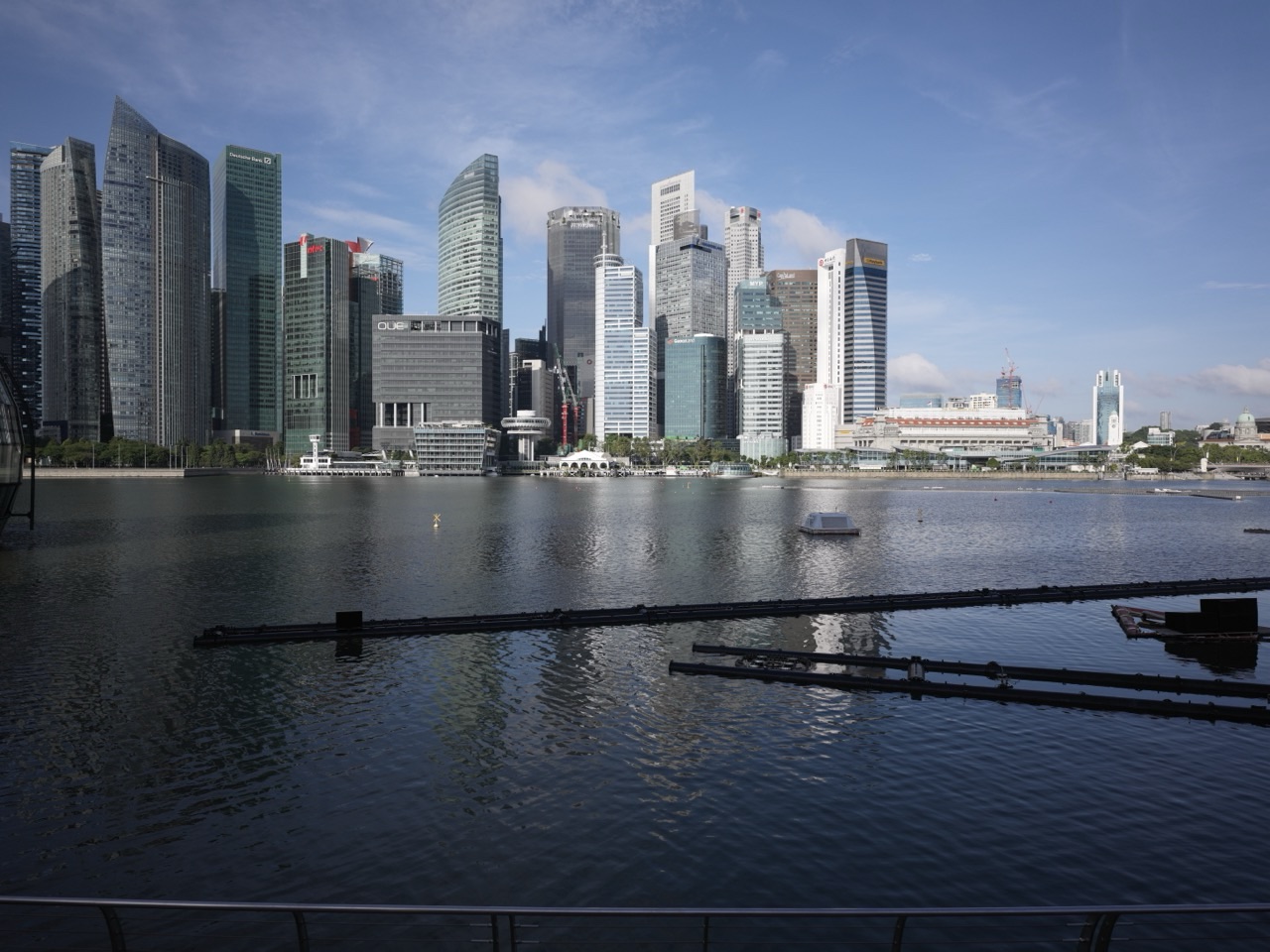
Things to do in Singapore | Battery Road. Walk one of Singapore’s earliest roads from Raffles Place toward Fullerton, trace its connection to Fort Fullerton and the colonial battery, compare historic commercial geography with today’s banking towers, and use the road to understand how defence, trade, photography and finance shared the same small city centre.
Battery Road is old infrastructure hiding in plain sight.
National Heritage Board records it as one of Singapore’s earliest roads, completed in the 1820s.
Its name came from Battery Point at Fort Fullerton.
The road connected Commercial Square — today’s Raffles Place — to that military position at the mouth of the Singapore River.
- Walk from Raffles Place toward Fullerton.
- Reconstruct the former Fort Fullerton and Battery Point geography.
- Study the financial towers that now line the same route.
- Learn about G. R. Lambert & Co., the major photography studio once on Battery Road.
- Compare the road’s military origin with its modern commercial role.
- Continue to Collyer Quay and Boat Quay.
- Use the street to understand how strategic locations often attract several functions over time.
Read: Things to do in Singapore | Raffles Place
Read: Things to do in Singapore | Collyer Quay
Read: Things to do in Singapore | Boat Quay
Start With the Big Idea: Battery Road Connected Commerce to Defence
Roots.gov.sg records Battery Road as one of Singapore’s first roads, developed in the late 1820s to link Commercial Square with the battery at Fort Fullerton.
That route tells us what mattered in the early settlement.
Commerce needed protection.
The river mouth needed defence.
The road physically connected those two functions.
Official heritage reference: Roots.gov.sg | Battery Road
Reconstruct Fort Fullerton
Fort Fullerton once occupied the strategic river-mouth area near today’s Fullerton Building.
Its guns protected the harbour approaches and commercial settlement.
The fort eventually disappeared as the city changed and military technology evolved.
Battery Road kept the memory through its name.
Street names can preserve infrastructure long after the infrastructure itself is gone.
Use the Road to Understand Strategic Geography
Why put a fort here?
Because the Singapore River and nearby harbour carried commercial value.
Defending the entrance meant protecting warehouses, ships and merchants.
Military geography followed economic geography.
The same relationship still exists in modern states, even if the technology looks very different.
Walk Toward Raffles Place
At the inland end, Battery Road feeds directly into Raffles Place.
Commercial Square became the centre of Singapore’s mercantile and later financial economy.
The road therefore evolved from a defence connection into a business-district street.
Continue nearby: Things to do in Singapore | Raffles Place
Learn the G. R. Lambert Photography Story
Roots.gov.sg records the studio of G. R. Lambert & Co. on Battery Road around 1900.
The company became one of Singapore’s leading photographic studios and documented major political events and city scenes.
That makes Battery Road part of Singapore’s visual-history infrastructure as well as its commercial geography.
Official collection reference: Roots.gov.sg | Studio of G. R. Lambert & Co. at Battery Road
Use Photography to Understand How Cities Remember
Without photographs, much of old Battery Road would survive only through maps and text.
Photography records façade, street width, traffic, clothing and everyday movement simultaneously.
A photograph therefore preserves both architecture and behaviour.
The studio on Battery Road helped create the visual archive through which later generations can reconstruct the city.
Compare Old and Modern Commercial Architecture
Historic photographs show a much lower-scale commercial district.
Today high-rise bank and office buildings dominate the skyline.
The economic function remained commercial.
The building technology and scale changed dramatically.
This is continuity of function with transformation of form.
Walk Toward Collyer Quay
Collyer Quay adds the reclaimed-waterfront story.
Battery Road connected to the old fort and Commercial Square.
Collyer Quay expanded the commercial district seaward from the 1860s onward.
Together the two roads explain how the CBD grew outward from the Singapore River.
Continue nearby: Things to do in Singapore | Collyer Quay
Walk Toward Boat Quay
Boat Quay provides the cargo-and-river layer immediately beside Battery Road.
The financial district did not emerge independently.
It grew because merchants needed banking, insurance and information beside the trade flowing through the river.
Continue nearby: Things to do in Singapore | Boat Quay
Use Battery Road to Teach Functional Succession
Battery Road demonstrates a useful urban pattern.
- strategic defence route;
- commercial connector;
- photographic and professional address;
- modern banking and office street.
The location stayed valuable because it remained close to the city’s economic core.
The dominant function simply changed with technology and institutions.
A Simple Battery Road Half-Day Plan
- Morning: arrive at Raffles Place MRT.
- Walk Battery Road toward Fullerton.
- History stop: reconstruct Fort Fullerton and Battery Point.
- Archive stop: read about G. R. Lambert & Co.
- Waterfront stop: continue to Collyer Quay.
- Finish at Boat Quay, Fullerton or Marina Bay.
Battery Road Through the eduKate Ecosystem
Things to do in Singapore | Raffles Place
Things to do in Singapore | Collyer Quay
Things to do in Singapore | Boat Quay
Things to do in Singapore | Downtown Core
Frequently Asked Questions
Why is it called Battery Road?
It was named for the battery at Fort Fullerton near the mouth of the Singapore River.
How old is Battery Road?
Roots.gov.sg records it as one of Singapore’s earliest roads, completed in the late 1820s.
What was G. R. Lambert & Co.?
It was a leading photographic studio on Battery Road that documented major events and city scenes in late nineteenth- and early twentieth-century Singapore.
What is the main learning idea?
Strategic continuity. Battery Road shows how a route created to connect commerce and defence remained valuable as the same district evolved into modern finance.
Official References and Heritage Sources
Roots.gov.sg | Studio of G. R. Lambert & Co. at Battery Road
Things to do in Singapore | Battery Road
Battery Road began by linking money to guns.
The fort disappeared.
The commercial centre grew.
Photographers documented the street.
Banks and towers replaced the earlier skyline.
The road survived because the location never stopped being strategic.