
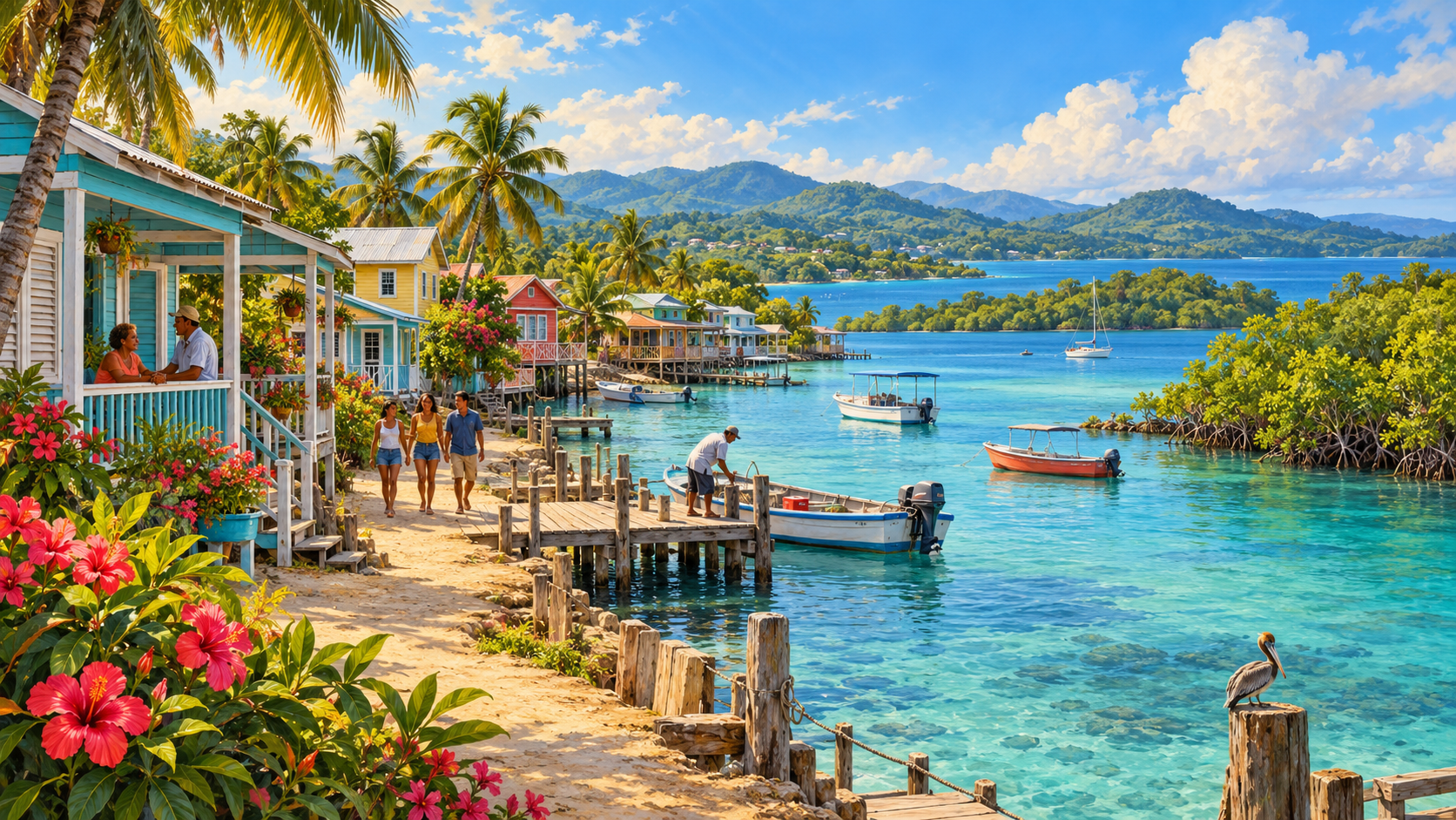
How does Belize’s government work, what are its six districts, and why does the barrier reef matter to tourism, fisheries and hurricane protection? Belize is a small Central American country with Caribbean coastlines and an English-speaking parliamentary system. It is a constitutional monarchy with King Charles III as head of state, represented by a governor-general, while Prime Minister John Briceño and cabinet direct the elected government as of October 2026. The country’s economy relies heavily on tourism and services, but also on farming, fisheries, forests and links with neighbouring markets.
The practical way to understand Belize is through its connections: government → districts and communities → reefs, rivers, ports, roads and electricity → businesses, schools and families → resilience during storms. A visitor sees beaches and the Maya heritage; a resident also needs dependable water, a safe road to school, affordable power, a functioning clinic and a job. Each part depends on the others, especially in a country exposed to hurricanes, floods and changing global tourism.
Belize in one minute: what you need to know
- Government: parliamentary constitutional monarchy, with a prime minister leading the elected executive and a governor-general representing the monarch.
- Parliament: a 31-member elected House of Representatives and an appointed Senate, traditionally comprising 13 members under the constitutional arrangements.
- Six districts: Belize, Cayo, Corozal, Orange Walk, Stann Creek and Toledo.
- Capital: Belmopan. Belize City remains a major commercial and maritime hub.
- Economy: tourism, services, farming, fisheries, trade and small-business employment.
- Marine system: the Belize Barrier Reef Reserve System is a UNESCO World Heritage site comprising seven designated protected areas.
- Climate readiness: weather forecasting, emergency shelters, NEMO coordination and resilient infrastructure are crucial.
This article is reviewed on 20 October 2026. For government developments see the Government of Belize’s October 2026 releases. For the economy use the World Bank’s May 2026 country strategy. For reef boundaries read UNESCO’s designation, not an undated travel advertisement.
1. Who runs Belize, and why is it called a parliamentary democracy?
Belize’s formal head of state is the monarch, represented locally by the governor-general. Executive government is directed by the prime minister and cabinet under parliamentary institutions. Belize’s House of Representatives consists of elected members representing constituencies; its Senate has appointed members with defined legislative review functions.
The structure matters when following a policy. Parliament may pass a law or budget, the executive may direct ministries, and a public agency must deliver the actual service. None can be evaluated entirely by another’s work. A school-feeding allocation does not guarantee meals reach every classroom, and a construction contract does not guarantee a road remains safe after several rainy seasons.
The government’s official October 2026 announcements continue to identify John Briceño as prime minister. That is a dated officeholder check; future elections or government changes require a new source.
2. Why does Belize have a 31-member House and a Senate?
The House of Representatives is the elected chamber at the centre of forming a parliamentary government. The Senate is an appointed second chamber with functions in scrutiny and legislation. Cabinet ministers, the prime minister and parliamentary offices have particular roles under Belize’s Constitution and laws.
This arrangement is different from a presidential system, where a separately elected president might hold executive power. A Belizean voter chooses a constituency representative; national political outcomes then determine who can lead government. The Senate’s appointed composition also differs from a second chamber elected directly by voters.
For a concrete illustration, the Belize National Assembly publishes parliamentary business and the government’s public finance documents. Identify whether a spending figure is a proposal, passed appropriation, executed payment or completed service. Parliamentary approval is a step in a longer operating chain.
3. Why is Belmopan the capital instead of Belize City?
Belmopan is the capital, situated inland in the Cayo District. Belize City, on the coast, was the former capital and remains important for commerce, population, maritime activity and transport. Moving major government functions inland reflected concerns about coastal disaster exposure and the need for a more protected administrative centre.
The distinction helps learners separate a country’s political capital from its biggest business hub. A ministry might be based in Belmopan while a port or commercial service operates in Belize City. A resident needs the appropriate office or service, not simply the city marked ‘capital’ on a map.
Belmopan does not sit outside climate risk. Rivers, heavy rain, strong winds and infrastructure problems can affect inland areas too. Relocating administrative operations can change some vulnerabilities while leaving others that still require planning.
4. How do Belize’s six districts work?
Belize has six districts: Belize, Cayo, Corozal, Orange Walk, Stann Creek and Toledo. They help organise government administration, statistics, services and local identity. District boundaries are not six autonomous states with independent constitutions. Municipalities, village councils, central ministries and specialised service providers hold different powers inside those districts.
For example, an issue in a Toledo village may be handled through village leadership, a district office or a national service agency depending on legal responsibility. A port matter in Belize City involves authorities different from a rural drinking-water project in Corozal. The district name indicates location but does not alone identify who can fix the problem.
Belize’s Elections and Boundaries Department lists electoral and district offices. Look at the exact service and its administering body rather than assume all complaints go through the same district officer.
5. What is the difference between a municipality and a village council?
Belize has elected local institutions including city and town councils and village councils with assigned powers. Their responsibilities are shaped by legislation, funding and links to central government. A public park, community road, water system and health centre may not have the same owner or operator.
Original worked example: a family reports flooding near a market. A local body receives the complaint, but investigation shows that an undersized culvert lies beside a highway. Drainage, highway safety and local market access may involve different agencies. A competent response locates the asset, coordinates works and tells users who is responsible.
The important habit is to distinguish where the problem is from who legally owns the solution. Geography helps identify a service location; law, budgets and engineering help deliver the remedy.
6. Why is Belize’s barrier reef so important?
The Belize Barrier Reef is the largest barrier reef in the Northern Hemisphere and forms part of an exceptional network of reefs, atolls, mangroves, cays and lagoons. UNESCO inscribed the Belize Barrier Reef Reserve System in 1996 and lists seven protected areas within the World Heritage property. The designation covers selected protected parts of the reef network, not every metre of all Belizean coastal water.
The reef supports tourism and fisheries and provides habitat for turtles, manatees, fish and other marine life. Healthy reefs and mangroves can also reduce some exposure to waves, erosion and storm damage. Their ecological value becomes a human economic value through jobs, food and coastal resilience.
The UNESCO site description identifies all seven constituent protected areas. A responsible tourist guide should not describe all sea activities as automatically safe or authorised; protected-area restrictions and environmental rules matter.
7. What are the seven UNESCO reef areas?
The seven constituent areas are Bacalar Chico National Park and Marine Reserve, Blue Hole Natural Monument, Half Moon Caye Natural Monument, South Water Caye Marine Reserve, Glover’s Reef Marine Reserve, Laughing Bird Caye National Park and Sapodilla Cayes Marine Reserve.
This list matters because UNESCO World Heritage designation concerns a particular property with defined components and management arrangements. It does not mean that every hotel, cay or fishing ground lies inside the listed property. Questions about access, fishing or diving must be checked against the individual area’s rules.
A student can place the seven sites on a map and draw the economic connections from reef protection to fisheries, dive tourism, marine research and coastal safety. Then add one caution: conservation outcomes also depend on water quality, enforcement and climate conditions outside the protected boundaries.
8. Why does reef protection create jobs rather than only restrict fishing?
Marine conservation can protect ecosystems that support commercial activities over time. Fishing, diving, guiding, lodging, boat maintenance and research depend on living marine habitats. But protections may also change where or when fishers can operate, creating real adjustment costs for communities.
A good blue-economy strategy does not assume the benefits appear automatically. It involves fishers, tourism operators, conservation managers, scientists and households in designing rules that protect resources while supporting feasible livelihoods. Investment in safe moorings, waste management and training can help.
Belize’s Ministry of Blue Economy and Marine Conservation describes its objective of linking marine resources with responsible growth and wellbeing. Judge that goal through ecosystem condition, enforcement and the livelihoods of actual people.
9. What are Belize’s blue bonds and debt-for-nature arrangements?
A debt-for-nature arrangement reorganises financial obligations under agreed terms to create resources and commitments for conservation. Belize undertook a significant marine-conservation financing transaction that has been discussed internationally as a blue-bond and debt-conversion case. It couples fiscal arrangements with conservation commitments, including marine protection and spatial planning.
UNESCO describes a Belize debt restructuring that helped secure long-term conservation finance. An official document described a goal of increasing protected national waters to 30 percent by 2026. A goal is not proof that 30 percent protection has been achieved and effectively enforced. The exact protected-area designations and monitoring results require a separate status check.
See UNESCO’s debt-for-nature explanation and Belize’s reported conservation commitments. Financing mechanisms should be assessed by both debt terms and demonstrable ecological outcomes.
10. How much does tourism contribute to Belize’s economy?
Tourism is one of Belize’s leading economic activities. It supports accommodation, marine tours, inland heritage tourism, transport, restaurants, retail, maintenance and construction. The World Bank’s May 2026 strategy described tourism as contributing about 45 percent of GDP under the measure used in that assessment. Such figures are period-specific estimates and may include wider indirect contributions.
That does not mean every visitor’s dollar becomes local family income. Tourism businesses buy imported goods, pay wages, maintain equipment, employ guides and pay taxes. The distribution of value depends on ownership, sourcing, skills and the connection between tourism and domestic agriculture or fisheries.
A policy that increases visitor arrivals while harming the reef or excluding local communities could undermine the industry’s own foundations. Sustainable tourism protects the natural systems and people on which the visitor experience depends.
11. How do Maya sites, forests and inland tourism connect?
Belize also attracts visitors to archaeological heritage, forests, caves, rivers and wildlife areas. Those sites create opportunities beyond the coast, but require roads, guides, visitor safety, heritage protection, communications and nearby communities able to benefit.
A tour begins long before a traveller reaches a rainforest trail. Bookings, information, transport, legal permissions and a trained local operator make the experience possible. Rainfall and river levels can change whether an excursion is safe, while heritage protection can set appropriate limits on visitor activity.
The useful development question is which investments improve both visitor experience and local outcomes. A well-maintained rural road can help tourists, farmers, school pupils and emergency vehicles at the same time.
12. How does agriculture support Belize?
Belize’s agricultural economy includes sugar cane, citrus, bananas and other crops, alongside livestock and local food production. Farmers depend on suitable weather, land, access to machinery, irrigation where appropriate, credit, storage, processing plants and roads to buyers.
Consider a sugar-cane grower. Harvest timing matters because cane must reach the mill under conditions that preserve value. If a rural road floods at harvest, a transport interruption can become a household income problem. Better road drainage may be an agricultural investment even though it is recorded in a transport budget.
Diversifying farming can improve opportunities but requires practical markets and skills. National strategies should distinguish farm production targets from sustained profits, safe environmental practice and improved food security.
13. What is Belize’s 2026 green and blue industrial strategy?
In June 2026, the United Nations in Belize described a partnership involving UNIDO and Japan to support development of Belize’s first industrial policy focused on green and blue economic activity. The ambition is to use forest and ocean resources responsibly to diversify production beyond a narrow set of tourism and commodity exports.
The United Nations Belize portal explains the vulnerability of a small economy to trade and climate shocks. A strategy is a planning instrument, not automatic proof that factories, jobs or exports have already appeared.
A sound approach needs safeguards for biodiversity, realistic business finance, traceability, labour protections, technology and buyers. An export product becomes genuinely useful only when it can be produced competitively without destroying the resource on which it relies.
14. Why does Belize use a fixed exchange rate?
The Belize dollar is pegged to the US dollar at BZ$2 for US$1 under the country’s longstanding monetary arrangement. That can improve predictability for tourism receipts and international trade, but prices for imported goods can still change when global costs or local expenses rise.
The Central Bank marked 50 years of the peg in May 2026 and continued displaying its official US-dollar reference in October. Bank buying and selling transactions may involve applicable rates and charges, so a fixed currency peg is not the same as a guarantee that every cash transaction has exactly the same fee-free rate.
The Central Bank of Belize publishes current rates and its financial-stability mandate. A household’s purchasing power depends not only on the exchange rate but also on wages, food costs, fuel, taxes and competition.
15. Why is energy reliability a national issue?
Reliable power allows schools to use technology, clinics to refrigerate medicine, hotels to serve visitors, farms to store food and small businesses to operate. A nominal electricity connection does not prove the same level of supply quality everywhere, particularly when storms damage distribution lines or demand exceeds available capacity.
The World Bank’s 2026 partnership framework places energy reliability alongside private-sector jobs, skills development and climate resilience. Infrastructure needs financing, maintenance and suitable regulation. A new power asset without trained operators or a working distribution network will not deliver its full value.
Fictional business case: a coastal guesthouse has bookings, but a power interruption disables refrigeration and electronic payments. The business needs backup arrangements and reliable utility communication. One electricity failure becomes a tourism, income and food-safety problem.
16. What do roads, buses and sea transport connect?
Highways and local roads connect inland farms and settlements to Belmopan, Belize City, towns and neighbouring borders. Boats also connect coastal settlements and cayes. Different modes have different operating hazards, regulatory rules, maintenance needs and costs.
In April 2026 Belize’s government published national-highway maximum bus fare rules and discussed fare changes. This is an example of transport regulation interacting with household affordability. A fare ceiling and a reliable journey are separate issues: a family needs both a manageable price and a bus that actually runs.
The government’s April 2026 transport releases provide the dated policy context. Always look for the latest timetable and operator arrangements before making a real journey.
17. How does Belize prepare for hurricanes and floods?
Belize faces tropical storms, intense rainfall, flooding and coastal risks. The National Emergency Management Organization, or NEMO, works with committees, public agencies, private organisations and communities to prepare for and respond to disasters.
NEMO’s publications include a 2026 National Disaster Preparedness and Response Plan, a 2026 Hurricane Response Plan and a 2026 Hurricane Shelter List. These are important because an emergency procedure must be current: a shelter used in one year is not necessarily suitable or open the next.
The National Meteorological Service provides forecasts and warnings. A warning is information; a safe evacuation is an outcome requiring transport, communication, accessible shelter, staff, supplies and household readiness.
18. How do mangroves and reefs reduce storm risk?
Reefs, mangroves and coastal habitats can dissipate wave energy and support ecological health, although the degree of protection varies with local geography and storm conditions. They complement rather than replace sound building standards, drainage, shelters and emergency response.
If mangroves are removed for development, a shoreline may lose habitat and some natural protection. However, protecting a mangrove strip is not a promise that every storm surge will be harmless. Good coastal management combines ecosystem science, accurate maps, infrastructure and community decisions.
Belize’s reef conservation thus connects two policy objectives: preserving the living resource that supports tourism and fisheries, and strengthening resilience for the people who share the coastline.
19. Why is drinking water more than a pipe network?
Safe water requires a source, treatment where necessary, storage, pipes, testing and maintenance. Rural water systems may face different costs and operating conditions from large urban networks. A new tank or pump is useful only when the complete chain brings dependable water to users.
In January 2026 the Belize government reported a rehabilitated water system at Sarteneja village, developed with conservation and UNICEF partners. The event illustrates how infrastructure can support remote communities. It does not independently prove continuous water for every household indefinitely.
Follow the January 2026 government release for the specific project, and evaluate ongoing water quality, uptime, affordability and repair capacity to judge results.
20. How do schools and skills support Belize’s future?
Belize’s education system includes primary Infant and Standard years, secondary school Forms 1–4 and routes toward Caribbean qualifications such as CSEC, followed by technical and tertiary options. The exact admissions, examination and fee rules vary by year and institution.
In its 2026–27 budget narrative the government described an expansion of tuition support and internet connectivity in education. Such reported allocations and future plans should be distinguished from verified learning outcomes. A school needs teachers, materials, meals, transport and students who can attend consistently.
For full pathways use Schools of Belize, How Education System of Belize Works and How Ministry of Education for Belize Works. Those specialist articles explain schooling; this guide explains why education supports the whole country.
21. A day in Belize: a family, a boat, a school and a storm warning
Original illustrative scenario: a family operates a small tour business near the coast. One adult guides reef visitors while a teenager travels to secondary school. A weather advisory warns of worsening marine conditions. Tour bookings are cancelled, income falls and a boat must be secured. The school may issue its own attendance guidance.
The household needs information from the meteorological service, an appropriate marine safety decision, insurance or savings, and possibly transport or emergency support. The reef and coast are the family’s source of income and part of their risk environment.
This shows why country systems are interconnected. A climate forecast can become a tourism decision, household budget problem, school planning question and public-safety responsibility in a matter of hours.
22. How does Belize compare with Singapore?
Both countries connect business, transport, schools and international markets. Singapore is a compact, heavily urbanised maritime city-state with extensive engineered public infrastructure. Belize has a much smaller population spread across mainland districts, coastal settlements and islands, with a major reef and broad natural landscapes.
Singapore’s dense expressway system solves different transport problems from a rural Belize highway or island ferry. Yet both systems need safe engineering, clear responsibilities and planning around future demand. In Belize, conservation adds a distinctive link: protecting marine ecosystems can protect economic opportunity as well as biodiversity.
Read How Singapore Works and How Singapore Connects | Roads, Expressways and Junctions for a companion case.
23. A useful classroom exercise: follow a reef tour from booking to return
Draw eight boxes: visitor booking, business licence and safety, road or airport arrival, boat, reef ecosystem, guide, payment, return journey. Add the energy, weather, communications and insurance services below each. Now imagine the weather deteriorates or a reef is closed for protection. Identify which steps must change and who should communicate those changes.
The exercise turns an attractive tourism image into a genuine understanding of how policy, ecology, safety and livelihoods meet. It also makes the limits clear: knowing the system is more helpful than memorising a list of attractions.
Frequently asked questions about how Belize works
Is Belize a republic?
No. It is an independent parliamentary constitutional monarchy. The prime minister leads elected government, and the monarch is represented by a governor-general.
Who is Belize’s prime minister in October 2026?
John Briceño, according to dated official government releases from October 2026.
What are Belize’s six districts?
Belize, Cayo, Corozal, Orange Walk, Stann Creek and Toledo.
Is Belize City the capital?
No. Belmopan is the capital. Belize City remains a major commercial and maritime centre.
Why is the Belize Barrier Reef famous?
It is the largest barrier reef in the Northern Hemisphere and a distinctive marine ecosystem; seven designated protected areas form its UNESCO World Heritage property.
Does UNESCO status cover every part of the reef?
No. The World Heritage listing describes a specific reserve system comprising seven protected areas, rather than every part of Belize’s marine territory.
Why is the reef important to the economy?
It helps sustain tourism, fisheries, biodiversity and some coastal protection, so ecosystem decline can affect jobs, food and storm resilience.
Is the Belize dollar pegged to the US dollar?
Yes. The established reference is two Belize dollars for one US dollar, with transaction rules and rates published by the Central Bank.
Who warns residents about hurricanes?
The National Meteorological Service issues weather warnings, while NEMO coordinates national emergency preparedness and response with other institutions.
Do all Belizean students use the same school exams?
Students follow different education routes; primary and secondary pathways commonly lead toward CSEC and other qualifications. Check the current education ministry and examining bodies for cohort-specific rules.
Continue the linked country-system series
You are in How Countries Work, the international sibling to How Singapore Works. Compare this reef-and-hurricane case with Belgium’s federal communities, Benin’s port and cotton economy, Bhutan’s hydropower and GNH, The Bahamas’ island networks and Barbados’s climate resilience.
Sources and date of editorial review
- Belize Government Press Office, October 2026 — prime minister, cabinet and public programmes.
- Belize National Assembly — House and Senate records.
- UNESCO World Heritage Centre, Belize Barrier Reef Reserve System — seven listed areas and ecological significance.
- World Bank, 20 May 2026 — tourism, economy, skills and resilience.
- United Nations in Belize, June 2026 — green and blue industrial-policy development.
- UNESCO, debt-for-nature financing for Belize — conservation commitments.
- Central Bank of Belize, October 2026 — currency exchange arrangement.
- NEMO publications, 2026 — current disaster and hurricane plans.
- National Meteorological Service of Belize — forecasting and warnings.
- Reviewed: 20 October 2026. Family examples are original fictional teaching cases. Policy targets are distinguished from delivered results.