
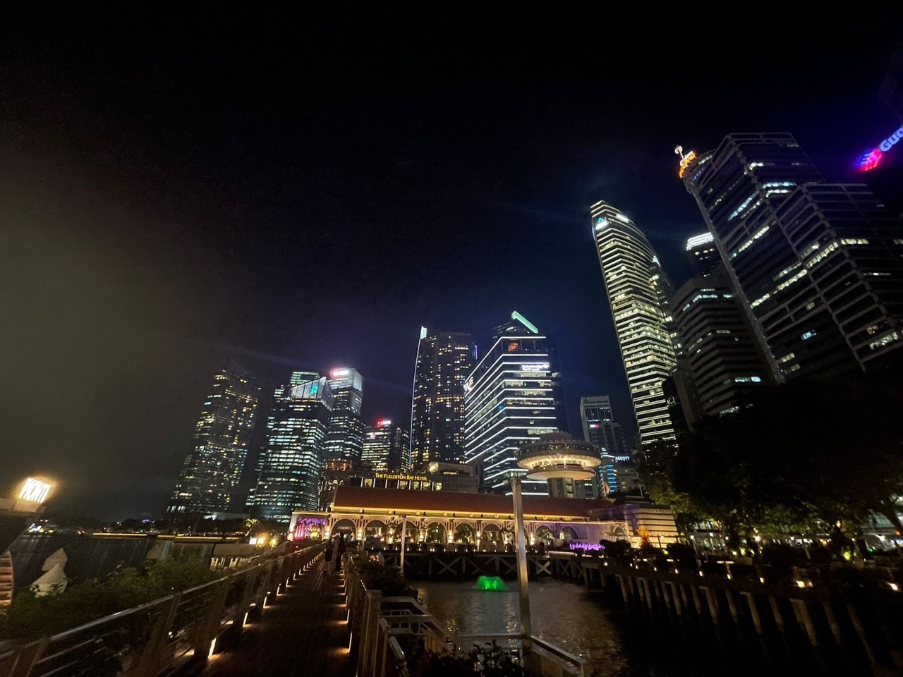
How does Singapore plan its land? The short answer is that Singapore plans housing, jobs, transport, parks, utilities, industry and coastal resilience together rather than treating every vacant plot as an isolated opportunity. URA’s Long-Term Plan sets broad strategies, while the gazetted Master Plan 2025 guides permitted uses and development intensity over the next 10 to 15 years. Buildings only become useful when their connections to people and infrastructure also work.
If you want to understand Singapore’s URA Master Plan, why HDB towns are built where they are, how MRT lines and new business districts are planned, why some land is reserved, or how reclamation and conservation affect development, this guide joins those answers. It leads to the existing How Singapore Works and How Singapore Connects specialist library without duplicating each individual mechanism.
A planning map is not a promise that everything printed on it will open tomorrow. It is a coordinated framework for deciding what can be built, what needs further approval, what must be protected and what future users will require. Let’s start with the part of planning we experience every day: the distance between a front door and the things that make life possible.
Quick answer: Singapore’s urban planning system
- Long-Term Plan: broad strategies for land use over decades, balancing future population, economy, climate and nature.
- Master Plan: URA’s statutory medium-term land-use plan, showing permitted uses and densities; Master Plan 2025 was gazetted on 1 December 2025.
- Development control: actual projects require appropriate planning permission and must satisfy detailed rules; a zoning designation is not unconditional consent.
- HDB and housing: public housing towns coordinate homes, schools, shops, public spaces and transport access.
- Transport and infrastructure: corridors, utility networks, drains, water, power and logistics must fit the physical arrangement.
- Employment and commerce: workplaces, industrial estates, ports, offices and neighbourhood businesses need sites and viable connections.
- Nature and climate: green corridors, heritage, coastal adaptation and stormwater risk influence what can be built and maintained.
- Delivery and renewal: agencies, developers, operators and residents manage the transition from plans to functioning places.
According to URA’s Master Plan overview, the Master Plan is reviewed every five years and provides a statutory 10-to-15-year land-use framework. The 1 December 2025 gazette circular confirms the current plan. These are important distinctions when reading online claims about future MRT stations or new towns.
1. Think of Singapore as a limited piece of shared space
An HDB block, school, clinic, office tower, port and reservoir all occupy land, yet each serves a different need. A new industrial site may support thousands of jobs but requires freight access, utilities and appropriate buffers from sensitive uses. Housing can bring more people into a district, but those residents need transport and community facilities.
In a larger country, planners may sometimes expand outward. Singapore has a particularly tight land constraint, so placing one function often changes the options available to another. The challenge is not simply fitting more buildings on the map; it is making the functions coexist without creating unacceptable costs for their neighbours.
Picture a family that moves to a new development. The private flat may be finished while the nearby shop, school or bus route is not yet fully ready. The family’s daily experience reveals which connections were built early enough and which depend on a later phase.
The deeper Land and Housing Engine explains this constraint at national scale. This article focuses on the public question: how do separate spatial decisions combine into a usable city?
2. What does the Long-Term Plan do?
The Long-Term Plan looks beyond a single development cycle. It considers national needs across decades: where people could live, how jobs and transport patterns might change, and what land or infrastructure may need to remain available for a future not yet fully visible.
A long-term plan is especially valuable for infrastructure that takes many years to deliver. If land for a future rail corridor is lost to incompatible permanent development, recovering that route later may be much more difficult and expensive.
Yet long-range planning cannot predict everything. Technology, demographic expectations, industry needs and climate conditions evolve. A good strategic plan creates options and broad directions rather than pretending that every street and building has been designed decades in advance.
See URA’s Long-Term Plan and The Rails Beneath the Train: Singapore’s Planning Horizon.
3. How does Master Plan 2025 differ from the Long-Term Plan?
The Long-Term Plan sets the broader horizon; the Master Plan translates that strategy into more specific land uses and permissible development intensities for the medium term. The two are related, but they are not interchangeable legal documents.
URA states that Master Plan 2025 was gazetted on 1 December 2025 and guides the next 10 to 15 years. Because development opportunities and constraints can change, the plan is reviewed approximately every five years and can be amended through formal processes.
The statutory map may show categories for land use and development parameters. Readers should consult the current plan and its Written Statement for the actual legal framework rather than relying on an old screenshot or a property advertisement.
Start with URA’s Master Plan. The current plan’s legal status matters more than the excitement surrounding a proposed concept.
4. Does a permitted land use mean a developer can build immediately?
No. A planning map guides what uses and intensity may be considered, but a real project requires approvals and compliance with relevant development controls. URA’s Master Plan Written Statement makes clear that its provisions do not automatically grant the right to develop a site to maximum permitted intensity.
Imagine a plot designated for residential development. The owner still needs to consider access, safety, drainage, building requirements, surrounding uses, conservation constraints and other applicable conditions. A design may need changes even if the broad land-use category appears compatible.
This is why a headline such as ‘site zoned commercial’ should not be translated into ‘a new shopping mall is confirmed and opening soon’. Zoning, planning approval, funding, building work and operational readiness are different stages.
The relevant built-environment interface is CORENET X, Building Plans and Construction Approvals.
5. Who does the planning?
URA coordinates land-use planning, but it cannot produce a complete city alone. HDB is central to public housing towns, LTA to land transport, PUB to water and drainage, JTC to many industrial areas, NParks to green networks and other agencies to their respective responsibilities.
A hospital site must connect to a healthcare plan, roads, utilities and the surrounding community. A future school needs suitable land and must match education requirements. A business district needs transport access and workable commercial demand.
One agency may lead a specific asset while other institutions manage approvals, construction, operations or safety. Recognising these handoffs helps residents ask the right question when they see a proposal, a construction notice or an unfinished amenity.
Compare How Singapore’s Government Works with The Governance Engine for the institutional architecture.
6. Why housing planning must include much more than flats
A newly completed home is not a self-contained island. Residents need schools, food, clinics, transport, work opportunities, recreation and the ability to visit friends and family. A good town plan distributes facilities at different levels rather than expecting everyone to make a long trip for every basic task.
HDB’s town-planning approach uses a hierarchy of precinct, neighbourhood and town-centre amenities. That means different facilities serve different numbers of people. The large library can be further away than the convenience shop without making the neighbourhood dysfunctional.
The arrangement changes as the town matures. Young families may create strong demand for childcare and primary schools, while an older population may need different accessibility and care services. The original design must therefore accommodate future renewal.
The dedicated owner is How Are HDB Towns Planned in Singapore?, supported by Town Centres, Neighbourhood Centres and Everyday Services.
7. Why transport corridors sometimes appear before buildings
Rail lines, expressways and major roads require physical space and complex junctions. Their routes can be difficult to change once dense development surrounds them. That is why land-use planning needs a long view of future travel, not simply the trips residents make today.
Transport also changes which activities can operate comfortably in an area. A neighbourhood near a well-connected rail station may accommodate more activity than a similarly sized isolated site, but only if walking access and local services work well.
An announced future rail line does not make the current station operational or guarantee an individual property a particular travel time. The user should distinguish a reserved corridor, a confirmed project, a construction stage and an operating service.
Read How Singapore’s Transport System Works and Roads, Expressways and Junctions.
8. The first and last hundred metres are land-use planning, too
A map can show an MRT station close to a housing precinct while overlooking a busy crossing, inaccessible stairway or circuitous entrance. The shortest geometric distance is not necessarily the usable journey.
Walking paths, sheltered links, kerbs, lifts, cycle connections and service access make buildings accessible. They affect children, wheelchair users, delivery workers and the older residents who may have to make the same trip every day.
The practical result is a chain of small design decisions. A new road may shorten vehicle journeys but create a longer route for a pedestrian. A sheltered crossing might make a slightly longer path much more usable during heavy rain.
The physical connections are explained in Covered Walkways and Pedestrian Links and Accessible Public Transport.
9. Why Singapore needs dedicated industrial land
Not every industry belongs beside a residential block. Manufacturing, laboratories, logistics and heavier operations can require specialised utilities, goods-vehicle access, safety controls and separation from incompatible uses.
JTC develops and manages significant parts of Singapore’s industrial land and infrastructure, including specialised estates and facilities. The needs of a semiconductor operation are not identical to a warehouse or a small neighbourhood business.
Planning should consider the whole supply chain: employees must reach the workplace, materials must arrive, finished goods must leave and essential services must operate safely. A factory cannot succeed on land-use permission alone.
See Jurong Island, Petrochemical Plants and Industrial Pipelines and Workplaces, Business Parks and Daily Commutes.
10. Where do offices and business districts fit?
Offices, commercial services and corporate headquarters benefit from proximity to talent, transport, customers and other businesses. Clustering can reduce the time needed for meetings and help specialised firms find partners or workers.
Yet concentrating every job in the same district increases commuting pressure. Planners also consider regional centres and employment areas closer to homes, while retaining globally connected business hubs.
A central business district does not operate alone. It depends on trains, lunch outlets, digital connectivity, electricity, waste management, finance and public spaces. Its economic role reaches far beyond its towers.
Read How Singapore Works | The CBD and Workplaces, Business Parks and Daily Commutes.
11. How does Singapore protect parks, nature and biodiversity?
Green land is not automatically unused land awaiting development. Parks, nature reserves, waterways, ecological connections and urban trees support recreation, habitat, shade and mental wellbeing, as well as a recognisable sense of place.
A green corridor can help people and wildlife move between spaces. Breaking it into isolated fragments may change its ecological value, even if the total amount of green-looking land on a map seems similar.
Protection involves trade-offs. A footpath may provide public access but also require habitat-sensitive design. Mature trees need monitoring and care; biodiversity needs more than ornamental planting.
The specialist owners are Parks and Green Corridors, Nature Reserves, Ecological Corridors and Wildlife Crossings and Urban Trees and Arborists.
12. Why heritage buildings and neighbourhood memory matter
An old building can carry social history and cultural meaning that cannot be reproduced simply by rebuilding its façade in a new location. Streets, markets and gathering places can also preserve relationships between generations.
Planning decisions therefore include questions about conservation and adaptation, not only density or short-term market value. Buildings may need modern access and safety upgrades while retaining features that make them historically significant.
Not every old building is formally conserved, and not every redevelopment opportunity should be treated identically. The correct decision depends on heritage value, condition, planning priorities and applicable rules.
Singapore’s heritage belongs to the wider The Legacy and Singapore as a 700-Year Civilisational System.
13. Why water and drainage must be planned before a neighbourhood is complete
A residential or industrial development needs reliable water supply and a route for used water. Rainwater needs a separate stormwater path. The landscape and building levels influence how water moves during heavy downpours.
A development that increases paved surfaces can affect the speed at which runoff reaches nearby drains. Local source controls, network capacity and protection of vulnerable entrances may all matter.
Water systems do not stop at the site’s legal boundary. The flow may pass into public drains, treatment facilities and reservoirs. That is why designing a single building without the surrounding catchment would be incomplete.
Read Drains, Canals and Flood Control and How Singapore Prevents Floods and Rising Seas.
14. Why utility corridors are valuable hidden land
Electricity, water, gas, telecommunications and other services require pipes, cables, substations and access for maintenance. Some are above ground; many are concealed within buildings or under streets.
A site may look empty but carry a buried network that cannot be moved casually. A road project may require utility diversions long before the new road opens. Workers need access to safely repair equipment after completion.
Planning should therefore reserve not only space for the finished buildings but also practical corridors for the networks that make them usable. A beautiful masterplan with no workable maintenance access is an unfinished design.
Explore Underground Utilities and Common Services Tunnels, Road Works and Utility Diversions and Singapore’s Electricity System.
15. What role does land reclamation play?
Land reclamation can create additional usable land at suitable coastal locations, but it is not equivalent to finding free space. Engineering must consider marine conditions, ground settlement, environmental impacts, coastal protection, shipping and long-term maintenance.
A reclaimed area also needs access, services and a development purpose. Building a road, terminal or industrial facility on new land creates continuing obligations for utilities, drainage and transport.
Singapore uses reclamation as one tool to manage land scarcity, not a universal substitute for planning existing land more efficiently. Some coastal environments and activities may make reclamation difficult or inappropriate.
The longer civilisational logic is explained in The Land and Housing Engine. Land reclamation also connects to Coastal Protection, Polders and Sea-Level Rise.
16. Climate adaptation changes where and how we can build
Singapore needs to account for heavy rain, rising seas and heat over a long planning horizon. A building that functions well in today’s typical conditions may need adaptation during its lifespan as environmental risks change.
Coastal protection can require land and engineering interfaces. Drainage improvements can alter local streets. Shade and greenery can influence comfort and the usefulness of public space, though they also require ongoing care.
Climate resilience is not a reason to abandon all development near water. It is a reason to assess exposure carefully and design with future conditions and alternative responses in mind.
Read Coastal Protection and Sea-Level Rise, Flood Sensors and Drainage Operations and Parks and Green Corridors.
17. A planning approval is not the same as construction or occupancy
A development may pass through land-use planning, detailed design, statutory submissions, construction, inspections and handover before anyone can occupy and use it. These stages have different owners and evidence requirements.
An announcement about a district may describe intended capacity; it does not establish that all roads, offices, schools and shops are finished. A building’s completion date also does not guarantee nearby services open at the same time.
This distinction is important to homebuyers and businesses comparing locations. Ask whether a feature is existing, approved, under construction or simply part of a long-term proposal.
Follow CORENET X and Building Approvals and Structural Inspections and Building Safety.
18. How does a new town become a mature town?
At first, development may bring homes and basic transport before a full range of shops, schools and community institutions is ready. As more residents arrive, the demand and economic basis for different services can change.
A new neighbourhood may attract young families, then age with its residents. The most useful facilities twenty years later can differ from those needed on the first day. Renewal is therefore another part of planning rather than an admission that the first plan was useless.
Residents experience this time dimension intimately. A supermarket opening, a new crossing or a clinic’s relocation may transform daily life even when the main buildings remain unchanged.
Read How Are HDB Towns Planned? and HDB Upgrading and Estate Renewal.
19. What can residents learn from URA SPACE?
URA SPACE is an online map service that helps readers inspect planning information, including the current Master Plan. It is useful for understanding designated land uses and the broader spatial relationships around a location.
Yet a map should not be used to guarantee a particular flat’s view, the timing of construction, or the final form of a proposed development. The site’s current plan and any relevant regulatory documents must be read together.
Try comparing three locations: a home, an MRT station and a school. Observe their relative positions and the permitted surrounding uses. Then ask which links exist on the ground and which are future planning ideas.
URA links to URA SPACE through its official Master Plan page. The point is to use the map as evidence, not as a crystal ball.
20. Why community feedback belongs to the planning process
Residents notice things that may be less obvious from aerial maps. They understand dangerous crossings, missing seating, overloaded walkways and the places where neighbours actually gather. Consultation can bring those experiences into a development discussion.
That does not mean every request can be granted or that public engagement eliminates competing interests. A new transit link may be popular while its construction disturbs nearby shops. Residents can disagree about what their neighbourhood needs.
URA’s Master Plan 2025 process included extensive public engagement over approximately two years, as described in the gazette announcement. The process matters because a plan needs both technical evidence and an understanding of how different people use places.
See URA’s Master Plan 2025 adoption announcement and The People.
21. Worked example: three competing uses for one site
Imagine a vacant parcel beside a transport interchange. A housing proposal would bring residents close to the network. A commercial proposal might create jobs and services. A park would provide recreation and breathing room. None is inherently the correct answer without context.
Start with evidence. Is affordable housing scarce in the surrounding area? Are jobs already nearby? Is the district short of public green space? How will people reach the site? Are utilities and drainage ready? What will the city need in fifteen years?
Then test the handoffs. A residential project may require school places. A commercial project may increase peak-hour traffic. A park needs access, habitat design and maintenance. The spatial decision changes costs beyond the parcel’s fence.
Good planning is the disciplined comparison of these linked consequences, not the selection of the proposal with the most impressive rendering.
22. The real test is a city that stays usable over time
Density alone does not prove success. A city can be dense and walkable, or dense and exhausting. The outcome depends on accessibility, safety, public space, service capacity, affordable options and the ability to change as residents’ needs evolve.
Planning must therefore be evaluated at several scales: whether the island has enough strategic capacity, whether towns offer useful daily services and whether individual people can actually reach opportunity.
Trade-offs will remain. A rail corridor may displace another potential use. A green buffer takes land. A specialised industry requires separation. The aim is to make those compromises transparent and purposeful rather than pretending no one bears a cost.
That returns to The Whole Machine, Lowering Friction and The Planning Horizon.
Explore the Singapore planning and land-use knowledge map
These are distinct existing specialist owners across the eduKateSG ecosystem. Open the guide that answers your narrower question; this overview links the parts without replacing them.
Land, housing and neighbourhoods
- The Land and Housing Engine — why land is allocated strategically
- HDB Towns — public housing as a planned system
- How Are HDB Towns Planned? — a reader’s everyday town map
- Town Centres and Neighbourhood Services — daily facilities
- HDB Upgrading and Estate Renewal — long-term adaptation
- Land Titles and Property Transactions — property rights and ownership
- CORENET X and Building Approvals — the approval handoff
Transport, industry and underground infrastructure
- Roads, Expressways and Junctions — island movement and exact addresses
- Transport System: MRT, Buses and Roads — all transport layers together
- Workplaces, Business Parks and Daily Commutes — employment geography
- Jurong Island and Industrial Pipelines — industrial land and safety
- Underground Utilities and Common Services Tunnels — buried capacity
- Road Works and Utility Diversions — construction handoffs
- Digital Twins and Virtual Singapore — using models to plan and coordinate
Green spaces, water and climate
- Parks and Green Corridors — public space
- Ecological Corridors and Wildlife Crossings — connected habitats
- Urban Trees and Arborists — shade and tree stewardship
- Water Supply, Reservoirs and Drainage — catchment planning
- Coastal Protection and Polders — future coastal levels
- Drains, Canals and Flood Control — stormwater planning
- The Resilience and Future-Upgrade Engine — planning across generations
Frequently asked questions about Singapore’s land use
Who plans Singapore’s land use?
URA guides land-use planning, working alongside HDB, LTA, JTC, PUB, NParks and other agencies according to their distinct responsibilities.
What is the URA Master Plan?
It is Singapore’s statutory medium-term land-use plan, guiding permissible uses and densities over about 10 to 15 years.
When was Master Plan 2025 approved?
It was gazetted on 1 December 2025, following review and public engagement. URA’s current published plan is the authoritative reference.
What is the difference between the Long-Term Plan and Master Plan?
The Long-Term Plan establishes longer-horizon strategies; the Master Plan translates those intentions into more detailed medium-term land-use provisions.
How often is the Master Plan reviewed?
URA states that the Master Plan is reviewed approximately every five years.
Does zoning mean a site can be developed immediately?
No. Developers still require appropriate planning approval and must satisfy specific controls and constraints.
Can a planned MRT station be cancelled or delayed?
Project stages, funding and implementation may change. A proposed or protected corridor is not the same as an operating station.
Why do new towns sometimes open before all shops and facilities?
Construction and demand are phased, so homes and amenities do not necessarily become ready on the same date.
How does land reclamation help?
It can create space at suitable coastal locations but has engineering, financial, environmental and maintenance implications.
Why does Singapore have designated industrial areas?
Different industries need appropriate infrastructure, freight access and separation from incompatible land uses.
Can citizens see the planning maps?
Yes. URA links public maps and Master Plan resources through its official site and URA SPACE.
Where should a buyer verify development claims?
Start with the current URA plan, formal development approvals and the responsible agency or developer’s current documentation.
Continue the How Singapore Works systems guides
- How Are HDB Towns Planned in Singapore?
- How Does Singapore’s Transport System Work?
- How Does Singapore Prevent Floods and Rising Seas?
- How Does Singapore Get Electricity?
- How Does Singapore’s Government Work?
The permanent series spine is the How Singapore Works Civilisation Atlas. This guide explains how space and land-use decisions connect its specialist articles.
Official planning references
- URA — Master Plan
- URA — Master Plan 2025
- URA — Long-Term Plan
- URA — Master Plan 2025 Gazette Circular
- HDB — Plan and Design Towns
Reader note: This article is an educational overview, not zoning approval, investment advice or a promise about a specific property. Always read the current statutory Master Plan, applicable Written Statement, amendments and project approvals before a property decision. Editorial review: 20 October 2026.